Storm archive.
Earlier storm updates for Todos Santos, El Pescadero, and Cerritos, newest first, kept exactly as published. They are a record, not a current forecast. For this week, see Weather + Waves. For anything official, follow NHC, SMN, and Protección Civil BCS.
Updated weekly, last updated Wednesday, November 11, 2026.
-
No storm threat for our towns: NHC lists no active eastern Pacific storms
NHC’s active-storms list is empty. Its eastern Pacific outlook (5:00 AM MST) shows a broad low off Central America, 30% chance of forming in 48 hours and 50% in 7 days, and a low well southeast of Hawaii, 50% in 48 hours and 70% in 7 days, both far from Baja California Sur.
-
No storm threat for our towns: NHC lists no active eastern Pacific storms
NHC’s active-storms list is empty and Vance is no longer active. Its eastern Pacific outlook (5:00 AM MST) shows one area well southeast of Hawaii, 0% chance of forming in 48 hours and 50% in 7 days, far from Baja California Sur.
-
Tropical Storm Vance passes to our east Thursday: heavy rain and bigger surf, no watches for BCS (Vance 29)
- Seven-day outlook (Wed Oct 28 to Tue Nov 3): For Todos Santos, El Pescadero, and Cerritos. Heavy rain this afternoon and Thursday (SMN, about 2–3 in for southern BCS), showers Friday and Saturday, then dry Sunday to Tuesday (Open-Meteo). Highs about 82–87 °F, about 93 °F Monday. Surf builds from about 3–4 ft today to about 4–7 ft Saturday and Sunday (4–6 ft Monday) at Cerritos and La Pastora (Surfline).
- What changed: NHC Advisory 29 (8:00 AM MST today) vs. Advisory 28 (2:00 AM): Vance holds at 40 mph, about 300 miles south-southeast of Todos Santos, but is now moving north-northwest at 10 mph (north at 12 mph before) and is fully exposed again, with its rain displaced well east of the center (NHC). NHC’s track shifted slightly west, toward us: its closest point is now about 130 miles (about 140 before), and it now keeps the weakening low over the Gulf of California into Friday morning instead of taking it inland over northwestern Mexico Thursday night. Still no coastal watches or warnings, same as Advisory 28.
- What this means here: Tropical Storm Vance is still not a storm threat for Todos Santos, Pescadero, or Cerritos: no watches, and NHC gives Cabo San Lucas, San José del Cabo, and La Paz under a 3% chance of tropical-storm-force wind. What reaches us is rain and surf. SMN has very heavy rain for southern BCS this afternoon and Thursday, about 2–3 in (its Vance advisory lists isolated 3–6 in), which can flood arroyo crossings and dirt roads; the Todos Santos point model (Open-Meteo) is much drier. Vance’s swells can bring life-threatening surf to southern Baja over the next couple of days (NHC), and our beaches build to about 4–7 ft by the weekend (Surfline).
- Stronger or weaker: Weaker. NHC expects little change today, then gradual weakening; Vance becomes a post-tropical low Thursday and may dissipate over the Gulf of California.
- Path and timing: Turning north to north-northeast today and tonight, passing west of Las Islas Marías overnight. NHC’s closest five-day point (5 PM MST Thursday) is about 130 miles east of Todos Santos, over the Gulf of California, as a 30 mph low. SMN’s Vance advisory 42 (8:00 AM MST) also takes it north toward Sinaloa.
- Wind chance: NHC Advisory 29, through 5 AM MST Monday: Cabo San Lucas, San José del Cabo, and La Paz are not listed (each under 3%). NHC lists no location in Baja California Sur, and it does not list Todos Santos.
- Windy + multi-source: NHC is official for Vance’s track and watches (none for BCS); SMN has 2–3 in of rain for southern BCS today and Thursday (isolated 3–6 in in its Vance advisory) while Open-Meteo has well under 1 in at the Todos Santos point; Windy (Todos Santos point) has highs about 82–86 °F; surf from Surfline for Cerritos, La Pastora, and San Pedrito; on the water, follow SEMAR.
- Do now: No watches for BCS, nothing to board up for Vance. Plan around the rain: stay off dirt roads and arroyo crossings this afternoon and Thursday, and never drive into running water. Tie down shade covers and loose items for gusts of about 25–37 mph today (SMN). Swim only at beaches you know, and check the surf from shore first; on the water, follow SEMAR. Next: NHC’s next Vance advisory ~2:00 PM MST; SMN’s next Vance advisory ~2:15 PM MST; SMN four-day forecast ~1:00 PM MST; SMN general forecast ~5:00 PM MST; SEMAR’s next marine bulletin ~7:00 PM MST. We update this page weekly; for anything newer, follow NHC, SMN, and Protección Civil BCS.
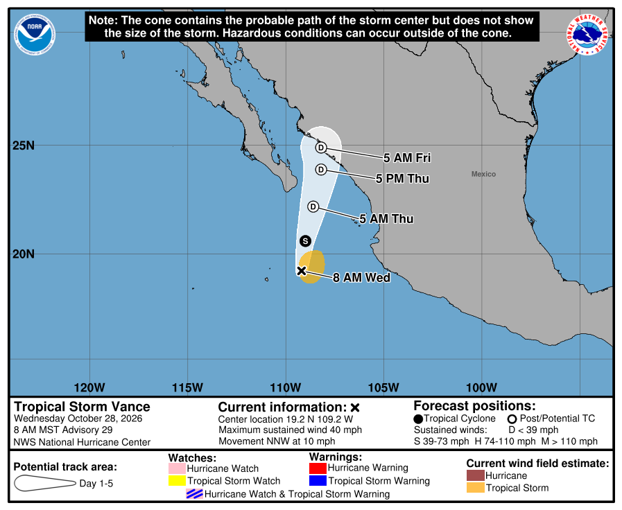
Official NHC cone for Vance, Advisory 29. It shows the likely path of the center, not the size of the storm; rain, wind, and surf can reach well outside it. 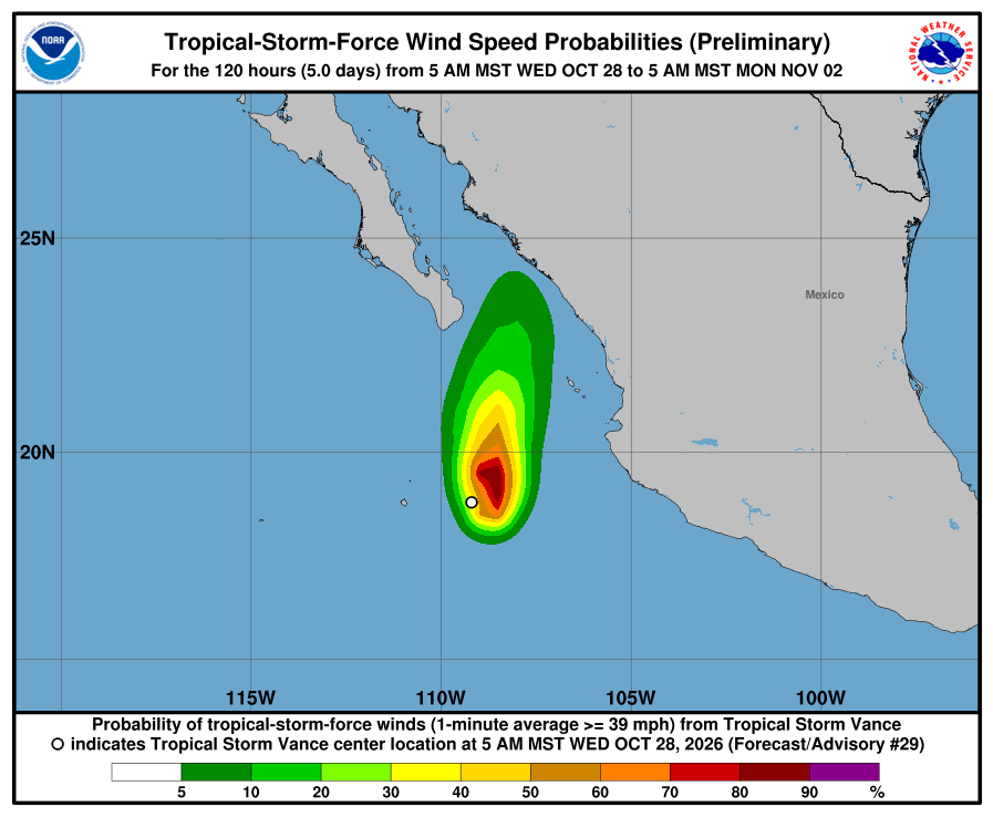
NHC wind-chance map, Advisory 29. Chance of tropical-storm-force wind over the next five days. Baja California Sur is not shaded; NHC does not list Cabo San Lucas, San José del Cabo, or La Paz (each under 3%). It is not a landfall forecast. NHC Vance Advisory 29 · NHC wind chances 29 · NHC eastern Pacific outlook · SMN Vance advisory No. 42 · SMN general forecast No. 601 · SMN four-day forecast No. 300 · SEMAR morning marine (7:00 AM MST) · Surfline Cerritos · Surfline La Pastora · Surfline San Pedrito · Windy Todos Santos · Open-Meteo
-
Hurricane Vance stays far to the south; no watches for BCS (Vance 9)
90 mph, forecast to become a major hurricane by Saturday morning. Its closest five-day point is about 553 miles from Todos Santos.
-
This week in our towns: SMN has showers today and isolated showers through Monday; warm; surf about 2–5 ft, smallest Monday and Tuesday; seas up to about 8–10 ft through Saturday; Hurricane Vance stays far to the south (Vance 8)
- Seven-day outlook (Fri Oct 23 to Thu Oct 29): For Todos Santos, El Pescadero, and Cerritos. Rain (SMN): showers today, then isolated showers Saturday to Monday; SMN's forecasts do not reach Tuesday to Thursday yet. Highs in the upper 80s °F (Windy). Surf about 2–5 ft Friday and Saturday (Surfline), smallest Monday and Tuesday (about 1–3 ft), and building again Wednesday and Thursday (about 3–5 ft at Cerritos and La Pastora). Wind is mostly light to moderate from the northwest. Seas stay up to about 8–10 ft on the southwest coast through Saturday (SEMAR).
- Surf at our beaches: From the Surfline spot forecasts (daytime, in our own words). Fri–Sat: Cerritos about 3–5 ft Friday and 3–4 ft Saturday; La Pastora about 4–5 ft, then 3–5 ft; San Pedrito about 2–4 ft, then 2–3 ft. A west-northwest to northwest swell (about 2–4 ft at 5–13 seconds) fades through Saturday, mixed with a south-southwest swell (about 1–3.5 ft at 12–16 seconds Friday, about 3 ft at 14 seconds Saturday). Sun–Tue: smaller. Cerritos about 2–4 ft Sunday, then 1–3 ft Monday and Tuesday; La Pastora about 3–4 ft, then 2–3 ft; San Pedrito about 2–3 ft, then 1–2 ft. The south-southwest swell runs about 3 ft at 13 seconds Sunday, then about 1–2.5 ft at 11–17 seconds. Wed–Thu: building again. Cerritos about 3–4 ft Wednesday and 3–5 ft Thursday; La Pastora about 3–4 ft, then 4–5 ft; San Pedrito about 1–3 ft, then 2–3 ft. A new long-period south-southwest swell arrives: about 1.5–3 ft at 14–18 seconds Wednesday and about 3.5 ft at 15–16 seconds Thursday. Southeast swell (possibly Vance's): Surfline's model shows a 13-second swell from the southeast: about 4–5 ft offshore Sunday, about 5–5.5 ft Monday to Wednesday, and about 3.5–5.5 ft Thursday. Linking it to Vance is our inference from its direction; Surfline does not name a source. Surfline's beach heights stay small Sunday to Tuesday (Cerritos about 1–3 ft Monday and Tuesday), so little of it shows at our beaches then; Wednesday and Thursday reach about 3–5 ft at Cerritos and La Pastora, when the new south-southwest swell also arrives. NHC's Advisory 8 names Vance's swells for southern and southwestern Mexico this weekend into next week, not BCS. Open-Meteo wave model near Pescadero agrees on the size: combined waves up to about 4–6 ft offshore all week, with swell periods of 11–13 seconds. Punta Lobos: no break-level forecast available. Official seas: SEMAR's evening marine bulletin (issued 7:00 PM MST Thursday) gives the southwest Baja coast 8–10 ft through 7 PM Saturday. SMN's general forecast No. 591 (issued 5:00 AM MST Friday) gives 1–2 m / about 3–7 ft for the west coast of the peninsula today; SMN's four-day forecast No. 295 has 1–2 m for BCS coasts Sunday and 2–3 m (about 7–10 ft) Monday. We follow the higher range: about 8–10 ft through Saturday. Seas are offshore wave heights, not the size of the surf at the beach.
- Wind: At the beaches (Surfline, daytime): northwest about 7–13 knots Friday and Saturday; lighter Sunday to Wednesday, about 1–11 knots (lightest at La Pastora), with light north (offshore) breezes some mornings; northwest picks up to about 12–14 knots Thursday afternoon. Windy (Todos Santos point, mblue AI model): about 2–10 knots with gusts to about 12 knots, Friday to Tuesday. The official marine forecast is stronger: SEMAR has northwest 15–20 knots, gusts 25–30 knots, in the coastal waters through 7 PM Saturday, and SMN has wind 20–30 km/h with gusts of 40–60 km/h (about 11–16 knots, gusts 22–32 knots) for BCS today. On the water, follow SEMAR.
- Weather: Rain (SMN only): SMN's general forecast No. 591 (5:00 AM MST Friday) has intervals of showers, 5–25 mm, for BCS today; SMN's four-day forecast No. 295 puts today's 5–25 mm in southern BCS. Saturday to Monday, No. 295 has only isolated showers, 0.1–5 mm, for BCS each day. SMN's forecasts do not reach Tuesday to Thursday yet; its next four-day forecast is due about 1:00 PM MST today. Sources disagree on today's rain: SMN (Nos. 591 and 295) has showers of 5–25 mm, but the corridor point models are drier: Windy shows no rain at Todos Santos, and Open-Meteo has a 2% chance and 0.0 mm at the Todos Santos point (23.45N 110.22W). Temperatures and sky: Friday partly to mostly cloudy (SMN 591), highs 30–35 °C (about 86–95 °F) for southern BCS (SMN 591). Windy (Todos Santos point): lows 75–76 °F and highs 86–87 °F Friday to Tuesday. Saturday and Monday SMN No. 295 has highs of 30–35 °C for BCS. Wednesday and Thursday, Open-Meteo (model, Todos Santos point 23.45N 110.22W) has lows of about 73–74 °F and highs of about 86–87 °F. Surfline's sky forecast: clear by day Saturday to Tuesday, some cloud Wednesday. A heavy shower can still muddy dirt roads and run water through arroyo crossings for a few hours.
- What changed: Vance is now Hurricane Vance (Category 1). NHC Advisory 8 (2:00 AM MST Friday) has 85 mph winds, about 440 miles south-southwest of Acapulco, moving north-northwest at 6 mph. There are no coastal watches or warnings. SMN's Vance advisory No. 8 (2:00 AM MST Friday) lists rain, strong wind, and high seas for the coasts of southern Mexico, not BCS.
- What this means here: Hurricane Vance is still not a storm threat for Todos Santos, Pescadero, or Cerritos. It is far to our south-southeast. The local items this week are a few showers today (SMN) and seas up to about 8–10 ft through Saturday from a cold front to the north.
- Stronger or weaker: Stronger. NHC expects rapid strengthening to a major hurricane by tonight, peaking near 115 mph, then gradual weakening over cooler water.
- Path and timing: North-northwest through the weekend, then slow and less certain as its steering weakens. NHC's closest five-day point (11 PM MST Tuesday) is about 529 miles from Todos Santos, still far away. SMN puts it about 140 km west-southwest of Punta San Telmo, Michoacán, at that time. Day-5 positions can shift a lot. NHC's outlook has no other areas to watch in the eastern Pacific.
- Wind chance: NHC Advisory 8, through 11 PM MST Tuesday: Cabo San Lucas, San José del Cabo, and La Paz are not listed (each under 3%). Manzanillo's chance of tropical-storm-force wind is 22% through 11 PM MST Sunday and 52% through 11 PM MST Tuesday. NHC does not list Todos Santos.
- Windy + multi-source: NHC is official for Vance's track and watches; SMN advisory 8 lists no BCS impacts; rain from SMN only, 5–25 mm for BCS today and isolated 0.1–5 mm Saturday to Monday, nothing from SMN yet for Tuesday to Thursday; seas SEMAR 8–10 ft through Saturday vs SMN 1–2 m (3–7 ft), we follow the higher; wind Surfline and Windy about 1–14 knots at the beaches vs SEMAR 15–20 knots in the coastal waters; surf Surfline checked for Cerritos, La Pastora, and San Pedrito
- Do now: No watches for BCS. Nothing to prepare for Vance. Plan dirt-road trips around SMN's showers today. Seas run up to about 8–10 ft on the southwest coast through Saturday; swim only at beaches you know. Surf is smallest Monday and Tuesday. We update this page weekly; for anything newer, follow NHC, SMN, and Protección Civil BCS.
Missed cycles: we did not post Vance Advisories 2–6 or a Thursday check; Vance stayed far from BCS. Wednesday's update showed stray code in its headline; that is fixed. Correction to the Oct 21 entry below (otherwise kept as published): it gave seas as about 3–7 ft from SMN and Surfline; SEMAR's 7:00 AM MST bulletin that day had 5–7 ft for the southwest coast, so the higher figure was 5–7 ft. Oct 23 edit: at the owner's direction, surf-current safety wording was removed from the archived entries below (the last few short mentions were removed in this update); no other changes. This entry was updated at 6:37 AM MST with Advisory 8 and the seven-day corridor outlook; the 12:29 AM MST version cited Advisory 7. At 6:49 AM MST rain wording was limited to SMN (model rain figures removed), SMN No. 591's area was corrected to all of BCS, the light-wind range and Wednesday–Thursday surf wording were corrected, and the southeast swell's link to Vance is now marked as our inference. At 7:18 AM MST the point models' drier reading for today's rain was added back as a labelled conflict with SMN, and the Wednesday–Thursday Open-Meteo temperatures were corrected to the Todos Santos point. Checked Fri, Oct 23 · 7:18 AM MST.
NHC Vance Advisory 8 · NHC wind chances 8 · NHC eastern Pacific outlook · SMN Vance advisory No. 8 · SMN general forecast No. 591 · SMN four-day forecast No. 295 · SEMAR evening marine (Thursday 7:00 PM MST) · Surfline Cerritos · Surfline La Pastora · Surfline San Pedrito · Windy Todos Santos
-
Superseded by the Oct 23 weekly update. Newer update above.
No storm threat for our towns; new Tropical Depression Twenty-Two-E is far south of Mexico; a few showers possible; seas about 3–7 ft (Twenty-Two-E 1)
- What changed: Tropical Depression Twenty-Two-E formed this morning (NHC Advisory 1, 8:00 AM MST). It has 35 mph winds and sits about 515 miles south of Acapulco, moving west at about 7 mph. NHC expects it to strengthen quickly and become a hurricane Friday. There are no coastal watches or warnings. Trudy is gone: NHC issued its final advisory at 8:00 PM MST Monday, when it became a remnant low. SMN's Twenty-Two-E advisory No. 1 (8:00 AM MST) says it does not affect Mexico for now.
- What this means here: Twenty-Two-E is not a storm threat for Todos Santos, Pescadero, or Cerritos. It is far to our south-southeast. The local items this week are a few showers and normal seas. SMN has intervals of showers, 5–25 mm, for BCS today and again Thursday (a statewide figure). A heavy cell can still muddy dirt roads and run water through arroyo crossings for a few hours.
- Stronger or weaker: Stronger. NHC forecasts steady to rapid strengthening: a hurricane Friday and a peak near 115 mph by Friday evening, then slow weakening.
- Path and timing: Slow motion west, then a turn northwest and north-northwest over the next few days. NHC's five-day point (5 AM MST Monday) is still about 645 miles from Todos Santos. Day-5 positions can shift a lot, so we keep checking once a day. NHC's outlook has no other areas to watch in the eastern Pacific.
- Wind chance: NHC Advisory 1, through 5 AM MST Monday: Cabo San Lucas, San José del Cabo, and La Paz are not listed (each under 3%). Manzanillo is 15%. NHC does not list Todos Santos.
- Rain: SMN's general forecast No. 587 (issued 5:00 AM MST) has intervals of showers, 5–25 mm, for BCS today, mostly in the afternoon, with gusts of 30–50 km/h (about 19–31 mph). SMN's four-day forecast No. 293 (issued 1:00 PM MST Tuesday; each period runs 7 AM to 7 AM MST): 5–25 mm for BCS through 7 AM Thursday and again through 7 AM Friday, then isolated showers, 0.1–5 mm, through 7 AM Saturday and through 7 AM Sunday.
- Surf at our beaches: Surfline's spot reports, checked at 8:56 AM MST (Surfline's own feet): Cerritos 4–5 ft, San Pedrito 3–4 ft, with light offshore wind this morning. A new long-period south-southwest swell is due to add size later today. Punta Lobos: no break-level forecast available. Official seas: SMN 587 gives 1–2 m / about 3–7 ft for the west coast of the peninsula today, and SMN 293 keeps 1–2 m for BCS coasts through 7 AM Sunday.
- Windy + multi-source: NHC is official for Twenty-Two-E's track and watches; SMN advisory 1 agrees it does not affect Mexico for now; rain follows SMN only (5–25 mm BCS today and Thursday); seas SMN 3–7 ft and Surfline 3–5 ft at our beaches
- Do now: No watches for BCS. Nothing to prepare for Twenty-Two-E yet. Plan dirt-road trips around afternoon showers today and Thursday. Swim only at beaches you know. Next: NHC's next Twenty-Two-E advisory ~2:00 PM MST; SMN's next Twenty-Two-E advisory ~2:15 PM MST; SMN general forecast next ~5:00 PM MST; SMN four-day next ~1:00 PM MST.
Missed cycles: we did not post Trudy Advisories 17–27 or the daily checks Oct 18–20; Trudy stayed far from BCS and ended Monday. Twenty-Two-E is not a storm threat for our towns; no watches for BCS. SMN has 5–25 mm of showers for BCS today and Thursday; seas about 3–7 ft. Checked Wed, Oct 21 · 8:56 AM MST.
NHC Twenty-Two-E Advisory 1 · NHC wind chances 1 · NHC eastern Pacific outlook · SMN Twenty-Two-E advisory No. 1 · SMN general forecast No. 587 · SMN four-day forecast No. 293 · Surfline Cerritos · Surfline San Pedrito
-
Superseded by the Oct 21 weekly update. Newer update above.
Trudy holds at 90 mph off mainland Mexico, may peak near 105 mph today; its track still ends about 175 miles from us; no watches for BCS; showers and seas up to about 10 ft (Trudy 16A)
- What changed: Hurricane Trudy Intermediate Advisory 16A (5:00 AM MST): Trudy holds at 90 mph / 979 mb, Category 1, about 255 miles west of Acapulco and 190 miles south-southeast of Manzanillo, moving northwest at about 8 mph. We missed overnight complete Advisory 16 (2:00 AM MST); this entry covers it and 16A. On the mainland coast: a Hurricane Warning from Manzanillo to Cabo Corrientes, a Hurricane Watch south of Manzanillo to Punta San Telmo, Tropical Storm Warnings south of Manzanillo to Zihuatanejo and, new since our last update, north of Cabo Corrientes to Punta Mita, and a Tropical Storm Watch north of Punta Mita to San Blas and for Las Islas Marías. None of Trudy's watches or warnings include BCS. NHC says more mainland watches or warnings are likely today. NHC's five-day track (Advisory 16) still ends with a remnant low about 175 miles from Todos Santos, now late Tuesday night. Cabo San Lucas is no longer on NHC's wind-chance list (under 3%, was 3%). SMN's Trudy advisory No. 26 (5:00 AM MST) also lists no BCS areas. Seas: SMN's general forecast No. 579 (issued 5:00 AM MST) gives the west coast of the peninsula 1–3 m / about 3–10 ft today. SEMAR's evening marine forecast (issued 7:00 PM MST Friday) gives the southwest Baja coast 6–8 ft through 7 PM tonight and 6–8 ft into Sunday evening. We follow the higher range: up to about 10 ft (SMN).
- What this means here: Trudy is still not a storm threat for Todos Santos, Pescadero, or Cerritos. It holds at 90 mph and is aimed at the coast of west-central Mexico, far to our southeast. NHC's track still ends as a weak remnant low about 175 miles from Todos Santos late Tuesday. Cabo San Lucas has dropped off NHC's wind-chance list. Rain and surf remain the local issues. SMN has showers with locally heavy rain, 25–50 mm, for all of BCS today, with lightning. A heavy cell can flood arroyo crossings and turn dirt roads around Pescadero to mud. Seas run up to about 10 ft.
- Stronger or weaker: Holding: 90 mph, the same as at 8 PM Friday. NHC says some strengthening is possible today, to a peak near 105 mph (Category 2) from late morning into tonight, then steady weakening from late Sunday, a tropical storm by Monday, a remnant low by late Tuesday, and gone by late Wednesday.
- Path and timing: Trudy keeps moving northwest at about 8 mph, nearing the coast of southwestern and west-central Mexico today and passing near it tonight into Sunday. NHC's track then bends west-northwest, away from the coast, and ends with a remnant low about 175 miles from Todos Santos (about 130 miles from Cabo San Lucas) by 11 PM MST Tuesday; NHC expects it to dissipate by 11 PM MST Wednesday. Day-4 positions can still shift a lot. Farther out: NHC's 5:00 AM MST outlook gives an area south of southern Mexico a 70% chance of becoming a tropical depression within 7 days, near 0% in 48 hours; it is far from us. Rain: SMN's general forecast No. 579 (issued 5:00 AM MST) gives all of BCS showers with locally heavy rain, 25–50 mm, today (a statewide figure), with lightning, from an upper-level low. SMN's four-day forecast No. 289 (issued 2:30 PM MST Friday) also has 25–50 mm for BCS from 7 AM today to 7 AM Sunday, northern BCS 25–50 mm Sunday (north of us), and southern BCS, which includes our towns, 25–50 mm again Monday.
- Wind chance: Trudy Advisory 16, through 11 PM MST Wednesday: Cabo San Lucas, San José del Cabo, and La Paz are not listed (each under 3%; Cabo San Lucas was 3% at Advisory 15). Las Islas Marías is 56%. NHC does not list Todos Santos in its wind-chance table.
- Surf at our beaches: Surfline's free spot forecasts, checked at 6:02 AM MST (hourly slots from 6 AM on, Surfline's own feet): Cerritos about 4–6 ft today, 4–6+ ft from 10 PM tonight, and 4–6 ft Sunday (4–6+ from 6 PM); La Pastora about 4–6+ ft this morning, 5–7 ft from 1 PM, and 6–8 ft much of Sunday; San Pedrito about 3–4+ ft today and Sunday, then 4–5 ft from 8 PM Sunday. Windy's forecast for Todos Santos, checked at 6:04 AM MST, shows waves about 2.0–2.2 m (about 7 ft) today and 2.1–2.4 m (about 7–8 ft) Sunday, with light to moderate wind. Official seas run higher than the beach forecasts: SMN's general forecast No. 579 (issued 5:00 AM MST) gives the west coast of the peninsula 1–3 m / about 3–10 ft today. SEMAR's evening marine forecast (issued 7:00 PM MST Friday) gives the southwest Baja coast 6–8 ft through 7 PM tonight and 6–8 ft into Sunday evening. We follow the higher range: up to about 10 ft (SMN). Sunday: 1–3 m / 3–10 ft for southern BCS coasts (SMN 289). Monday: 2–4 m / 7–13 ft for BCS coasts (SMN 289). NHC says Trudy's swells will spread north toward west-central Mexico through the weekend with life-threatening surf there. Punta Lobos: no break-level forecast available.
- Windy + multi-source: NHC is official for watches and Trudy's track; SMN Trudy 26 (5:00 AM MST) matches NHC on Category 1 now and a Category 2 peak; rain follows SMN only: general 579 has 25–50 mm for all of BCS today; seas today SMN 579 3–10 ft vs SEMAR 6–8 ft, we follow the higher; Windy about 7 ft with light to moderate wind; Surfline spots about 3–7 ft today
- Do now: There are no watches for BCS. Plan dirt-road trips and arroyo crossings around today's showers; a heavy cell can close them quickly. Secure loose outdoor items before storms. Skip swimming at open beaches today and Sunday — seas up to about 10 ft (SMN, west coast of the peninsula). Keep basic supplies ready and check Trudy again Sunday morning. Follow NHC, SMN, and Protección Civil BCS. Next: NHC's next complete Trudy advisory (17) around 8:00 AM MST and intermediate around 11:00 AM MST; SMN's next Trudy advisory ~8:15 AM MST; SMN general forecast next ~5:00 PM MST; SMN four-day next ~1:00 PM MST; SEMAR's next marine bulletin ~7:00 AM MST. Simon's advisories have ended.
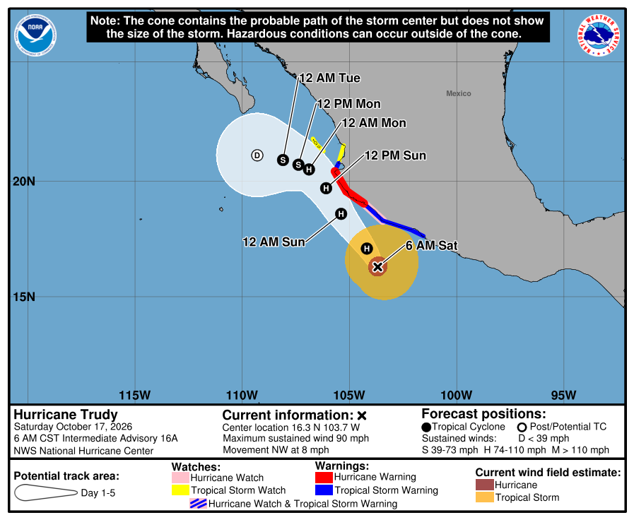
Official NHC cone for Trudy, Advisory 16A. It shows the likely path of the center, not the size of the storm; rain, wind, and surf can reach outside it. Red is the Hurricane Warning, pink the Hurricane Watch, blue the Tropical Storm Warning (striped pink and blue where a Hurricane Watch and Tropical Storm Warning overlap), and yellow the Tropical Storm Watch, on the mainland coast and at Las Islas Marías; the Tropical Storm Warning now also runs north of Cabo Corrientes to Punta Mita. The open circle is a weak post-tropical low by 11 PM MST Tuesday, about 175 miles from Todos Santos. 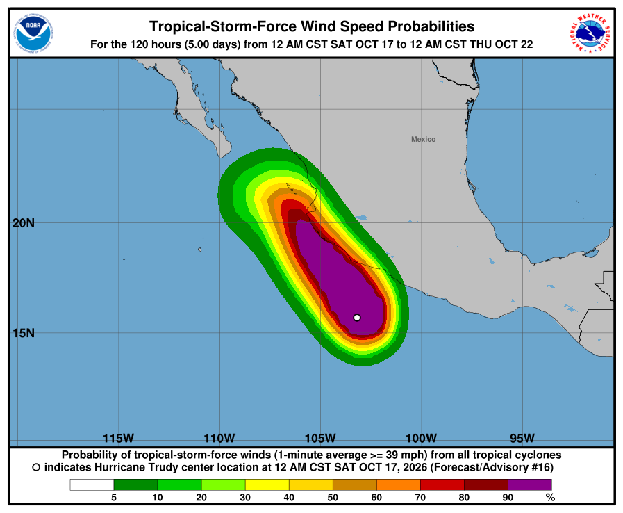
NHC wind-chance map, Advisory 16. Chance of tropical-storm-force wind over the next five days from all storms. Baja California Sur is not shaded; NHC no longer lists Cabo San Lucas, San José del Cabo, or La Paz (each under 3%). It is not a landfall forecast. Missed cycle: we did not publish Trudy Advisory 16 (2:00 AM MST) overnight; this entry covers 16 and 16A. Trudy holds at 90 mph and is aimed at mainland Mexico; its track still ends about 175 miles from Todos Santos. Cabo San Lucas is off NHC's wind-chance list; no watches for BCS. Rain is the main local issue: SMN 579 gives all of BCS showers with locally heavy rain, 25–50 mm, today; a heavy cell can flood arroyo crossings and dirt roads for a few hours. SMN's general forecast No. 579 (issued 5:00 AM MST) gives the west coast of the peninsula 1–3 m / about 3–10 ft today. SEMAR's evening marine forecast (issued 7:00 PM MST Friday) gives the southwest Baja coast 6–8 ft through 7 PM tonight and 6–8 ft into Sunday evening. We follow the higher range: up to about 10 ft (SMN). Skip swimming at open beaches today and Sunday. Next NHC complete Trudy advisory (17) around 8:00 AM MST and intermediate around 11:00 AM MST; SMN's next Trudy advisory ~8:15 AM MST; SMN general next ~5:00 PM MST; SMN four-day next ~1:00 PM MST; SEMAR next ~7:00 AM MST. Simon's advisories have ended. Checked Sat, Oct 17 · 6:09 AM MST.
-
Superseded by Trudy Advisory 16A. Newer update above.
Trudy strengthens to 90 mph, still aimed at mainland Mexico; its track now ends farther from us; no watches for BCS; seas up to about 10 ft (Trudy 15)
- What changed: Hurricane Trudy Advisory 15 (8:00 PM MST): Trudy strengthened to 90 mph / 979 mb, still a Category 1, about 210 miles southwest of Acapulco, moving north at about 7 mph. On the mainland coast: a Hurricane Warning from Manzanillo to Cabo Corrientes, a Hurricane Watch south of Manzanillo to Punta San Telmo, a Tropical Storm Warning south of Manzanillo to Zihuatanejo, and a Tropical Storm Watch north of Cabo Corrientes to San Blas. New: a Tropical Storm Watch for Las Islas Marías, the islands off Nayarit. None of Trudy's watches or warnings include BCS. NHC says more mainland watches or warnings are likely tonight or early Saturday. NHC's new five-day track ends with a remnant low about 175 miles from Todos Santos on Tuesday, farther than the 2 PM track (about 110 miles). NHC now lists Cabo San Lucas at 3% for tropical-storm-force wind; San José del Cabo and La Paz are not listed. SMN's Trudy advisory No. 23 (8:00 PM MST) also lists no BCS areas. Seas: SMN gives 2–3 m / about 7–10 ft seas for Baja California Sur coasts through 7 AM Saturday MST (four-day No. 289). SEMAR's evening marine forecast (issued 7:00 PM MST) gives the southwest Baja coast 6–8 ft through 7 PM Saturday. We follow the higher range: up to about 10 ft (SMN).
- What this means here: Trudy is still not a storm threat for Todos Santos, Pescadero, or Cerritos. It strengthened to 90 mph tonight, but it is heading for mainland Mexico, and NHC's new track ends farther from us, about 175 miles away. NHC now gives Cabo San Lucas a 3% chance of tropical-storm-force wind, still low. Rain and surf remain the local issues. SMN keeps very heavy rain possible in spots in southern BCS tonight and has 25–50 mm for BCS on Saturday. A heavy cell can flood arroyo crossings and turn dirt roads around Pescadero to mud. Seas stay up to about 10 ft.
- Stronger or weaker: Stronger: 90 mph, up from 85 mph at 5 PM. NHC says steady strengthening is possible through Saturday and forecasts a peak near 105 mph Saturday, then weakening near the coast of Jalisco Sunday, a remnant low by Tuesday, and gone by Wednesday.
- Path and timing: Trudy turns north-northwest, then northwest and faster, overnight and into Saturday, nearing the coast of southwestern and west-central Mexico Saturday and passing near it Saturday night into Sunday. NHC's track then bends west-northwest and ends with a remnant low about 175 miles from Todos Santos (about 130 miles from Cabo San Lucas) by 5 PM MST Tuesday; NHC expects it to dissipate by 5 PM MST Wednesday. Day-4 positions can still shift a lot. Farther out: NHC's 5:00 PM MST outlook gives an area south of southern Mexico a 70% chance of becoming a tropical depression within 7 days, near 0% in 48 hours; it is far from us. Rain: SMN's general forecast No. 578 (issued 5:00 PM MST) says Simon's leftovers keep very heavy rain possible in spots in southern BCS tonight, and gives BCS 25–50 mm Saturday. SMN's four-day forecast No. 289 (issued 2:30 PM MST) has southern BCS, which includes our towns, at 50–75 mm through 7 AM Saturday, northern BCS 25–50 mm Sunday (north of us), and southern BCS 25–50 mm again Monday.
- Wind chance: Trudy Advisory 15, through 5 PM MST Wednesday: Cabo San Lucas 3% (up from under 1%); San José del Cabo and La Paz are not listed (under 1%). Las Islas Marías is 51%. NHC does not list Todos Santos in its wind-chance table.
- Surf at our beaches: Surfline's free spot forecasts, checked at 9:43 PM MST (hourly slots from 9 PM on): Cerritos about 4–5 ft this evening and 4–6 ft overnight and Saturday; La Pastora about 4–6 ft tonight and 4–7 ft Saturday; San Pedrito about 2–4 ft tonight and 3–4 ft Saturday. Windy's forecast for Todos Santos, checked at 9:26 PM MST, shows waves about 6 ft tonight, 6–7 ft Saturday, and about 7–8 ft Sunday, with light wind tonight. Official seas run higher than the beach forecasts: SMN gives 2–3 m / about 7–10 ft seas for Baja California Sur coasts through 7 AM Saturday MST (four-day No. 289). SEMAR's evening marine forecast (issued 7:00 PM MST) gives the southwest Baja coast 6–8 ft through 7 PM Saturday. We follow the higher range: up to about 10 ft (SMN). Saturday: SMN's general No. 578 gives the west coast of the peninsula 1–3 m / 3–10 ft; SEMAR has 6–8 ft into Sunday evening. Sunday: 1–3 m / 3–10 ft for southern BCS coasts (SMN 289). Monday: 2–4 m / 7–13 ft for BCS coasts. NHC says Trudy's swells will spread north toward west-central Mexico through the weekend with life-threatening surf there; NHC's final Simon advisory said its swells could bring life-threatening surf to Baja California Sur over the next day or so. Punta Lobos: no break-level forecast available.
- Windy + multi-source: NHC is official for watches and Trudy's track; SMN Trudy 23 (8:00 PM MST) matches NHC on Category 1; rain follows SMN only: four-day 289 has 50–75 mm for southern BCS through 7 AM Saturday and general 578 has 25–50 mm for BCS Saturday; seas through 7 AM Saturday SMN four-day 289 7–10 ft vs SEMAR 6–8 ft, and into Saturday SMN 578 3–10 ft vs SEMAR 6–8 ft, we follow the higher; Windy about 6–7 ft with light wind tonight; Surfline spots about 2–6 ft tonight
- Do now: There are no watches for BCS. Plan dirt-road trips and arroyo crossings for dry hours tonight through Monday; a heavy cell can close them quickly. Secure loose outdoor items before storms. Skip swimming at open beaches tonight and Saturday — seas up to about 10 ft (SMN, Baja California Sur coasts). Keep basic supplies ready and check Trudy again Saturday morning. Follow NHC, SMN, and Protección Civil BCS. Next: NHC's next Trudy update (intermediate) around 11:00 PM MST and complete advisory around 2:00 AM MST Saturday; SMN's next Trudy advisory ~11:15 PM MST; SMN general forecast next ~5:00 AM MST Saturday; SMN four-day next ~1:00 PM MST Saturday; SEMAR's next marine bulletin ~7:00 AM MST Saturday. Simon has no more NHC or SMN advisories.
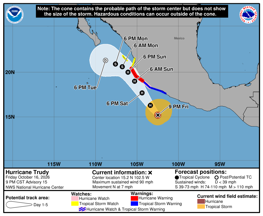
Official NHC cone for Trudy, Advisory 15. It shows the likely path of the center, not the size of the storm; rain, wind, and surf can reach outside it. Red is the Hurricane Warning, pink the Hurricane Watch, blue the Tropical Storm Warning (striped pink and blue where a Hurricane Watch and Tropical Storm Warning overlap), and yellow the Tropical Storm Watch, on the mainland coast and at Las Islas Marías. The open circle is a weak post-tropical low by 5 PM MST Tuesday, about 175 miles from Todos Santos. 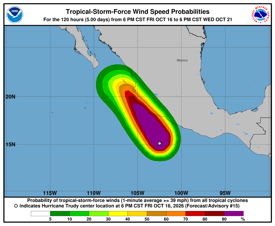
NHC wind-chance map, Advisory 15. Chance of tropical-storm-force wind over the next five days from all storms. Baja California Sur is not shaded; NHC lists Cabo San Lucas at 3% and San José del Cabo and La Paz under 1%. It is not a landfall forecast. Trudy strengthened to 90 mph and is aimed at mainland Mexico; its track now ends about 175 miles from Todos Santos, farther than at 2 PM. Cabo San Lucas wind chance 3%; no watches for BCS. Rain is the main local issue: SMN keeps very heavy rain possible in spots in southern BCS tonight and has 25–50 mm for BCS Saturday; a heavy cell can flood arroyo crossings and dirt roads for a few hours. SMN gives 2–3 m / about 7–10 ft seas for Baja California Sur coasts through 7 AM Saturday MST (four-day No. 289). SEMAR's evening marine forecast (issued 7:00 PM MST) gives the southwest Baja coast 6–8 ft through 7 PM Saturday. We follow the higher range: up to about 10 ft (SMN). Skip swimming at open beaches tonight and Saturday. Next NHC Trudy intermediate around 11:00 PM MST and complete around 2:00 AM MST Saturday; SMN's next Trudy advisory ~11:15 PM MST; SMN general next ~5:00 AM MST Saturday; SMN four-day next ~1:00 PM MST Saturday; SEMAR next ~7:00 AM MST Saturday. No more Simon advisories. Checked Fri, Oct 16 · 9:44 PM MST.
-
Superseded by Trudy Advisory 15. Newer update above.
Trudy holds at Category 1, still aimed at mainland Mexico; no watches for BCS; heavy rain possible in spots tonight, seas up to about 10 ft (Trudy 14A)
- What changed: Hurricane Trudy Intermediate Advisory 14A (5:00 PM MST) shows little change: a Category 1 hurricane near 85 mph / 982 mb, about 220 miles southwest of Acapulco, moving north-northwest at about 6 mph. NHC made no watch or warning changes. On the mainland coast: a Hurricane Warning from Manzanillo to Cabo Corrientes, a Hurricane Watch from Manzanillo south to Punta San Telmo, a Tropical Storm Warning from Manzanillo south to Zihuatanejo, and a Tropical Storm Watch north of Cabo Corrientes to San Blas. None of Trudy's watches or warnings include BCS. NHC says more mainland watches or warnings are likely tonight. SMN's Trudy advisory No. 22 (5:00 PM MST) also lists no BCS areas. Simon has no more advisories; NHC's final one was Advisory 38 at 2:00 PM MST. Rain: SMN's general forecast No. 578 (5:00 PM MST) keeps very heavy rain possible in spots in southern BCS tonight from Simon's leftovers. Seas: SMN gives 2–3 m / about 7–10 ft seas for Baja California Sur coasts today (four-day No. 289 and this morning's general No. 577). SEMAR's Friday morning marine forecast (issued 7:00 AM MST) gives the southwest Baja coast 5–7 ft. We follow the higher range: up to about 10 ft (SMN).
- What this means here: Trudy is still not a storm threat for Todos Santos, Pescadero, or Cerritos. At 5 PM it is still a Category 1 near 85 mph, heading for mainland Mexico, and NHC's wind chance at Cabo San Lucas, San José del Cabo, and La Paz stays under 1%. Rain and surf are the local issues. SMN says Simon's leftovers can still bring very heavy rain in spots in southern BCS tonight, and it has 25–50 mm for BCS on Saturday. A heavy cell can flood arroyo crossings and turn dirt roads around Pescadero and Todos Santos to mud. Seas stay up to about 10 ft tonight.
- Stronger or weaker: Trudy holds near 85 mph, the same as at 2 PM. NHC says slight strengthening is possible Saturday and Saturday night. Its 2 PM forecast peaks near 90 mph, then weakens near the coast of Jalisco Sunday and down to about 35 mph by Tuesday.
- Path and timing: Trudy moves north-northwest, then faster northwest through Sunday, nearing the coast of southwestern and west-central Mexico Saturday and passing near it Saturday night into Sunday. NHC's five-day track from 2 PM still ends with a weak remnant low about 110 miles from Todos Santos (about 67 miles from Cabo San Lucas) by 11 AM MST Wednesday. Day-5 positions can still shift a lot. Farther out: NHC's 5:00 PM MST outlook gives an area south of southern Mexico a 70% chance of becoming a tropical depression within 7 days (up from 60% at 11 AM MST), near 0% in 48 hours. It is a week or more away and far from us; too early to say where it goes. Rain: SMN's general forecast No. 578 (issued 5:00 PM MST) says Simon's leftovers keep very heavy rain possible in spots in southern BCS tonight, and gives BCS 25–50 mm Saturday. SMN's four-day forecast No. 289 (issued 2:30 PM MST) has southern BCS, which includes our towns, at 50–75 mm today, northern BCS 25–50 mm Sunday (north of us), and southern BCS 25–50 mm again Monday.
- Wind chance: Trudy Advisory 14 (the latest wind-chance table; 5 PM was an intermediate update), through 11 AM MST Wednesday: Cabo San Lucas, San José del Cabo, and La Paz are under 1% and not listed. NHC does not list Todos Santos in its wind-chance table.
- Surf at our beaches: Surfline's free spot forecasts, checked around 4:20 PM MST: Cerritos about 3–4 ft today and 4–6 ft Saturday; La Pastora about 4–5 ft today and 4–7 ft Saturday; San Pedrito about 2–3 ft today and 3–4 ft Saturday. Windy's forecast for Todos Santos, checked again at 5:42 PM MST, shows waves about 6 ft now, about 8 ft this evening, and 6–7 ft Saturday, and wind around 8 PM about 23 mph, gusting about 32 mph, easing to about 20 mph, gusting 30 mph, by 11 PM. Official seas run higher than the beach forecasts: SMN gives 2–3 m / about 7–10 ft seas for Baja California Sur coasts today (four-day No. 289 and this morning's general No. 577). SEMAR's Friday morning marine forecast (issued 7:00 AM MST) gives the southwest Baja coast 5–7 ft. We follow the higher range: up to about 10 ft (SMN). Saturday: SMN's general No. 578 gives the west coast of the peninsula 1–3 m / 3–10 ft. Sunday: 1–3 m / 3–10 ft for southern BCS coasts. Monday: 2–4 m / 7–13 ft for BCS coasts. NHC's final Simon advisory said its swells could bring life-threatening surf to Baja California Sur over the next day or so. Punta Lobos: no break-level forecast available.
- Windy + multi-source: NHC is official for watches and Trudy's track; SMN Trudy 22 (5:00 PM MST) matches NHC on Category 1; rain follows SMN only: four-day 289 has 50–75 mm for southern BCS today and general 578 has 25–50 mm for BCS Saturday; seas today SMN four-day 289 7–10 ft vs SEMAR 5–7 ft, and into Saturday SMN 578 3–10 ft vs SEMAR 6–8 ft, we follow the higher; Windy about 6–8 ft tonight sits inside SMN's range, with wind about 23 mph gusting 32 mph around 8 PM; Surfline spots about 2–5 ft today
- Do now: There are no watches for BCS. Plan dirt-road trips and arroyo crossings for dry hours tonight through Monday; a heavy cell can close them quickly. Secure loose outdoor items before storms and this evening's gusty wind. Skip swimming at open beaches tonight and Saturday — seas up to about 10 ft (SMN, Baja California Sur coasts). Keep basic supplies ready and check Trudy again Saturday morning. Follow NHC, SMN, and Protección Civil BCS. Next: NHC's next complete Trudy advisory around 8:00 PM MST; SMN's next Trudy advisory ~8:15 PM MST; SMN general forecast next ~5:00 AM MST Saturday; SMN four-day next ~1:00 PM MST Saturday. Simon has no more NHC or SMN advisories.
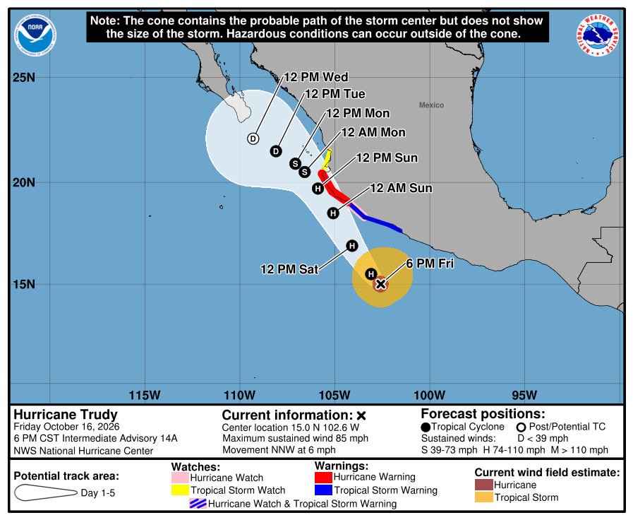
Official NHC cone for Trudy, Intermediate Advisory 14A. It shows the likely path of the center, not the size of the storm; rain, wind, and surf can reach outside it. Red is the Hurricane Warning, pink the Hurricane Watch, blue the Tropical Storm Warning (striped pink and blue where a Hurricane Watch and Tropical Storm Warning overlap), and yellow the Tropical Storm Watch, all on the mainland coast. The open circle is a weak post-tropical low south-southeast of Los Cabos by 11 AM MST Wednesday. 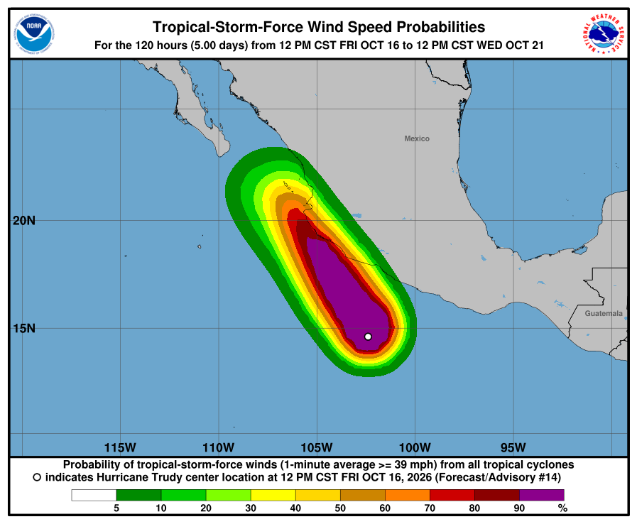
NHC wind-chance map, Advisory 14 (still current at 5 PM). Chance of tropical-storm-force wind over the next five days from all storms. Baja California Sur is not shaded; NHC lists Cabo San Lucas, San José del Cabo, and La Paz under 1%. It is not a landfall forecast. Trudy holds at Category 1 near 85 mph, aimed at mainland Mexico, with Los Cabos and La Paz wind chance under 1% and no watches for BCS. Simon has no more advisories. Rain is the main local issue: SMN keeps very heavy rain possible in spots in southern BCS tonight and has 25–50 mm for BCS Saturday; a heavy cell can flood arroyo crossings and dirt roads for a few hours. SMN gives 2–3 m / about 7–10 ft seas for Baja California Sur coasts today (four-day No. 289 and this morning's general No. 577). SEMAR's Friday morning marine forecast (issued 7:00 AM MST) gives the southwest Baja coast 5–7 ft. We follow the higher range: up to about 10 ft (SMN). Skip swimming at open beaches tonight and Saturday. Next NHC complete Trudy advisory around 8:00 PM MST; SMN's next Trudy advisory ~8:15 PM MST; SMN general next ~5:00 AM MST Saturday; SMN four-day next ~1:00 PM MST Saturday. No more Simon advisories. Checked Fri, Oct 16 · 6:07 PM MST.
-
Superseded by Trudy Intermediate Advisory 14A. Newer update above.
Simon is gone (final advisory) and Trudy is a Category 1 aimed at mainland Mexico; no watches for BCS; heavy rain possible today, seas up to about 10 ft (Simon 38, Trudy 14)
- What changed: Remnants of Simon Advisory 38 (Fri, Oct 16 · 2:00 PM MST) is NHC's final advisory: Simon has dissipated. Its remnants are about 100 miles south-southwest of Cabo San Lucas, near 35 mph, moving northwest at about 13 mph. SMN also issued its final Simon advisory (No. 76, 2:00 PM MST), with heavy rain of 50–75 mm in spots in Baja California Sur. Hurricane Trudy Advisory 14 (2:00 PM MST) is a Category 1 hurricane near 85 mph / 982 mb, about 225 miles southwest of Acapulco, moving north-northwest at about 5 mph. A Hurricane Warning now runs on the mainland coast from Manzanillo to Cabo Corrientes, with a Tropical Storm Watch north to San Blas. Trudy's watches and warnings do not include BCS. NHC no longer lists Cabo San Lucas, San José del Cabo, or La Paz in Trudy's wind chances (all under 1%). Seas: SMN gives 2–3 m / about 7–10 ft seas for Baja California Sur coasts today (four-day No. 289 and general No. 577). SEMAR's Friday morning marine forecast (issued 7:00 AM MST) gives the southwest Baja coast 5–7 ft. We follow the higher range: up to about 10 ft (SMN).
- What this means here: Simon is gone, and Trudy is still not a wind threat for Todos Santos, Pescadero, or Cerritos: NHC's wind chance at Cabo San Lucas, San José del Cabo, and La Paz is now under 1%. Rain and surf are the local issues. SMN has 50–75 mm for southern BCS today. A heavy cell can flood arroyo crossings and turn dirt roads around Pescadero and Todos Santos to mud. Seas up to about 10 ft today.
- Stronger or weaker: Simon is gone. Trudy is weaker than this morning: about 85 mph now. NHC forecasts a peak near 90 mph by Saturday, then weakening near the coast of Jalisco Sunday and down to about 35 mph by Tuesday.
- Path and timing: Trudy moves slowly north-northwest toward the coast of Jalisco Saturday night into Sunday, then bends west, weakening. NHC's five-day track ends with a weak remnant low about 110 miles from Todos Santos (about 67 miles from Cabo San Lucas) by 11 AM MST Wednesday. Day-5 positions can still shift a lot. Rain: SMN's four-day forecast No. 289 (issued 2:30 PM MST) gives southern BCS, which includes our towns, 50–75 mm today, BCS 25–50 mm Saturday, northern BCS 25–50 mm Sunday (north of us), and southern BCS 25–50 mm again Monday.
- Wind chance: Trudy Advisory 14, through 11 AM MST Wednesday: Cabo San Lucas, San José del Cabo, and La Paz are under 1% and no longer listed. Simon's final advisory lists no points. NHC does not list Todos Santos in its wind-chance table.
- Surf at our beaches: Surfline's free spot forecasts, checked around 4:20 PM MST: Cerritos about 3–4 ft today and 4–6 ft Saturday; La Pastora about 4–5 ft today and 4–7 ft Saturday; San Pedrito about 2–3 ft today and 3–4 ft Saturday. Official seas run higher than the beach forecasts: SMN gives 2–3 m / about 7–10 ft seas for Baja California Sur coasts today (four-day No. 289 and general No. 577). SEMAR's Friday morning marine forecast (issued 7:00 AM MST) gives the southwest Baja coast 5–7 ft. We follow the higher range: up to about 10 ft (SMN). Saturday: SMN gives the west coast of the peninsula 1–3 m / 3–10 ft. Sunday: 1–3 m / 3–10 ft for southern BCS coasts. Monday: 2–4 m / 7–13 ft for BCS coasts. NHC's final Simon advisory says its swells could bring life-threatening surf to Baja California Sur over the next day or so. Punta Lobos: no break-level forecast available.
- Windy + multi-source: NHC is official for watches and Trudy's track; SMN Trudy 21 (2:00 PM MST) matches NHC on Category 1; rain follows SMN only: SMN general 577 (5:00 AM MST) had 25–50 mm for southern BCS today and the newer SMN four-day 289 has 50–75 mm, we follow the newer; seas SMN 7–10 ft vs SEMAR 5–7 ft today, we follow the higher; Surfline corridor spots about 2–5 ft today
- Do now: There are no watches for BCS. Plan dirt-road trips and arroyo crossings for dry hours today through Monday; a heavy cell can close them quickly. Secure loose outdoor items before storms. Skip swimming at open beaches today and Saturday — seas up to about 10 ft (SMN, Baja California Sur coasts). Keep basic supplies ready and check Trudy again Saturday morning. Follow NHC, SMN, and Protección Civil BCS. Next: NHC's next Trudy update (intermediate) around 5:00 PM MST and complete advisory around 8:00 PM MST; SMN's next Trudy advisory ~5:15 PM MST; SMN general forecast next ~5:00 PM MST; SMN four-day next ~1:00 PM MST Saturday. Simon has no more NHC or SMN advisories.
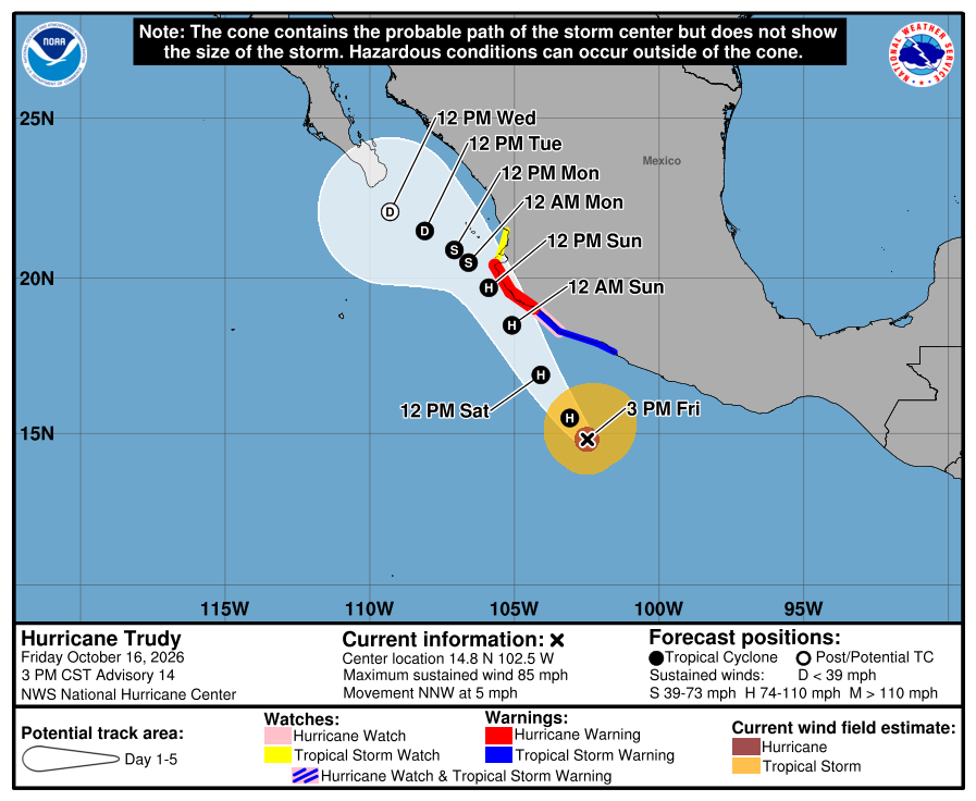
Official NHC cone for Trudy, Advisory 14. It shows the likely path of the center, not the size of the storm; rain, wind, and surf can reach outside it. Red is the Hurricane Warning, pink the Hurricane Watch, blue the Tropical Storm Warning (striped pink and blue where a Hurricane Watch and Tropical Storm Warning overlap), and yellow the Tropical Storm Watch, all on the mainland coast. The open circle is a weak post-tropical low south-southeast of Los Cabos by 11 AM MST Wednesday.
NHC wind-chance map, Advisory 14. Chance of tropical-storm-force wind over the next five days from all storms. Baja California Sur is not shaded; NHC lists Cabo San Lucas, San José del Cabo, and La Paz under 1%. It is not a landfall forecast. 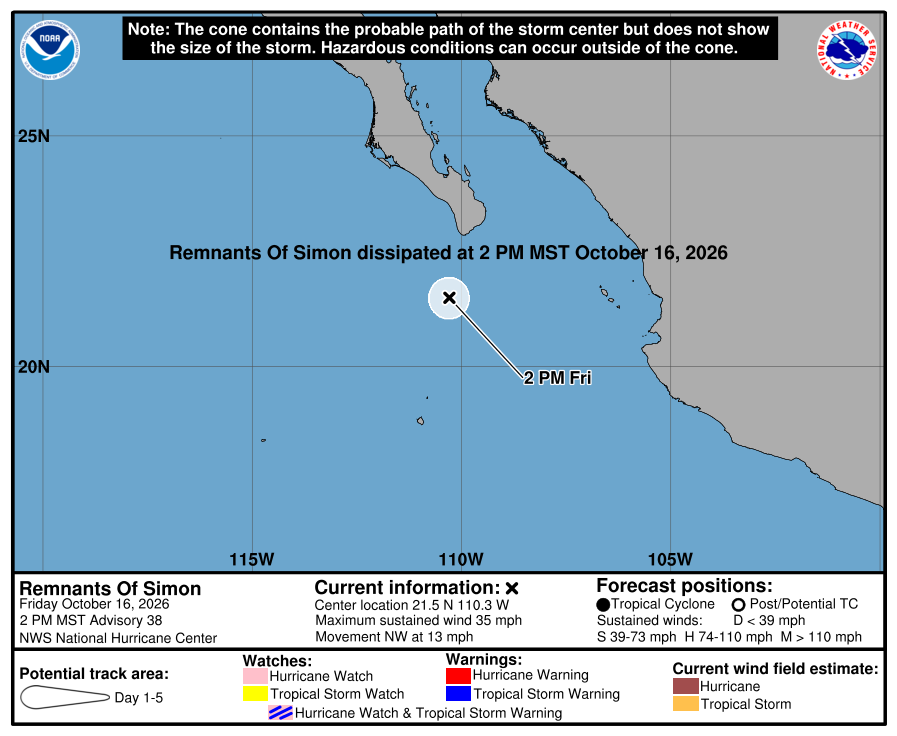
NHC's final Simon graphic, Advisory 38. Simon dissipated at 2 PM MST Friday about 100 miles south-southwest of Cabo San Lucas. No watches or warnings. Simon has dissipated, and NHC and SMN issued their final Simon advisories. Trudy is a Category 1 hurricane aimed at mainland Mexico, with Los Cabos and La Paz wind chance under 1% and no watches for BCS. Rain is the main local issue: SMN has 50–75 mm for southern BCS today, and a heavy cell can flood arroyo crossings and dirt roads for a few hours. SMN gives 2–3 m / about 7–10 ft seas for Baja California Sur coasts today (four-day No. 289 and general No. 577). SEMAR's Friday morning marine forecast (issued 7:00 AM MST) gives the southwest Baja coast 5–7 ft. We follow the higher range: up to about 10 ft (SMN). Skip swimming at open beaches today and Saturday. Next NHC Trudy intermediate around 5:00 PM MST and complete around 8:00 PM MST; SMN's next Trudy advisory ~5:15 PM MST; SMN general next ~5:00 PM MST; SMN four-day next ~1:00 PM MST Saturday. No more Simon advisories. Checked Fri, Oct 16 · 4:25 PM MST.
NHC Simon Advisory 38 (final)NHC Simon Discussion 38NHC Simon wind chances 38NHC Trudy Advisory 14 (current)NHC Trudy Discussion 14NHC Trudy wind chances 14SMN Simon advisory No. 76 (final)SMN Trudy advisory No. 21SMN general forecast No. 577SMN four-day forecast No. 289SEMAR morning marineSurfline CerritosSurfline San PedritoSurfline La Pastora -
Superseded by Simon Advisory 38 (final) and Trudy Advisory 14. Newer update above.
Trudy's Los Cabos wind chance drops to 5% and Simon is falling apart offshore; no watches for BCS; rain likely today and Saturday; seas up to about 10 ft (Trudy 12A, Simon 36)
- What changed: Tropical Storm Simon Advisory 36 (Fri, Oct 16 · 2:00 AM MST): Simon weakened to a tropical storm near 40 mph / 1002 mb (it was about 60 mph at Advisory 32 Thursday morning; our once-a-day check skipped Advisories 33–35 on Thursday). The center is near 20.0N 108.8W, about 210 miles south-southeast of Cabo San Lucas, moving northwest at about 9 mph. Simon's advisory lists no coastal watches or warnings. NHC says Baja California Sur should keep monitoring Simon. NHC expects Simon to become a remnant low within a day and to be gone by late Saturday. Hurricane Trudy (Intermediate Advisory 12A, 5:00 AM MST) is now a major hurricane near 120 mph / 956 mb, about 240 miles southwest of Acapulco, moving northwest at about 6 mph. Trudy's Hurricane Watch and Tropical Storm Warning are for the mainland coast from Zihuatanejo to Cabo Corrientes, with no watch for BCS. NHC now gives Trudy only a 5% chance of tropical-storm-force wind at Cabo San Lucas and San José del Cabo (La Paz under 3%). It was 15% at Advisory 8 Thursday, our Prepare level. Seas: SMN general forecast No. 577 (5:00 AM MST) gives 2.0–3.0 m / about 7–10 ft for Baja California Sur coasts today, Friday, building tonight into early Saturday. SEMAR's Thursday evening marine forecast (issued 7:00 PM MST) gives the southwest Baja coast (Costa Sur Occidental) 5–7 ft through Friday evening. We follow the higher range for our beaches today: up to about 10 ft (SMN).
- What this means here: Simon is no longer a wind threat for Todos Santos, Pescadero, and Cerritos. It is falling apart offshore, and its wind chance at Los Cabos and La Paz is under 3%. Trudy's Los Cabos chance dropped to 5%, below our Prepare level. There are no watches. Rain is the main local issue: SMN has 25–50 mm today and 50–75 mm Saturday for southern BCS (regional figures for a zone that includes our towns). A heavy cell can flood arroyo crossings and turn dirt roads around Pescadero and Todos Santos to mud for a few hours. Seas up to about 10 ft today.
- Stronger or weaker: Simon is weaker: about 60 mph at Advisory 32, now about 40 mph. Its tropical-storm winds reach only about 25 miles from the center. NHC forecasts about 35 mph by 11 AM MST today, a remnant low near 30 mph by 11 PM MST tonight, and gone by 11 PM MST Saturday. Trudy is the opposite: a major hurricane that NHC expects to peak near 145 mph by 11 PM MST tonight off southwestern Mexico, then weaken to about 75 mph by 11 PM MST Sunday and about 50 mph by 11 PM MST Monday.
- Path and timing: Simon keeps moving northwest. NHC's forecast puts the center about 135 miles (220 km) west-southwest of Cabo San Lucas by 11 PM MST tonight as a remnant low, about 150 miles southwest of Todos Santos, then farther west of the Pacific coast of Baja California Sur on Saturday. That path stays offshore, near but west of Baja. SMN Simon advisory No. 73 (5:00 AM MST) shows the same track. Trudy: NHC brings it near the coast of Jalisco and Colima Saturday into Sunday, then bends a weakening Trudy west: about 160 miles southeast of Cabo San Lucas by 11 PM MST Monday, and about 95 miles south-southeast of Cabo San Lucas as a post-tropical low by 11 PM MST Tuesday. Day-5 positions can still shift a lot. SMN rain for southern BCS (regional figures for a zone that includes our towns): 25–50 mm today (general No. 577, 5:00 AM MST) and 50–75 mm Saturday (four-day No. 288, issued 1:00 PM MST Thursday). Sunday SMN names only central BCS (25–50 mm); Monday 5–25 mm for BCS (regional). SMN's Simon advisory No. 73 (5:00 AM MST) says the system has no effects on Mexico. Our rain figures follow SMN only. NHC also watches an area south of southern Mexico with a 60% chance of forming in 7 days.
- Wind chance: Simon Advisory 36, through 11 PM MST Tuesday: NHC lists no points anymore. Cabo San Lucas, San José del Cabo, and La Paz are all under 3% from Simon (Cabo was 24% at Advisory 29). Trudy Advisory 12: Cabo San Lucas and San José del Cabo 5% each, mostly Sunday night through Monday; La Paz under 3%. That is below our Prepare level (Trudy was 15% at Advisory 8). NHC does not list Todos Santos in its wind-chance table.
- Surf at our beaches: Surfline's free spot forecasts, checked this morning around 6:16 AM MST: Cerritos about 3–4 ft, La Pastora about 4–5 ft, and San Pedrito about 2–3 ft, from a long-period south-southwest swell. Windy at Todos Santos (ECMWF wave model) shows about 1.5 m / 5 ft seas now, building to about 1.8–1.9 m / 6 ft from Saturday evening through Monday. Official seas come from SMN and SEMAR, and they run higher than the beach forecasts: SMN general forecast No. 577 (5:00 AM MST) gives 2.0–3.0 m / about 7–10 ft for Baja California Sur coasts today, Friday, building tonight into early Saturday. SEMAR's Thursday evening marine forecast (issued 7:00 PM MST) gives the southwest Baja coast (Costa Sur Occidental) 5–7 ft through Friday evening. We follow the higher range for our beaches today: up to about 10 ft (SMN). SEMAR also flags a long-period ground swell on the Pacific side of the peninsula Friday, easing by Sunday. Saturday: SMN No. 577 has the 7–10 ft seas building into early Saturday, higher than SEMAR's 6–8 ft for the southwest Baja coast through Saturday evening and SMN's four-day No. 288 (issued 1:00 PM MST Thursday) 1–2 m / 3–7 ft for the west coast; we follow the higher: up to about 10 ft early Saturday (SMN). Sunday: SMN lists 2–3 m / 7–10 ft for Baja California Sur coasts. Monday: 1–2 m / 3–7 ft. NHC says Simon's swells could bring dangerous surf to Baja California Sur over the next day or so. Punta Lobos: no break-level forecast available.
- Windy + multi-source: NHC is official for watches; SMN Simon 73 (5:00 AM MST) matches NHC on ~40 mph and the offshore track; rain differs: NHC's Simon advisory lists rain for parts of BCS, but SMN's Simon advisory says no effects on Mexico; we use SMN's figures only (general forecast 25–50 mm southern BCS today, regional); seas SMN 577 7–10 ft vs SEMAR 5–7 ft today, we follow the higher; Windy at Todos Santos about 5 ft now and its tracker agrees Trudy is a major hurricane and Simon a tropical storm; Surfline corridor spots about 2–5 ft
- Do now: There are no watches for BCS. Trudy's Los Cabos chance is low now (5%), but its five-day track bends toward the waters south of Los Cabos by Tuesday, so keep basic supplies ready and check again Saturday morning. Plan dirt-road trips and arroyo crossings for dry hours today and Saturday; a heavy cell can close them quickly. Secure loose outdoor items before afternoon storms. Skip swimming at open beaches today and Saturday — seas up to about 10 ft (SMN, Baja California Sur coasts). Follow NHC, SMN, and Protección Civil BCS. Next: NHC complete advisories for Simon and Trudy around 8:00 AM MST; SMN's next Simon and Trudy advisories ~8:15 AM MST; SMN four-day forecast ~1:00 PM MST; SMN general next ~5:00 PM MST.
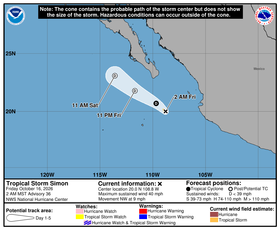
Official NHC cone for Simon, Advisory 36. It shows the likely path of the center, not the size of the storm; rain, wind, and surf can reach outside it. No watches or warnings are shown. The open circles mean Simon is forecast to be a post-tropical low by 11 PM MST Friday, passing offshore, near but west of Baja. 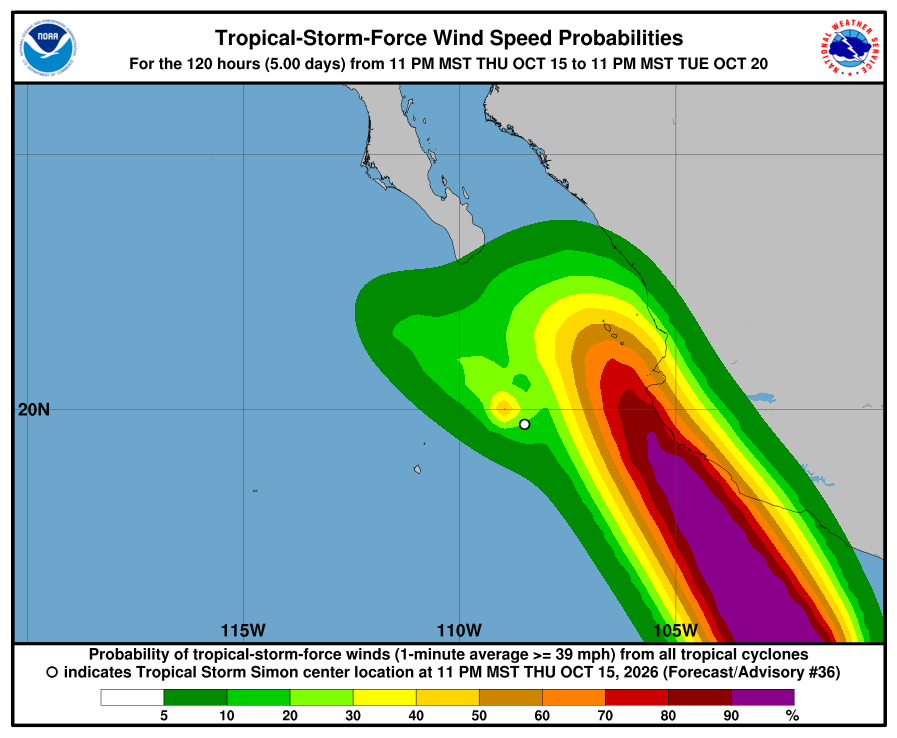
NHC wind-chance map, Advisory 36. Chance of tropical-storm-force wind over the next five days from all storms. Simon alone gives Cabo San Lucas, San José del Cabo, and La Paz under 3%. The light Los Cabos shading (about 5–10%) comes mainly from Trudy (5% at Cabo San Lucas). The high-chance area along southwestern Mexico is Trudy. It is not a landfall forecast. 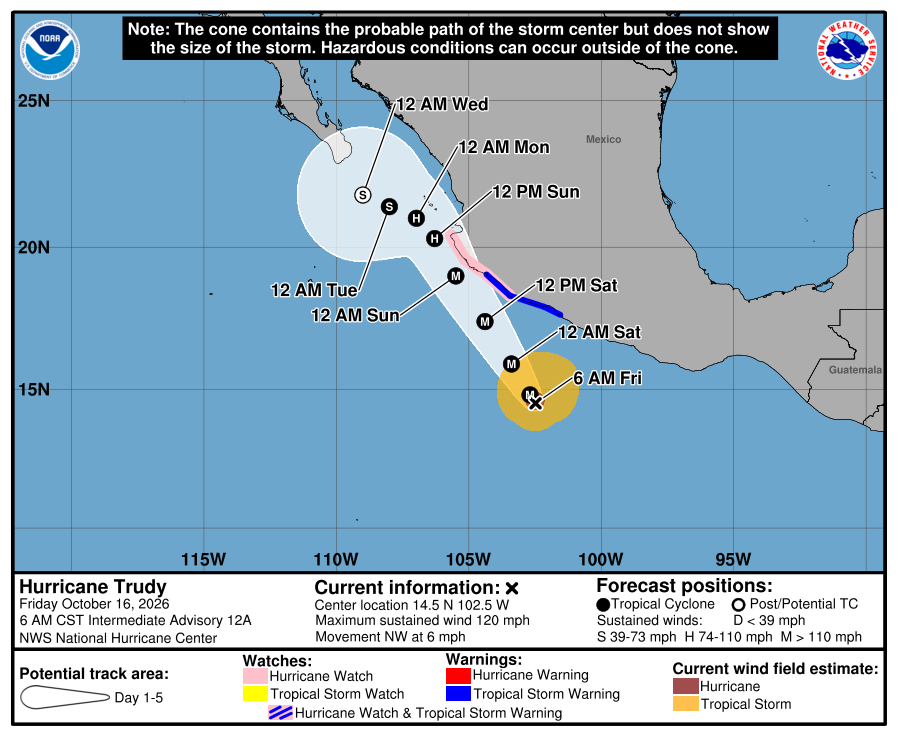
Official NHC cone for Trudy, Intermediate Advisory 12A. It shows the likely path of the center, not the size of the storm; rain, wind, and surf can reach outside it. The pink and blue coastline marks are mainland Mexico (Hurricane Watch and Tropical Storm Warning), not BCS. The track bends west after the weekend, with the open circle (post-tropical) south of Los Cabos late Tuesday (the map's "12 AM Wed" is Mexico City time, Tuesday 11 PM MST). Simon is now a tropical storm near 40 mph, weakening, falling apart offshore, with its Los Cabos wind chance under 3%. Trudy's Los Cabos chance dropped to 5%, below our Prepare level. There are no watches for BCS. Rain is the main local issue: SMN has 25–50 mm today and 50–75 mm Saturday for southern BCS (regional), and a heavy cell can flood arroyo crossings and dirt roads for a few hours. SMN general forecast No. 577 (5:00 AM MST) gives 2.0–3.0 m / about 7–10 ft for Baja California Sur coasts today, Friday, building tonight into early Saturday. SEMAR's Thursday evening marine forecast (issued 7:00 PM MST) gives the southwest Baja coast (Costa Sur Occidental) 5–7 ft through Friday evening. We follow the higher range for our beaches today: up to about 10 ft (SMN). Skip swimming at open beaches today and Saturday, and check again after the 8:00 AM MST advisories. Next NHC complete for Simon and Trudy around 8:00 AM MST; SMN's next Simon and Trudy advisories ~8:15 AM MST; SMN four-day ~1:00 PM MST; SMN general next ~5:00 PM MST. Checked Fri, Oct 16 · 6:36 AM MST.
NHC Simon Advisory 36 (current)NHC Simon Discussion 36NHC Simon wind chances 36NHC Trudy Intermediate Advisory 12ANHC Trudy wind chances 12NHC Tropical Weather OutlookSMN Simon advisory No. 73SMN Trudy advisory No. 17SMN general forecast No. 577SMN four-day forecast No. 288SEMAR evening marineProtección Civil BCS noticeSurfline CerritosSurfline San PedritoSurfline La PastoraWindy waves at Todos Santos (checked)Windy tracker (checked) -
Superseded by Simon Advisory 36. Newer update above.
Trudy brings a Prepare-level wind chance to Los Cabos; Simon weakens to a tropical storm and stays west of Baja; no watches; seas up to about 7 ft today (Simon 32, Trudy 8)
- What changed: Tropical Storm Simon Advisory 32 (Thu, Oct 15 · 2:00 AM MST): Simon weakened to a small tropical storm near 60 mph / 996 mb (it was Category 1, about 90 mph, at Advisory 29 Wednesday morning; we missed Advisory 30 at 2:00 PM MST and Advisory 31 at 8:00 PM MST Wednesday on the daily check). The center is near 19.2N 108.5W, about 270 miles south-southeast of Cabo San Lucas and about 200 miles west-southwest of Cabo Corrientes, and is nearly stationary. Simon's advisory lists no coastal watches or warnings. NHC says Baja California Sur should keep monitoring, and that wind watches are not needed for BCS at this time. NHC shifted the path a little farther west again: near but west of Baja this weekend, becoming a post-tropical remnant low by late weekend. Hurricane Trudy (Advisory 8, 2:00 AM MST) is near 75 mph, about 300 miles south-southwest of Acapulco, moving northwest at about 9 mph. NHC expects rapid strengthening to a major hurricane Friday and an approach to southwestern Mexico this weekend. NHC gives Trudy a 15% chance of tropical-storm-force wind at Cabo San Lucas and San José del Cabo (La Paz 4%) through 11 PM MST Monday. That is our Prepare level, so Trudy is now the storm to watch for southern Baja. Seas: SEMAR's Wednesday evening marine forecast (issued 7:00 PM MST) gives the southwest Baja coast (Costa Sur Occidental) 4–6 ft through Thursday evening. SMN general forecast No. 575 (5:00 AM MST) gives 1.0–2.0 m / about 3–7 ft for Baja California Sur coasts today, Thursday. We follow the higher range for our beaches today: up to about 7 ft (SMN).
- What this means here: Trudy is the storm to watch for Todos Santos, Pescadero, and Cerritos. NHC gives Los Cabos a 15% tropical-storm wind chance from Trudy through 11 PM MST Monday. That is our Prepare level. Most of that chance comes Sunday night into Monday. Simon is much weaker and stays west of Baja. Its wind chance at Los Cabos and La Paz is under 3%. There are no watches. Plan for rain and rough seas. SMN has 25–50 mm Friday, 50–75 mm Saturday, and 25–50 mm Sunday for southern BCS (regional). Seas up to about 7 ft today.
- Stronger or weaker: Weaker since Wednesday morning: Simon dropped from Category 1 near 90 mph (Advisory 29) to a tropical storm near 60 mph. NHC expects little change today, then more weakening Friday into the weekend as shear increases. NHC's forecast has Simon near 50 mph by 11 PM MST Thursday, near 40 mph by 11 PM MST Friday west of southern Baja, near 30 mph as a remnant low by 11 PM MST Saturday, and gone by 11 PM MST Monday. Small storms can still change strength fast.
- Path and timing: Simon meanders nearly stationary through today. NHC expects a northwest turn by Friday. NHC's forecast puts the center about 125 miles (200 km) south-southwest of Cabo San Lucas by 11 PM MST Friday as a weakening tropical storm, then north-northwest well west of the Pacific coast of Baja California Sur, becoming post-tropical by 11 PM MST Saturday. That is farther west than Wednesday's Advisory 29 path. SMN Simon advisory No. 65 (5:15 AM MST) agrees on a northwest turn this afternoon and a path west of Cabo. SMN rain (regional): 5–25 mm showers with possible thunderstorms for Baja California Sur today (general 575); 25–50 mm for southern BCS Friday and 50–75 mm Saturday, and 25–50 mm Sunday for southern and central BCS (four-day forecast No. 287, issued 1:00 PM MST Wednesday). NHC lists 1–2 inches of rain for parts of BCS through early Saturday — SMN's storm advisory says no rain effects on Mexico in the next 24 hours; for our towns we lead with SMN's general and four-day rain numbers.
- Wind chance: Simon Advisory 32, through about 11 PM MST Monday: Cabo San Lucas, San José del Cabo, and La Paz are no longer listed (under 3% each; Cabo was 24% at Advisory 29). Only a nearby ocean point (20N 110W) still shows about 18%. That is below our Prepare level for Los Cabos from Simon. Trudy Advisory 8 adds a separate chance at Cabo San Lucas and San José del Cabo: about 6% by 11 PM MST Sunday and 15% total by 11 PM MST Monday (La Paz 4%). That is our Prepare level for Los Cabos. NHC does not list Todos Santos in its wind-chance table.
- Surf at our beaches: Surfline's free spot forecasts, checked this morning around 6:05 AM MST: Cerritos about 3–5 ft (0.9–1.4 m), La Pastora about 3–5 ft (0.9–1.4 m), and San Pedrito about 2–4 ft (0.6–1.1 m), from a long-period south-southwest swell. That is waist-to-shoulder surf at Cerritos and La Pastora — not a swim day. Windy at Todos Santos shows about 1.5 m seas now; the Open-Meteo wave model near Pescadero shows about 1.5 m / 5 ft now. Official seas still come from SEMAR and SMN: SEMAR's Wednesday evening marine forecast (issued 7:00 PM MST) gives the southwest Baja coast (Costa Sur Occidental) 4–6 ft through Thursday evening. SMN general forecast No. 575 (5:00 AM MST) gives 1.0–2.0 m / about 3–7 ft for Baja California Sur coasts today, Thursday. We follow the higher range for our beaches today: up to about 7 ft (SMN). NHC warns that Simon's swells will affect Baja California Sur over the next couple of days, with dangerous surf. For Friday, SMN's four-day forecast (issued 1:00 PM MST Wednesday) lists about 2–3 m / 7–10 ft for BCS coasts; Saturday's west-coast line is about 1–2 m / 3–7 ft. For Sunday, SMN lists about 2–3 m / 7–10 ft for Baja California Sur. Punta Lobos: no break-level forecast available.
- Windy + multi-source: NHC is official for watches; SMN Simon 65 (5:15 AM MST) matches ~60 mph (NHC lists 1–2 in BCS rain through Sat while SMN storm aviso says no Mexico rain effects next 24h); SEMAR southwest Baja 4–6 ft vs SMN 575 3–7 ft BCS coasts today, we follow the higher; Open-Meteo near Pescadero ~5 ft; Windy at Todos Santos shows about 1.5 m seas now; Surfline corridor spots about 2–5 ft
- Do now: There are no watches. Trudy gives Los Cabos a 15% wind chance through 11 PM MST Monday. That is our Prepare level: check water, food, fuel, and flashlights before Sunday. Simon's Los Cabos chance is under 3%. Plan for rain Friday through Sunday: stay off arroyo crossings and dirt roads when storms hit; never drive into running water. Secure loose outdoor items if gusty weather shows up. Stay out of the ocean and off exposed beaches today — seas up to about 7 ft (SMN, Baja California Sur coasts). Follow NHC, SMN, and Protección Civil BCS. Next: NHC complete advisory around 8:00 AM MST; SMN's next Simon advisory ~8:15 AM MST; SMN four-day forecast ~1:00 PM MST; SMN general next ~5:00 PM MST.
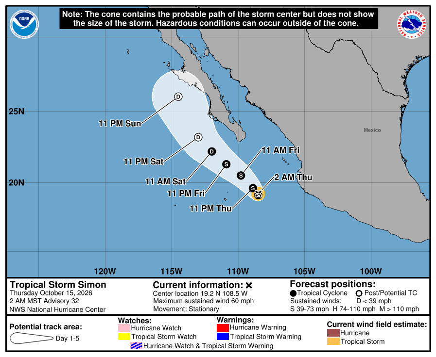
Official NHC cone for Simon, Advisory 32. It shows the likely path of the center, not the size of the storm; rain, wind, and surf can reach well outside it. No watches or warnings are shown. The center track stays mostly west of Baja California Sur this weekend. NHC says confidence is still limited and the path can still shift. 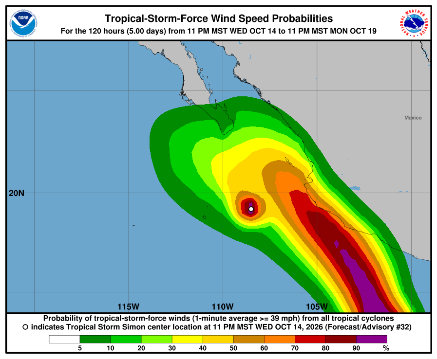
NHC wind-chance map, Advisory 32. Chance of tropical-storm-force wind over the next five days. The map shows all storms. Simon alone gives Cabo San Lucas, San José del Cabo, and La Paz under 3%. The Los Cabos shading of about 10–20% comes mainly from Trudy (15% at Cabo San Lucas). The high-chance area toward southwestern Mexico is Trudy. It is not a landfall forecast. Trudy gives Los Cabos a 15% wind chance through 11 PM MST Monday, our Prepare level. Simon is now a tropical storm near 60 mph, with the path west of Baja and its Los Cabos wind chance under 3%. There are no watches. Still plan for rain Friday through Sunday (SMN four-day 25–50 mm Friday / 50–75 mm Saturday / 25–50 mm Sunday for southern BCS, regional): stay off arroyo crossings and dirt roads. SEMAR's Wednesday evening marine forecast (issued 7:00 PM MST) gives the southwest Baja coast (Costa Sur Occidental) 4–6 ft through Thursday evening. SMN general forecast No. 575 (5:00 AM MST) gives 1.0–2.0 m / about 3–7 ft for Baja California Sur coasts today, Thursday. We follow the higher range for our beaches today: up to about 7 ft (SMN). Stay out of the ocean and off exposed beaches today, and check again after the 8:00 AM MST complete. Next NHC complete around 8:00 AM MST; SMN's next Simon advisory ~8:15 AM MST; SMN four-day ~1:00 PM MST; SMN general next ~5:00 PM MST. Checked Thu, Oct 15 · 6:18 AM MST.
NHC Simon Advisory 32 (current)NHC Simon Discussion 32NHC Simon wind chances 32NHC Trudy Advisory 8NHC Trudy wind chances 8SMN Simon advisory No. 65SMN Trudy advisory No. 9SMN general forecast No. 575SMN four-day forecast No. 287SEMAR evening marineProtección Civil BCS noticeSurfline CerritosSurfline San PedritoSurfline La PastoraWindy tracker (checked) -
Superseded by Simon Advisory 32. Newer update above.
Simon weakens to Category 1 and its path shifts a little west — still a possible storm for us late Friday into Saturday; no watch here yet; Cabo wind chance 24%; seas about 6–8 ft today (Advisory 29)
- What changed: Hurricane Simon Advisory 29 (Wed, Oct 14 · 8:00 AM MST): Simon weakened to a very small Category 1 hurricane near 90 mph / 975 mb (it was Category 2, 105 mph, at Intermediate 28A). The center is near 19.7N 108.1W, about 165 miles west-southwest of Cabo Corrientes and about 250 miles south-southeast of Cabo San Lucas, drifting southwest at about 2 mph. Mexico dropped the Hurricane Watch for Las Islas Marías. Simon's advisory now lists no coastal watches or warnings. NHC says Baja California Sur should keep monitoring, and watches or warnings may be needed for parts of BCS in the next day or two. NHC moved the path a little west again. Tropical Storm Trudy (Advisory 5, 8:00 AM MST) is near 60 mph, about 375 miles south of Acapulco. NHC expects it to become a hurricane tonight and a major hurricane Friday, and to approach southwestern Mexico Saturday. NHC gives Trudy a 7% chance of tropical-storm-force wind at Cabo San Lucas and San José del Cabo, from 5 AM MST Sunday to 5 AM MST Monday. Simon is still the first threat for us. Seas: SEMAR's Wednesday morning marine forecast (issued 7:00 AM MST) gives the southwest Baja coast (Costa Sur Occidental) 6–8 ft through Thursday morning, then 5–7 ft. SMN general forecast No. 573 (5:00 AM MST) gives 1.0–2.0 m / about 3–7 ft for the west coasts of Baja California Sur today, Wednesday — lower. We follow the higher official range for our beaches today: about 6–8 ft (SEMAR).
- What this means here: Simon is still a possible storm threat for Todos Santos, Pescadero, and Cerritos late Friday into Saturday. It weakened this morning, and NHC moved the path a little west again: a weakening tropical storm passing off our Pacific coast Saturday, with low confidence. There is no watch here yet; one could come in the next day or two. Cabo San Lucas wind chance is 24%, still our Prepare level. SMN expects heavy rain in southern BCS Friday and Saturday, so arroyo crossings and dirt roads could flood fast. Stay out of the ocean: about 6–8 ft today.
- Stronger or weaker: Weaker since this morning: Simon dropped from Category 2 near 105 mph (Intermediate 28A) to Category 1 near 90 mph. NHC says some ups and downs in strength are possible through Thursday night, followed by weakening on Friday and into the weekend. NHC's forecast has Simon near 75 mph Friday evening, near 60 mph (tropical storm) by early Saturday as it nears southern Baja California Sur, and near 40 mph by early Sunday. Small storms like Simon can change strength fast.
- Path and timing: NHC says confidence is lower than normal, and the computer models disagree. Simon drifts slowly southwest, well offshore, through Thursday. NHC expects a turn north or north-northwest by Friday. NHC's forecast puts the center about 50 miles west-southwest of Cabo San Lucas by 5 AM MST Saturday as a tropical storm, then moving north-northwest along the Pacific side of Baja California Sur on Saturday, and near the Pacific coast farther north by 5 AM MST Sunday. That path passes offshore, west of our corridor, but Simon's tropical-storm winds reach about 35 miles from the center, and a small shift east brings them to our coast. SMN's Simon advisory No. 58 (8:15 AM MST) now shows a similar path: a weakening tropical storm passing just west of Cabo San Lucas early Saturday, then offshore, west of our corridor. It lists no watch for Baja California Sur. SMN rain (regional): 5–25 mm showers with possible thunderstorms for Baja California Sur today (general 573); 50–75 mm for southern BCS Friday and again Saturday (four-day forecast, issued 1:00 PM MST Tuesday).
- Wind chance: Simon Advisory 29, through 5 AM MST Monday: Cabo San Lucas 24% (was 27%), San José del Cabo 17% (was 26%), and La Paz 8% (was 14%). Loreto is no longer listed. Most of that chance starts between Friday morning and early Saturday. That is still our Prepare level for Cabo. Cabo San Lucas has a 1% chance of hurricane-force wind. Trudy adds a separate 7% at Cabo San Lucas and San José del Cabo, from 5 AM MST Sunday to 5 AM MST Monday. SMN's four-day forecast (issued 1:00 PM MST Tuesday) lists gusts of 60–80 km/h / about 37–50 mph in Baja California Sur on Saturday (regional). NHC does not list Todos Santos in its wind-chance table.
- Surf at our beaches: Surfline's free spot forecasts, checked this morning around 8:30 AM MST: Cerritos about 4–6 ft, La Pastora about 4–6 ft, and San Pedrito about 3–4 ft, from a long-period south-southwest swell. That is chest-high to overhead surf — not a swim day. Punta Lobos: no break-level forecast available. The Open-Meteo wave model near Pescadero shows about 1.6 m / 5 ft now. Official seas for our coast come from SEMAR and SMN: SEMAR's Wednesday morning marine forecast (issued 7:00 AM MST) gives the southwest Baja coast (Costa Sur Occidental) 6–8 ft through Thursday morning, then 5–7 ft. SMN general forecast No. 573 (5:00 AM MST) gives 1.0–2.0 m / about 3–7 ft for the west coasts of Baja California Sur today, Wednesday — lower. We follow the higher official range for our beaches today: about 6–8 ft (SEMAR). NHC warns that Simon's swells will reach Baja California Sur over the next few days, with life-threatening surf. For Saturday, SMN's four-day forecast (issued 1:00 PM MST Tuesday, before the latest track changes) lists 1–2 m / about 3–7 ft for the peninsula's west coast. With Simon passing close, watch for higher numbers in the next SEMAR and SMN updates.
- Windy + multi-source: NHC is official for watches; SMN Simon advisory 58 (8:15 AM MST) agrees with NHC 29 on Category 1 and a path west of our corridor; SEMAR southwest Baja 6–8 ft vs SMN 573 3–7 ft west coasts today (we follow the higher); Open-Meteo wave model near Pescadero about 5 ft; Surfline corridor spots 3–6 ft
- Do now: Prepare now, while it is calm. There is no watch yet, but Simon's path still brings a tropical storm close to southern Baja late Friday into Saturday. By Thursday: stock water, food, medicine, flashlights, and batteries; charge phones and power banks; fill the car and get some cash. Secure or bring in loose outdoor items. Plan to stay off arroyo crossings and dirt roads Friday and Saturday — never drive into running water. Stay out of the ocean and off exposed beaches today — seas about 6–8 ft (SEMAR southwest Baja; SMN 573 is lower at 3–7 ft). Keep kids and pets well back from the waterline. Follow NHC, SMN, and Protección Civil BCS for watches and shelters. Next: NHC complete advisory around 2:00 PM MST; SMN's next Simon advisory ~11:15 AM MST; SMN four-day forecast ~1:00 PM MST; SMN general next ~5:00 PM MST.
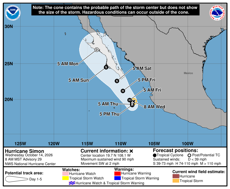
Official NHC cone for Simon, Advisory 29. It shows the likely path of the center, not the size of the storm; rain, wind, and surf can reach well outside it. No watches or warnings are shown. The cone still covers southern Baja California Sur, including Los Cabos and the Todos Santos area, for Friday night and Saturday, with the forecast center just off the Pacific side. NHC says confidence is lower than normal and the path can still shift. 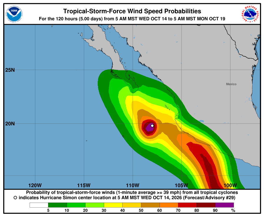
NHC wind-chance map, Advisory 29. Chance of tropical-storm-force wind from 5 AM MST Wednesday to 5 AM MST Monday. Cabo San Lucas 24%, San José del Cabo 17%, La Paz 8%. Todos Santos is not listed. The map counts all storms, so the high area toward southwestern Mexico is Trudy. It is not a landfall forecast. Simon weakened to Category 1, and NHC moved its path a little west again, but a weakening tropical storm still passes close to southern Baja California Sur late Friday into Saturday. Our corridor has no watch yet; watches could come in the next day or two. Cabo San Lucas is at 24%, still our Prepare level. Plan for heavy rain Friday and Saturday (SMN four-day 50–75 mm, regional southern BCS, issued 1:00 PM MST Tuesday): stay off arroyo crossings and dirt roads. SEMAR's Wednesday morning marine forecast (issued 7:00 AM MST) gives the southwest Baja coast (Costa Sur Occidental) 6–8 ft through Thursday morning, then 5–7 ft. SMN general forecast No. 573 (5:00 AM MST) gives 1.0–2.0 m / about 3–7 ft for the west coasts of Baja California Sur today, Wednesday — lower. We follow the higher official range for our beaches today: about 6–8 ft (SEMAR). Stay out of the ocean and off exposed beaches today, and check again after the 2:00 PM MST complete. Next NHC complete around 2:00 PM MST; SMN's next Simon advisory ~11:15 AM MST; SMN four-day ~1:00 PM MST; SMN general next ~5:00 PM MST. Checked Wed, Oct 14 · 9:54 AM MST.
NHC Simon Advisory 29 (current)NHC Simon Discussion 29NHC Simon wind chances 29NHC Trudy Advisory 5NHC Trudy wind chances 5SMN Simon advisory No. 58SMN general forecast No. 573SMN four-day forecastSEMAR morning marineProtección Civil BCS noticeSurfline CerritosSurfline San PedritoSurfline La PastoraWindy tracker -
Superseded by Simon Advisory 29. Newer update above.
Simon's path shifts west toward southern Baja for Friday night and Saturday — no watch here yet; Los Cabos wind chance jumps to 26–27%; seas about 6–8 ft today (Advisory 28A)
- What changed: We missed Simon Advisories 25–27 after Tuesday's Intermediate 24A; this entry covers the latest complete, Hurricane Simon Advisory 28 (Wed, Oct 14 · 2:00 AM MST), and Intermediate 28A (Wed, Oct 14 · 5:00 AM MST). Hurricane Simon Intermediate Advisory 28A: Simon is a very small Category 2 hurricane near 105 mph / 969 mb. The center is near 19.8N 108.1W, about 160 miles west-southwest of Cabo Corrientes and about 240 miles south-southeast of Cabo San Lucas, drifting west-southwest at about 3 mph. The big change: NHC shifted the long-range path west, and it now crosses southern Baja California Sur late Friday into Saturday. Watches: a Hurricane Watch for Las Islas Marías only; the mainland watches are gone. There is no BCS or corridor watch yet, but NHC says Baja California Sur should keep monitoring and more watches may be needed in the next day or two. Tropical Storm Trudy (Advisory 4, 50 mph) formed far south of Acapulco. NHC gives Trudy tropical-storm-force wind chances of 10% at Cabo San Lucas and San José del Cabo and 4% at La Paz through 11 PM MST Sunday, and forecasts it to become a major hurricane near west-central Mexico late this week into the weekend. Simon is still the first threat for us. Seas: SEMAR's Wednesday morning marine forecast (issued 7:00 AM MST) gives the southwest Baja coast (Costa Sur Occidental) 6–8 ft through Thursday morning, then 5–7 ft. SMN general forecast No. 573 (5:00 AM MST) gives 1.0–2.0 m / about 3–7 ft for the west coasts of Baja California Sur today, Wednesday (regional BCS) — lower. We follow the higher official range for our beaches today: about 6–8 ft (SEMAR).
- What this means here: Simon is now a possible storm threat for Todos Santos, Pescadero, and Cerritos late Friday into Saturday. NHC's path now crosses southern Baja California Sur as a weakening tropical storm, but confidence is low. There is no watch here yet; one could come in the next day or two. Los Cabos wind chance jumped to 26–27%. SMN expects heavy rain in southern BCS Friday and Saturday, so arroyo crossings and dirt roads could flood fast. Stay out of the ocean: about 6–8 ft today.
- Stronger or weaker: Stronger since Tuesday: Simon rose from Category 1 near 90 mph (Advisory 24A) to Category 2 near 105 mph. NHC expects some ups and downs through Thursday, then steady weakening from Friday as wind shear picks up. NHC's forecast has Simon near 60 mph (tropical storm) by late Friday, when it nears Los Cabos, and weaker inland on Saturday. Small storms like Simon can change strength fast.
- Path and timing: NHC says confidence is lower than normal and future changes are likely. Simon meanders slowly well off west-central Mexico through Thursday, then turns north. NHC's forecast takes the center just south-southeast of Cabo San Lucas by 11 PM MST Friday (SMN puts it about 50 km / 30 miles away), then inland over southern Baja California Sur by 11 PM MST Saturday (SMN: about 95 km west-northwest of La Paz). That line passes close to our corridor; a small shift east or west changes a lot. SMN rain (regional): 5–25 mm showers with possible thunderstorms for Baja California Sur today (general 573); 50–75 mm for southern BCS Friday and again Saturday (four-day forecast, issued 1:00 PM MST Tuesday).
- Wind chance: Simon Advisory 28, through 11 PM MST Sunday: Cabo San Lucas 27%, San José del Cabo 26%, La Paz 14%, and Loreto 7%. On Tuesday Los Cabos was at 5–7%. Most of that chance starts Thursday night or Friday. That is our Prepare level, and rising. Cabo San Lucas has a 2% chance of hurricane-force wind. SMN's four-day forecast lists gusts of 60–80 km/h / about 37–50 mph in Baja California Sur on Saturday (regional). NHC does not list Todos Santos in its wind-chance table.
- Surf at our beaches: Surfline's free spot forecasts this morning: Cerritos about 4–6 ft, La Pastora about 4–6 ft, and San Pedrito about 3–4 ft, with a long-period south-southwest swell. That is chest-high to overhead surf — not a swim day. Official seas still come from SEMAR and SMN: SEMAR's Wednesday morning marine forecast (issued 7:00 AM MST) gives the southwest Baja coast (Costa Sur Occidental) 6–8 ft through Thursday morning, then 5–7 ft. SMN general forecast No. 573 (5:00 AM MST) gives 1.0–2.0 m / about 3–7 ft for the west coasts of Baja California Sur today, Wednesday (regional BCS) — lower. We follow the higher official range for our beaches today: about 6–8 ft (SEMAR). Saturday could be much rougher: SMN's four-day forecast (issued 1:00 PM MST Tuesday, before the track shift) lists 3–4 m / about 10–13 ft seas for the east and south coasts of Baja California Sur and 1–2 m on the peninsula's west coast (regional). Sources differ; we follow the higher official number for safety.
- Windy + multi-source: NHC is official for watches; SMN Simon advisory 57 agrees on the path toward southern BCS; SEMAR southwest Baja 6–8 ft vs SMN 573 3–7 ft west coasts today (we follow the higher); Surfline corridor spots 3–6 ft; Protección Civil BCS says the state is watching Simon's rain
- Do now: Prepare now, while it is calm. There is no watch yet, but Simon's path now points at southern Baja for Friday night and Saturday. By Thursday: stock water, food, medicine, flashlights, and batteries; charge phones and power banks; fill the car and get some cash. Secure or bring in loose outdoor items. Plan to stay off arroyo crossings and dirt roads Friday and Saturday — never drive into running water. Stay out of the ocean and off exposed beaches today — seas about 6–8 ft (SEMAR southwest Baja; SMN 573 is lower at 3–7 ft). Keep kids and pets well back from the waterline. Follow NHC, SMN, and Protección Civil BCS for watches and shelters. Next: NHC complete advisory around 8:00 AM MST; SMN's next Simon advisory ~8:15 AM MST; SMN four-day forecast ~1:00 PM MST; SMN general next ~5:00 PM MST.
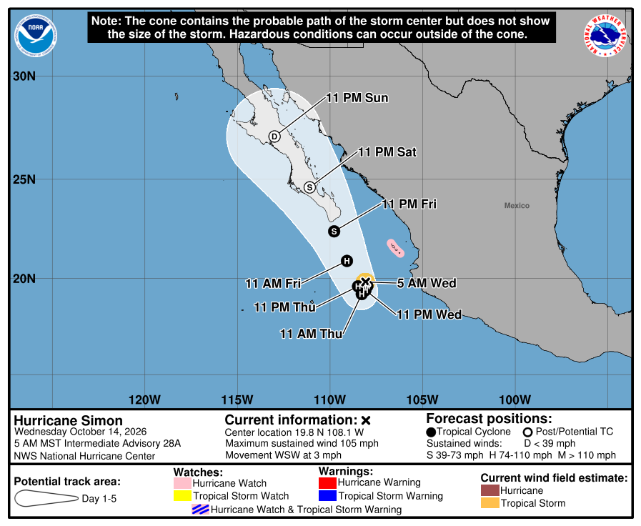
Official NHC cone for Simon, Intermediate Advisory 28A. It shows the likely path of the center, not the size of the storm; rain, wind, and surf can reach well outside it. Pink is the Hurricane Watch on Las Islas Marías. The cone now covers southern Baja California Sur, including Los Cabos and the Todos Santos area, for Friday night and Saturday. NHC says confidence is lower than normal and the path can still shift. 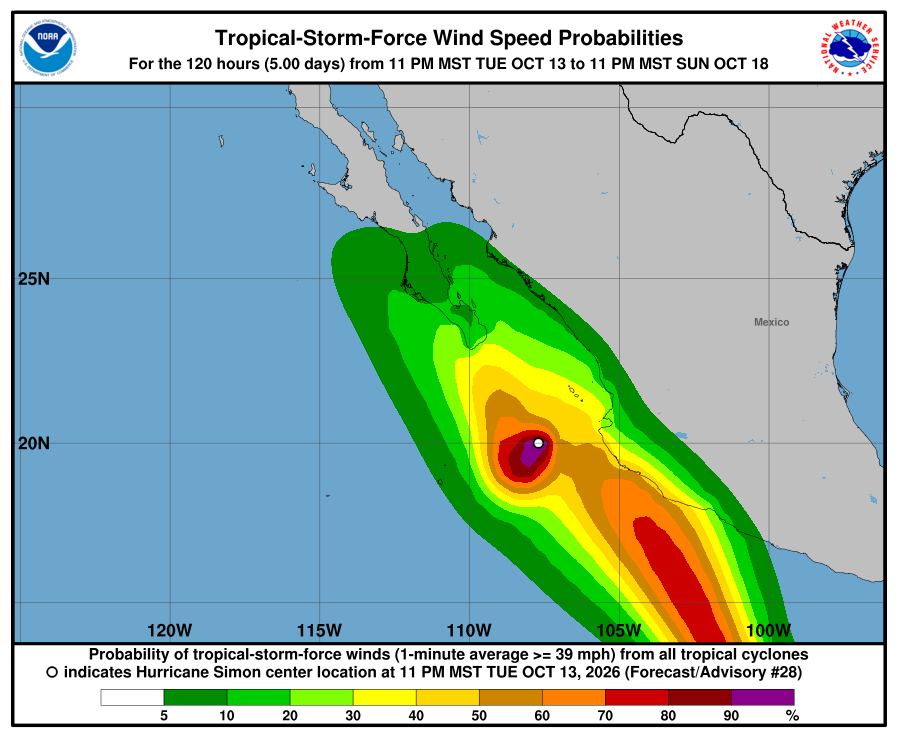
NHC wind-chance map, Advisory 28. Chance of tropical-storm-force wind through 11 PM MST Sunday. Cabo San Lucas 27%, San José del Cabo 26%, La Paz 14%, Loreto 7%. Todos Santos is not listed. The map counts all storms, so the high area toward southwestern Mexico is Trudy. It is not a landfall forecast. Our corridor has no watch yet, but NHC now takes Simon toward southern Baja California Sur late Friday into Saturday and says BCS should keep monitoring. Los Cabos is at 26–27%, our Prepare level, and rising. Plan for heavy rain Friday and Saturday (SMN four-day 50–75 mm, regional southern BCS): stay off arroyo crossings and dirt roads. SEMAR's Wednesday morning marine forecast (issued 7:00 AM MST) gives the southwest Baja coast (Costa Sur Occidental) 6–8 ft through Thursday morning, then 5–7 ft. SMN general forecast No. 573 (5:00 AM MST) gives 1.0–2.0 m / about 3–7 ft for the west coasts of Baja California Sur today, Wednesday (regional BCS) — lower. We follow the higher official range for our beaches today: about 6–8 ft (SEMAR). Stay out of the ocean and off exposed beaches today, and check again after the 8:00 AM MST complete. Next NHC complete around 8:00 AM MST; SMN's next Simon advisory ~8:15 AM MST; SMN four-day ~1:00 PM MST; SMN general next ~5:00 PM MST. Checked Wed, Oct 14 · 6:27 AM MST.
-
Superseded by Simon Intermediate Advisory 28A. Newer update above.
Simon weakens to Category 1 — very low-confidence track farther west; BCS told to keep watching; Los Cabos at Prepare; seas about 5–8 ft today (Advisory 24A)
- What changed: We missed overnight complete Advisories Simon 22–23 after Monday's Advisory 21; this trail covers the latest complete — Hurricane Simon Advisory 24 (Tue, Oct 13 · 2:00 AM MST) — and notes Intermediate 24A (Tue, Oct 13 · 5:00 AM MST). Hurricane Simon Intermediate Advisory 24A (Tue, Oct 13 · 5:00 AM MST): Simon is a small Category 1 hurricane at about 90 mph / 977 mb. The center is near 20.4N 107.2W, about 95 miles west of Cabo Corrientes and about 200 miles south-southwest of Mazatlán, moving west-northwest at about 3 mph. Watch changes since Monday: Hurricane Warning for Las Islas Marías; Hurricane Watch north of Escuinapa to Bahía Tempehuaya; Tropical Storm Watch Cabo Corrientes to Escuinapa. Simon still has no BCS or corridor watches. NHC says interests in Baja California Sur should continue to monitor — changes to watches are possible today. Rachel has ended. EP93 has a near-100% formation chance well south of southern Mexico and is moving west-northwest — not toward our corridor. Seas: SMN general forecast No. 571 (5:00 AM MST) gives 1.5–2.5 m / about 5–8 ft for BCS coasts today, Tuesday (regional BCS). SMN Simon advisory No. 48 (5:15 AM MST) covers mainland Nayarit / Sinaloa seas only (2.0–3.0 m) — no BCS seas line. SEMAR's Monday evening marine forecast (issued 7:00 PM MST Monday) gives southwest Baja (Costa Sur Occidental) 5–7 ft through Tuesday evening — lower. We follow the higher official range for our beaches today: about 5–8 ft (SMN).
- What this means here: Simon still has no watch on Todos Santos, Pescadero, or Cerritos. NHC says Baja California Sur should keep watching — watch changes are possible today. Los Cabos is at 5–7% wind chance (our Prepare level). NHC does not list Todos Santos. Seas eased: about 5–8 ft possible today on Cerritos, La Pastora, and San Pedrito (SMN general 571, regional BCS).
- Stronger or weaker: Weaker: Simon dropped from Category 2 near 110 mph (Advisory 21) to Category 1 near 90 mph. NHC expects it to stay a hurricane through midweek, with little change or some further weakening, then weaken more by Thursday. Small storms like Simon can change strength fast. The intensity forecast is low-confidence.
- Path and timing: NHC calls this a very low-confidence track. The trend is slower and farther west than Monday: Simon meanders with little net motion for a couple of days, then a general northward turn later in the week toward the west-central mainland coast. Models disagree on the meander. NHC does not currently take the center into the Todos Santos corridor. SMN general 571 lists intervals of showers (chubascos) about 5–25 mm for Baja California Sur today (regional BCS). Five-day paths can shift.
- Wind chance: Simon Advisory 24 / Intermediate 24A, through 11 PM MST Saturday: Cabo San Lucas 5%, San José del Cabo 7%, and La Paz 3%. That is our Prepare level for Los Cabos. Mazatlán, on the mainland, is 11%; Las Islas Marías is 15%. NHC does not list Todos Santos in its wind-chance table.
- Surf at our beaches: Official seas still come from SMN: SMN general forecast No. 571 (5:00 AM MST) gives 1.5–2.5 m / about 5–8 ft for BCS coasts today, Tuesday (regional BCS). SMN Simon advisory No. 48 (5:15 AM MST) covers mainland Nayarit / Sinaloa seas only (2.0–3.0 m) — no BCS seas line. SEMAR's Monday evening marine forecast (issued 7:00 PM MST Monday) gives southwest Baja (Costa Sur Occidental) 5–7 ft through Tuesday evening — lower. We follow the higher official range for our beaches today: about 5–8 ft (SMN). Sources may disagree; we follow SMN for safety messaging.
- Windy + multi-source: NHC is official for watches; SMN general 571 5–8 ft BCS coasts today (regional) vs SEMAR southwest Baja 5–7 ft (we follow the higher)
- Do now: Prepare for Los Cabos (5–7% wind chance). Our corridor has no watch — but NHC says Baja California Sur should keep watching. Stay out of the ocean and off exposed beaches today — seas could reach about 5–8 ft (SMN general 571, regional BCS coasts; SEMAR southwest Baja is lower at 5–7 ft). Keep kids and pets well back from the waterline. Never drive into running water or a flooded arroyo. Stock water, food, and flashlight basics. Secure loose outdoor items if Simon trends closer to Baja. Follow NHC, SMN, and Protección Civil BCS updates. Next: NHC complete advisory around 8:00 AM MST; SMN's next Simon advisory ~8:15 AM MST; SMN general next ~5:00 PM MST.
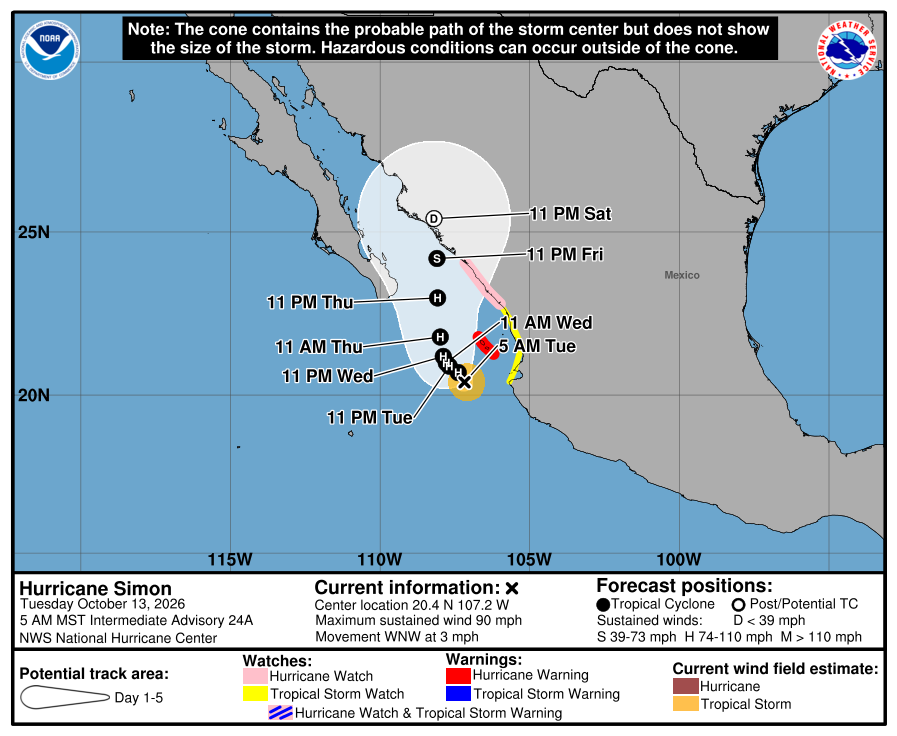
Official NHC cone for Simon, Intermediate Advisory 24A. It shows the likely path of the center, not every area that can get rain, wind, or surf. Red is the Hurricane Warning (Islas Marías); pink is the mainland Hurricane Watch; the Tropical Storm Watch runs Cabo Corrientes to Escuinapa. NHC calls this a very low-confidence track: slower and farther west, with models disagreeing on the meander. It can shift. 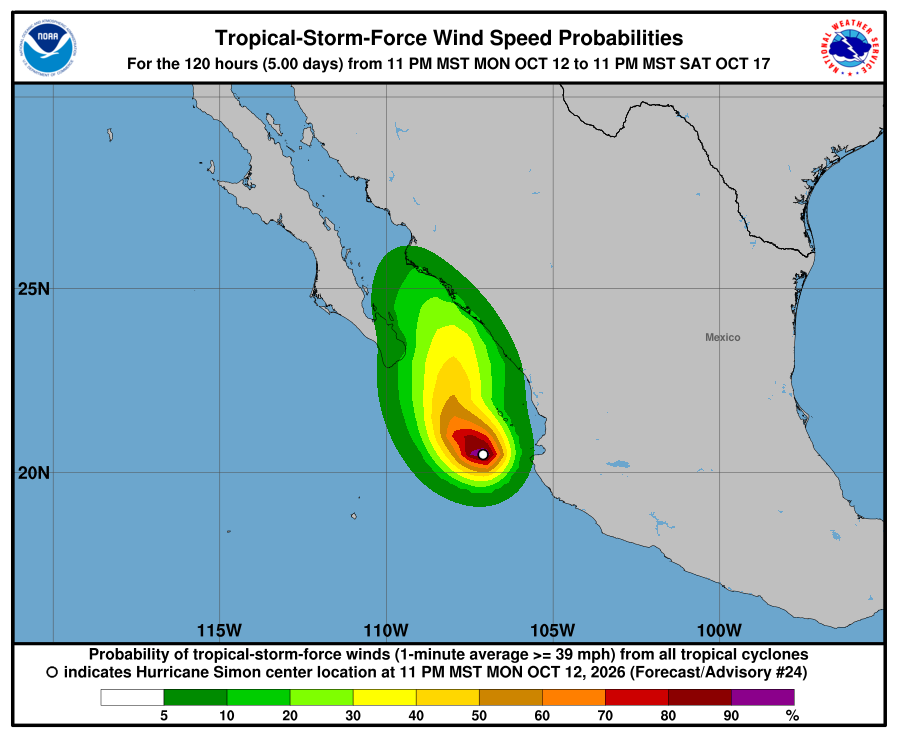
NHC wind-chance chart for Simon, Advisory 24. Cabo San Lucas 5%, San José del Cabo 7%, and La Paz 3%. Mazatlán 11% and Las Islas Marías 15% through 11 PM MST Saturday. Los Cabos at 5–7% is our Prepare level. Todos Santos is not listed. It is not a landfall forecast. Our corridor has no watch. NHC says Baja California Sur should keep watching; Los Cabos is at 5–7%, our Prepare level. NHC calls Simon's track very low-confidence and shifted it farther west. Simon's flooding rain and storm surge are forecast for west-central mainland Mexico. Rachel has ended. SMN general forecast No. 571 (5:00 AM MST) gives 1.5–2.5 m / about 5–8 ft for BCS coasts today, Tuesday (regional BCS). SMN Simon advisory No. 48 (5:15 AM MST) covers mainland Nayarit / Sinaloa seas only (2.0–3.0 m) — no BCS seas line. SEMAR's Monday evening marine forecast (issued 7:00 PM MST Monday) gives southwest Baja (Costa Sur Occidental) 5–7 ft through Tuesday evening — lower. We follow the higher official range for our beaches today: about 5–8 ft (SMN). Stay out of the ocean and off exposed beaches today, and check again after the 8:00 AM MST complete. Next NHC complete around 8:00 AM MST; SMN's next Simon advisory ~8:15 AM MST; SMN general next ~5:00 PM MST. Checked Tue, Oct 13 · 6:29 AM MST.
-
Superseded by Simon Intermediate Advisory 24A. Newer update above.
Simon weakens to Category 2 — low-confidence track shifted west toward waters south of Baja; Los Cabos at Prepare; seas about 10–13 ft Monday (Advisory 21)
- What changed: Hurricane Simon Advisory 21 (Mon, Oct 12 · 8:00 AM MST): Simon weakened to Category 2 at about 110 mph / 962 mb. The center is near 20.1N 106.5W, about 55 miles west-southwest of Cabo Corrientes and about 215 miles south of Mazatlán, moving northwest at about 3 mph. Watch changes: Mexico changed the Hurricane Warning to a Hurricane Watch north of Cabo Corrientes to El Roblito, and to a Tropical Storm Warning from Playa Pérula to Cabo Corrientes. Now: Hurricane Warning for Las Islas Marías; Hurricane Watch north of Cabo Corrientes to Bahía Tempehuaya; Tropical Storm Warning Playa Pérula to Cabo Corrientes. Simon has no BCS or corridor watches. Rachel has ended (NHC and SMN). EP93 has a high formation chance well south of southern Mexico and is moving west-northwest — not toward our corridor. Seas: SMN general forecast No. 569 (5:00 AM MST) gives 3.0–4.0 m / about 10–13 ft for BCS coasts on Monday (regional BCS). SMN Simon advisory No. 41 (8:15 AM MST) covers mainland Jalisco / Nayarit / Sinaloa seas only — no BCS seas line. SEMAR's Monday morning marine forecast (issued 7:00 AM MST Monday) gives southwest Baja (Costa Sur Occidental) 6–8 ft through 7:00 AM MST Tuesday and 6–8 ft again through 7:00 AM MST Wednesday — lower. We follow the higher official range for our beaches Monday: about 10–13 ft (SMN).
- What this means here: Simon could still come closer to Todos Santos, Pescadero, and Cerritos. NHC calls its track low-confidence. NHC shifted the track west and slower, toward the waters south of Baja. Los Cabos has a 3–4% wind chance. That is our Prepare level. Our corridor has no watch. NHC does not list Todos Santos in its wind-chance table. Seas are the risk now: about 10–13 ft possible Monday on Cerritos, La Pastora, and San Pedrito (SMN general 569, regional BCS).
- Stronger or weaker: Weaker for now: Simon dropped from Category 3 (115 mph) to Category 2 near 110 mph. NHC expects a little more weakening today. Then Simon could strengthen again Tuesday and Wednesday. Small storms like Simon can change strength fast. It stays a hurricane through midweek.
- Path and timing: The path is uncertain. NHC calls it a low-confidence track. NHC moved the track west and slower: Simon drifts northwest into Tuesday, then turns north-northeast toward the west-central mainland coast later this week. Some models disagree. One major model (ECMWF) keeps Simon meandering offshore, southeast of the Baja peninsula, before it turns north into the Gulf of California. Others take it back to mainland Mexico sooner. SMN general 569 lists intervals of showers (chubascos) about 5–25 mm for Baja California Sur on Monday (regional BCS).
- Wind chance: Simon Advisory 21, through 5:00 AM MST Saturday: Cabo San Lucas 3% and San José del Cabo 4%. That is our Prepare level for Los Cabos. NHC does not list La Paz. Mazatlán, on the mainland, is 56%; Las Islas Marías is 30%. NHC does not list Todos Santos in its wind-chance table.
- Surf at our beaches: Beach-level check from about 6:34 AM MST: Cerritos about 5–7 ft, San Pedrito about 4–5 ft, and La Pastora about 4–6 ft+ (free Surfline spot heights — our words, not their forecast text). Those beach-level reads are lower than SMN. Official seas still come from SMN: SMN general forecast No. 569 (5:00 AM MST) gives 3.0–4.0 m / about 10–13 ft for BCS coasts on Monday (regional BCS). SMN Simon advisory No. 41 (8:15 AM MST) covers mainland Jalisco / Nayarit / Sinaloa seas only — no BCS seas line. SEMAR's Monday morning marine forecast (issued 7:00 AM MST Monday) gives southwest Baja (Costa Sur Occidental) 6–8 ft through 7:00 AM MST Tuesday and 6–8 ft again through 7:00 AM MST Wednesday — lower. We follow the higher official range for our beaches Monday: about 10–13 ft (SMN). Sources disagree; we follow SMN for safety messaging.
- Windy + multi-source: NHC is official for watches; SMN general 569 10–13 ft BCS coasts Monday (regional) vs SEMAR southwest Baja 6–8 ft through Wednesday morning (we follow the higher); Surfline corridor spots about 4–7 ft (~6:34 AM read)
- Do now: Prepare. Stay out of the ocean and off exposed beaches Monday — seas could reach about 10–13 ft (SMN general 569, regional BCS coasts; SEMAR southwest Baja is lower at 6–8 ft). Keep kids and pets well back from the waterline. Never drive into running water or a flooded arroyo. Stock water, food, and flashlight basics now. Check this page again tomorrow. If Simon trends closer to Baja, secure loose outdoor items and be ready for wind and rain. Follow NHC, SMN, and Protección Civil BCS updates. Next: NHC intermediate advisory around 11:00 AM MST and complete around 2:00 PM MST; SMN's next Simon advisory ~11:30 AM MST; SMN general next ~5:00 PM MST.
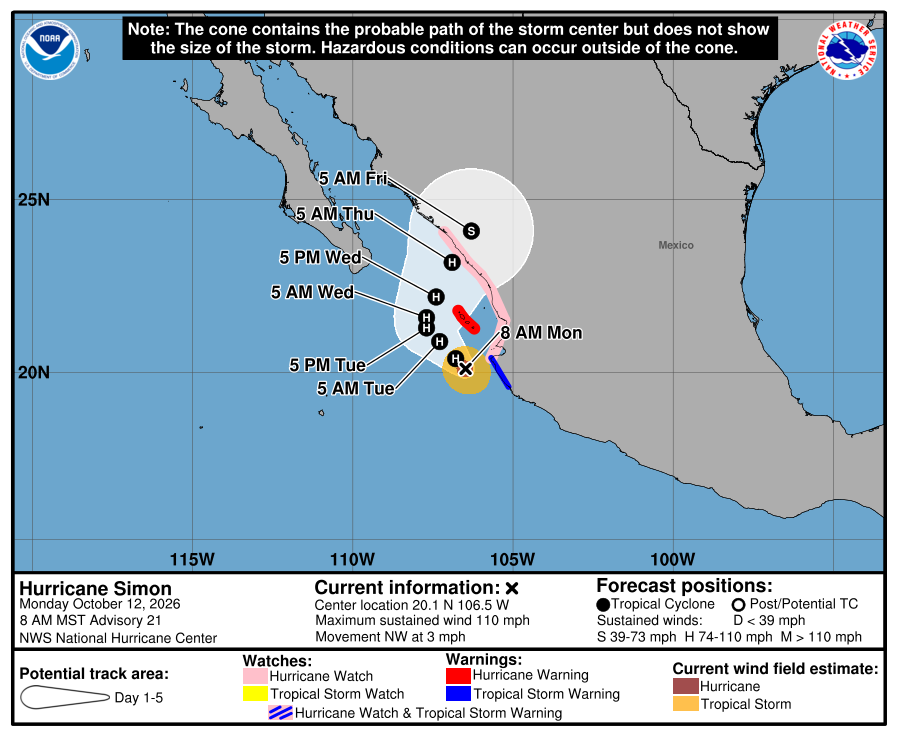
Official NHC cone for Simon, Advisory 21. It shows the likely path of the center, not every area that can get rain, wind, or surf. Red is the Hurricane Warning (Islas Marías); pink is the mainland Hurricane Watch; blue is the Tropical Storm Warning. NHC calls this a low-confidence track: it was shifted west and slower, and some models keep Simon offshore southeast of Baja. It can shift. 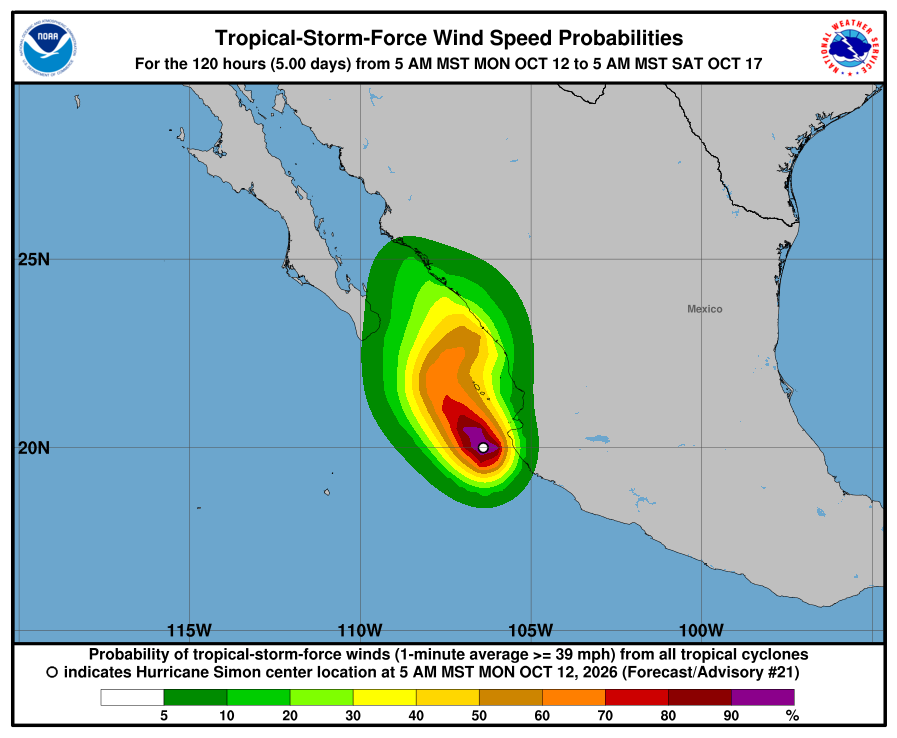
NHC wind-chance chart for Simon, Advisory 21. Cabo San Lucas 3% and San José del Cabo 4%; La Paz unlisted. Mazatlán 56% and Las Islas Marías 30% through Saturday morning. Los Cabos at 3–4% is our Prepare level. Todos Santos is not listed. It is not a landfall forecast. Our corridor has no watch. NHC calls Simon's track low-confidence and shifted it west toward the waters south of Baja; Los Cabos is at 3–4%, our Prepare level. Simon's flooding rain and storm surge are forecast for southwestern and west-central mainland Mexico. Rachel has ended. SMN general forecast No. 569 (5:00 AM MST) gives 3.0–4.0 m / about 10–13 ft for BCS coasts on Monday (regional BCS). SMN Simon advisory No. 41 (8:15 AM MST) covers mainland Jalisco / Nayarit / Sinaloa seas only — no BCS seas line. SEMAR's Monday morning marine forecast (issued 7:00 AM MST Monday) gives southwest Baja (Costa Sur Occidental) 6–8 ft through 7:00 AM MST Tuesday and 6–8 ft again through 7:00 AM MST Wednesday — lower. We follow the higher official range for our beaches Monday: about 10–13 ft (SMN). Stay out of the ocean and off exposed beaches Monday, and check again tomorrow. Next NHC intermediate around 11:00 AM MST and complete around 2:00 PM MST; SMN's next Simon advisory ~11:30 AM MST; SMN general next ~5:00 PM MST. Checked Mon, Oct 12 · 9:08 AM MST.
-
Superseded by Simon Advisory 21. Newer update above.
Simon Category 3 near mainland Mexico — still no corridor watches; Rachel exited; seas about 10–13 ft Monday on our BCS beaches (Advisory 20)
- What changed: We missed overnight complete Advisories Simon 17–19; this trail covers the latest complete — Hurricane Simon Advisory 20 (Mon, Oct 12 · 2:00 AM MST) — and notes Intermediate 20A (about 5:00 AM MST). Advisory 20 / Intermediate 20A: Category 3 at about 115 mph / 958 mb. Intermediate 20A places the center near 20.1N 106.4W, about 50 miles west-southwest of Cabo Corrientes and about 215 miles south of Mazatlán, moving northwest at about 2 mph. Watch changes: none. Hurricane Warning still Playa Pérula to El Roblito plus Las Islas Marías; Hurricane Watch north of El Roblito to Bahía Tempehuaya. Simon has no BCS or corridor watches. Rachel is no longer an active NHC storm (SMN Rachel advisory No. 90 on Sunday was FINAL). A disturbance (EP93) has a high formation chance well south of southern Mexico and is moving west-northwest — not toward our corridor. Seas: SMN general forecast No. 569 (about 5:00 AM MST) gives 3.0–4.0 m / about 10–13 ft for BCS coasts on Monday (regional BCS). SMN Simon advisory No. 40 (5:15 AM MST) covers mainland Jalisco / Nayarit / Sinaloa seas only — no BCS seas line. SEMAR's Sunday evening marine forecast (issued 7:00 PM MST Sunday) gives southwest Baja (Costa Sur Occidental) 6–8 ft through 7:00 PM MST Monday, then 7–9 ft from Monday 7:00 PM MST into Tuesday evening — lower. We follow the higher official range for our beaches Monday: about 10–13 ft (SMN).
- What this means here: Simon is still not a storm threat for Todos Santos, Pescadero, or Cerritos. Rachel has ended as an NHC storm and is far to the north. Seas are the local risk: about 10–13 ft possible Monday on Cerritos, La Pastora, and San Pedrito (SMN general 569, regional BCS). Showers can still run arroyo crossings, wash out dirt roads, or drop a heavy cell. Exact numbers below.
- Stronger or weaker: Simon is a Category 3 near about 115 mph / 958 mb (same at Adv 20 and Intermediate 20A). That is weaker than the Category 4 peak near Manzanillo over the weekend. NHC expects it to remain a hurricane into midweek, then weaken quickly after it moves inland over west-central mainland Mexico. Rachel has exited — remnant only, far north.
- Path and timing: Simon is not heading toward Todos Santos, Pescadero, or Cerritos. It tracks northwest parallel to the mainland into early Tuesday, then gradually northeast, inland over west-central Mexico midweek — east of Baja, across the Gulf from us. Rachel's remnant is far to the north and no longer an NHC named storm. Local effects for us remain elevated Pacific seas and passing rain cells. SMN general 569 lists intervals of showers (chubascos) about 5–25 mm for Baja California Sur on Monday (regional BCS). Five-day paths can shift.
- Wind chance: Simon Advisory 20: NHC does not list Cabo San Lucas, San José del Cabo, or La Paz (under 3%). Las Islas Marías is 51%; Mazatlán, on the mainland, is 48% through Friday. NHC does not list Todos Santos separately.
- Surf at our beaches: Beach-level check this morning: Cerritos about 5–7 ft, San Pedrito about 4–5 ft, and La Pastora about 4–6 ft+ (free Surfline spot heights read about 6:34 AM MST — our words, not their forecast text). Those beach-level reads are lower than SMN. Official seas still come from SMN: SMN general forecast No. 569 (about 5:00 AM MST) gives 3.0–4.0 m / about 10–13 ft for BCS coasts on Monday (regional BCS). SMN Simon advisory No. 40 (5:15 AM MST) covers mainland Jalisco / Nayarit / Sinaloa seas only — no BCS seas line. SEMAR's Sunday evening marine forecast (issued 7:00 PM MST Sunday) gives southwest Baja (Costa Sur Occidental) 6–8 ft through 7:00 PM MST Monday, then 7–9 ft from Monday 7:00 PM MST into Tuesday evening — lower. We follow the higher official range for our beaches Monday: about 10–13 ft (SMN). Sources disagree; we follow SMN for safety messaging.
- Windy + multi-source: NHC is official for watches; SMN general 569 10–13 ft BCS coasts Monday (regional) vs SEMAR southwest Baja 6–8 ft to Mon 7 PM / 7–9 ft after (we follow the higher); Surfline corridor spots about 4–7 ft (~6:34 AM read)
- Do now: Stay out of the ocean and off exposed beaches Monday — seas could reach about 10–13 ft (SMN general 569, regional BCS coasts; SEMAR southwest Baja is lower at 6–8 ft). Keep kids and pets well back from the waterline. Plan around arroyo crossings and dirt roads if heavy cells hit. Never drive into running water. Stock water, food, and flashlight basics. Secure loose outdoor items. Follow NHC, SMN, and Protección Civil BCS updates. Traveling to mainland Mexico this week (Cabo Corrientes, Islas Marías, Mazatlán coast)? Plan around Simon — it is a Category 3 hurricane with a Hurricane Warning up there. Next: NHC next complete advisory around 8:00 AM MST; SMN's next Simon advisory ~8:15 AM MST; SMN general next ~5:00 PM MST.
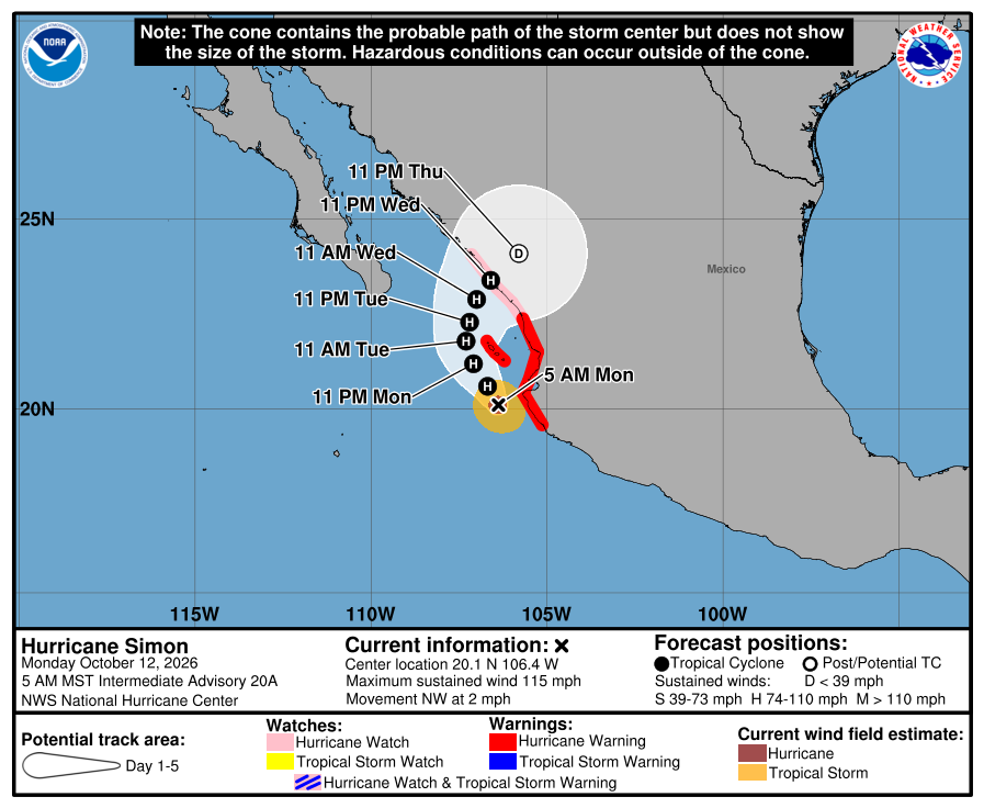
Official NHC cone for Simon, Intermediate Advisory 20A. It shows the likely path of the center, not every area that can get rain, wind, or surf. Red is the Hurricane Warning; the watch is north along the mainland. The path runs northwest parallel to mainland Mexico, then inland west-central Mexico midweek — east of the Baja tip and across the Gulf from us. It is five days out and can shift. 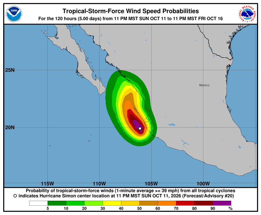
NHC wind-chance chart for Simon, Advisory 20. Cabo / SJD / La Paz unlisted (under 3%). Las Islas Marías 51% and Mazatlán 48% through Friday. Small for our corridor. It is not a landfall forecast for Todos Santos. NHC lists no hazards for our area from Simon. Simon's flooding rain and storm surge are forecast for southwestern mainland Mexico. Rachel has exited. SMN general forecast No. 569 (about 5:00 AM MST) gives 3.0–4.0 m / about 10–13 ft for BCS coasts on Monday (regional BCS). SMN Simon advisory No. 40 (5:15 AM MST) covers mainland Jalisco / Nayarit / Sinaloa seas only — no BCS seas line. SEMAR's Sunday evening marine forecast (issued 7:00 PM MST Sunday) gives southwest Baja (Costa Sur Occidental) 6–8 ft through 7:00 PM MST Monday, then 7–9 ft from Monday 7:00 PM MST into Tuesday evening — lower. We follow the higher official range for our beaches Monday: about 10–13 ft (SMN). Plan around arroyo crossings and stay out of the ocean and off exposed beaches Monday. Next NHC complete around 8:00 AM MST; SMN's next Simon advisory ~8:15 AM MST; SMN general next ~5:00 PM MST. Checked Mon, Oct 12 · 7:24 AM MST.
NHC Simon Advisory 20A (current)NHC Simon Advisory 20 archiveNHC Simon Discussion 20NHC Simon wind chances 20NHC Current Storms (Rachel inactive)NHC Tropical Weather Outlook (EP93)SMN general forecast No. 569SMN Simon advisory No. 40SMN Rachel advisory No. 90 (FINAL)SEMAR evening marineSurfline CerritosSurfline San PedritoSurfline La PastoraWindy tracker -
Superseded by Simon Advisory 20 / Intermediate 20A. Newer update above.
Rachel now post-tropical inland; Simon Category 4 near mainland Mexico — still no corridor watches; seas still about 8–10 ft Sunday on our Pacific beaches (Advisory 57)
- What changed: We missed overnight complete Advisories Rachel 56 and Simon 15; this trail covers the latest completes — Post-Tropical Cyclone Rachel Advisory 57 and Hurricane Simon Advisory 16 (Sun, Oct 11 · 2:00 AM MST) — and notes Intermediates 57A / 16A (about 5:00 AM MST). Hurricane Simon Advisory 16: Category 4 at about 155 mph / 930 mb, moving north-northwest at about 6 mph, about 60 miles west-southwest of Manzanillo. Intermediate 16A: still Category 4 at about 150 mph / 933 mb, about 60 miles west of Manzanillo — "core of extremely dangerous hurricane very near the coast of west-central Mexico." Watch changes: none for Simon — Hurricane Warning still Punta San Telmo to El Roblito plus Las Islas Marías; Tropical Storm Watch east of Punta San Telmo to Lázaro Cárdenas. Simon has no BCS or corridor watches. NHC still expects Simon near or just inland of west-central mainland Mexico later today (Sunday). Post-Tropical Cyclone Rachel Advisory 57: now post-tropical at about 50 mph / 990 mb, moving north at about 25 mph, about 60 miles east-northeast of San Diego (inland). At Adv 57, Tropical Storm Warning still covered west Baja from Punta Eugenia to the U.S. border plus east Baja Isla San Luis–Puerto Peñasco; southern California watch discontinued. Intermediate 57A: about 40 mph / 993 mb farther inland; Mexico discontinued the west Baja Tropical Storm Warning (Punta Eugenia→border) and the east-Baja / northwest-Mexico watches — only Tropical Storm Warning left is east Baja Isla San Luis to Puerto Peñasco. Todos Santos, Pescadero, and Cerritos stay outside every watch and warning. Seas: SMN Rachel advisory No. 89 (5:15 AM MST) lists 4.0–6.0 m / about 13–20 ft only for the western Baja California coast (northern — regional, not our corridor) and no longer gives a BCS west-coast seas line. SEMAR's Saturday evening marine forecast (7:00 PM MST Saturday) gives southwest Baja (Costa Sur Occidental) 8–10 ft through 7:00 PM MST Sunday, then 7–9 ft through 7:00 PM MST Monday. SMN Simon advisory No. 32 (5:15 AM MST) and SMN general forecast No. 567 (5:00 AM MST) are lower: 1.5–2.5 m / about 5–8 ft for Baja California Sur (sur) on Sunday. We follow the higher official range for our beaches Sunday: about 8–10 ft (SEMAR).
- What this means here: Rachel and Simon are still not a storm threat for Todos Santos, Pescadero, or Cerritos. Rachel is now post-tropical and inland far to the north. Seas are the local risk: about 8–10 ft possible Sunday on Cerritos, La Pastora, and San Pedrito (SEMAR southwest Baja, through 7:00 PM MST Sunday), then about 7–9 ft into Monday. Showers can still run arroyo crossings, wash out dirt roads, or drop a heavy cell. Exact numbers below.
- Stronger or weaker: Simon holds as a Category 4 near about 150–155 mph (Adv 16 was 155 / 930 mb; Intermediate 16A is 150 / 933 mb). NHC still expects it near or just inland of west-central mainland Mexico as a major hurricane today, then rapid weakening if the core moves fully onshore. Rachel is post-tropical and weakening inland (50 mph at Adv 57 → about 40 mph at 57A). NHC expects dissipation later today.
- Path and timing: Neither storm center comes near Todos Santos, Pescadero, or Cerritos — and Rachel is not heading toward our corridor. Simon moves north-northwest at about 6 mph and is forecast near or just inland of west-central mainland Mexico later today (Sunday), then very close to that coast Monday — east of Baja, across the Gulf from us. Rachel is already inland over the southwestern U.S., moving north, and is forecast to dissipate later today — far northwest of us. Local effects for us remain passing rain cells and still-rough Pacific seas as seas ease from Saturday's peak. SMN Rachel 89's strong showers (25–50 mm) are for Baja California state (regional — not BCS / not our corridor totals). SMN general 567 lists Baja California Sur only under scattered showers (5–25 mm) on Sunday (regional, all of BCS). SEMAR’s Saturday evening bulletin adds possible strong local storms (25–50 mm) with thunder in BCS. Five-day paths can shift.
- Wind chance: Simon Advisory 16: NHC does not list Cabo San Lucas, San José del Cabo, or La Paz (under 3%). Mazatlán, on the mainland, is 19%; Las Islas Marías 53%; Puerto Vallarta 69% through Thursday Oct 15, 11:00 PM MST. Rachel Advisory 57: Cabo / La Paz stay under 3% (unlisted). Ensenada, far to the north, is 99%; San Diego is 8%. NHC does not list Todos Santos separately.
- Surf at our beaches: Official seas: SMN Rachel advisory No. 89 (5:15 AM MST) lists 4.0–6.0 m / about 13–20 ft only for the western Baja California coast (northern — regional, not our corridor) and no longer gives a BCS west-coast seas line. SEMAR's Saturday evening marine forecast (7:00 PM MST Saturday) gives southwest Baja (Costa Sur Occidental) 8–10 ft through 7:00 PM MST Sunday, then 7–9 ft through 7:00 PM MST Monday. SMN Simon advisory No. 32 (5:15 AM MST) and SMN general forecast No. 567 (5:00 AM MST) are lower: 1.5–2.5 m / about 5–8 ft for Baja California Sur (sur) on Sunday. We follow the higher official range for our beaches Sunday: about 8–10 ft (SEMAR). SMN's 96-hour forecast No. 283 (1:00 PM MST Saturday) gives BCS coasts about 3.0–4.0 m / 10–13 ft on Monday, then about 1.5–2.5 m / 5–8 ft Tuesday and Wednesday — regional BCS.
- Windy + multi-source: NHC is official for watches; SMN Rachel 89 drops BCS west seas (northern BC only); SEMAR evening southwest Baja 8–10 ft Sunday, 7–9 ft Monday vs lower SMN Simon 32 / general 567 5–8 ft BCS sur Sunday (we follow the higher); SMN 96h 283 10–13 ft Monday, 5–8 ft Tuesday–Wednesday
- Do now: Stay out of the ocean and off exposed beaches Sunday — seas could reach about 8–10 ft (SEMAR southwest Baja; SMN Simon 32 / general 567 lower at 5–8 ft). Keep kids and pets well back from the waterline. Plan around arroyo crossings and dirt roads if heavy cells hit. Never drive into running water. Stock water, food, and flashlight basics. Secure loose outdoor items. Seas stay elevated after Sunday: SEMAR southwest Baja about 7–9 ft through 7:00 PM MST Monday; SMN 96h No. 283 gives BCS coasts about 10–13 ft Monday (regional), then about 5–8 ft Tuesday–Wednesday. Follow NHC, SMN, and Protección Civil BCS updates. Traveling to mainland Mexico this weekend (Manzanillo, Puerto Vallarta, Nayarit coast)? Plan around Simon now — it is a Category 4 hurricane with a Hurricane Warning up there, core very near the coast. Driving in northern Baja or the U.S. Southwest? Watch Rachel's remnant rain and gusts — far from our corridor. Next: NHC next complete advisories around 8:00 AM MST; SMN's next Rachel and Simon advisories ~8:15 AM MST.
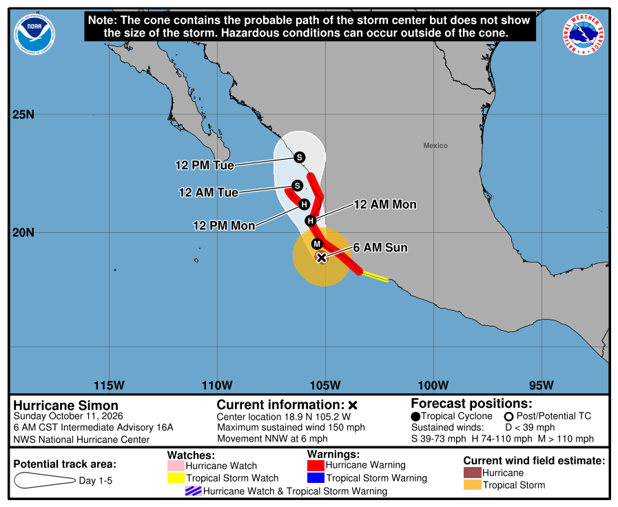
Official NHC cone for Simon, Intermediate Advisory 16A. It shows the likely path of the center, not every area that can get rain, wind, or surf. Red is the Hurricane Warning; yellow is the Tropical Storm Watch. The path runs north-northwest toward west-central mainland Mexico, near or just inland later Sunday, east of the Baja tip and across the Gulf from us. It is five days out and can shift. 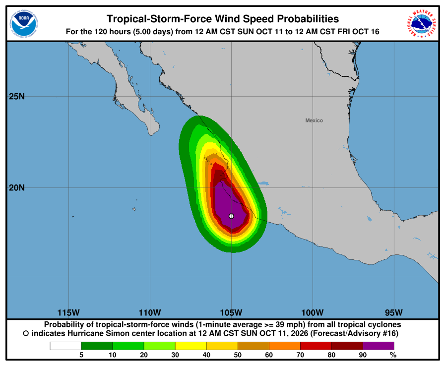
NHC wind-chance chart for Simon, Advisory 16. Cabo / SJD / La Paz unlisted (under 3%). Mazatlán 19%, Las Islas Marías 53%, and Puerto Vallarta 69% through Thursday Oct 15, 11:00 PM MST. Small for our corridor. It is not a landfall forecast for Todos Santos. 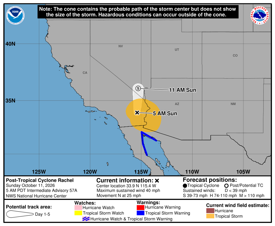
Official NHC cone for Rachel, Advisory 57 (graphic refresh may also reflect Intermediate 57A watch cuts). Rachel is post-tropical and inland far northwest of us. Intermediate 57A discontinued the west Baja Tropical Storm Warning; only east Baja Isla San Luis to Puerto Peñasco remains. Our corridor stays outside the watches and outside the near-term cone threat. 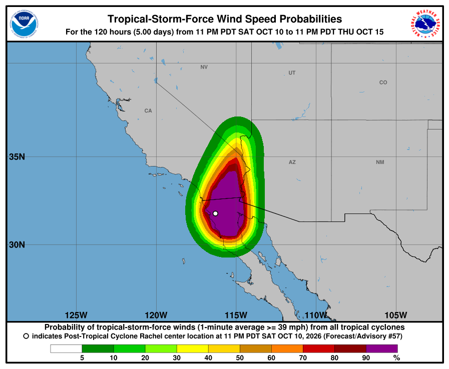
NHC wind-chance chart for Rachel, Advisory 57. Cabo / La Paz stay under 3%. Ensenada, far north, is 99%; San Diego is 8% through the five-day window. NHC lists no hazards for our area from Rachel or Simon. Simon's flooding rain and storm surge are forecast for southwestern mainland Mexico. Rachel's remnant rain and gusts are forecast for northern Baja California and the U.S. Southwest. SMN Rachel advisory No. 89 (5:15 AM MST) lists 4.0–6.0 m / about 13–20 ft only for the western Baja California coast (northern — regional, not our corridor) and no longer gives a BCS west-coast seas line. SEMAR's Saturday evening marine forecast (7:00 PM MST Saturday) gives southwest Baja (Costa Sur Occidental) 8–10 ft through 7:00 PM MST Sunday, then 7–9 ft through 7:00 PM MST Monday. SMN Simon advisory No. 32 (5:15 AM MST) and SMN general forecast No. 567 (5:00 AM MST) are lower: 1.5–2.5 m / about 5–8 ft for Baja California Sur (sur) on Sunday. We follow the higher official range for our beaches Sunday: about 8–10 ft (SEMAR). Plan around arroyo crossings and stay out of the ocean and off exposed beaches Sunday. Next NHC complete around 8:00 AM MST; SMN's next Rachel and Simon advisories ~8:15 AM MST. Checked Sun, Oct 11 · 6:18 AM MST.
NHC Simon Advisory 16NHC Simon Discussion 16NHC Simon wind chances 16NHC Simon Advisory 16 archiveNHC Rachel Advisory 57A (current)NHC Rachel Advisory 57 archiveNHC Rachel Discussion 57NHC Rachel wind chances 57SMN general forecast No. 567SMN Rachel advisory No. 89SMN Simon advisory No. 32SMN 96-hour forecast No. 283SEMAR evening marineSurfline CerritosSurfline San PedritoSurfline La PastoraWindy tracker -
Superseded by Advisory 57 / Simon 16. Newer update above.
Simon still Category 4 at 150 mph; Rachel strengthens to 65 mph — still no corridor watches; SMN Rachel 84 keeps about 10–16 ft seas for our BCS west-coast beaches (Advisory 55)
- What changed: Hurricane Simon Advisory 14 (Sat, Oct 10 · 2:00 PM MST): still a Category 4 hurricane at about 150 mph / 932 mb, moving north at about 5 mph, about 100 miles south-southwest of Manzanillo. Watch changes: none. Hurricane Warning from Punta San Telmo to El Roblito plus Las Islas Marías; Tropical Storm Watch east of Punta San Telmo to Lázaro Cárdenas. Simon has no BCS or corridor watches. NHC still expects Simon near or just inland of west-central mainland Mexico as a major hurricane on Sunday. Tropical Storm Rachel Advisory 55 (Sat, Oct 10 · 2:00 PM MST): now about 65 mph / 989 mb (was 60 mph / 992 mb), moving north-northeast at about 30 mph, about 255 miles southwest of Punta Baja / 400 miles south of San Diego. Watch changes: none — Tropical Storm Warning still covers west Baja from Punta Eugenia to the U.S. border, plus east Baja Isla San Luis–Puerto Peñasco; California and other far-north watches unchanged. Todos Santos, Pescadero, and Cerritos stay outside every watch and warning. Rachel is expected to move ashore northern Baja tonight and become post-tropical by Sunday morning. Seas: SMN Rachel advisory No. 84 (2:15 PM MST) gives 3.0–5.0 m / about 10–16 ft for the BCS west coast (regional west BCS — no north limit in that line) — that includes Cerritos, La Pastora, and San Pedrito. The same advisory also lists 5.0–7.0 m for the coasts of Baja California state (northern — regional, not our corridor). SMN's general forecast No. 565 lists 4–5 m / about 13–16 ft for the northern west coast only. SEMAR's morning marine forecast gives southwest Baja (Costa Sur Occidental) 8–10 ft through Sunday morning, then 5–7 ft Sunday into Monday — unchanged. We follow the higher official range for our beaches: about 10–16 ft Saturday.
- What this means here: Rachel and Simon are still not a storm threat for Todos Santos, Pescadero, or Cerritos. Seas are the risk: about 10–16 ft possible Saturday on Cerritos, La Pastora, and San Pedrito (SMN Rachel 84, regional BCS west coast). Showers can still run arroyo crossings, wash out dirt roads, or drop a heavy cell. Exact numbers below.
- Stronger or weaker: Simon holds at about 150 mph / 932 mb Category 4 (same intensity class; pressure 932 mb vs 933 at Intermediate 13A). NHC still expects it near or just inland of west-central mainland Mexico as a major hurricane on Sunday. NHC says rapid weakening could occur if Simon’s core moves fully onshore by Monday. Rachel strengthened slightly to about 65 mph / 989 mb (from 60 / 992). Some weakening is forecast after it moves inland tonight, becoming post-tropical by Sunday morning.
- Path and timing: Neither storm center comes near Todos Santos, Pescadero, or Cerritos. Simon moves north at about 5 mph and is forecast near or just inland of west-central mainland Mexico on Sunday — east of Baja, across the Gulf from us. Rachel moves north-northeast at about 30 mph toward northern Baja California tonight, then quickly into the southwestern U.S. on Sunday — far northwest of us. Local effects for us remain passing rain cells and rough Pacific seas. SMN Rachel 84's strong showers (25–50 mm) are for Baja California state (regional — not BCS / not our corridor totals). Five-day paths can shift.
- Wind chance: Simon Advisory 14: NHC does not list Cabo San Lucas, San José del Cabo, or La Paz (under 3%). Mazatlán, on the mainland, is 12% and Las Islas Marías 26% through Thursday Oct 15, 11:00 AM MST. Rachel Advisory 55: Cabo / La Paz stay under 3% (unlisted). Ensenada, far to the north, is 48%; San Diego is 7%; Punta Eugenia (northern BCS, far from us) 8%. NHC does not list Todos Santos separately.
- Surf at our beaches: Official seas still come from SMN: SMN Rachel advisory No. 84 (2:15 PM MST) gives 3.0–5.0 m / about 10–16 ft for the BCS west coast (regional west BCS — no north limit in that line) — that includes Cerritos, La Pastora, and San Pedrito. The same advisory also lists 5.0–7.0 m for the coasts of Baja California state (northern — regional, not our corridor). SMN's general forecast No. 565 lists 4–5 m / about 13–16 ft for the northern west coast only. SEMAR's morning marine forecast gives southwest Baja (Costa Sur Occidental) 8–10 ft through Sunday morning, then 5–7 ft Sunday into Monday — unchanged. We follow the higher official range for our beaches: about 10–16 ft Saturday. SMN's 96-hour forecast No. 283 (1:00 PM MST) still shows BCS coast seas about 3.0–4.0 m / 10–13 ft Monday.
- Windy + multi-source: NHC is official for watches; SMN Rachel 84 10–16 ft BCS west coast (regional) vs SMN general 565 13–16 ft northern only vs SEMAR southwest Baja 8–10 ft (we follow the higher)
- Do now: Stay out of the ocean and off exposed beaches Saturday — seas could reach about 10–16 ft (SMN Rachel advisory No. 84, regional BCS west coast, including Cerritos, La Pastora, and San Pedrito). Keep kids and pets well back from the waterline. Plan around arroyo crossings and dirt roads if heavy cells hit. Never drive into running water. Stock water, food, and flashlight basics. Secure loose outdoor items. Seas stay rough after Saturday: about 5–7 ft Sunday into Monday (SEMAR southwest Baja) and about 10–13 ft Monday (SMN BCS coasts). Follow NHC, SMN, and Protección Civil BCS updates. Traveling to mainland Mexico this weekend (Manzanillo, Puerto Vallarta, Nayarit coast)? Plan around Simon now — it is a Category 4 hurricane with a Hurricane Warning up there. Driving to northern Baja California or southern California? Watch Rachel — Tropical Storm Warning still runs from Punta Eugenia to the U.S. border on the west coast; center expected ashore northern Baja tonight. Next: NHC intermediate advisories around 5:00 PM MST; SMN's next Rachel advisory ~5:15 PM MST; next NHC complete around 8:00 PM MST.
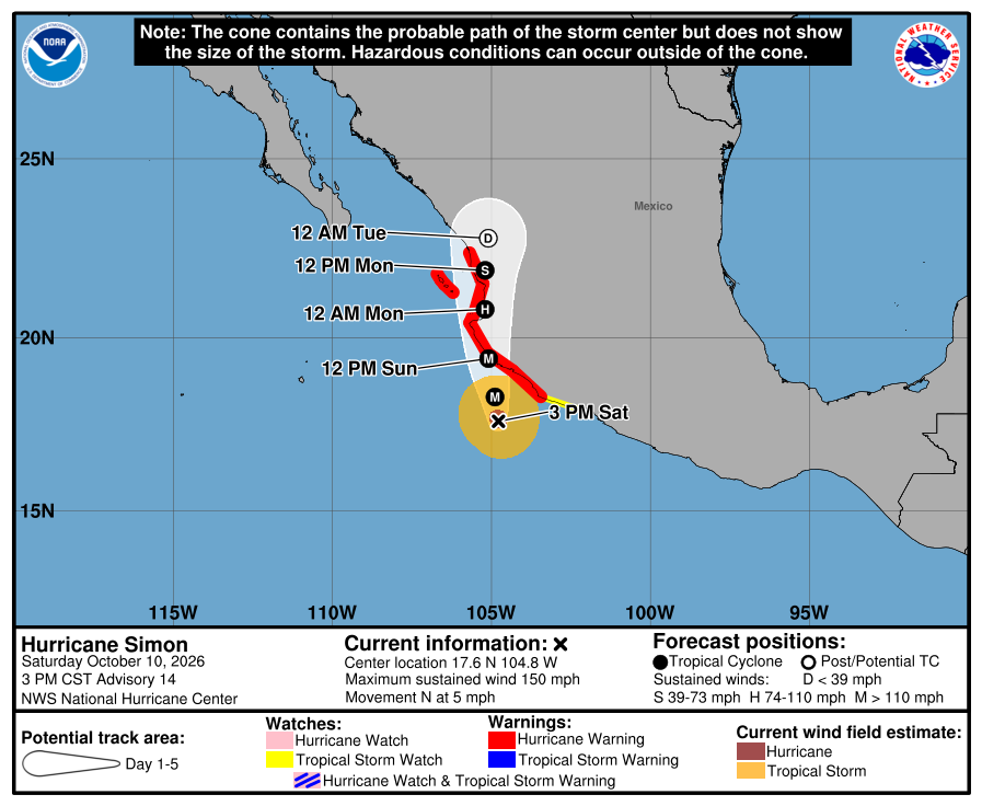
Official NHC cone for Simon, Advisory 14. It shows the likely path of the center, not every area that can get rain, wind, or surf. Red is the Hurricane Warning; yellow is the Tropical Storm Watch. The path runs north toward west-central mainland Mexico, near or just inland Sunday, east of the Baja tip and across the Gulf from us. It is five days out and can shift. 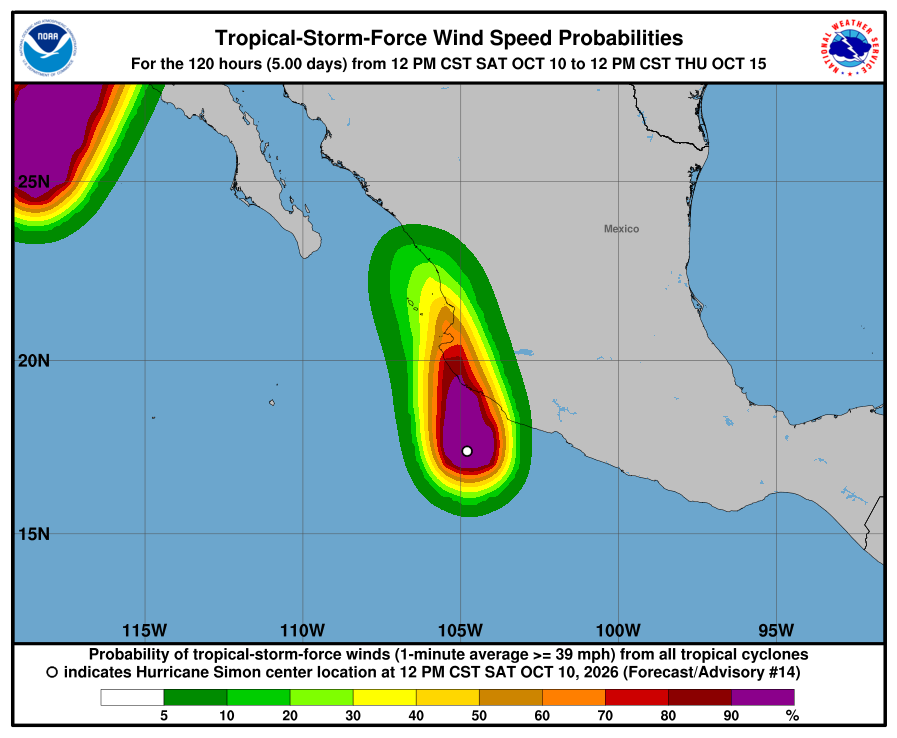
NHC wind-chance chart for Simon, Advisory 14. Cabo / SJD / La Paz unlisted (under 3%). Mazatlán 12% and Las Islas Marías 26% through Thursday Oct 15, 11:00 AM MST. Small for our corridor. It is not a landfall forecast for Todos Santos. 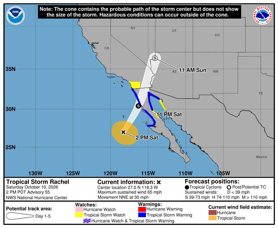
Official NHC cone for Rachel, Advisory 55. Blue is the Tropical Storm Warning (still from Punta Eugenia to the U.S. border on the west coast, plus east northern Baja); yellow is the Tropical Storm Watch on southern California, east Baja, and northwest Mexico. The track bends north-northeast far northwest of us toward northern Baja tonight. Our corridor stays outside the watches and outside the near-term cone threat. 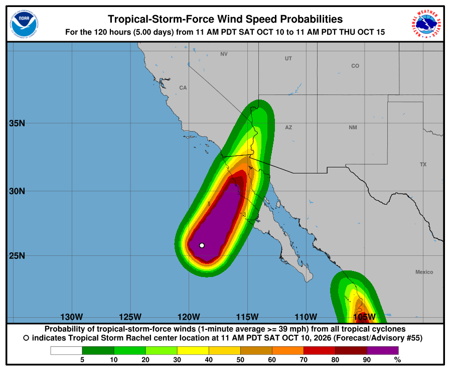
NHC wind-chance chart for Rachel, Advisory 55. Cabo / La Paz stay under 3%. Ensenada, far north, is 48%; San Diego is 7%; Punta Eugenia (northern BCS) is 8% through the five-day window. NHC lists no hazards for our area from Rachel or Simon. Simon's flooding rain and storm surge are forecast for southwestern mainland Mexico. Rachel's rain and wind are forecast for northern Baja California and the U.S. Southwest. SMN Rachel advisory No. 84 (2:15 PM MST) gives 3.0–5.0 m / about 10–16 ft for the BCS west coast (regional west BCS — no north limit in that line) — that includes Cerritos, La Pastora, and San Pedrito. The same advisory also lists 5.0–7.0 m for the coasts of Baja California state (northern — regional, not our corridor). SMN's general forecast No. 565 lists 4–5 m / about 13–16 ft for the northern west coast only. SEMAR's morning marine forecast gives southwest Baja (Costa Sur Occidental) 8–10 ft through Sunday morning, then 5–7 ft Sunday into Monday — unchanged. We follow the higher official range for our beaches: about 10–16 ft Saturday. Plan around arroyo crossings and stay out of the ocean and off exposed beaches Saturday. Next NHC intermediate around 5:00 PM MST; SMN's next Rachel advisory ~5:15 PM MST; next NHC complete around 8:00 PM MST. Checked Sat, Oct 10 · 3:16 PM MST.
NHC Simon Advisory 14NHC Simon Discussion 14NHC Simon wind chances 14NHC Rachel Advisory 55NHC Rachel Discussion 55NHC Rachel wind chances 55SMN general forecast No. 565SMN Rachel advisory No. 84SMN 96-hour forecastSEMAR morning marineSurfline CerritosSurfline San PedritoSurfline La PastoraWindy tracker -
Superseded by Advisory 55 / Simon 14. Newer update above.
Simon still Category 4 at 150 mph; Rachel Warning extended south to Punta Eugenia — still no corridor watches; SMN Rachel 82 keeps about 10–16 ft seas for our BCS west-coast beaches (Advisory 54)
- What changed: Hurricane Simon Advisory 13 (Sat, Oct 10 · 8:00 AM MST): still a Category 4 hurricane at about 150 mph / 938 mb, moving north at about 3 mph, about 115 miles south-southwest of Manzanillo. Watch changes: none. Hurricane Warning from Punta San Telmo to El Roblito plus Las Islas Marías; Tropical Storm Watch east of Punta San Telmo to Lázaro Cárdenas. Simon has no BCS or corridor watches. Some additional strengthening remains possible today; NHC says Simon approaches west-central Mexico as a major hurricane tonight or early Sunday, near or just inland Sunday. Tropical Storm Rachel Advisory 54 (Sat, Oct 10 · 8:00 AM MST): still about 60 mph / 992 mb, moving northeast at about 22 mph, about 390 miles southwest of Punta Baja / 520 miles south-southwest of San Diego. Watch change: Mexico extended the Tropical Storm Warning on the west Baja coast southward to Punta Eugenia (northern BCS, still far north of us). Warning now covers west Baja from Punta Eugenia to the U.S. border, plus east Baja Isla San Luis–Puerto Peñasco. Watches remain for southern California (border to San Diego/Orange County line), east Baja Bahía de los Ángeles–Isla San Luis, and Puerto Libertad–Puerto Peñasco. Todos Santos, Pescadero, and Cerritos stay outside every watch and warning. Rachel is expected to move ashore northern Baja tonight and become post-tropical by Sunday morning. Seas: SMN Rachel advisory No. 82 (8:15 AM MST) gives 3.0–5.0 m / about 10–16 ft for the BCS west coast (no north limit) — that includes Cerritos, La Pastora, and San Pedrito. SMN's general forecast No. 565 lists 4–5 m / about 13–16 ft for the northern west coast only. SEMAR's morning marine forecast (7:00 AM MST Saturday) gives southwest Baja (Costa Sur Occidental) 8–10 ft through Sunday morning, then 5–7 ft Sunday into Monday. We follow the higher official range for our beaches: about 10–16 ft Saturday.
- What this means here: Rachel is still not a storm threat for Todos Santos, Pescadero, or Cerritos: no watch here, no landfall near us, and its strong wind stays far to the north. Simon is still not a storm threat for our towns — its center stays on the mainland side. The seas are the risk for us: about 10–16 ft possible Saturday on Cerritos, La Pastora, and San Pedrito (SMN Rachel 82, BCS west coast). Showers may still run arroyos or wash out dirt roads. Exact numbers below.
- Stronger or weaker: Simon holds at about 150 mph / 938 mb Category 4 (same intensity class as Intermediate 12A). NHC says some additional strengthening remains possible today before it nears the mainland coast as a major hurricane tonight or early Sunday. Rachel holds near 60 mph / 992 mb; some strengthening is possible through tonight, then rapid weakening after it moves inland Sunday, becoming post-tropical by Sunday morning.
- Path and timing: Neither storm center comes near Todos Santos, Pescadero, or Cerritos. Simon moves north at about 3 mph and is forecast near or just inland of west-central mainland Mexico on Sunday — east of Baja, across the Gulf from us. Rachel moves northeast at about 22 mph toward northern Baja California tonight, then quickly north-northeast across the southwestern U.S. on Sunday — far northwest of us. Local effects for us remain passing rain cells and rough Pacific seas. Five-day paths can shift.
- Rain, wind, and seas by day: From SMN's general forecast No. 565 (5:00 AM MST Saturday), SMN Rachel advisory No. 82 (8:15 AM MST), and SMN's 96-hour forecast (issued 1:00 PM MST Friday; still current); regional BCS figures, not each town. Saturday: BCS rain 5–25 mm / 0.2–1 in (SMN general and 96-hour). Saturday seas: SMN Rachel advisory No. 82 (8:15 AM MST) gives 3.0–5.0 m / about 10–16 ft for the BCS west coast (no north limit) — that includes Cerritos, La Pastora, and San Pedrito. SMN's general forecast No. 565 lists 4–5 m / about 13–16 ft for the northern west coast only. SEMAR's morning marine forecast (7:00 AM MST Saturday) gives southwest Baja (Costa Sur Occidental) 8–10 ft through Sunday morning, then 5–7 ft Sunday into Monday. We follow the higher official range for our beaches: about 10–16 ft Saturday. Saturday's stronger wind (about 25–37 mph, gusts up to about 50 mph) stays on the north west coast of BCS in SMN, far from us. Sunday: BCS rain still light (5–25 mm / 0.2–1 in); SEMAR southwest Baja seas about 5–7 ft Sunday into Monday; SMN 96-hour gives about 2.0–3.0 m / 7–10 ft for northern west BCS Sunday, easing. Monday: BCS not listed for heavy rain; BCS coast seas 3.0–4.0 m / about 10–13 ft (SMN 96-hour). What it means here: a heavy cell can still run an arroyo through Sunday; Saturday has the biggest official seas for our coast (about 10–16 ft), with rough seas again Monday. Rachel's NHC rain of 1–3 inches is for northern Baja California (regional — not totals for our towns). SMN Rachel 82's strong rain (25–50 mm) is also for Baja California state, not BCS.
- Wind chance: Simon Advisory 13: NHC does not list Cabo San Lucas, San José del Cabo, or La Paz (under 3%). Mazatlán, on the mainland, is 26% and Las Islas Marías, off the mainland coast, 41% through Thursday 5:00 AM MST (Oct 15). Rachel Advisory 54: Cabo / La Paz stay under 3% (unlisted). Ensenada, far to the north, is 33%; San Diego is 5%; Punta Eugenia (northern BCS, far from us) 15%. NHC does not list Todos Santos separately. SMN's strong Saturday wind line for BCS is for the northern west coast only, far from us.
- Surf at our beaches: The Open-Meteo wave model near Pescadero (labeled Open-Meteo, not Windy) shows about 1.8 m / ~6 ft Saturday max and about 2.3 m / ~8 ft Sunday afternoon — lower than the official ranges. SMN Rachel advisory No. 82 (8:15 AM MST) gives 3.0–5.0 m / about 10–16 ft for the BCS west coast (no north limit) — that includes Cerritos, La Pastora, and San Pedrito. SMN's general forecast No. 565 lists 4–5 m / about 13–16 ft for the northern west coast only. SEMAR's morning marine forecast (7:00 AM MST Saturday) gives southwest Baja (Costa Sur Occidental) 8–10 ft through Sunday morning, then 5–7 ft Sunday into Monday. We follow the higher official range for our beaches: about 10–16 ft Saturday. SMN's 96-hour forecast (issued 1:00 PM MST Friday; still current) still shows BCS coast seas about 3.0–4.0 m / 10–13 ft Monday.
- Windy + multi-source: NHC is official for watches; SMN Rachel 82 10–16 ft BCS west coast vs SMN general 565 13–16 ft northern only vs SEMAR southwest Baja 8–10 ft (we follow the higher); Open-Meteo below; SMN Rachel 82 watch text still ends at San José de las Palomas while NHC now warns to Punta Eugenia — trust NHC
- Do now: Stay out of the ocean and off exposed beaches Saturday — seas could reach about 10–16 ft (SMN Rachel advisory No. 82, BCS west coast, including Cerritos, La Pastora, and San Pedrito). Keep kids and pets well back from the waterline. Plan around arroyo crossings and dirt roads if heavy cells hit. Never drive into running water. Stock water, food, and flashlight basics. Secure loose outdoor items. Seas stay rough after Saturday: about 5–7 ft Sunday into Monday (SEMAR southwest Baja) and about 10–13 ft Monday (SMN BCS coasts). Follow NHC, SMN, and Protección Civil BCS updates. Traveling to mainland Mexico this weekend (Manzanillo, Puerto Vallarta, Nayarit coast)? Plan around Simon now — it is a Category 4 hurricane with a Hurricane Warning up there. Driving to northern Baja California or southern California? Watch Rachel — Tropical Storm Warning now runs from Punta Eugenia to the U.S. border on the west coast; center expected ashore northern Baja tonight. Next: NHC intermediate advisories around 11:00 AM MST; SMN's next Rachel advisory around 11:15 AM MST; next NHC complete around 2:00 PM MST.
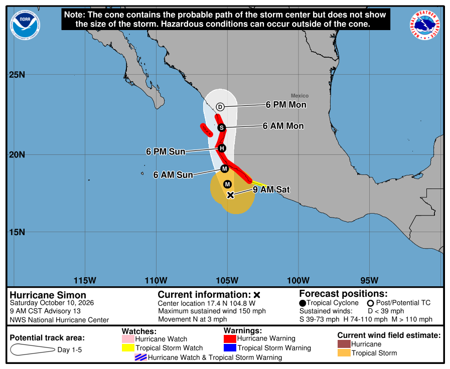
Official NHC cone for Simon, Advisory 13. It shows the likely path of the center, not every area that can get rain, wind, or surf. Red is the Hurricane Warning; yellow is the Tropical Storm Watch. The path runs north toward west-central mainland Mexico, near or just inland Sunday, east of the Baja tip and across the Gulf from us. It is five days out and can shift. 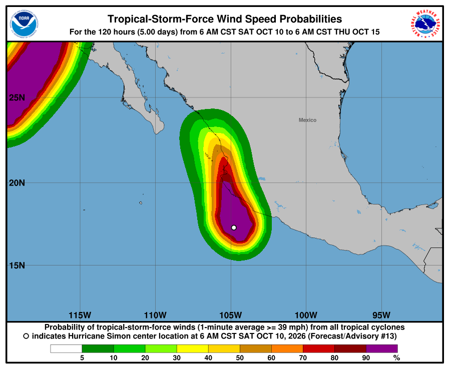
NHC wind-chance chart for Simon, Advisory 13. Cabo / SJD / La Paz unlisted (under 3%). Mazatlán 26% and Las Islas Marías 41% through Thursday 5:00 AM MST (Oct 15). Small for our corridor. It is not a landfall forecast for Todos Santos. 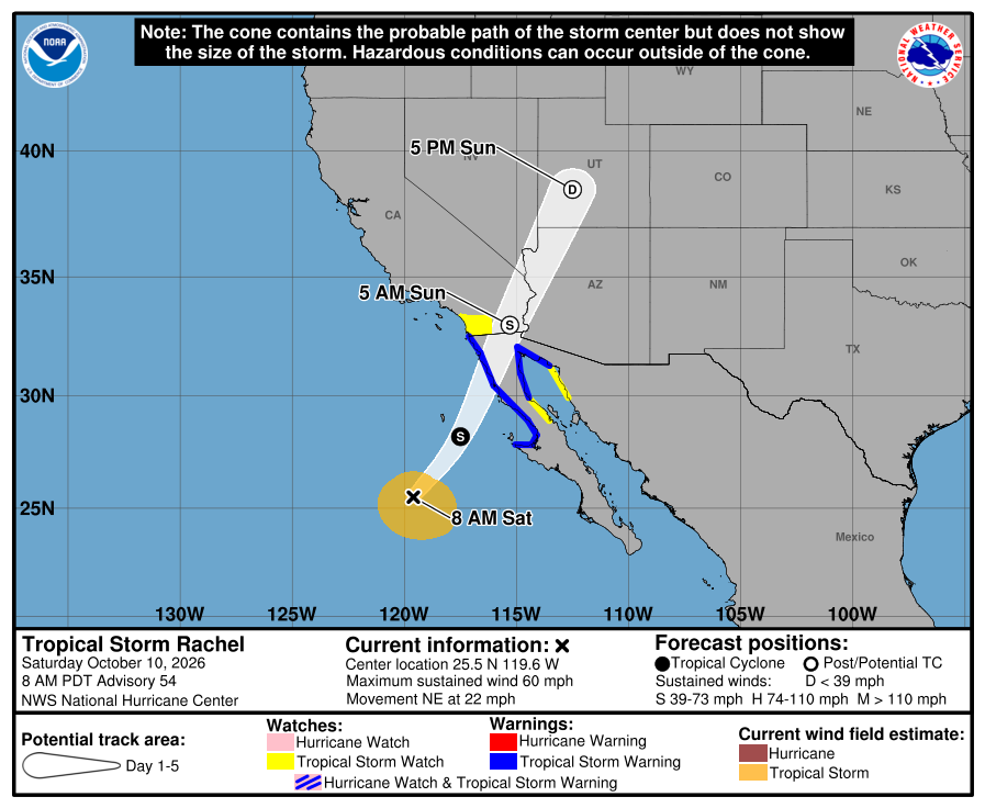
Official NHC cone for Rachel, Advisory 54. Blue is the Tropical Storm Warning (now from Punta Eugenia to the U.S. border on the west coast, plus east northern Baja); yellow is the Tropical Storm Watch on southern California, east Baja, and northwest Mexico. The track bends north-northeast far northwest of us toward northern Baja tonight. Our corridor stays outside the watches and outside the near-term cone threat. 
NHC wind-chance chart for Rachel, Advisory 54. Cabo / La Paz stay under 3%. Ensenada, far north, is 33%; San Diego is 5%; Punta Eugenia (northern BCS) is 15% through the five-day window. NHC lists no hazards for our area from Rachel or Simon. Simon's flooding rain and storm surge are forecast for southwestern mainland Mexico. Rachel's rain and wind are forecast for northern Baja California and the U.S. Southwest. SMN Rachel advisory No. 82 (8:15 AM MST) gives 3.0–5.0 m / about 10–16 ft for the BCS west coast (no north limit) — that includes Cerritos, La Pastora, and San Pedrito. SMN's general forecast No. 565 lists 4–5 m / about 13–16 ft for the northern west coast only. SEMAR's morning marine forecast (7:00 AM MST Saturday) gives southwest Baja (Costa Sur Occidental) 8–10 ft through Sunday morning, then 5–7 ft Sunday into Monday. We follow the higher official range for our beaches: about 10–16 ft Saturday. Plan around arroyo crossings and stay out of the ocean and off exposed beaches Saturday. Next NHC intermediate around 11:00 AM MST; SMN's next Rachel advisory around 11:15 AM MST; next NHC complete around 2:00 PM MST. Checked Sat, Oct 10 · 9:21 AM MST.
NHC Simon Advisory 13NHC Simon Discussion 13NHC Simon wind chances 13NHC Rachel Advisory 54NHC Rachel Discussion 54NHC Rachel wind chances 54SMN general forecast No. 565SMN Rachel advisory No. 82SMN Simon advisory No. 25SMN 96-hour forecastSEMAR morning marineSurfline CerritosSurfline San PedritoSurfline La PastoraWindy tracker -
Superseded by Advisory 54 / Simon 13. Newer update above.
Simon still rapidly intensifying at 150 mph (Category 4); Rachel holds at 60 mph, ashore near the border tonight — still no corridor watches; 13–16 ft seas warning kept for our beaches (Intermediate 12A / 53A)
- What changed: Hurricane Simon Intermediate Advisory 12A (5:00 AM MST Saturday): No watch or local-risk change. Simon is still rapidly intensifying (NHC): now about 150 mph / 938 mb, with more strengthening forecast before it nears the mainland coast as a major hurricane this evening or early Sunday. Still a Category 4 hurricane (was 145 mph / 942 mb at Advisory 12), moving north at about 5 mph, about 120 miles south-southwest of Manzanillo. Watches unchanged: Hurricane Warning from Punta San Telmo to El Roblito plus Las Islas Marías; Tropical Storm Watch east of Punta San Telmo to Lázaro Cárdenas. No BCS or corridor watches. Tropical Storm Rachel Intermediate Advisory 53A (5:00 AM MST): still about 60 mph / 992 mb, moving east-northeast at about 21 mph, about 595 miles south-southwest of San Diego, and expected to move ashore near the U.S./Mexico border tonight. Watch changes: none — the far-north watches are unchanged (Tropical Storm Warnings on west and east northern Baja California; Watches on southern California, east Baja Bahía de los Ángeles–Isla San Luis, and Puerto Libertad–Puerto Peñasco). Todos Santos, Pescadero, and Cerritos stay outside every watch and warning. Seas: SMN's general forecast No. 565 (5:00 AM MST) again lists 13–16 ft for the northern west coast only; SMN's current Rachel advisory No. 81 does not limit it to the north, so we keep the warning for our beaches until No. 82 (~8:15 AM MST).
- What this means here: Rachel is still not a storm threat for Todos Santos, Pescadero, or Cerritos: no watch here, no landfall near us, and its strong wind stays far to the north. Simon is still not a storm threat for our towns — its center stays on the mainland side. The seas are the risk for us. SMN's general forecast No. 565 (5:00 AM MST) again lists 13–16 ft for the northern west coast only; SMN's current Rachel advisory No. 81 does not limit it to the north, so we keep the warning for our beaches until No. 82 (~8:15 AM MST). That means seas of about 13–16 ft are possible Saturday on Cerritos, La Pastora, and San Pedrito. Showers may still run arroyos or wash out dirt roads.
- Stronger or weaker: Simon is still rapidly intensifying: about 150 mph / 938 mb now, up from 145 mph at Advisory 12. NHC forecasts more strengthening today (its latest full forecast peaks near 155 mph) and says Simon could become stronger than forecast. Rachel holds near 60 mph / 992 mb; some strengthening is possible through tonight, then rapid weakening once it moves inland Sunday.
- Path and timing: Neither storm center comes near Todos Santos, Pescadero, or Cerritos. Simon moves north at about 5 mph and is forecast to near the west-central coast of mainland Mexico as a major hurricane this evening or early Sunday, near or just inland early Sunday — east of Baja, across the Gulf from us. Rachel moves east-northeast at about 21 mph, should turn north-northeast and speed up, and is expected to approach and move ashore near the U.S./Mexico border tonight, far northwest of us. Local effects for us remain passing rain cells and rough Pacific seas. Five-day paths can shift.
- Rain, wind, and seas by day: From SMN's 96-hour forecast (issued 1:00 PM MST Friday; still the current issue) and SMN's general forecast (5:00 AM MST Saturday); regional BCS figures, not each town. Saturday: BCS rain 5–25 mm / 0.2–1 in in both; BCS coast seas about 2.0–3.0 m / 7–10 ft in the 96-hour forecast. Saturday seas update: SMN's general forecast No. 565 again lists 4–5 m / about 13–16 ft for the northern west coast only; SMN's current Rachel advisory No. 81 (2:15 AM MST) gives the same 13–16 ft for the BCS west coast with no north limit, so we keep the warning for our Pacific beaches (Cerritos, La Pastora, San Pedrito) until No. 82 (~8:15 AM MST). Saturday's stronger wind (about 25–37 mph, gusts up to about 50 mph) stays on the north west coast of BCS in both, far from us. Sunday: BCS rain still light (5–25 mm / 0.2–1 in); SMN gives no Sunday seas line for our stretch of coast, so we go by SEMAR's 8–10 ft for southwest Baja. Monday: BCS not listed for heavy rain; BCS coast seas 3.0–4.0 m / about 10–13 ft (SMN 96-hour forecast). What it means here: a heavy cell can still run an arroyo through Sunday; Saturday has the biggest official seas for our coast (about 13–16 ft), with rough seas again Monday. Rachel's NHC rain of 1–3 inches is for northern Baja California (regional — not totals for our towns).
- Wind chance: Same Advisory 12 / 53 figures (intermediate advisories do not update the wind-chance product). Simon: NHC does not list Cabo San Lucas, San José del Cabo, or La Paz (under 3%). Mazatlán, on the mainland, is 28% through Wednesday 11 PM MST (Oct 14 window in the table). Rachel: Cabo / La Paz stay under 3% (unlisted). Ensenada, far to the north, is 51%; San Diego is 18%; Punta Eugenia (northern BCS, far from us) 10%. NHC does not list Todos Santos separately. SMN's strong Saturday wind line for BCS is for the northern west coast only, far from us.
- Surf at our beaches: SEMAR's evening marine forecast (7:00 PM MST Friday, still SEMAR's latest) gives the southwest Baja coast (Costa Sur Occidental) 6–8 ft through Saturday evening and 8–10 ft Saturday evening into Sunday. SMN's Rachel advisory No. 81 gives 13–16 ft for the BCS west coast Saturday, and SMN's 96-hour forecast about 10–13 ft Monday on BCS coasts. For safety we follow the higher official range each day.
- Windy + multi-source: NHC is official for watches; SMN Rachel advisory 81 13–16 ft for the BCS west coast with no north limit vs SMN general forecast 565 13–16 ft for the northern west coast only — we follow the wider advisory; SEMAR southwest Baja 6–8 ft to Saturday evening and 8–10 ft into Sunday (lower — we follow the higher); SMN BCS 10–13 ft Monday; SEMAR synopsis still called Simon Category 2 in Friday evening's forecast while NHC has Category 4 at 150 mph — trust NHC for intensity
- Do now: Stay out of the ocean and off exposed beaches Saturday — seas could reach about 13–16 ft (SMN Rachel advisory No. 81, BCS west coast, including Cerritos, La Pastora, and San Pedrito; we keep this warning at least until SMN's next Rachel advisory). Keep kids and pets well back from the waterline. Plan around arroyo crossings and dirt roads if heavy cells hit. Never drive into running water. Stock water, food, and flashlight basics. Secure loose outdoor items. Seas stay rough after Saturday: about 8–10 ft Saturday evening into Sunday (SEMAR) and about 10–13 ft Monday (SMN BCS coasts). Follow NHC, SMN, and Protección Civil BCS updates. Traveling to mainland Mexico this weekend (Manzanillo, Puerto Vallarta, Nayarit coast)? Plan around Simon now — it is a Category 4 hurricane, still strengthening, with a Hurricane Warning up there. Driving to northern Baja California or southern California? Watch Rachel — Tropical Storm Warnings remain on both west and east northern Baja; center expected ashore near the border tonight. Next: NHC complete advisories around 8:00 AM MST; SMN's next Rachel advisory (No. 82) around 8:15 AM MST.
Official NHC cone for Simon, Intermediate Advisory 12A. It shows the likely path of the center, not every area that can get rain, wind, or surf. Red is the Hurricane Warning; yellow is the Tropical Storm Watch. The path runs north toward west-central mainland Mexico, near or just inland early Sunday, east of the Baja tip and across the Gulf from us. It is five days out and can shift. 
NHC wind-chance chart for Simon, Advisory 12 (latest; intermediate advisories don't update it). Cabo / SJD / La Paz unlisted (under 3%). Mazatlán 28% through the five-day window. Small for our corridor. It is not a landfall forecast for Todos Santos. 
Official NHC cone for Rachel, Intermediate Advisory 53A. Blue is the Tropical Storm Warning on west and east northern Baja California; yellow is the Tropical Storm Watch on southern California, east Baja, and northwest Mexico. The track bends north-northeast far northwest of us toward the border tonight. Our corridor stays outside the watches and outside the near-term cone threat. 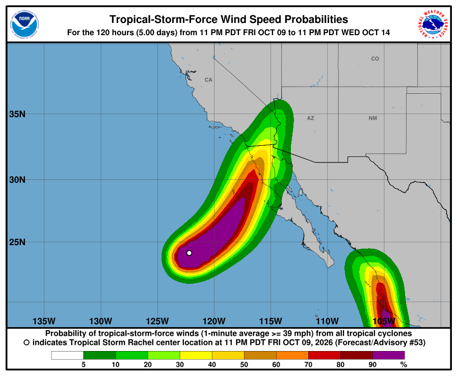
NHC wind-chance chart for Rachel, Advisory 53 (latest; intermediate advisories don't update it). Cabo / La Paz stay under 3%. Ensenada, far north, is 51%; San Diego is 18% through the five-day window. NHC lists no hazards for our area from Rachel or Simon. Simon's flooding rain and storm surge are forecast for southwestern mainland Mexico. Rachel's rain and wind are forecast for northern Baja California and the U.S. Southwest. SMN's general forecast No. 565 (5:00 AM MST) again lists 13–16 ft for the northern west coast only; SMN's current Rachel advisory No. 81 does not limit it to the north, so we keep the warning for our beaches until No. 82 (~8:15 AM MST). Plan around arroyo crossings and stay out of the ocean and off exposed beaches Saturday. Next: NHC complete advisories around 8:00 AM MST; SMN's next Rachel advisory (No. 82) around 8:15 AM MST. Checked Sat, Oct 10 · 6:17 AM MST.
-
Superseded by Intermediate Advisory 12A / 53A. Newer update above.
Simon strengthens to 145 mph (still Category 4); Hurricane Watch upgraded to Warning on mainland coast; Rachel holds at 60 mph racing northeast — still no corridor watches (Advisory 53)
- What changed: Hurricane Simon Advisory 12 (2:00 AM MST Saturday): still a Category 4 hurricane, now about 145 mph / 942 mb (was 140 mph / 945 mb at Intermediate 11A), moving north at about 5 mph, about 125 miles south of Manzanillo. Watch change: Mexico upgraded the Hurricane Watch from Punta Mita to El Roblito, including Las Islas Marías, to a Hurricane Warning. Hurricane Warning now covers Punta San Telmo to Punta Mita, Punta Mita to El Roblito, and Las Islas Marías. Tropical Storm Watch remains east of Punta San Telmo to Lázaro Cárdenas. No BCS or corridor watches. NHC expects more rapid strengthening during the next day or so (discussion peaks near 155 mph); center still forecast near or just inland of west-central Mexico later today or early Sunday. Tropical Storm Rachel Advisory 53: still about 60 mph / 992 mb, now moving northeast at about 22 mph, about 640 miles south-southwest of San Diego. Watch changes: none. Tropical Storm Warnings remain on west and east northern Baja California; Watches remain on southern California, east Baja Bahia De Los Angeles–Isla San Luis, and Puerto Libertad–Puerto Peñasco. Todos Santos, Pescadero, and Cerritos stay outside every watch and warning. Neither storm is heading toward our corridor.
- What this means here: Rachel is still not a storm threat for Todos Santos, Pescadero, or Cerritos: no watch here, no landfall near us, and its strong wind stays far to the north. Simon is still not a storm threat for our towns — its center stays on the mainland side. The seas are the risk for us. SMN's Rachel advisory No. 81 (2:15 AM MST Saturday) gives 4–5 m / about 13–16 ft seas for the BCS west coast, not limited to the north, so they are possible Saturday on Cerritos, La Pastora, and San Pedrito. Showers may still run arroyos or wash out dirt roads.
- Stronger or weaker: Simon edged up to 145 mph (still Category 4), up from 140 at Intermediate 11A. NHC Discussion 12 still shows a peak near 155 mph later today, then inland as a major hurricane. Rachel holds near 60 mph / 992 mb; some strengthening is possible tonight (discussion near 65 mph) before rapid weakening inland Sunday.
- Path and timing: Neither storm center comes near Todos Santos, Pescadero, or Cerritos. Simon moves north at about 5 mph and is forecast near or just inland of the west-central coast of mainland Mexico later Saturday or early Sunday — east of Baja, across the Gulf from us. Rachel is accelerating northeast and is expected to approach and move ashore near the U.S./Mexico border tonight, far northwest of us. Local effects for us remain passing rain cells and rough Pacific seas. Five-day paths can shift.
- Rain, wind, and seas by day: From SMN's Oct 9 96-hour forecast No. 282 (issued 1:00 PM MST; content re-checked this run — still the current issue); regional BCS figures, not each town. Into Saturday morning: BCS rain 5–25 mm / 0.2–1 in; BCS coast wind about 6–12 mph, gusts 19–31 mph; west-peninsula seas 1.5–2.5 m / about 5–8 ft. Saturday: BCS rain 5–25 mm / 0.2–1 in; BCS coast seas about 2.0–3.0 m / 7–10 ft. Saturday seas update: SMN's Rachel advisory No. 81 (2:15 AM MST Saturday) gives 4–5 m / about 13–16 ft seas for the BCS west coast, with no north limit — so they are possible on our Pacific beaches (Cerritos, La Pastora, San Pedrito). That is newer than SMN's general forecast No. 564 (5:00 PM MST Friday), which had put these seas on the north west coast only. Saturday's stronger wind (about 25–37 mph, gusts up to about 50 mph) stays on the north west coast of BCS in both, far from us. Sunday: BCS rain still light (5–25 mm / 0.2–1 in); SMN gives no Sunday seas line for our stretch of coast, so we go by SEMAR's 8–10 ft for southwest Baja. Monday: BCS not listed for heavy rain; BCS coast seas 3.0–4.0 m / about 10–13 ft (SMN 96-hour forecast). What it means here: a heavy cell can still run an arroyo through Sunday; Saturday now has the biggest official seas for our coast (about 13–16 ft), with rough seas again Monday. Rachel's NHC rain of 1–3 inches is for northern Baja California (regional — not totals for our towns).
- Wind chance: From Advisory 12 / 53 wind-prob products. Simon: NHC does not list Cabo San Lucas, San José del Cabo, or La Paz (under 3%). Mazatlán, on the mainland, is 28% through Wednesday 11 PM MST (Oct 14 window in the table). Rachel: Cabo / La Paz stay under 3% (unlisted). Ensenada, far to the north, is 51%; San Diego is 18%; Punta Eugenia (northern BCS, far from us) 10%. NHC does not list Todos Santos separately. SMN's strong Saturday wind line for BCS (advisory No. 81) is for the northern west coast only, far from us.
- Surf at our beaches: The Open-Meteo wave model near Pescadero (labeled Open-Meteo, not Windy) shows about 1.8 m / ~6 ft Saturday max, about 2.3 m / 7.5 ft Sunday afternoon–evening max, then about 2.1 m / 7 ft Monday max — lower than the official ranges. SEMAR's evening marine forecast (7:00 PM MST Friday, still SEMAR's latest forecast) gives the southwest Baja coast (Costa Sur Occidental) 6–8 ft through Saturday evening and 8–10 ft Saturday evening into Sunday. SMN shows about 5–8 ft into Saturday morning on the west peninsula, then its Rachel advisory No. 81 gives 13–16 ft for the BCS west coast Saturday, and about 10–13 ft Monday on BCS coasts. For safety we follow the higher official range each day.
- Windy + multi-source: NHC is official for watches; SEMAR southwest Baja 6–8 ft to Saturday evening, 8–10 ft into Sunday; SMN west peninsula 5–8 ft into Saturday morning, BCS 10–13 ft Monday; SMN Rachel advisory 81 13–16 ft BCS west coast Saturday with no north limit (newer than general forecast 564's north-only line and above SEMAR — we follow the higher); Open-Meteo below all; SEMAR synopsis text still called Simon Category 2 in Friday evening's SEMAR forecast while NHC has Category 4 at 145 mph — trust NHC for intensity
- Do now: Stay out of the ocean and off exposed beaches Saturday — seas could reach about 13–16 ft (SMN Rachel advisory No. 81, BCS west coast, including Cerritos, La Pastora, and San Pedrito). Keep kids and pets well back from the waterline. Plan around arroyo crossings and dirt roads if heavy cells hit. Never drive into running water. Stock water, food, and flashlight basics. Secure loose outdoor items. Seas stay rough after Saturday: about 8–10 ft Saturday evening into Sunday (SEMAR) and about 10–13 ft Monday (SMN BCS coasts). Follow NHC, SMN, and Protección Civil BCS updates. Traveling to mainland Mexico this weekend (Manzanillo, Puerto Vallarta, Nayarit coast)? Plan around Simon now — it is a Category 4 hurricane with an expanded Hurricane Warning up there. Driving to northern Baja California or southern California? Watch Rachel — Tropical Storm Warnings remain on both west and east northern Baja; center expected near the border tonight. Next: NHC intermediate advisories around 5:00 AM MST, then complete advisories around 8:00 AM MST.
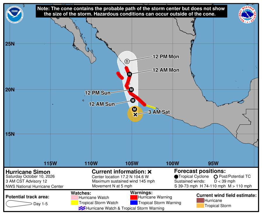
Official NHC cone for Simon, Advisory 12. It shows the likely path of the center, not every area that can get rain, wind, or surf. Red is the Hurricane Warning (now including the former Watch from Punta Mita to El Roblito and Las Islas Marías); yellow is the Tropical Storm Watch. The path runs toward west-central mainland Mexico this weekend, east of the Baja tip and across the Gulf from us. It is five days out and can shift.
NHC wind-chance chart for Simon, Advisory 12. Cabo / SJD / La Paz unlisted (under 3%). Mazatlán 28% through the five-day window. Small for our corridor. It is not a landfall forecast for Todos Santos. 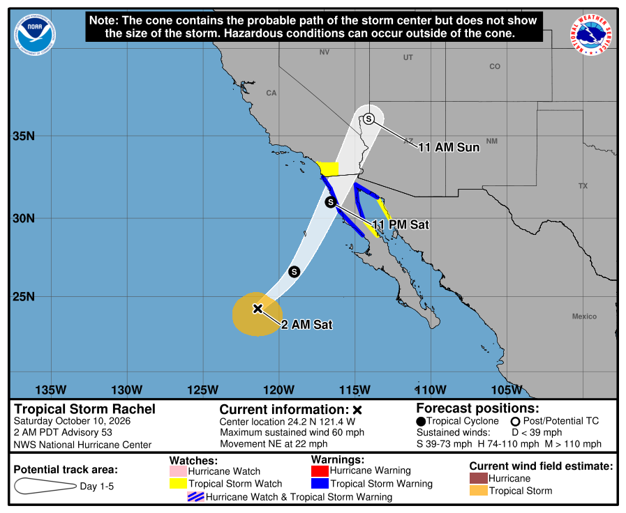
Official NHC cone for Rachel, Advisory 53. Blue is the Tropical Storm Warning on west and east northern Baja California; yellow is the Tropical Storm Watch on southern California, east Baja, and northwest Mexico. The track bends northeast far northwest of us toward the border tonight. Our corridor stays outside the watches and outside the near-term cone threat.
NHC wind-chance chart for Rachel, Advisory 53. Cabo / La Paz stay under 3%. Ensenada, far north, is 51%; San Diego is 18% through the five-day window. NHC lists no hazards for our area from Rachel or Simon. Simon's flooding rain and storm surge are forecast for southwestern mainland Mexico. Rachel's rain and wind are forecast for northern Baja California and the U.S. Southwest. SMN's Oct 9 96-hour No. 282 (1:00 PM MST; still current) still shows light BCS shower chances and Monday BCS coast seas about 10–13 ft / 3.0–4.0 m. SMN's Rachel advisory No. 81 (2:15 AM MST) gives 13–16 ft / 4–5 m seas for the BCS west coast Saturday, not limited to the north. Plan around arroyo crossings and stay out of the ocean and off exposed beaches Saturday. Next NHC intermediate advisories around 5:00 AM MST; complete advisories around 8:00 AM MST. Checked Sat, Oct 10 · 3:28 AM MST.
-
Superseded by Advisory 12 / 53. Newer update above.
Simon is now a Category 4 hurricane at 140 mph; Rachel strengthens to 60 mph — still no corridor watches (Intermediate 11A / 52A)
- What changed: Hurricane Simon Intermediate Advisory 11A (11:00 PM MST Friday): now a Category 4 hurricane at about 140 mph / 945 mb (was 120 mph / 952 mb Category 3 at Advisory 11), moving north at about 5 mph, about 140 miles south of Manzanillo. Watches unchanged: Hurricane Warning Punta San Telmo to Punta Mita; Hurricane Watch Punta Mita to El Roblito plus Las Islas Marías; Tropical Storm Watch east of Punta San Telmo to Lázaro Cárdenas. No BCS or corridor watches. NHC expects more rapid strengthening during the next day or so; center still forecast near or just inland of west-central Mexico later today or Sunday. Tropical Storm Rachel Intermediate Advisory 52A: now about 60 mph / 990 mb (was 45 mph / 995 mb), moving northeast at about 12 mph, about 670 miles south-southwest of San Diego. Watches unchanged (Tropical Storm Warnings on west and east northern Baja California; Watches on southern California, east Baja Bahia De Los Angeles–Isla San Luis, and Puerto Libertad–Puerto Peñasco). Todos Santos, Pescadero, and Cerritos stay outside every watch and warning. Neither storm is heading toward our corridor.
- What this means here: Rachel is still not a storm threat for Todos Santos, Pescadero, or Cerritos. Simon is still not a storm threat for our towns — its center stays on the mainland side. SMN still shows light shower chances for BCS and rough Pacific seas that peak Monday. For us, arroyo crossings may run or close, dirt roads may wash out, and a heavy cell is still possible. Stay out of the ocean when seas are high. Exact rain and sea numbers are below.
- Stronger or weaker: Simon jumped to Category 4 at 140 mph, up from 120 / Category 3 at Advisory 11. NHC’s last complete discussion still showed a peak near 155 mph later Saturday; Intermediate 11A already reached Category 4 early. Rachel strengthened to 60 mph / 990 mb. NHC still expects rapid weakening after Rachel moves inland Sunday.
- Path and timing: Neither storm center comes near Todos Santos, Pescadero, or Cerritos. Simon moves north at about 5 mph and is forecast near or just inland of the west-central coast of mainland Mexico later Saturday or Sunday — east of Baja, across the Gulf from us. Rachel accelerates northeast toward northern Baja California and southern California late Saturday or early Sunday, far northwest of us. Local effects for us remain passing rain cells and rough Pacific seas. Five-day paths can shift.
- Rain, wind, and seas by day: From SMN's Oct 9 96-hour forecast No. 282 (issued 1:00 PM MST); regional BCS figures, not each town. Tonight into Saturday morning: BCS rain 5–25 mm / 0.2–1 in; BCS coast wind about 6–12 mph, gusts 19–31 mph; west-peninsula seas 1.5–2.5 m / about 5–8 ft. Saturday: BCS rain 5–25 mm / 0.2–1 in; BCS coast seas about 2.0–3.0 m / 7–10 ft. SMN's general forecast No. 564 (5:00 PM MST) puts Saturday's stronger wind (about 25–37 mph, gusts 43–50 mph) and 4–5 m / 13–16 ft seas on the north west coast of BCS only — not our corridor. Sunday: BCS rain still light (5–25 mm / 0.2–1 in); SMN gives no Sunday seas line for our stretch of coast, so we go by SEMAR's 8–10 ft for southwest Baja. Monday: BCS not listed for heavy rain; BCS coast seas 3.0–4.0 m / about 10–13 ft — SMN's biggest BCS seas this cycle. What it means here: a heavy cell can still run an arroyo through Sunday; Monday has the biggest official seas for BCS coasts.
- Wind chance: Same Adv 11 / 52 wind-prob figures (intermediates did not republish a new wind-prob product). Simon: NHC does not list Cabo San Lucas, San José del Cabo, or La Paz (under 3%). Mazatlán, on the mainland, is 21% through Wednesday 5 PM MST (Oct 14). Rachel: Cabo / La Paz stay under 3% (unlisted). Ensenada, far to the north, is 45%; San Diego is 28%. NHC does not list Todos Santos separately. SMN's strong Saturday wind line for BCS is northern west coast only, not our corridor.
- Surf at our beaches: The Open-Meteo wave model near Pescadero (labeled Open-Meteo, not Windy) shows about 1.7–1.8 m / ~6 ft Saturday, about 2.3 m / 7.5 ft Sunday afternoon–evening max — lower than the official ranges. SEMAR's evening marine forecast (7:00 PM MST Friday, still current) gives the southwest Baja coast (Costa Sur Occidental) 6–8 ft through Saturday evening and 8–10 ft Saturday evening into Sunday. SMN shows about 5–8 ft into Saturday morning on the west peninsula and about 10–13 ft Monday on BCS coasts. For safety we follow the higher official range each day.
- Windy + multi-source: NHC is official for watches; SEMAR southwest Baja 6–8 ft to Saturday evening, 8–10 ft into Sunday; SMN west peninsula 5–8 ft into Saturday morning, BCS 10–13 ft Monday; Open-Meteo below both; SEMAR synopsis text still called Simon Category 2 earlier Friday evening while NHC now has Category 4 — trust NHC for intensity.
- Do now: Plan around arroyo crossings and dirt roads if heavy cells hit. Never drive into running water. Stock water, food, and flashlight basics. Secure loose outdoor items. Stay out of the ocean when seas are high: about 6–8 ft through Saturday evening (SEMAR southwest Baja; SMN about 5–8 ft into Saturday morning), about 8–10 ft Saturday evening into Sunday (SEMAR), and about 10–13 ft Monday (SMN BCS coasts). Follow NHC, SMN, and Protección Civil BCS updates. Traveling to mainland Mexico this weekend (Manzanillo, Puerto Vallarta, Nayarit coast)? Plan around Simon now — it is a Category 4 hurricane with a Hurricane Warning and Watch up there. Driving to northern Baja California or southern California? Watch Rachel — Tropical Storm Warnings remain on both west and east northern Baja. Next: NHC complete advisories around 2:00 AM MST Saturday.
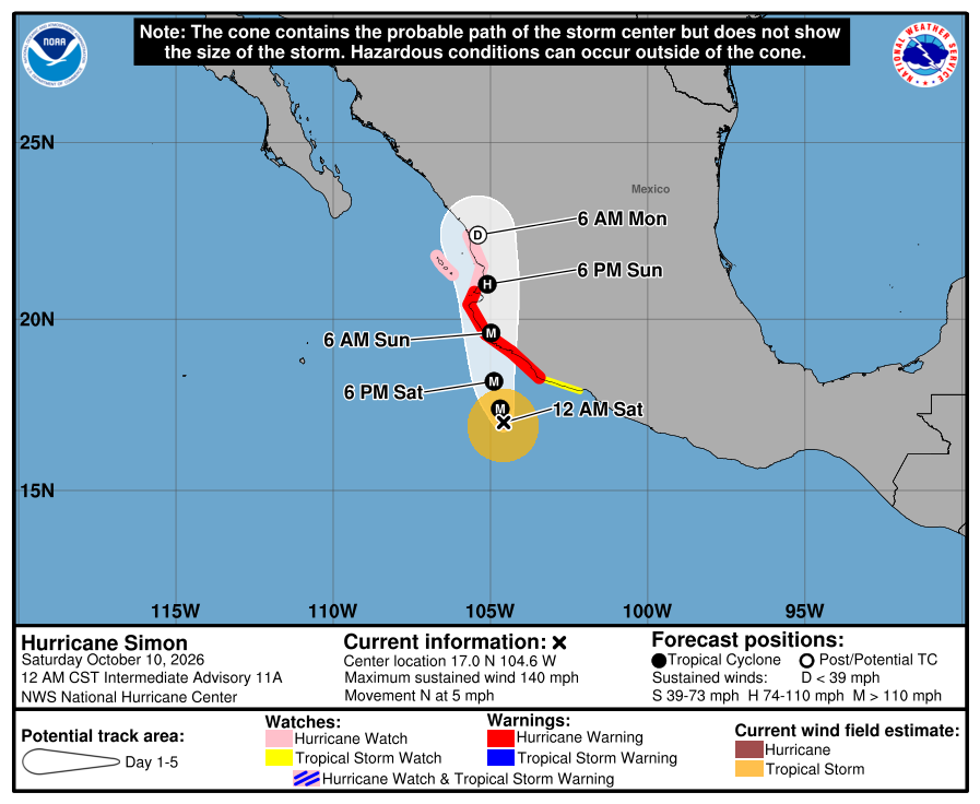
Official NHC cone for Simon, Intermediate Advisory 11A intensity update. It shows the likely path of the center, not every area that can get rain, wind, or surf. Red is the Hurricane Warning; pink is the Hurricane Watch (to El Roblito and Las Islas Marías); yellow is the Tropical Storm Watch. The path runs toward west-central mainland Mexico this weekend, east of the Baja tip and across the Gulf from us. Cone packaging may still reflect the last complete advisory; intensity is Intermediate 11A (Category 4 / 140 mph). It is five days out and can shift. 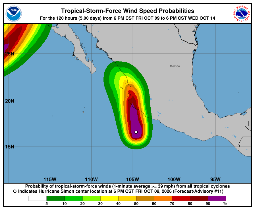
NHC wind-chance chart for Simon, Advisory 11 (latest; intermediate advisories don't update it). Cabo / SJD / La Paz unlisted (under 3%). Mazatlán 21% through Wednesday 5 PM MST (Oct 14) — same Adv 11 product. Small for our corridor. It is not a landfall forecast for Todos Santos. 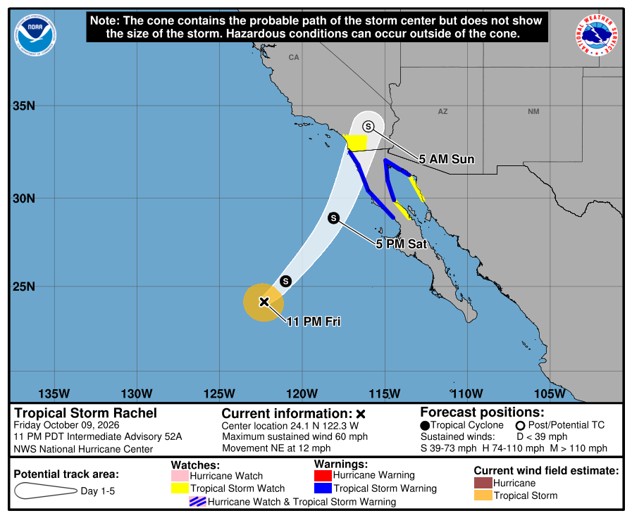
Official NHC cone for Rachel, Intermediate Advisory 52A intensity update. Blue is the Tropical Storm Warning on west and east northern Baja California; yellow is the Tropical Storm Watch on southern California, east Baja, and northwest Mexico. The track bends northeast far northwest of us. Intensity is Intermediate 52A (about 60 mph); cone packaging may still reflect the last complete advisory. Our corridor stays outside the watches and outside the near-term cone threat. 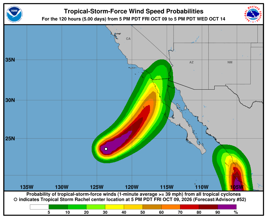
NHC wind-chance chart for Rachel, Advisory 52 (latest; intermediate advisories don't update it). Cabo / La Paz stay under 3%. Ensenada, far north, is 45%; San Diego is 28% through Wednesday 5 PM MST (Oct 14) — same Adv 52 product. NHC lists no hazards for our area from Rachel or Simon. Simon's flooding rain and storm surge are forecast for southwestern mainland Mexico. Rachel's rain and wind are forecast for northern Baja California and the U.S. Southwest. SMN's Oct 9 96-hour No. 282 (1:00 PM MST) still shows light BCS shower chances and Monday BCS coast seas about 10–13 ft / 3.0–4.0 m. Plan around arroyo crossings and stay out of the ocean. Next NHC complete advisories are due around 2:00 AM MST Saturday. Checked Sat, Oct 10 · 12:18 AM MST.
-
Superseded by Intermediate Advisory 11A / 52A. Newer update above.
Simon becomes a major hurricane at 120 mph (Category 3), peaking near 155 mph Saturday; Rachel still 45 mph with a NEW Tropical Storm Warning on east Baja too — no corridor watches (Advisory 52)
- What changed: Hurricane Simon Advisory 11 (8:00 PM MST Friday): now a major hurricane at about 120 mph / 952 mb (was 105 mph / 966 mb at Advisory 10; Intermediate 10A was about 110 mph), moving north at about 7 mph, about 155 miles south of Manzanillo. Mainland watches unchanged: Hurricane Warning from Punta San Telmo to Punta Mita; Hurricane Watch from Punta Mita to El Roblito plus Las Islas Marías; Tropical Storm Watch east of Punta San Telmo to Lázaro Cárdenas. No BCS or corridor watches. NHC forecasts more rapid strengthening, peaking near Category 4 (~155 mph) Saturday, with the center near or just inland of west-central Mexico late Saturday or Sunday. Tropical Storm Rachel Advisory 52: still about 45 mph / 995 mb, moving northeast at about 9 mph, about 720 miles south-southwest of San Diego. NEW Tropical Storm WARNING on the east coast of Baja California from Isla San Luis northward to Puerto Peñasco (upgraded from Watch). Tropical Storm Warning remains on the west coast of northern Baja California from San Jose de Las Palomas northward to the U.S. border. NEW Tropical Storm Watch on east Baja from Bahia De Los Angeles to Isla San Luis, and on northwest Mexico from Puerto Libertad to Puerto Peñasco. Southern California Tropical Storm Watch unchanged (border to the San Diego/Orange County line). Todos Santos, Pescadero, and Cerritos stay outside every watch and warning. Neither storm is heading toward our corridor.
- What this means here: Rachel is still not a storm threat for Todos Santos, Pescadero, or Cerritos. Simon is still not a storm threat for our towns — its center stays on the mainland side. SMN still shows light shower chances for BCS and rough Pacific seas that peak Monday. For us, arroyo crossings may run or close, dirt roads may wash out, and a heavy cell is still possible. Stay out of the ocean when seas are high. Exact rain and sea numbers are below.
- Stronger or weaker: Simon strengthened hard: now a Category 3 major hurricane at 120 mph, up from 105 at Advisory 10. NHC now peaks it near 155 mph (Category 4) Saturday, then near or just inland of west-central Mexico late Saturday or Sunday. Rachel holds at 45 mph / 995 mb. NHC says some strengthening is possible before land, then rapid weakening inland Sunday.
- Path and timing: Neither storm center comes near Todos Santos, Pescadero, or Cerritos. Simon moves north at about 7 mph and is forecast near or just inland of the west-central coast of mainland Mexico late Saturday or Sunday — east of Baja, across the Gulf from us. Track after landfall is uncertain. Rachel is accelerating northeast toward northern Baja California and southern California late Saturday or early Sunday, far northwest of us. For our corridor, the local effects are passing rain cells and rough Pacific seas, not either storm's center. Five-day paths can shift.
- Rain, wind, and seas by day: From SMN's Oct 9 96-hour forecast No. 282 (issued 1:00 PM MST); regional BCS figures, not each town. Tonight into Saturday morning: BCS rain 5–25 mm / 0.2–1 in; BCS coast wind about 6–12 mph, gusts 19–31 mph; west-peninsula seas 1.5–2.5 m / about 5–8 ft. Saturday: BCS rain 5–25 mm / 0.2–1 in; BCS coast seas about 2.0–3.0 m / 7–10 ft. SMN's general forecast No. 564 (5:00 PM MST) puts Saturday's stronger wind (about 25–37 mph, gusts 43–50 mph) and 4–5 m / 13–16 ft seas on the north west coast of BCS only — not our corridor. Sunday: BCS rain still light (5–25 mm / 0.2–1 in); SMN gives no Sunday seas line for our stretch of coast, so we go by SEMAR's 8–10 ft for southwest Baja. Monday: BCS not listed for heavy rain; BCS coast seas 3.0–4.0 m / about 10–13 ft — SMN's biggest BCS seas this cycle. What it means here: a heavy cell can still run an arroyo through Sunday; Monday has the biggest official seas for BCS coasts.
- Wind chance: Simon: NHC does not list Cabo San Lucas, San José del Cabo, or La Paz (under 3%). Mazatlán, on the mainland, is 21% through Wednesday 5 PM MST (Oct 14). Rachel: Cabo / La Paz stay under 3% (unlisted). Ensenada, far to the north, is 45%; San Diego is 28%. NHC does not list Todos Santos separately. SMN's strong Saturday wind line for BCS is northern west coast only, not our corridor.
- Surf at our beaches: The Open-Meteo wave model near Pescadero (labeled Open-Meteo, not Windy) shows about 1.8 m / 6 ft Friday and Saturday max, about 2.3 m / 7.5 ft Sunday max, then about 2.1 m / 7 ft Monday max — lower than the official ranges. SEMAR's evening marine forecast (7:00 PM MST) gives the southwest Baja coast (Costa Sur Occidental) 6–8 ft through Saturday evening and 8–10 ft Saturday evening into Sunday evening. SMN shows about 5–8 ft tonight into Saturday morning on the west peninsula and about 10–13 ft Monday on BCS coasts. For safety we follow the higher official range each day.
- Windy + multi-source: NHC is official for watches; SEMAR southwest Baja 6–8 ft to Saturday evening, 8–10 ft into Sunday; SMN west peninsula 5–8 ft tonight, BCS 10–13 ft Monday; Open-Meteo below both.
- Do now: Plan around arroyo crossings and dirt roads if heavy cells hit. Never drive into running water. Stock water, food, and flashlight basics. Secure loose outdoor items. Stay out of the ocean when seas are high: about 6–8 ft tonight into Saturday (SEMAR southwest Baja; SMN about 5–8 ft), about 8–10 ft Saturday evening into Sunday (SEMAR), and about 10–13 ft Monday (SMN BCS coasts). Follow NHC, SMN, and Protección Civil BCS updates. Traveling to mainland Mexico this weekend (Manzanillo, Puerto Vallarta, Nayarit coast)? Plan around Simon now — it is a major hurricane with a Hurricane Warning and Watch up there; Category 4 possible Saturday. Driving to northern Baja California or southern California? Watch Rachel — Tropical Storm Warnings are now up on both west and east northern Baja. Next: NHC intermediate advisories around 11:00 PM MST, then complete advisories around 2:00 AM MST Saturday.
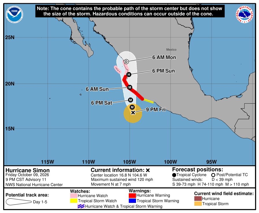
Official NHC cone for Simon, Advisory 11. It shows the likely path of the center, not every area that can get rain, wind, or surf. Red is the Hurricane Warning; pink is the Hurricane Watch (to El Roblito and Las Islas Marías); yellow is the Tropical Storm Watch. The path runs toward west-central mainland Mexico this weekend, east of the Baja tip and across the Gulf from us. It is five days out and can shift. 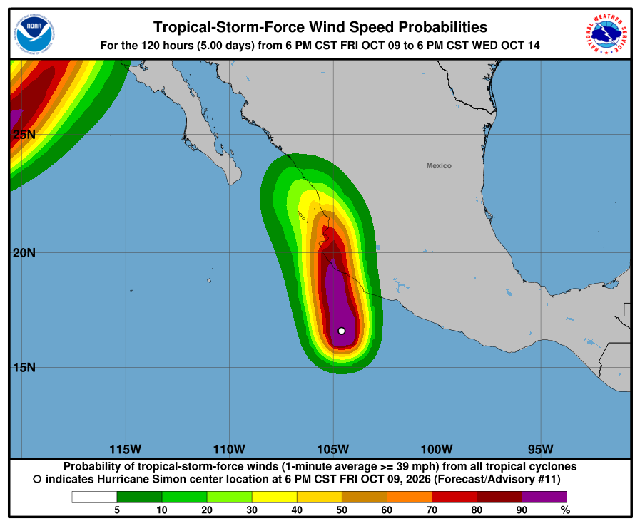
NHC wind-chance chart for Simon, Advisory 11. Cabo / SJD / La Paz unlisted (under 3%). Mazatlán 21% through Wednesday 5 PM MST (Oct 14). Small for our corridor. It is not a landfall forecast for Todos Santos. 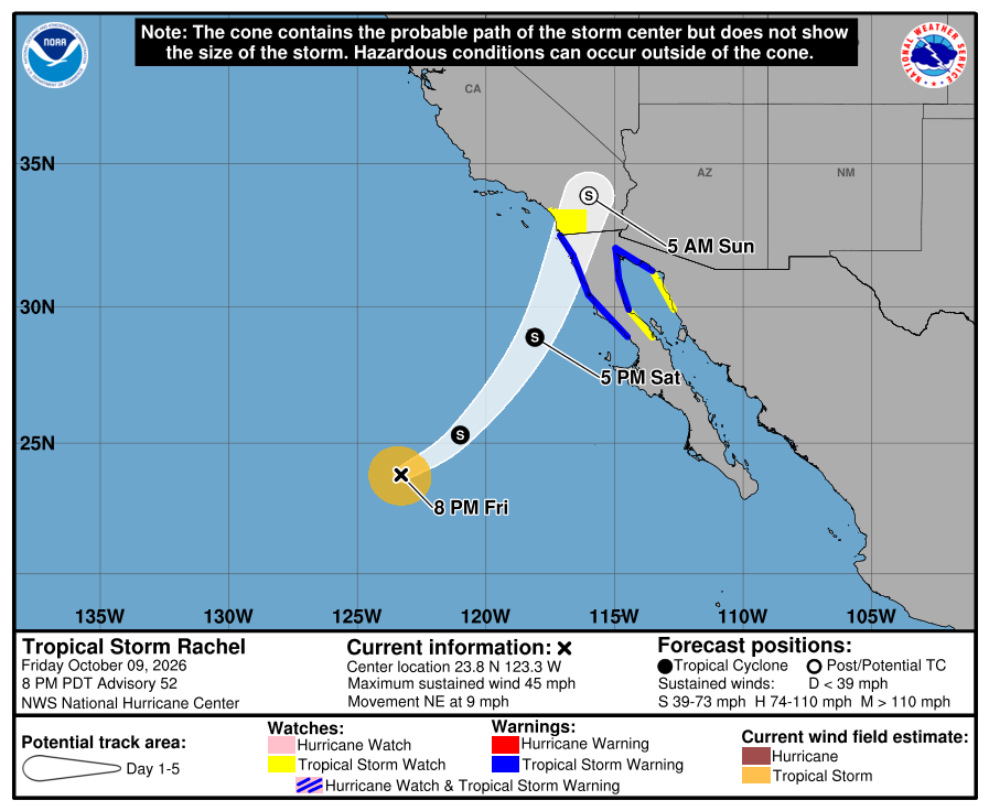
Official NHC cone for Rachel, Advisory 52. Blue is the Tropical Storm Warning on west and east northern Baja California; yellow is the Tropical Storm Watch on southern California, east Baja, and northwest Mexico. The track bends northeast far northwest of us. Our corridor stays outside the watches and outside the near-term cone threat. 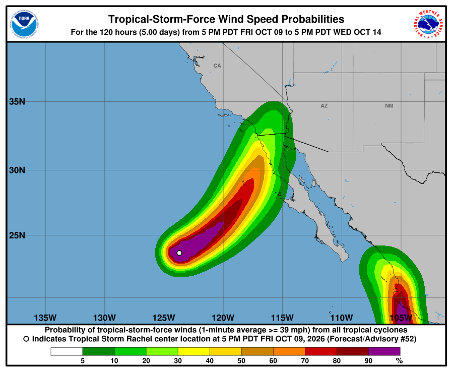
NHC wind-chance chart for Rachel, Advisory 52. Cabo / La Paz stay under 3%. Ensenada, far north, is 45%; San Diego is 28% through Wednesday 5 PM MST (Oct 14). NHC lists no hazards for our area from Rachel or Simon. Simon's flooding rain and storm surge are forecast for southwestern mainland Mexico. Rachel's rain and wind are forecast for northern Baja California and the U.S. Southwest. SMN's Oct 9 96-hour No. 282 (1:00 PM MST) still shows light BCS shower chances and Monday BCS coast seas about 10–13 ft / 3.0–4.0 m. Plan around arroyo crossings and stay out of the ocean. Next NHC intermediate advisories are due around 11:00 PM MST; complete advisories around 2:00 AM MST Saturday. Checked Fri, Oct 9 · 9:18 PM MST.
-
Superseded by Advisory 52 (Rachel 52 / Simon 11). Newer update above.
Simon strengthens to 105 mph with Hurricane Watch extended to El Roblito and Las Islas Marías; Category 4 peak still likely Saturday, then the center very near or over west-central Mexico late Saturday or Sunday; Rachel weakens to 45 mph with a NEW Tropical Storm Warning on west northern Baja only; SMN Oct 9 cuts prior heavy Sunday–Monday southern BCS rain; corridor still outside every watch and warning
- What changed: Hurricane Simon Advisory 10 (2:00 PM MST Friday): now about 105 mph / 966 mb (was 100 mph / 973 mb), moving northwest at about 2 mph, about 195 miles south of Manzanillo. Mainland Hurricane Warning unchanged from Punta San Telmo to Punta Mita. Hurricane Watch extended from Punta Mita to El Roblito, plus Las Islas Marías (beyond the prior San Blas endpoint). Tropical Storm Watch still east of Punta San Telmo to Lázaro Cárdenas. No BCS or corridor watches. NHC expects rapid strengthening to a major hurricane this evening, peaking near Category 4 (~145 mph) Saturday, with the center very near or over west-central Mexico late Saturday or Sunday. Tropical Storm Rachel Advisory 51: now about 45 mph / 995 mb (was 50 mph / 994 mb), moving northeast at about 7 mph, about 895 miles west of the Baja tip. NEW Tropical Storm WARNING (upgraded from Watch) on the west coast of northern Baja California from San Jose de Las Palomas northward to the U.S. border — far from our corridor. Tropical Storm Watch remains for southern California (border to the San Diego/Orange County line) and east Baja from Isla San Luis to Puerto Peñasco. Todos Santos, Pescadero, and Cerritos stay outside every watch and warning. Neither storm is heading toward our corridor.
- What this means here: Rachel is still not a storm threat for Todos Santos, Pescadero, or Cerritos. Simon is still not a storm threat for our towns — its center stays on the mainland side. SMN's Oct 9 update cuts the prior heavy Sunday–Monday southern BCS rain; seas still build Monday. For us, arroyo crossings may run or close, dirt roads may wash out, and heavy cells are still possible. Stay out of the ocean when seas are high. Exact rain and sea numbers are below.
- Stronger or weaker: Simon strengthened: 105 mph hurricane, up from 100. NHC still forecasts a peak near 145 mph (Category 4) Saturday, then the center very near or over west-central Mexico late Saturday or Sunday. Rachel weakened slightly: 45 mph / 995 mb, down from 50. NHC says some strengthening is possible before land, then rapid weakening inland Sunday.
- Path and timing: Neither storm center comes near Todos Santos, Pescadero, or Cerritos. Simon creeps northwest at about 2 mph and passes very near or over the west-central coast of mainland Mexico late Saturday or Sunday — east of Baja, across the Gulf from us. Track after landfall is uncertain. Rachel moves northeast at about 7 mph toward northern Baja California and southern California late Saturday or early Sunday, far northwest of us. For our corridor, the local effects are passing rain cells and rough Pacific seas, not either storm's center. Five-day paths can shift.
- Rain, wind, and seas by day: Today (Friday), two SMN products differ. SMN's 563 general forecast (5:00 AM MST) says 25–50 mm / 1–2 in for southern BCS and 2.5–3.5 m / about 8–11 ft west-coast seas today. SMN's 282 four-day forecast (1:00 PM MST) says 5–25 mm / 0.2–1 in for BCS and 1.5–2.5 m / about 5–8 ft west-peninsula seas from this afternoon to 7 AM Saturday. SMN 282 by day. These are regional figures for all of BCS or a BCS coast, not a forecast for each town. Friday afternoon to 7 AM Saturday: rain 5–25 mm / 0.2–1 in; BCS coast wind 10–20 km/h / 6–12 mph, gusts 30–50 km/h / 19–31 mph; west-peninsula seas 1.5–2.5 m / about 5–8 ft. Saturday: rain 5–25 mm / 0.2–1 in; SMN's strong-wind line, 40–50 km/h / 25–31 mph with gusts 60–70 km/h / 37–43 mph, is for the north BCS coast, far north of us; BCS coast seas 2.0–3.0 m / about 7–10 ft. Sunday: rain 5–25 mm / 0.2–1 in; wind 10–20 km/h / 6–12 mph, gusts 30–50 km/h / 19–31 mph; west BCS seas 1.5–2.5 m / about 5–8 ft. Monday: BCS is not listed for rain; BCS coast wind 10–20 km/h / 6–12 mph, gusts 30–50 km/h / 19–31 mph; BCS coast seas 3.0–4.0 m / about 10–13 ft. What it means here: a heavy cell can still run an arroyo through Sunday, the strong Saturday wind is not our coast, and Monday has the biggest seas SMN shows for BCS.
- Wind chance: Simon: NHC does not list Cabo San Lucas, San José del Cabo, or La Paz (under 3%). Mazatlán, on the mainland, is 30% through Wednesday 11:00 AM MST. Rachel: Cabo / La Paz stay under 3% (unlisted). Ensenada, far to the north, is 54%; San Diego is 31%. NHC does not list Todos Santos separately. SMN's only strong-wind line for BCS (Saturday) is for the north BCS coast, not our corridor; SMN wind by day is in the line above.
- Surf at our beaches: The Open-Meteo wave model near Pescadero (labeled Open-Meteo, not Windy) shows about 1.8 m / 6 ft Friday and Saturday max, about 2.2 m / 7 ft Sunday max, then about 2.1 m / 7 ft Monday max — lower than the official ranges. SEMAR's morning marine forecast (7:00 AM MST) gives the southwest Baja coast 6–8 ft through 7 AM Saturday and 8–10 ft from Friday evening into Saturday. SMN's 563 says 8–11 ft today, so SMN runs higher today. Each day we follow the higher official range for safety: about 8–11 ft today (SMN 563), about 8–10 ft tonight into Saturday (SEMAR), about 5–8 ft Sunday (SMN 282), and about 10–13 ft Monday (SMN 282).
- Windy + multi-source: NHC is official for watches; SMN 563 today 8–11 ft vs SEMAR 6–8 ft (SMN higher), SMN 282 tonight 5–8 ft; Open-Meteo waves below both.
- Do now: Plan around arroyo crossings and dirt roads if heavy cells hit. Never drive into running water. Stock water, food, and flashlight basics. Secure loose outdoor items. Stay out of the ocean when seas are high: about 8–11 ft today (SMN 563), about 8–10 ft tonight into Saturday (SEMAR), and about 10–13 ft Monday (SMN 282). Follow NHC, SMN, and Protección Civil BCS updates. Traveling to mainland Mexico this weekend (Manzanillo, Puerto Vallarta, Nayarit coast)? Plan around Simon now — Hurricane Warning and an extended Hurricane Watch (to El Roblito and Las Islas Marías) are up there; Category 4 possible Saturday. Driving to northern Baja California or southern California? Watch Rachel — a Tropical Storm Warning is now up on west northern Baja. Next: NHC complete advisories around 8:00 PM MST.
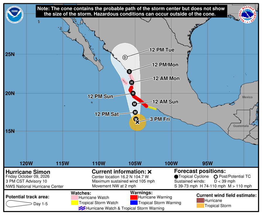
Official NHC cone for Simon, Advisory 10. It shows the likely path of the center, not every area that can get rain, wind, or surf. Red is the Hurricane Warning; pink is the Hurricane Watch (now to El Roblito and Las Islas Marías); yellow is the Tropical Storm Watch. The path runs toward west-central mainland Mexico this weekend, east of the Baja tip and across the Gulf from us. It is five days out and can shift. 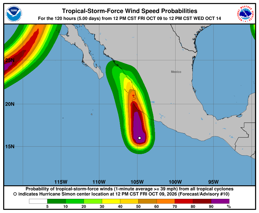
NHC wind-chance chart for Simon, Advisory 10. Cabo / SJD / La Paz unlisted (under 3%). Mazatlán 30% through Wednesday 11:00 AM MST. Small for our corridor. It is not a landfall forecast for Todos Santos. 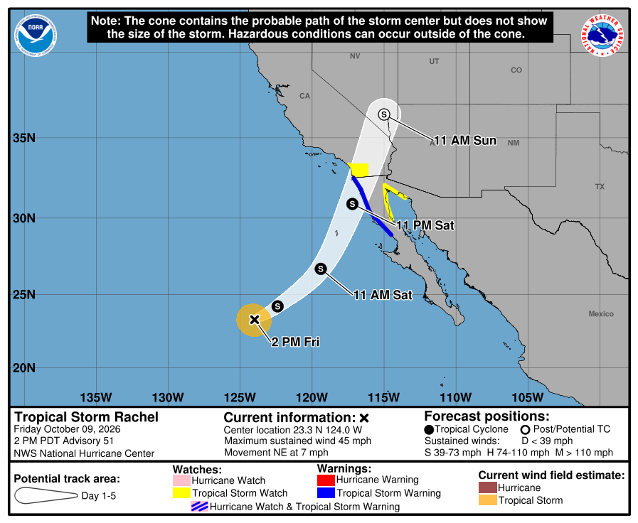
Official NHC cone for Rachel, Advisory 51. Blue is the Tropical Storm Warning on west northern Baja California; yellow is the Tropical Storm Watch on southern California and east Baja. The track bends northeast far northwest of us. Our corridor stays outside the watches and outside the near-term cone threat. 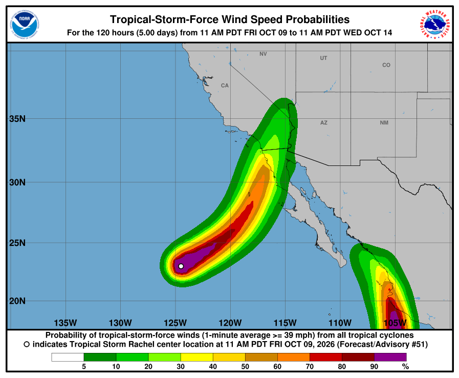
NHC wind-chance chart for Rachel, Advisory 51. Cabo / La Paz stay under 3%. Ensenada, far north, is 54%; San Diego is 31% through Wednesday 11:00 AM MST. NHC lists no hazards for our area from Rachel or Simon. Simon's flooding rain and storm surge are forecast for southwestern mainland Mexico. Rachel's rain and wind are forecast for northern Baja California and the U.S. Southwest. SMN Oct 9 content no longer shows the prior heavy Sunday–Monday southern BCS rain totals; seas still build Monday (BCS Sur about 10–13 ft / 3.0–4.0 m). Plan around arroyo crossings and stay out of the ocean. Next NHC complete advisories are due around 8:00 PM MST Friday. Checked Fri, Oct 9 · 6:08 PM MST: Simon Intermediate 10A — no material change (now ~110 mph / same mainland watches; ~190 mi S Manzanillo, NNW ~3 mph); Rachel Intermediate 51A — no material change (still 45 mph / same far-north watches). SMN 564: southern BCS still 5–25 mm showers; 4–5 m seas labeled northern west BCS only. Next NHC complete ~8:00 PM MST. The live official-source panel above may update before this written report.
-
Superseded by Advisory 51 (Rachel 51 / Simon 10). Newer update above.
Simon strengthens to 100 mph with a new mainland Hurricane Watch; Category 4 peak still likely before the coast Saturday, then the center very near or over west-central Mexico Sunday; Rachel holds at 50 mph with new Tropical Storm Watches only far north; SMN still shows heavy southern BCS rain Sunday into Monday; corridor still outside every watch and warning
- What changed: Hurricane Simon Advisory 9 (8:00 AM MST Friday): now about 100 mph / 973 mb (was 90 mph / 978 mb), moving northwest at about 3 mph, about 210 miles south of Manzanillo. Mainland Hurricane Warning unchanged from Punta San Telmo to Punta Mita. NEW Hurricane Watch from Punta Mita to San Blas. Tropical Storm Watch still east of Punta San Telmo to Lázaro Cárdenas. No BCS or corridor watches. NHC expects rapid strengthening to a major hurricane, peaking near Category 4 (~145 mph) before the mainland coast Saturday, then the center passing very near or over the west-central coast of Mexico on Sunday. Tropical Storm Rachel Advisory 50: still about 50 mph / 994 mb, moving northeast at about 5 mph, about 935 miles west of the Baja tip. NEW Tropical Storm Watch for southern California (border to the San Diego/Orange County line), the west coast of Baja from San Jose de Las Palomas to the U.S. border, and the east Baja/Gulf side from Isla San Luis to Puerto Peñasco — far north of us, not our corridor. Todos Santos, Pescadero, and Cerritos stay outside every watch and warning. Neither storm is heading toward our corridor.
- What this means here: Rachel is still not a storm threat for Todos Santos, Pescadero, or Cerritos. Simon is still not a storm threat for our towns — its center stays on the mainland side. SMN (still the Oct 8 issue) shows the heaviest southern BCS rain Sunday into Monday, with rough seas building. For us, arroyo crossings may run or close, dirt roads may wash out, and heavy cells are possible. Stay out of the ocean when seas are high. Exact rain and sea numbers are below.
- Stronger or weaker: Simon strengthened: 100 mph hurricane, up from 90. NHC still forecasts a peak near 145 mph (Category 4) before the mainland coast Saturday, then weakening once inland. Rachel holds at 50 mph / 994 mb. NHC says some strengthening is possible over the next 1–2 days, then rapid weakening inland Sunday.
- Path and timing: Simon moves northwest at about 3 mph and approaches west-central Mexico as a major hurricane Saturday. The center passes very near or over the west-central coast of Mexico on Sunday — still east of Baja across the Gulf. Track after landfall is uncertain. Rachel moves northeast toward northern Baja California and southern California this weekend, far northwest of us. SMN rain for southern BCS as a whole (Oct 8 issue — not a promise for each town): Friday 25–50 mm / 1–2 in. Saturday 5–25 mm / 0.2–1 in. Sunday 50–75 mm / 2–3 in. Monday 75–150 mm / 3–6 in. SMN seas: Friday west Baja 2.5–3.5 m / about 8–11 ft. Saturday 2–3 m / 7–10 ft. Sunday 2–4 m / 7–13 ft on the south BCS coast. Monday 3–4 m / 10–13 ft. SMN next emission 1:00 PM MST. Five-day paths can shift.
- Wind chance: Simon: NHC gives Cabo San Lucas 3%, San José del Cabo 4%, and La Paz 3% odds of tropical-storm-force winds through early Wednesday 5:00 AM MST. Mazatlán, on the mainland, is 31%. Rachel: Cabo / La Paz stay under 3% (unlisted). Ensenada, far to the north, is 46%; San Diego is 23%. NHC does not list Todos Santos separately. SMN wind for BCS: Sunday about 25–31 mph, gusts 37–43 mph (40–50 km/h, gusts 60–70). Monday BCS coasts about 6–12 mph, gusts 19–31 mph (10–20 km/h, gusts 30–50).
- Surf at our beaches: The Open-Meteo wave model near Pescadero (labeled Open-Meteo, not Windy) shows about 1.8 m / 6 ft Friday and Saturday max, about 2.2 m / 7 ft Sunday max, then about 2.1 m / 7 ft Monday max. That is lower than SMN's Monday BCS seas of 3–4 m / 10–13 ft. Official seas differ too: SEMAR says 6–8 ft, SMN says 2.5–3.5 m / 8–11 ft. For safety we follow SMN.
- Windy + multi-source: NHC is official for watches; SMN still the Oct 8 issue, with Friday west-Baja seas (2.5–3.5 m / 8–11 ft) above SEMAR's 6–8 ft; Open-Meteo waves below SMN Monday seas.
- Do now: Plan to avoid arroyo crossings and dirt roads Sunday and Monday. Never drive into running water. Stock water, food, and flashlight basics. Secure loose outdoor items by Sunday. Stay out of the ocean when seas are high: building from Friday (~8–11 ft SMN west Baja), still rough Monday. Follow NHC, SMN, and Protección Civil BCS updates. Traveling to mainland Mexico this weekend (Manzanillo, Puerto Vallarta, Nayarit coast)? Plan around Simon now — Hurricane Warning and a new Hurricane Watch are up there; Category 4 possible before the coast Saturday. Driving to northern Baja California or southern California? Watch Rachel. Next: NHC complete advisories around 2:00 PM MST; SMN next emission 1:00 PM MST.
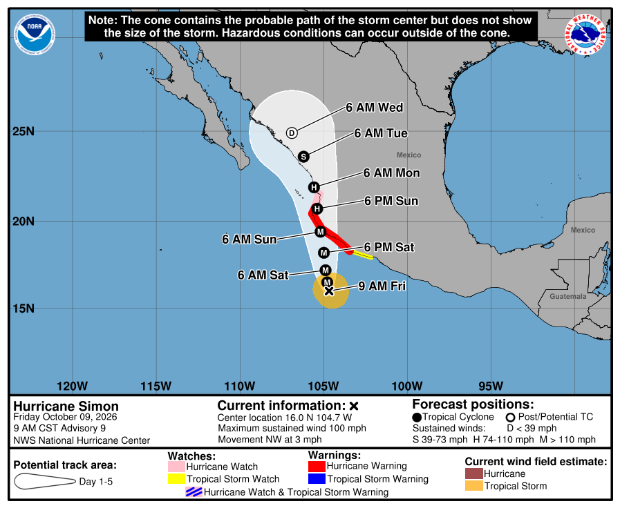
Official NHC cone for Simon, Advisory 9. It shows the likely path of the center, not every area that can get rain, wind, or surf. Red is the Hurricane Warning; pink is the new Hurricane Watch; yellow is the Tropical Storm Watch. The path runs toward west-central mainland Mexico this weekend, east of the Baja tip and across the Gulf from us. It is five days out and can shift. 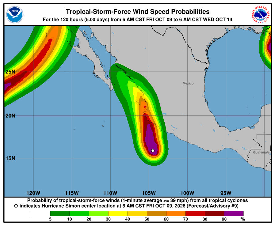
NHC wind-chance chart for Simon, Advisory 9. Cabo San Lucas 3%, San José del Cabo 4%, La Paz 3% through early Wednesday 5:00 AM MST. Small. It is not a landfall forecast for Todos Santos. 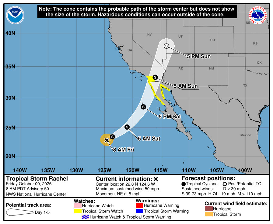
Official NHC cone for Rachel, Advisory 50. Yellow is the new Tropical Storm Watch on northern Baja California and southern California only. The track bends northeast far northwest of us. Our corridor stays outside the watches and outside the near-term cone threat. 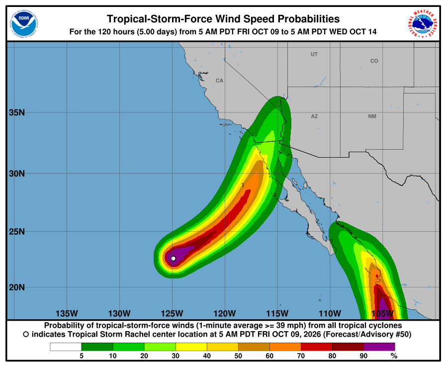
NHC wind-chance chart for Rachel, Advisory 50. Cabo / La Paz stay under 3%. Ensenada, far north, is 46%; San Diego is 23% through early Wednesday 5:00 AM MST. NHC lists no hazards for our area from Rachel or Simon. Simon's flooding rain and storm surge are forecast for southwestern mainland Mexico. Rachel's rain and wind are forecast for far northern Baja California and the U.S. Southwest. SMN (Oct 8 issue; next emission 1:00 PM MST) still shows heavy rain for southern BCS Sunday into Monday and rough BCS seas (Friday west Baja about 8–11 ft), so plan around arroyo crossings and stay out of the ocean. Next NHC complete advisories are due around 2:00 PM MST Friday. Checked Fri, Oct 9 · 12:14 PM MST: Simon Intermediate 9A — no material change (still 100 mph / same mainland watches; ~210 mi S Manzanillo, NW ~2 mph); Rachel Intermediate 50A — no material change (still 50 mph / same far-north watches). SMN 282 not out yet (still due ~1:00 PM MST). Next NHC complete ~2:00 PM MST. The live official-source panel above may update before this written report.
-
Superseded by Advisory 50 (Rachel 50 / Simon 9). Newer update above.
Simon strengthens to 90 mph and is forecast to reach Category 4 before the mainland coast, with landfall likely late Saturday night or Sunday; Rachel weakens to 50 mph and turns northeast far to the west; SMN still shows heavy southern BCS rain Sunday into Monday; corridor still outside every watch and warning
- What changed: Hurricane Simon Advisory 8 (2:00 AM MST Friday): now about 90 mph / 978 mb (was 75 mph), still moving northwest at about 5 mph, about 220 miles south of Manzanillo. Mainland Hurricane Warning unchanged from Punta San Telmo to Punta Mita. Tropical Storm Watch still east of Punta San Telmo to Lázaro Cárdenas. No BCS or corridor watches. NHC expects rapid strengthening to a very dangerous Category 4 (~145 mph) before reaching the coast; landfall likely late Saturday night or Sunday. Hurricane conditions in the warning area Saturday evening or Sunday. Tropical Storm Rachel Advisory 49: weaker at about 50 mph / 994 mb (was 60), now moving northeast at about 3 mph, about 955 miles west of the Baja tip. No coastal watches yet. A Tropical Storm Watch is likely later today for extreme northern Baja California, the northern Gulf of California, and southern California only — not our corridor. Todos Santos, Pescadero, and Cerritos stay outside every watch and warning. Neither storm is heading toward our corridor.
- What this means here: Rachel is still not a storm threat for Todos Santos, Pescadero, or Cerritos. Simon is still not a storm threat for our towns — its center stays on the mainland side. SMN (still the Oct 8 issue) shows the heaviest southern BCS rain Sunday into Monday, with rough seas building. Rachel's rain and wind stay far north, near the U.S. border. For us, arroyo crossings may run or close, dirt roads may wash out, and heavy cells are possible. Stay out of the ocean when seas are high. Exact rain and sea numbers are below.
- Stronger or weaker: Simon strengthened: 90 mph hurricane, up from 75. NHC forecasts a peak near 145 mph (Category 4) before reaching the coast, then weakening over the mainland. Rachel weakened slightly: 50 mph / 994 mb, down from 60 mph. NHC forecasts little change in strength over the next two days. It could get a little stronger for a short time. Then it weakens over land.
- Path and timing: Simon moves northwest at about 5 mph. A turn north is forecast Saturday morning. NHC's track keeps the center just offshore late Saturday night and brings it inland near the Jalisco coast by late Sunday morning. It then moves north near the coast, briefly over water off Nayarit, with a second landfall in Sinaloa near Mazatlán forecast around Monday. All of this is east of Baja, across the Gulf. The track after Sunday is less certain. Rachel speeds up toward far northern Baja California and southern California. It reaches land late Saturday, then moves into the U.S. Southwest Sunday. That is far northwest of us. SMN rain for southern BCS as a whole (Oct 8 issue — not a promise for each town): Friday 25–50 mm / 1–2 in. Saturday 5–25 mm / 0.2–1 in. Sunday 50–75 mm / 2–3 in. Monday 75–150 mm / 3–6 in. SMN seas: Friday west Baja 2.5–3.5 m / about 8–11 ft. Saturday 2–3 m / 7–10 ft. Sunday 2–4 m / 7–13 ft on the south BCS coast. Monday 3–4 m / 10–13 ft. SMN next emission 1:00 PM MST. Five-day paths can shift.
- Wind chance: Simon: NHC gives Cabo San Lucas 3% and San José del Cabo 3% odds of tropical-storm-force winds through Tuesday 11 PM MST. La Paz is not listed (under 3%). Mazatlán, on the mainland, is 36%. Rachel: Cabo / La Paz stay under 3%. Ensenada, far to the north, is 23%. NHC does not list Todos Santos separately. SMN wind for BCS: Sunday about 25–31 mph, gusts 37–43 mph (40–50 km/h, gusts 60–70). Monday BCS coasts about 6–12 mph, gusts 19–31 mph (10–20 km/h, gusts 30–50).
- Surf at our beaches: The Open-Meteo wave model near Pescadero (labeled Open-Meteo, not Windy) shows about 1.7 m / 6 ft now, near 1.8 m Saturday, about 2.4 m / 8 ft Sunday evening, then about 1.9–2.0 m Monday. That is lower than SMN's Monday BCS seas of 3–4 m / 10–13 ft. For safety we follow SMN.
- Windy + multi-source: NHC is official for watches; SMN still the Oct 8 issue, with Friday west-Baja seas (2.5–3.5 m / 8–11 ft) above SEMAR's 6–8 ft; Open-Meteo waves below SMN Monday seas.
- Do now: Plan to avoid arroyo crossings and dirt roads Sunday and Monday. Never drive into running water. Stock water, food, and flashlight basics. Secure loose outdoor items by Sunday. Stay out of the ocean when seas are high: building from Friday (~8–11 ft SMN west Baja), still rough Monday. Follow NHC, SMN, and Protección Civil BCS updates. Traveling to mainland Mexico this weekend (Manzanillo, Puerto Vallarta, Mazatlán)? Plan around Simon now — Hurricane Warning is up there; Category 4 possible before the coast. Driving to northern Baja California or southern California? Watch Rachel. Next: complete NHC advisories around 8:00 AM MST; SMN next emission 1:00 PM MST.
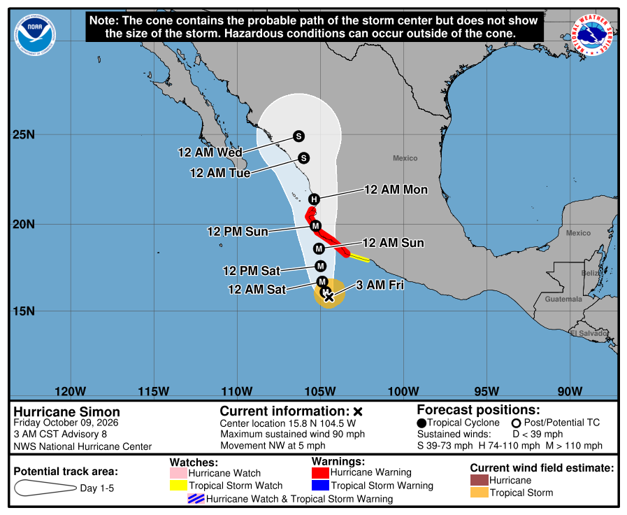
Official NHC cone for Simon, Advisory 8. It shows the likely path of the center, not every area that can get rain, wind, or surf. Red is the Hurricane Warning; yellow is the Tropical Storm Watch. The path runs north along the mainland coast this weekend, east of the Baja tip and across the Gulf from us. It is five days out and can shift. 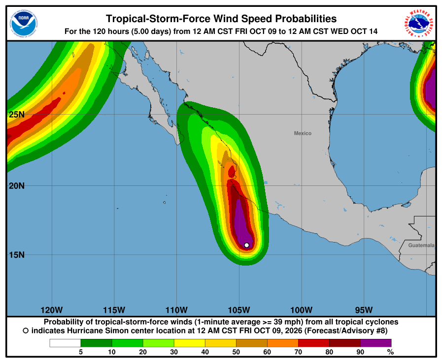
NHC wind-chance chart for Simon, Advisory 8. Cabo San Lucas 3%, San José del Cabo 3%, La Paz under 3% through Tuesday 11 PM MST. Small. It is not a landfall forecast for Todos Santos. 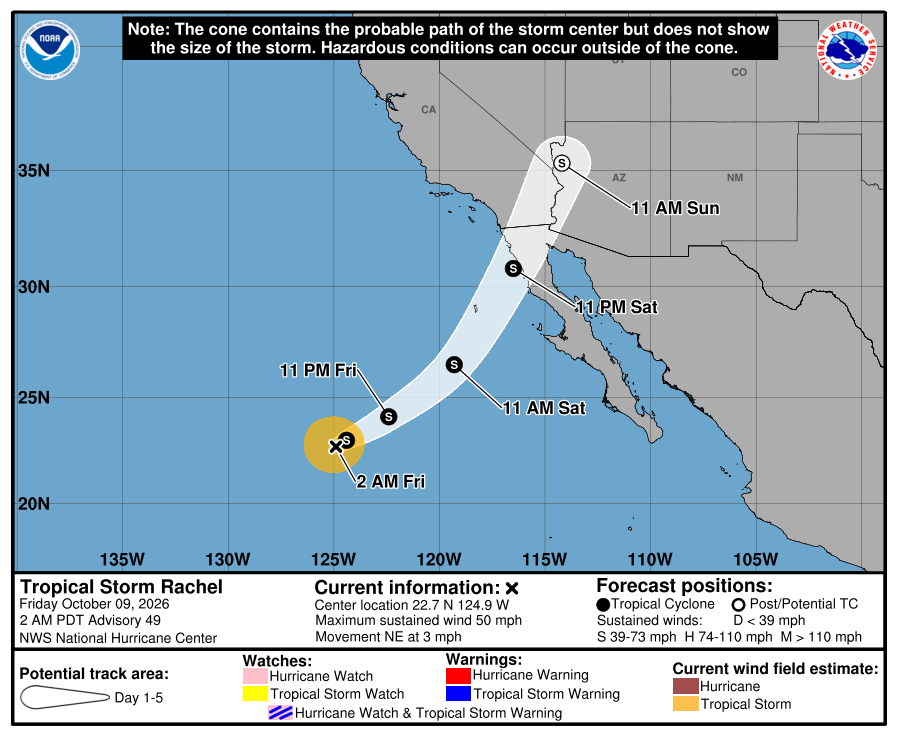
Official NHC cone for Rachel, Advisory 49. The track bends northeast to extreme northern Baja California and southern California, far northwest of us. Our corridor stays outside the cone. 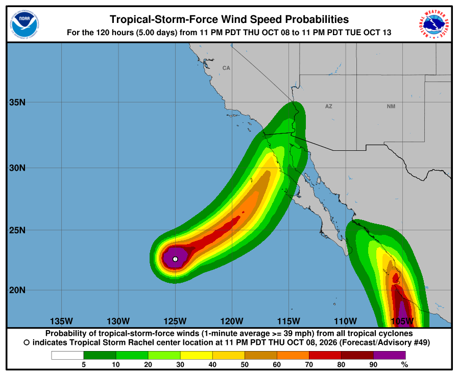
NHC wind-chance chart for Rachel, Advisory 49. Cabo / La Paz stay under 3%. Ensenada, far north, is 23% through Tuesday 11 PM MST. NHC lists no hazards for our area from Rachel or Simon. Simon's flooding rain and storm surge are forecast for southwestern mainland Mexico. Rachel's rain and wind are forecast for far northern Baja California and the U.S. Southwest. SMN (Oct 8 issue; next emission 1:00 PM MST) still shows heavy rain for southern BCS Sunday into Monday and rough BCS seas (Friday west Baja about 8–11 ft), so plan around arroyo crossings and stay out of the ocean. Corrected 3:25 AM MST: wind-chance window, Rachel strength outlook, Simon landfall timing, and cone colors. Checked Fri, Oct 9 · 6:25 AM MST: Simon Intermediate 8A — no material change (still 90 mph / same watches; position ~215 mi S Manzanillo); Rachel still Advisory 49. Next complete advisories around 8:00 AM MST. The live official-source panel above may update before this written report.
-
Superseded by Advisory 49 (Rachel 49 / Simon 8). Newer update above.
Simon Intermediate Advisory 7A: still 75 mph and slowing northwest toward the mainland Hurricane Warning area; Rachel still Advisory 48 at 60 mph far to the west; SMN still shows heavy southern BCS rain Sunday into Monday; corridor still outside every watch and warning
- What changed: Hurricane Simon Intermediate Advisory 7A (11:00 PM MST Thursday): still about 75 mph, now moving northwest at about 5 mph (slowing), about 220 miles south of Manzanillo. Hurricane Warning unchanged on the mainland from Punta San Telmo to Punta Mita, near Puerto Vallarta. Tropical Storm Watch still east of Punta San Telmo to Lázaro Cárdenas. That is far southeast of us, not Baja. NHC still expects rapid strengthening to a very dangerous Category 4 before the mainland coast Saturday. Tropical Storm Rachel is unchanged at Advisory 48: about 60 mph, about 995 miles west of the Baja tip, still expected to turn northeast toward extreme northern Baja California and southern California this weekend — far northwest of us. Todos Santos, Pescadero, and Cerritos stay outside every watch and warning. Neither storm is heading toward our corridor.
- What this means here: Rachel is still not a storm threat for Todos Santos, Pescadero, or Cerritos. Simon is still not a storm threat for our towns in NHC's forecast. Its center stays on the mainland side, east of us. SMN still shows the heaviest rain for southern BCS Sunday into Monday, with rough seas building through the weekend. For us, arroyo crossings may run or close, dirt roads may wash out, and heavy cells are possible. Stay out of the ocean when seas are high. Exact rain and sea numbers are below.
- Stronger or weaker: Simon is still a 75 mph hurricane and is forecast to strengthen fast to Category 4 before landfall Saturday, then weaken once inland. Rachel is still a weakening tropical storm at 60 mph / 990 mb. NHC expects more weakening, then little change until it moves inland over the Southwest U.S. as a post-tropical low.
- Path and timing: Simon moves northwest at about 5 mph. A turn north is forecast by early Saturday. The core should approach southwestern and west-central Mexico on Saturday, then move inland near Nayarit — still east of us across the Gulf. Rachel should turn northeast overnight and head toward extreme northern Baja California this weekend, far northwest of us. SMN rain for southern BCS as a whole (Oct 8 issue, not a promise for each town): Friday 25–50 mm / 1–2 in. Saturday 5–25 mm / 0.2–1 in. Sunday 50–75 mm / 2–3 in. Monday 75–150 mm / 3–6 in. SMN seas: Friday 2.5–3.5 m / about 8–11 ft on the west Baja coast. Saturday 2–3 m / 7–10 ft. Sunday 2–4 m / 7–13 ft on the south BCS coast. Monday 3–4 m / 10–13 ft. Five-day paths can shift.
- Wind chance: Simon: NHC still gives Cabo San Lucas 3% and San José del Cabo 3% odds of tropical-storm-force winds by early Tuesday (from Advisory 7 wind-chance product; intermediate 7A does not refresh that table). La Paz is not listed (under 3%). Mazatlán, on the mainland, is 20%. Rachel: Cabo / La Paz stay under 3%. Ensenada, far to the north, is 14%. NHC does not list Todos Santos separately. SMN wind for BCS: Sunday about 25–31 mph, gusts 37–43 mph (40–50 km/h, gusts 60–70). Monday BCS coasts about 6–12 mph, gusts 19–31 mph (10–20 km/h, gusts 30–50).
- Surf at our beaches: The Open-Meteo wave model near Pescadero shows about 1.7 m / 6 ft now, near 1.8 m Saturday, about 2.4 m / 8 ft Sunday evening, then about 1.9–2.0 m Monday. That is lower than SMN's Monday BCS seas of 3–4 m / 10–13 ft. For safety we follow SMN.
- Windy + multi-source: NHC is official for watches; SMN (still the Oct 8 issue) shows heavy southern BCS rain Sunday–Monday; Open-Meteo waves run below SMN Monday seas.
- Do now: Plan to avoid arroyo crossings and dirt roads Sunday and Monday. Never drive into running water. Stock water, food, and flashlight basics. Secure loose outdoor items by Sunday. Stay out of the ocean when seas are high: building from Friday, still rough Monday. Follow NHC, SMN, and Protección Civil BCS updates. Traveling to mainland Mexico this weekend (Manzanillo, Puerto Vallarta, Mazatlán)? Plan around Simon now — Hurricane Warning is up there. Driving to northern Baja California or southern California? Watch Rachel. Next: complete NHC advisories around 2:00 AM MST Friday.
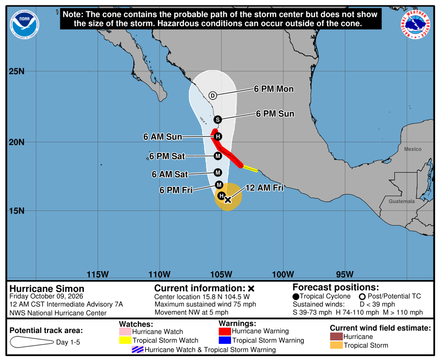
Official NHC cone for Simon, Intermediate Advisory 7A. It shows the likely path of the center, not every area that can get rain, wind, or surf. Red is the Hurricane Warning; yellow is the Tropical Storm Watch. The path runs north along the mainland coast this weekend, east of the Baja tip and across the Gulf from us. It is five days out and can shift. 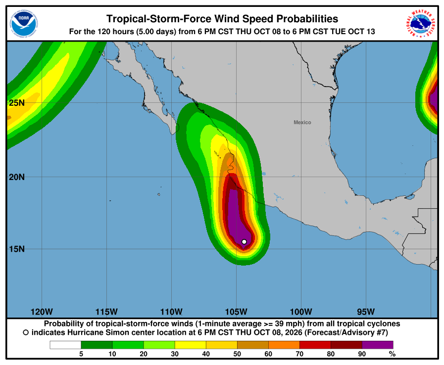
NHC wind-chance chart for Simon, Advisory 7. Cabo San Lucas 3%, San José del Cabo 3%, La Paz under 3% by early Tuesday. Small. It is not a landfall forecast for Todos Santos. 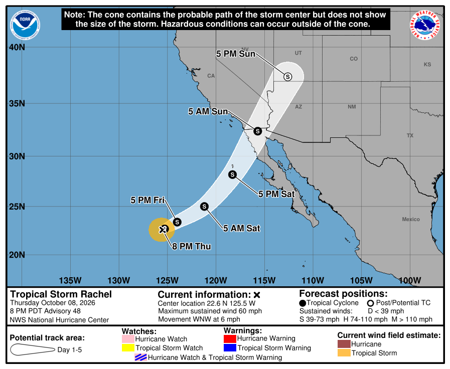
Official NHC cone for Rachel, Advisory 48 (unchanged this cycle). The weekend part bends northeast to extreme northern Baja California and southern California, far northwest of us. Our corridor stays outside the cone. 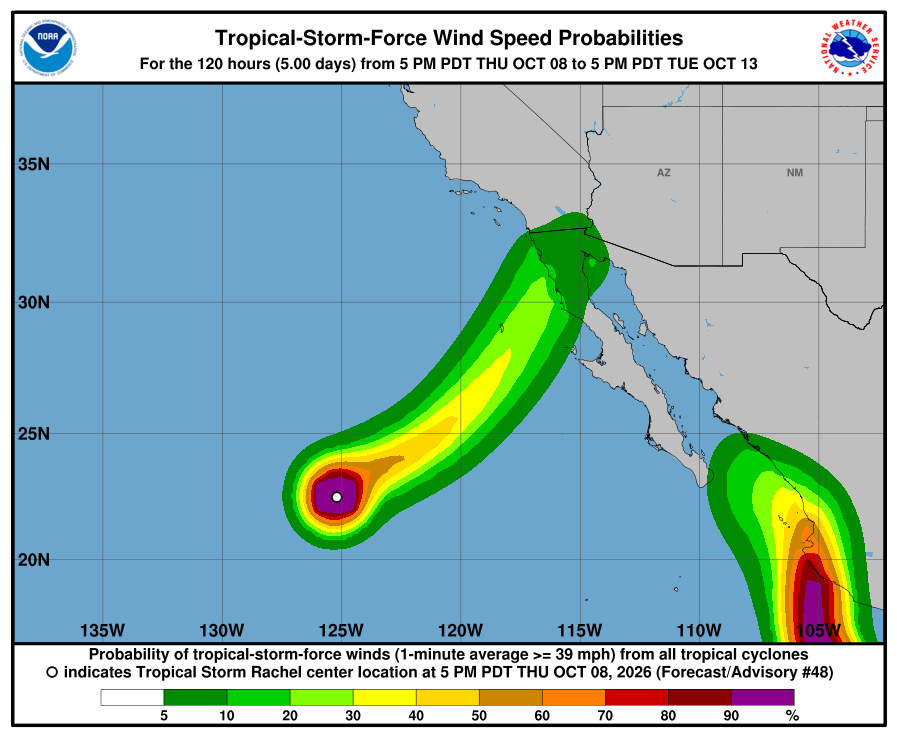
NHC wind-chance chart for Rachel, Advisory 48. Cabo / La Paz stay under 3%. Ensenada, far north, is 14%. NHC lists no hazards for our area from Rachel or Simon. Simon's flooding rain and storm surge are forecast for southwestern mainland Mexico. Rachel's rain and wind are forecast for far northern Baja California and the U.S. Southwest. SMN (Oct 8 issue; next emission 2:00 PM MST Friday) still shows heavy rain for southern BCS Sunday into Monday and rough BCS seas, so plan around arroyo crossings and stay out of the ocean. Next complete advisories are due around 2:00 AM MST Friday. The live official-source panel above may update before this written report.
-
Superseded by Simon Intermediate Advisory 7A (Rachel 48 / Simon 7A). Newer update above.
Simon becomes a hurricane with a Hurricane Warning for mainland Mexico from Punta San Telmo to Punta Mita, still east of us; Rachel weakens to 60 mph far to the west; SMN still shows heavy rain for southern BCS Sunday into Monday; corridor still outside every watch and warning
- What changed: Hurricane Simon is now a hurricane, about 75 mph (up from 65 mph as a tropical storm this morning). Mexico upgraded the mainland coast from Punta San Telmo to Punta Mita, near Puerto Vallarta, to a Hurricane Warning. A Tropical Storm Watch remains east of Punta San Telmo to Lázaro Cárdenas. That is far southeast of us, not Baja. NHC still expects rapid strengthening to a very dangerous Category 4, with a peak near 140 mph, before it reaches the mainland coast Saturday. Tropical Storm Rachel is weaker, about 60 mph, about 995 miles west of the Baja tip. NHC says a Tropical Storm Watch could still be needed tonight for extreme northern Baja California, the northern Gulf of California, and southern California. That is far north of us. Todos Santos, Pescadero, and Cerritos stay outside every watch and warning.
- What this means here: Rachel is still not a storm threat for Todos Santos, Pescadero, or Cerritos. Simon is still not a storm threat for our towns in NHC's forecast. Its center stays on the mainland side, east of us. SMN shows the heaviest rain for southern BCS Sunday into Monday, with rough seas building through the weekend. For us, arroyo crossings may run or close, dirt roads may wash out, and heavy cells are possible. Stay out of the ocean when seas are high. Exact rain and sea numbers are below.
- Stronger or weaker: Simon just became a hurricane and is forecast to strengthen fast to Category 4 before landfall Saturday, then weaken quickly once inland Sunday and Monday. Rachel is weaker: 60 mph and 990 mb, down from 70 mph. NHC expects more weakening tonight and Friday, then little change until it moves inland over the Southwest U.S. as a post-tropical low.
- Path and timing: Simon moves west-northwest at about 6 mph. It turns northwest Friday, then north. The core should reach the mainland coast Saturday, then move inland near Nayarit. It stays east of us, across the Gulf. Rachel turns northeast tonight. It heads toward extreme northern Baja California this weekend, far northwest of us. SMN rain for southern BCS as a whole (not a promise for each town): Friday 25–50 mm / 1–2 in. Saturday 5–25 mm / 0.2–1 in. Sunday 50–75 mm / 2–3 in. Monday 75–150 mm / 3–6 in. SMN seas: Friday 2.5–3.5 m / about 8–11 ft on the west Baja coast. Saturday 2–3 m / 7–10 ft. Sunday 2–4 m / 7–13 ft on the south BCS coast. Monday 3–4 m / 10–13 ft. Five-day paths can shift.
- Wind chance: Simon: NHC gives Cabo San Lucas 3% and San José del Cabo 3% odds of tropical-storm-force winds by early Tuesday. La Paz is not listed (under 3%). That is smaller than this morning. Mazatlán, on the mainland, is 20%. Rachel: Cabo / La Paz stay under 3%. Ensenada, far to the north, is 14%. NHC does not list Todos Santos separately. SMN wind for BCS: Sunday about 25–31 mph, gusts 37–43 mph (40–50 km/h, gusts 60–70). Monday is lighter on BCS coasts: about 6–12 mph, gusts 19–31 mph (10–20 km/h, gusts 30–50).
- Surf at our beaches: The Open-Meteo wave model near Pescadero shows about 1.7 m / 6 ft now, near 1.8 m through Saturday, about 2.4 m / 8 ft Sunday evening, then about 2.0–2.4 m Monday. That is lower than SMN's Monday BCS seas of 3–4 m / 10–13 ft. For safety we follow SMN.
- Windy + multi-source: NHC is official for watches; SMN shows heavy southern BCS rain Sunday to Monday; the Open-Meteo wave model runs below SMN's Monday seas.
- Do now: Plan to avoid arroyo crossings and dirt roads Sunday and Monday. Never drive into running water. Stock water, food, and flashlight basics. Secure loose outdoor items by Sunday. Stay out of the ocean when seas are high: building from Friday, still rough Monday. Follow NHC, SMN, and Protección Civil BCS updates. Traveling to mainland Mexico this weekend (Manzanillo, Puerto Vallarta, Mazatlán)? Plan around Simon now — Hurricane Warning is up there. Driving to northern Baja California or southern California? Watch Rachel. Next: NHC intermediate Simon Advisory 7A around 11:00 PM MST tonight, then complete NHC advisories around 2:00 AM MST Friday.
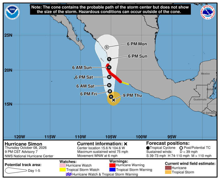
Official NHC cone for Simon, Advisory 7. It shows the likely path of the center, not every area that can get rain, wind, or surf. Red is the Hurricane Warning; yellow is the Tropical Storm Watch. The path runs north along the mainland coast this weekend, east of the Baja tip and across the Gulf from us. It is five days out and can shift. 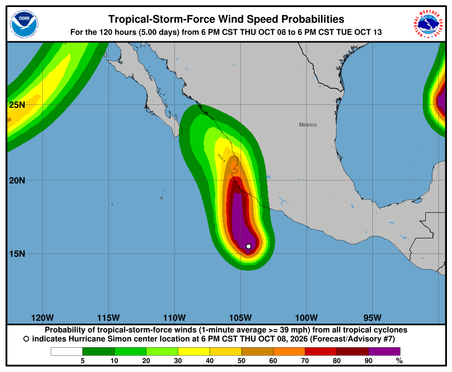
NHC wind-chance chart for Simon, Advisory 7. Cabo San Lucas 3%, San José del Cabo 3%, La Paz under 3% by early Tuesday. Small. It is not a landfall forecast for Todos Santos.
Official NHC cone for Rachel, Advisory 48. The weekend part bends northeast to extreme northern Baja California and southern California, far northwest of us. Our corridor stays outside the cone.
NHC wind-chance chart for Rachel, Advisory 48. Cabo / La Paz stay under 3%. Ensenada, far north, is 14%. We missed a cycle. We missed posting NHC Advisory 47 / Simon 6 and 6A this afternoon. From about 2 PM to 9:18 PM MST this page still showed a Hurricane Watch where NHC had a Hurricane Warning. This update covers those changes, including the Hurricane Warning for the mainland coast.
NHC lists no hazards for our area from Rachel or Simon. Simon's flooding rain and storm surge are forecast for southwestern mainland Mexico. Rachel's rain and wind are forecast for far northern Baja California and the U.S. Southwest. SMN shows heavy rain for southern BCS Sunday into Monday and rough BCS seas, so plan around arroyo crossings and stay out of the ocean. SMN's Sunday wind for BCS is stronger than Monday's. NHC's intermediate Simon Advisory 7A is due around 11:00 PM MST; the next complete advisories are due around 2:00 AM MST Friday. The live official-source panel above may update before this written report.
-
Superseded by Advisory 48 (Rachel 48 / Simon 7). Newer update above.
Hurricane Watch for mainland Mexico from Manzanillo to Punta Mita as Simon is forecast to strengthen fast to a Category 4, still east of us; Rachel holds at 70 mph and may bring watches to far northern Baja California; SMN shows heavy rain and very rough seas for southern BCS Sunday into Monday; corridor still outside every watch and warning
- What changed: Tropical Storm Simon is now about 65 mph, and NHC expects it to strengthen fast: a hurricane later today and a very dangerous Category 4, about 130 mph, before it reaches the mainland coast late Saturday. Mexico put up a Hurricane Watch for the mainland coast from Manzanillo to Punta Mita, near Puerto Vallarta, and a Tropical Storm Watch from east of Manzanillo to Punta San Telmo. That is far southeast of us, not Baja. Tropical Storm Rachel holds at about 70 mph, about 915 miles west of the Baja tip. NHC says a Tropical Storm Watch could be needed tonight for extreme northern Baja California and southern California, about 600 miles northwest of us. Todos Santos, Pescadero, and Cerritos stay outside every watch and warning. Update: SMN's newest four-day forecast is wetter for southern BCS and now runs through Monday. We corrected the rain and seas below.
- What this means here: Rachel is still not a storm threat for Todos Santos, Pescadero, or Cerritos. Simon is still not a storm threat for our towns in NHC's forecast. Its center stays on the mainland side, east of us. But SMN now expects heavy rain and very rough seas in southern BCS. SMN rain for southern BCS: showers today (about 0.2–1 in / 5-25 mm). Heavier showers Friday (about 1–2 in / 25-50 mm). Showers Saturday (about 0.2–1 in / 5-25 mm). Heavy rain Sunday (about 2–3 in / 50-75 mm). Very heavy rain Monday (about 3–6 in / 75-150 mm). These are SMN figures for southern BCS as a whole, not a promise for each town. The worst rain looks like Sunday into Monday. For us, arroyo crossings may run or close, dirt roads may wash out, and heavy cells are possible. Seas: SMN shows about 7–11 ft / 2-3.5 m Friday through Sunday. On Monday it shows very rough seas on BCS coasts, about 16–20 ft / 5-6 m (another SMN line says 10–13 ft / 3-4 m). Monday wind: SMN's forecast mixes two lines for BCS coasts. The strong one has gusts of about 106–118 mph / 170-190 km/h, shared with southern Sonora and Sinaloa. The weaker one has gusts of about 50–62 mph / 80-100 km/h. Strong wind on our coast Monday is possible, not certain. Big surf and rough seas at our beaches Monday are likely.
- Stronger or weaker: Simon is getting much stronger: 65 mph now, up from 50 mph this morning. NHC still forecasts a peak near 130 mph on Saturday, now described as Category 4. It should weaken quickly once it moves inland on Sunday and Monday. Rachel is the same as this morning: 70 mph and 985 mb. It should slowly weaken.
- Path and timing: Simon moves west at about 5 mph. On Friday it turns north-northwest, then north. It should reach the Colima and Jalisco coast late Saturday, then move north inland near Nayarit and Sinaloa. NHC's last point, early Tuesday, is inland over Durango, about 290 miles east of Todos Santos across the Gulf. NHC says the models still differ on exactly where and when Simon reaches the coast. Rachel moves west-northwest at about 7 mph. On Saturday it turns sharply northeast and speeds up, approaching northern Baja California late Saturday, about 600 miles northwest of us. Five-day paths can shift. We will check each new advisory.
- Wind chance: Simon: NHC gives Cabo San Lucas 4%, San José del Cabo 5%, and La Paz 3% odds of tropical-storm-force winds by early Tuesday. That is about the same as this morning, and it is small. Mazatlán, on the mainland, is higher at 40%, up from 35%. Rachel: Cabo / La Paz stay under 3%. Ensenada, far to the north, is 14%. NHC does not list Todos Santos separately.
- Surf at our beaches: Surfline's free beach forecasts show about 4–7 ft at Cerritos through Saturday, rising to about 6–8 ft Sunday evening into early Monday. La Pastora runs about 4–8 ft, biggest this evening. San Pedrito is smaller, about 3–5 ft. The main swell comes from the south-southwest with long gaps between waves, so sets hit harder than they look and pull hard back out. The model also shows a southeast swell from Saturday night into Monday; that part is uncertain. These beach forecasts are much smaller than SMN's Monday seas of 16–20 ft / 5-6 m on BCS coasts. For safety we follow SMN.
- Windy + multi-source: NHC and SMN disagree on Monday: NHC keeps wind odds low for Cabo San Lucas (4%), San José del Cabo (5%), and La Paz (3%) with Simon inland, while SMN shows strong coastal wind and heavy rain for BCS. We will watch the next updates.
- Do now: Plan to avoid arroyo crossings and dirt roads Sunday and Monday. Never drive into running water. Stock water, food, and flashlight basics. Secure loose outdoor items by Sunday. Stay out of the ocean when seas are high: rough from Friday, roughest Monday. Follow NHC, SMN, and Protección Civil BCS updates. Traveling to mainland Mexico this weekend (Manzanillo, Puerto Vallarta, Mazatlán)? Plan around Simon now. Driving to northern Baja California or southern California? Watch Rachel. Next complete NHC advisories ~2:00 PM MST.
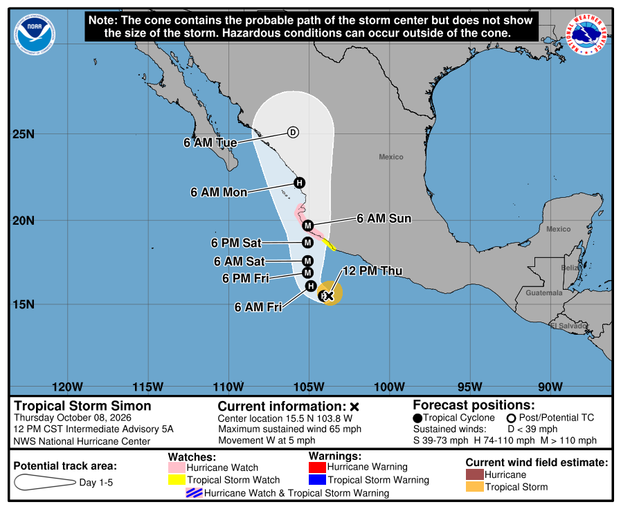
Official NHC cone for Simon, 11:00 AM Thursday. It shows the likely path of the center, not every area that can get rain, wind, or surf. Pink is the new mainland Hurricane Watch; yellow is the Tropical Storm Watch. The path runs north along the mainland coast this weekend, east of the Baja tip and across the Gulf from us. It is five days out and can shift. 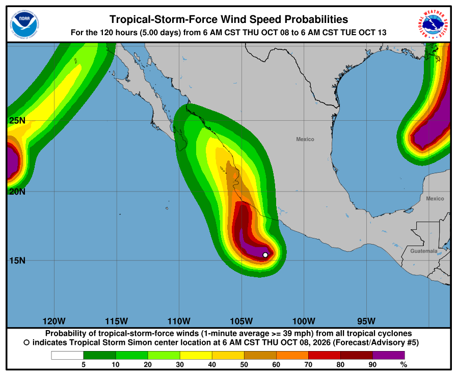
NHC wind-chance chart for Simon, Advisory 5. Cabo San Lucas 4%, San José del Cabo 5%, La Paz 3% by early Tuesday. Small. It is not a landfall forecast for Todos Santos. 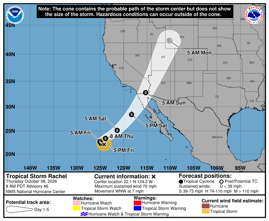
Official NHC cone for Rachel, Advisory 46. The weekend part bends northeast to extreme northern Baja California and southern California, far northwest of us. Our corridor stays outside the cone. 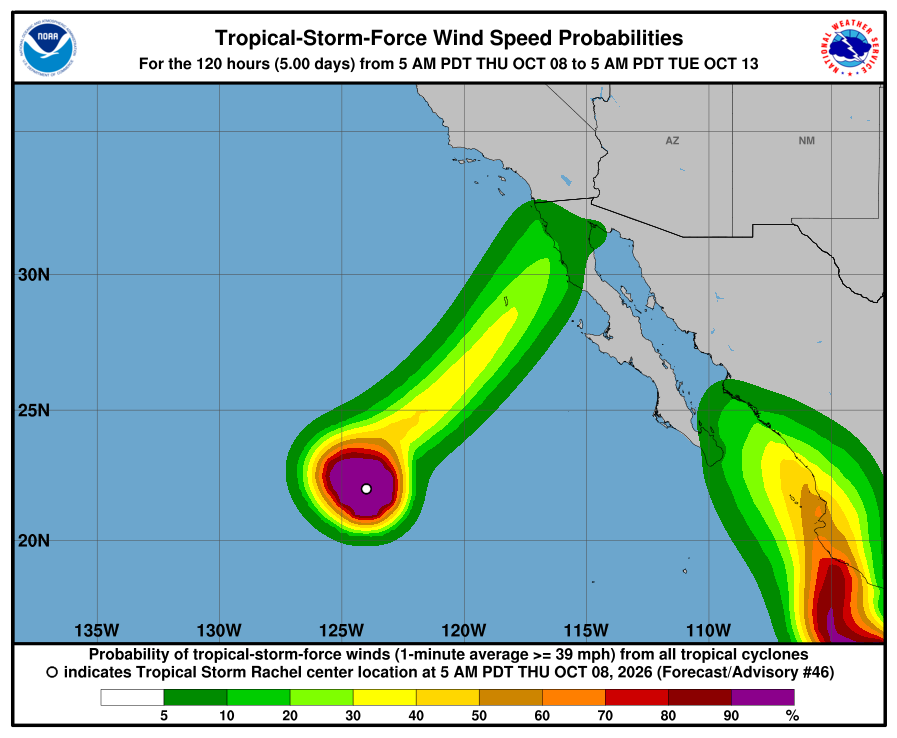
NHC wind-chance chart for Rachel, Advisory 46. Cabo / La Paz stay under 3%. NHC lists no hazards for our area from Rachel or Simon. Simon's flooding rain is forecast for southwestern mainland Mexico, mainly Michoacán, Colima, and Jalisco. Rachel's rain and wind are forecast for far northern Baja California and the U.S. Southwest. SMN, Mexico's weather service, shows heavier rain for southern BCS Friday, Sunday, and Monday, with very rough seas on BCS coasts Monday, so plan around arroyo crossings and stay out of the ocean. NHC and SMN differ on Monday wind for BCS; we will watch the next updates. The next complete advisories are due at 2:00 PM MST Thursday. The live official-source panel above may update before this written report.
-
Superseded by Advisory 46 (Rachel 46 / Simon 5 and 5A). Newer update above.
Mexico issues a Tropical Storm Watch for the mainland coast as NHC raises Simon's forecast peak to 130 mph near Colima and Jalisco, still east of us; Rachel weakens to a 70 mph tropical storm far to the west; corridor still outside every watch and warning
- What changed: Tropical Storm Simon holds at about 50 mph, but NHC now forecasts a peak near 130 mph, a major hurricane, on Saturday near the Colima and Jalisco coast. Mexico issued a Tropical Storm Watch for the mainland coast from Punta San Telmo to Manzanillo. That is far southeast of us, not Baja. Tropical Storm Rachel has dropped below hurricane strength, at about 70 mph. It is about 895 miles west of the Baja tip. Todos Santos, Pescadero, and Cerritos stay outside every watch and warning.
- What this means here: Rachel is still not a storm threat for Todos Santos, Pescadero, or Cerritos. Simon is not a storm threat for our towns this morning. Its path stays on the mainland side, east of us across the Gulf. Lead local prep with SMN: showers on and off today through Saturday (about 0.2–1 in / 5-25 mm a day), then heavier rain on Sunday (about 2–3 in / 50-75 mm in southern BCS). Seas about 3–7 ft / 1-2 m today, rising to about 7–10 ft / 2-3 m Friday through Sunday. Arroyos and rough surf are the local story.
- Stronger or weaker: Simon is about to get much stronger. NHC raised its top forecast to about 130 mph on Saturday, up from 125 mph. It should weaken on Sunday and Monday as it moves north near the Nayarit coast and inland over Sinaloa. Rachel is weaker: 70 mph and 985 mb, down from 75 mph. It is now a tropical storm and should keep weakening.
- Path and timing: Simon moves west at about 7 mph today. On Friday it turns northwest, then north. It should near the Colima and Jalisco coast on Saturday, then move north near the Nayarit coast on Sunday. NHC's Monday-night point is inland over Sinaloa, about 270 miles east of Todos Santos across the Gulf. NHC says two main models still lean west of its path, but they are moving closer to it. A path farther west would keep Simon over water longer. Rachel moves west-northwest at about 8 mph. On Friday it turns sharply northeast and speeds up toward extreme northern Baja California and southern California this weekend, about 600 miles northwest of us. Five-day paths can shift. We will check each new advisory.
- Wind chance: Simon: NHC gives Cabo San Lucas 4%, San José del Cabo 5%, and La Paz under 3% odds of tropical-storm-force winds by late Monday. That is down from 7%, 8%, and 6% last night. It is still small. Mazatlán, on the mainland, is higher at 35%. Rachel: Cabo / La Paz stay under 3%. NHC does not list Todos Santos separately.
- Windy + multi-source: NHC, SMN, and Windy agree: no watch or warning for our corridor. One difference: SMN is wetter than NHC for southern BCS on Sunday, and SMN builds seas sooner, from Friday. Open-Meteo wave model near Pescadero (earlier labeled Windy in error): about 1.8 m / 6 ft now, near 1.8 m through Saturday, then about 2.7 m / 9 ft Sunday evening. Protección Civil BCS's last posts, on Wednesday, showed no storm alert. NHC is official for watches.
- Do now: Expect showers on and off through Saturday, with heavier rain possible on Sunday. Do not drive flooded arroyos. Stay out of rough surf from Friday; it is likely worst on Sunday. No storm prep is needed today. Simon will be strong this weekend, so keep checking this page. If you plan to travel to mainland Mexico this weekend (Manzanillo, Puerto Vallarta, Mazatlán), watch Simon closely. The next Simon update (5:00 AM MST) and complete NHC advisories (8:00 AM MST) have since been issued.
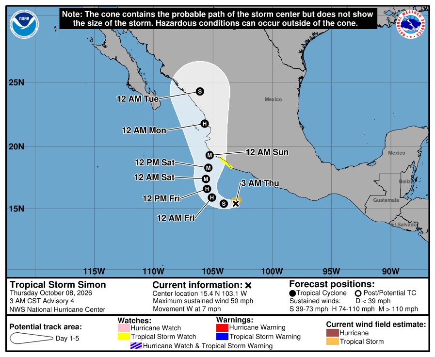
Official NHC cone for Simon, Advisory 4. It shows the likely path of the center, not every area that can get rain, wind, or surf. The yellow line is the new mainland Tropical Storm Watch. The path runs north along the mainland coast this weekend, east of the Baja tip and across the Gulf from us. It is five days out and can shift. 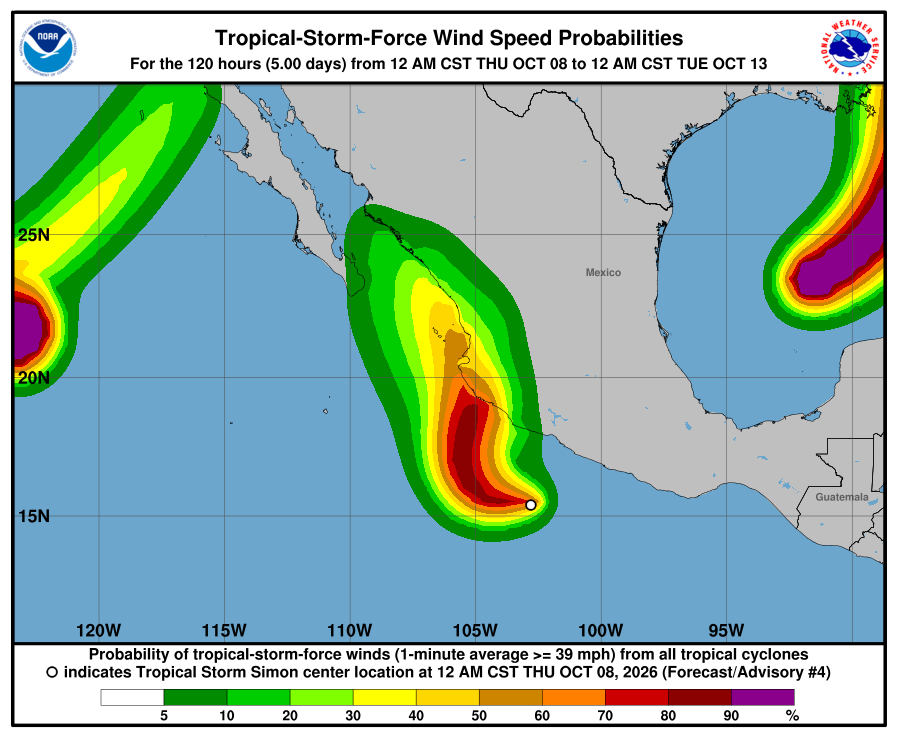
NHC wind-chance chart for Simon, Advisory 4. Cabo San Lucas 4%, San José del Cabo 5%, La Paz under 3% by late Monday. Small, and down from last night. It is not a landfall forecast for Todos Santos. 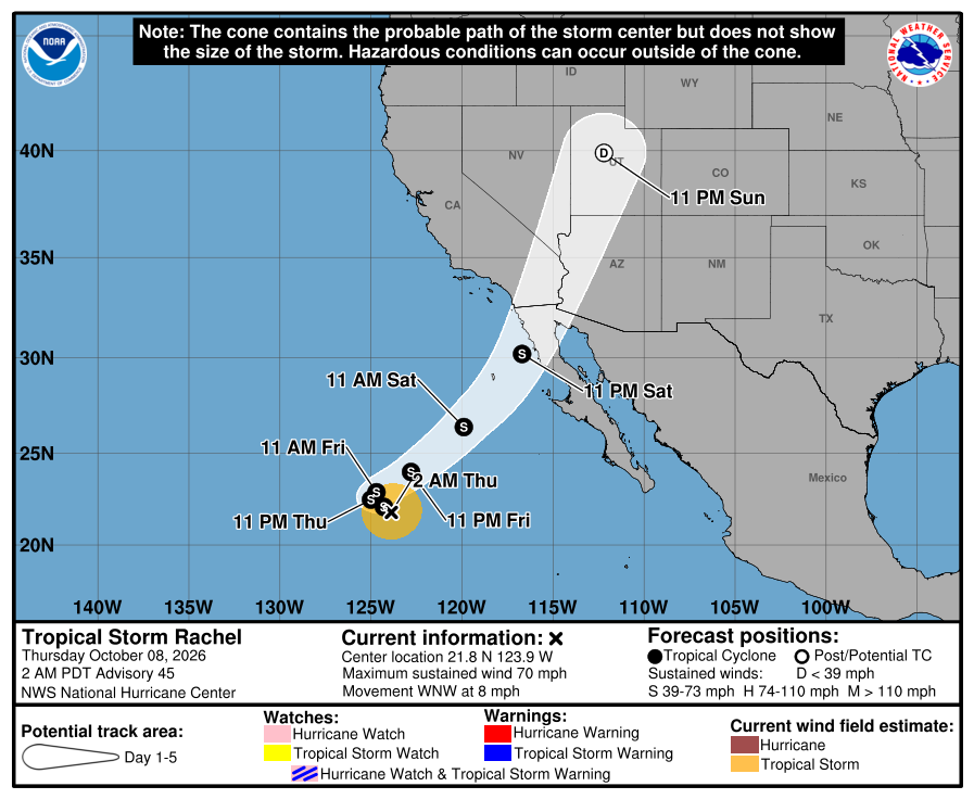
Official NHC cone for Rachel, 2:00 AM Thursday. The weekend part bends northeast to extreme northern Baja California and southern California, far northwest of us. Our corridor stays outside the cone. 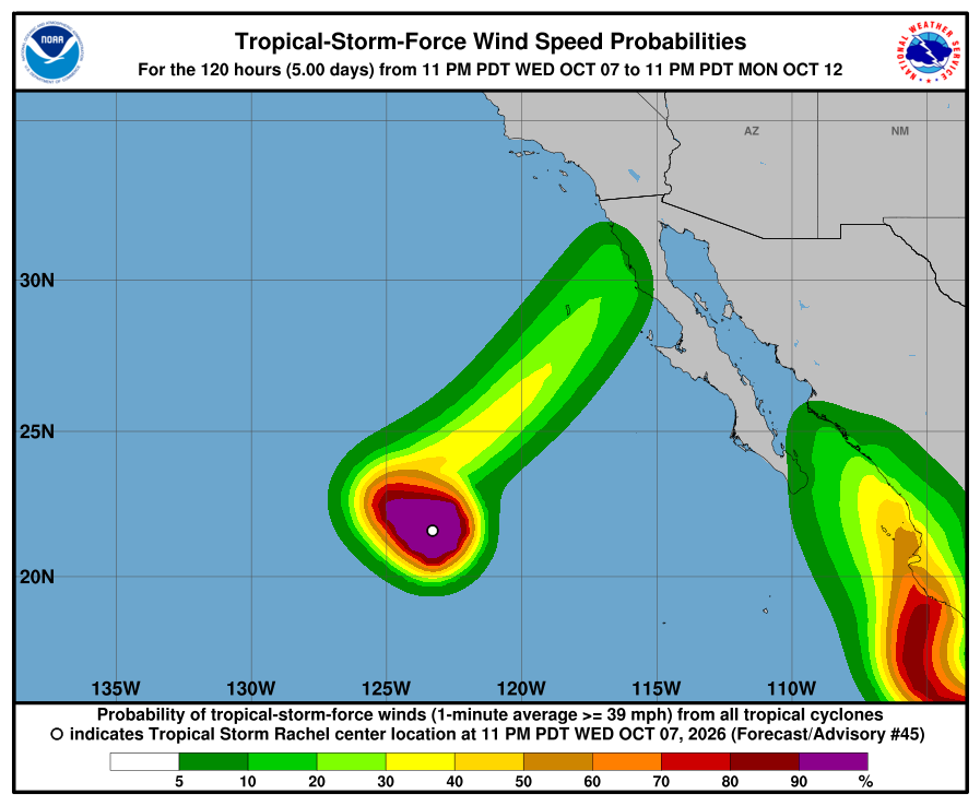
NHC wind-chance chart for Rachel, Advisory 45. Cabo / La Paz stay under 3%. NHC lists no hazards for our area from Rachel or Simon. Simon's flooding rain is forecast for southwestern mainland Mexico, mainly Colima and Michoacán. SMN shows showers in BCS through Saturday and heavier rain in southern BCS on Sunday, with seas about 2-3 m on the west coast Friday to Sunday, so stay careful near arroyos and in the ocean. The next Simon update (5:00 AM MST) and the next complete advisories (8:00 AM MST Thursday) have since been issued; see the newer entry above. The live official-source panel above may update before this written report.
-
Superseded by Advisory 45 (Rachel 45 / Simon 4). Newer update above.
Simon strengthens to 50 mph and NHC now forecasts a 125 mph major hurricane near mainland Mexico this weekend, still east of us; Rachel weakens slightly to 75 mph far to the west; corridor still outside every watch and warning
- What changed: Tropical Storm Simon is stronger, at about 50 mph. It was 40 mph this afternoon. NHC now expects fast strengthening: a hurricane by Thursday night and a major hurricane near 125 mph by late Friday or Saturday, near the west-central coast of mainland Mexico. Watches will likely go up tonight or Thursday for parts of southwestern mainland Mexico, not Baja. Hurricane Rachel is a little weaker, at about 75 mph. It is still Category 1, about 840 miles west of the Baja tip. Todos Santos, Pescadero, and Cerritos stay outside every watch and warning.
- What this means here: Rachel is still not a storm threat for Todos Santos, Pescadero, or Cerritos. Simon is not a storm threat for our towns tonight. Its path stays on the mainland side, east of us across the Gulf. Lead local prep with SMN: showers tonight (locally about 1–2 in / 25-50 mm in southern BCS), lighter showers Thursday to Saturday (about 0.2–1 in / 5-25 mm a day), then heavier rain on Sunday (about 2–3 in / 50-75 mm). Seas about 3–7 ft / 1-2 m tomorrow, rising to about 7–10 ft / 2-3 m Friday through Sunday. Arroyos and rough surf are the local story.
- Stronger or weaker: Simon is getting stronger fast. NHC raised its top forecast to about 125 mph, a major hurricane, on Saturday. It should slowly weaken on Sunday and Monday as it nears and moves inland over Sinaloa. Rachel is a little weaker: 75 mph and 982 mb, down from 80 mph. NHC expects it to drop to tropical-storm strength by Thursday and keep weakening.
- Path and timing: Simon moves west-northwest at about 7 mph and stays south of Mexico through Friday. Then it turns northwest and north. It should near the Colima and Jalisco coast on Saturday, then move north near the Nayarit and Sinaloa coast. NHC's Monday point is inland over Sinaloa, about 220 miles east of Todos Santos across the Gulf. NHC says the models still spread out. A path farther west would keep Simon over water longer. Rachel moves west-northwest at about 7 mph. Late this week it turns northeast toward extreme northern Baja California and southern California, about 650 to 750 miles northwest of us. Five-day paths can shift. We will check each new advisory.
- Wind chance: Simon: NHC gives Cabo San Lucas 7%, San José del Cabo 8%, and La Paz 6% odds of tropical-storm-force winds by Monday. That is up 1 to 2 points from this afternoon. It is still small. Rachel: Cabo / La Paz stay under 3%. NHC does not list Todos Santos separately.
- Windy + multi-source: NHC, SMN, and Windy agree: no watch or warning for our corridor. One difference: SMN is wetter than NHC for southern BCS on Sunday, and SMN builds seas sooner, from Friday. Open-Meteo wave model near Pescadero (earlier labeled Windy in error): about 1.7 m / 6 ft now, near 1.8 m through Saturday, then about 2.7 m / 9 ft Sunday afternoon. Protección Civil BCS's last posts showed no storm alert. NHC is official for watches.
- Do now: Expect showers tonight, with heavier rain possible on Sunday. Do not drive flooded arroyos. Stay out of rough surf from Friday; it is likely worst on Sunday. No storm prep is needed tonight. Simon will be strong this weekend, so keep checking this page. If you plan to travel to mainland Mexico this weekend (Manzanillo, Puerto Vallarta, Mazatlán), watch Simon closely. Next complete NHC advisories ~2:00 AM MST.
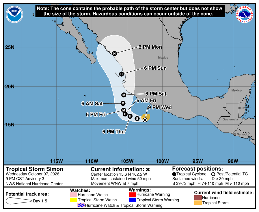
Official NHC cone for Simon, Advisory 3. It shows the likely path of the center, not every area that can get rain, wind, or surf. The path runs north along the mainland coast this weekend, east of the Baja tip and across the Gulf from us. It is five days out and can shift. 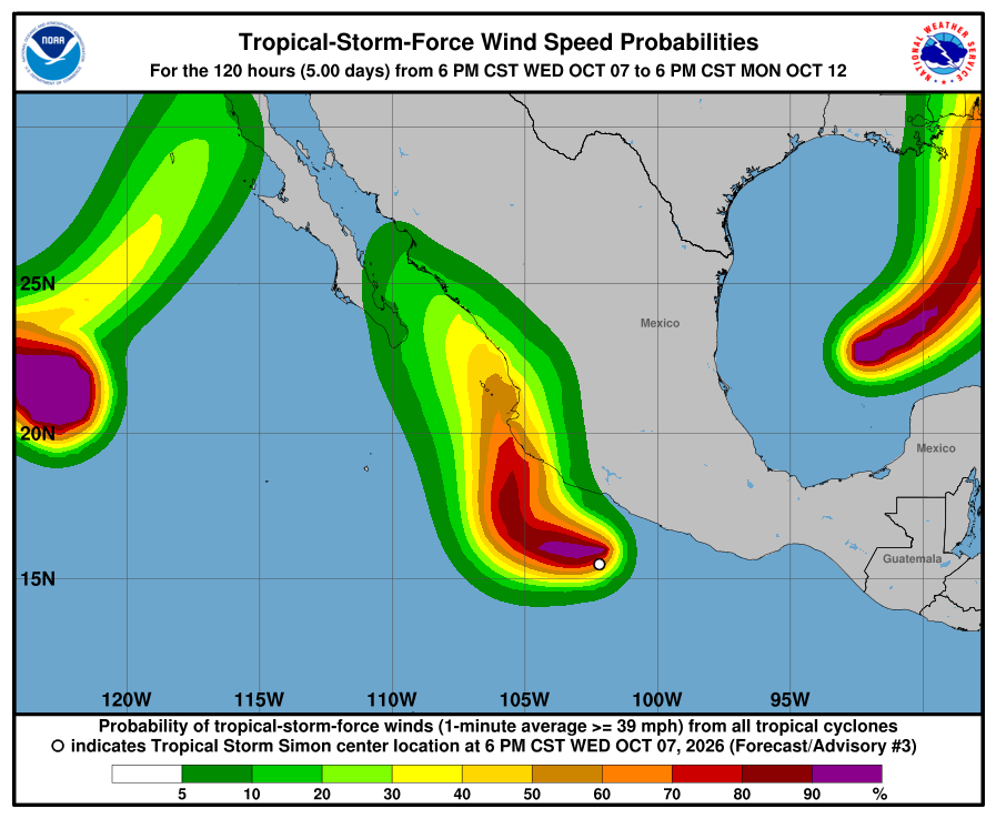
NHC wind-chance chart for Simon, Advisory 3. Cabo San Lucas 7%, San José del Cabo 8%, La Paz 6% by Monday. Small. It is not a landfall forecast for Todos Santos. 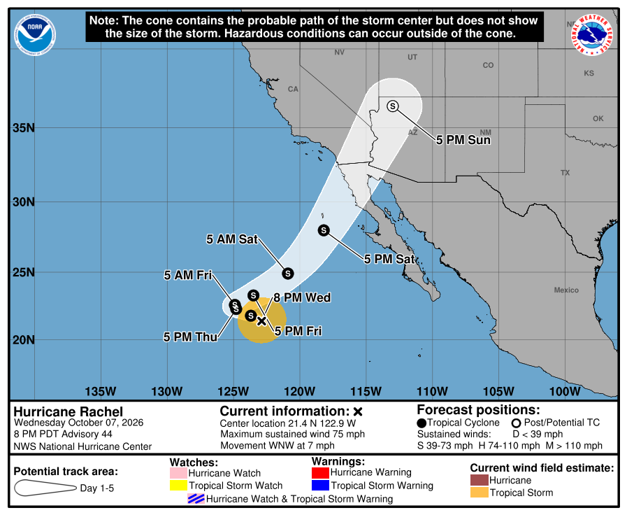
Official NHC cone for Rachel, 8:00 PM Wednesday. The weekend part bends northeast to extreme northern Baja California and southern California, far northwest of us. Our corridor stays outside the cone. 
NHC wind-chance chart for Rachel, Advisory 44. Cabo / La Paz stay under 3%. NHC lists no hazards for our area from Rachel or Simon. Simon's flooding rain is forecast for southwestern mainland Mexico, mainly Colima and Michoacán. SMN shows showers in BCS tonight and heavier rain in southern BCS on Sunday, with seas about 2-3 m on the west coast Friday to Sunday, so stay careful near arroyos and in the ocean. The next complete advisories are due at 2:00 AM MST Thursday. The live official-source panel above may update before this written report.
-
Superseded by Advisory 44 (Rachel 44 / Simon 3). Newer update above.
Twenty-E becomes Tropical Storm Simon and may be a major hurricane by Saturday, but its path stays on the mainland side, east of us; Rachel holds at 80 mph far to the west; SMN now shows heavier rain for southern BCS on Sunday; corridor still outside every watch and warning
- What changed: Twenty-E is now Tropical Storm Simon, at about 40 mph. NHC expects it to become a hurricane by Thursday night and a major hurricane by Saturday near the west-central coast of mainland Mexico. Watches may go up tonight for parts of southwestern mainland Mexico, not Baja. Rachel holds at about 80 mph, still Category 1, about 800 miles west of the Baja tip. SMN's newest forecast now shows heavier rain for southern BCS on Sunday. Todos Santos, Pescadero, and Cerritos stay outside every watch and warning.
- What this means here: Rachel is still not a storm threat for Todos Santos, Pescadero, or Cerritos. Simon is not a storm threat for our towns today. Its path stays on the mainland side, east of us across the Gulf. Lead local prep with SMN: showers today and tonight (locally about 1–2 in / 25-50 mm), lighter showers Thursday to Saturday (about 0.2–1 in / 5-25 mm a day), then heavier rain on Sunday (about 2–3 in / 50-75 mm in southern BCS). Seas about 3–7 ft / 1-2 m now, rising to about 7–10 ft / 2-3 m Friday through Sunday. Arroyos and rough surf are the local story.
- Stronger or weaker: Rachel is the same as Advisory 42: 80 mph and 979 mb. NHC expects it to drop to tropical-storm strength by Thursday and keep weakening. Simon is getting stronger. Over very warm water, NHC expects a hurricane by Thursday night and possibly a major hurricane by Saturday.
- Path and timing: Rachel moves west-northwest at about 7 mph. Late this week it turns northeast toward extreme northern Baja California and southern California. NHC expects it to reach that coast at tropical-storm strength this weekend, about 650 to 750 miles northwest of us. Simon moves west-northwest at about 8 mph, then turns north on Friday. It should near the Colima and Jalisco coast on Saturday, then move north toward Nayarit and Sinaloa. NHC's Monday point is inland over Sinaloa, about 220 miles east of Todos Santos across the Gulf. Five-day paths can shift. We will check each new advisory.
- Wind chance: Rachel: Cabo / La Paz stay under 3%. Simon: NHC gives Cabo San Lucas 6%, San José del Cabo 6%, and La Paz 5% odds of tropical-storm-force winds by Monday. That is about the same as this morning, and it is small. NHC does not list Todos Santos separately.
- Windy + multi-source: NHC, SMN, Protección Civil BCS, and Windy agree: no watch or warning for our corridor. One difference: SMN is wetter than NHC for southern BCS on Sunday, and SMN builds seas sooner, from Friday. Open-Meteo wave model near Pescadero (earlier labeled Windy in error): about 1.6 m / 5 ft now, near 1.9 m through Saturday, then about 2.9 m / 9 ft Sunday into Monday. Protección Civil BCS: no new storm notice this check. NHC is official for watches.
- Do now: Expect showers, with heavier rain possible on Sunday. Do not drive flooded arroyos. Stay out of rough surf from Friday; it is likely worst Sunday and Monday. No storm prep is needed today. If you plan to travel to mainland Mexico this weekend (Manzanillo, Puerto Vallarta, Mazatlán), watch Simon closely. Next complete NHC advisories ~8:00 PM MST.
Official NHC cone for Simon, Advisory 2. It shows the likely path of the center, not every area that can get rain, wind, or surf. The path turns north along the mainland coast this weekend, east of the Baja tip and across the Gulf from us. It is five days out and can shift. 
NHC wind-chance chart for Simon, Advisory 2. Cabo San Lucas 6%, San José del Cabo 6%, La Paz 5% by Monday. Small. It is not a landfall forecast for Todos Santos. 
Official NHC cone for Rachel, 2:00 PM Wednesday. The weekend part bends northeast to extreme northern Baja California and southern California, far northwest of us. Our corridor stays outside the cone. 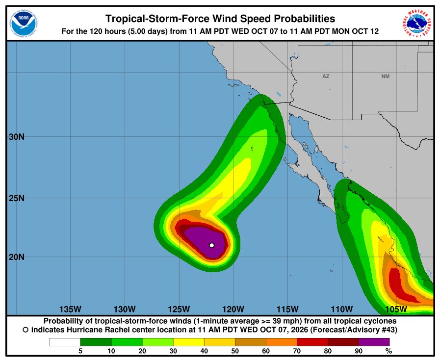
NHC wind-chance chart for Rachel, Advisory 43. Cabo / La Paz stay under 3%. NHC lists no hazards for our area from Rachel or Simon. Simon's flooding rain is forecast for southwestern mainland Mexico. SMN shows showers in BCS now and heavier rain in southern BCS on Sunday, with seas about 2-3 m on the west coast Friday to Sunday, so stay careful near arroyos and in the ocean. The next complete advisories are due at 8:00 PM MST Wednesday. The live official-source panel above may update before this written report.
-
Superseded by Advisory 43 (Rachel 43 / Simon 2). Newer update above.
Rachel still Category 1 and moving away, now aimed at the northern Baja coast early Sunday as a weak low, far from us; new Tropical Depression Twenty-E forms far south of mainland Mexico and is the one to watch; corridor still outside every watch and warning; light SMN showers
- What changed: Rachel is still Category 1 at about 80 mph. It is about 775 miles west of the Baja tip and still moving away. Rachel's late track moved: NHC now brings its weak leftover low to the northern Baja Pacific coast early Sunday, about 650 miles northwest of Todos Santos, then inland over the southwestern U.S. on Monday. New: Tropical Depression Twenty-E formed this morning far south of mainland Mexico. Todos Santos, Pescadero, and Cerritos stay outside every watch and warning.
- What this means here: Rachel is still not a storm threat for Todos Santos, Pescadero, or Cerritos. Twenty-E is not a storm threat for our towns today. It is about 890 miles southeast of us. NHC's path keeps it near the mainland coast, east of us across the Gulf. It is five days out, so it is the one to watch. Lead local prep with SMN: light scattered showers today through Saturday (about 0.2–1 in / 5-25 mm a day) and seas about 3–7 ft / 1-2 m. Soft arroyos after Polo and rough surf are the local story.
- Stronger or weaker: Rachel is about the same as Advisory 41 — still 80 mph and 979 mb. NHC expects it to drop to tropical-storm strength by about Thursday morning and keep weakening. Twenty-E is the opposite: NHC expects it to become a tropical storm tonight and a hurricane by about Friday, and to keep growing through the weekend over very warm water.
- Path and timing: Rachel moves west-northwest at about 7 mph. Late this week it should slow, turn northeast, and speed toward northern Baja California and southern California — far northwest of us. Twenty-E moves west-northwest at about 8 mph, then turns north this weekend along the mainland coast (Jalisco to Nayarit). NHC's Monday point is near the Islas Marías, about 225 miles east-southeast of Cabo San Lucas. Five-day paths can shift. We will check each new advisory.
- Wind chance: Rachel: Cabo / La Paz stay under 3%. Twenty-E: NHC gives Cabo San Lucas 7%, San José del Cabo 8%, and La Paz 4% odds of tropical-storm-force winds by Monday. That is small, but it is new. NHC does not list Todos Santos separately.
- Windy + multi-source: NHC, SMN, Proteccion Civil BCS, and Windy agree: no corridor watch or warning. SMN's newest forecast came out before Twenty-E formed; it still shows light showers for BCS. Open-Meteo wave model near Pescadero (earlier labeled Windy in error): about 1.6 m / 5 ft now, near 1.8 m through Saturday, then building to about 2.9 m / 9 ft late Sunday into Monday. Proteccion Civil BCS: no new storm notice this check. NHC is official for watches.
- Do now: Expect light showers. Do not drive flooded arroyos. Stay out of rough surf; bigger surf is likely Sunday night and Monday. No storm prep is needed today. Check back Thursday for Twenty-E. Next complete NHC advisories ~2:00 PM MST.
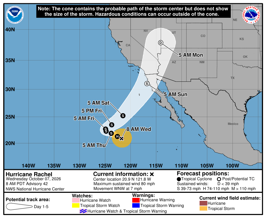
Official NHC cone for Rachel, 8:00 AM Wednesday. It shows the likely path of the center, not every area that can get rain, wind, or surf. The weekend part bends northeast to the northern Baja coast and the southwestern U.S., far north of us. Our corridor stays outside the cone. 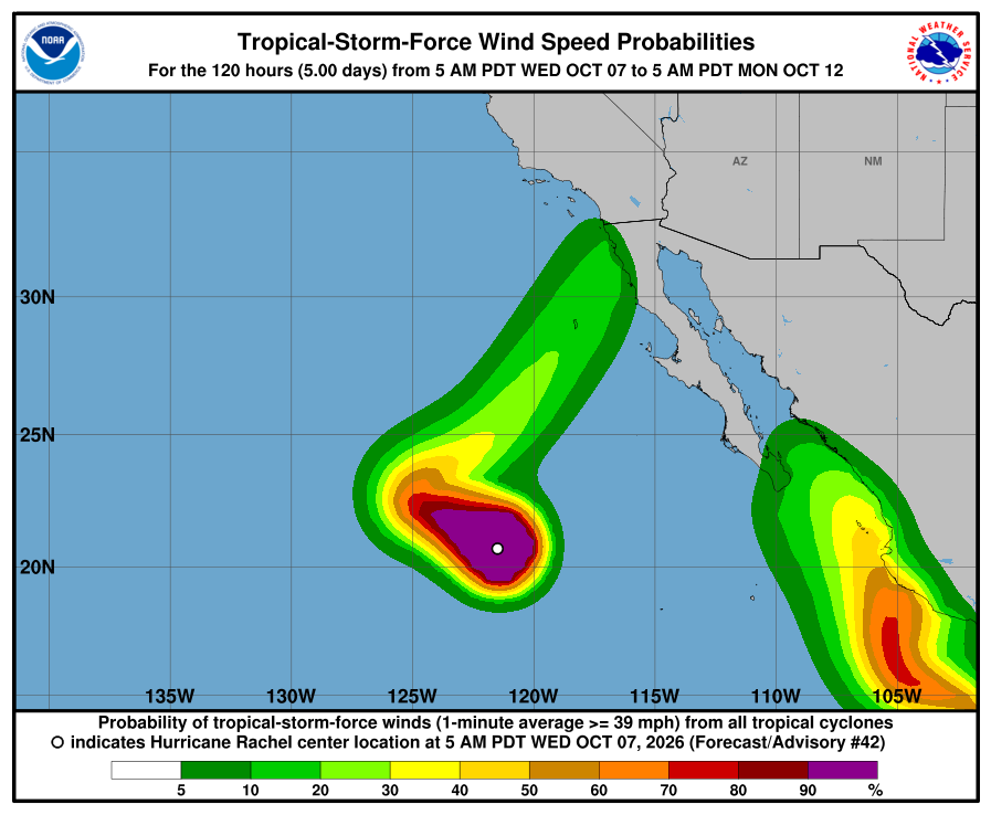
NHC wind-chance chart for Rachel, Advisory 42. Cabo / La Paz stay under 3%. 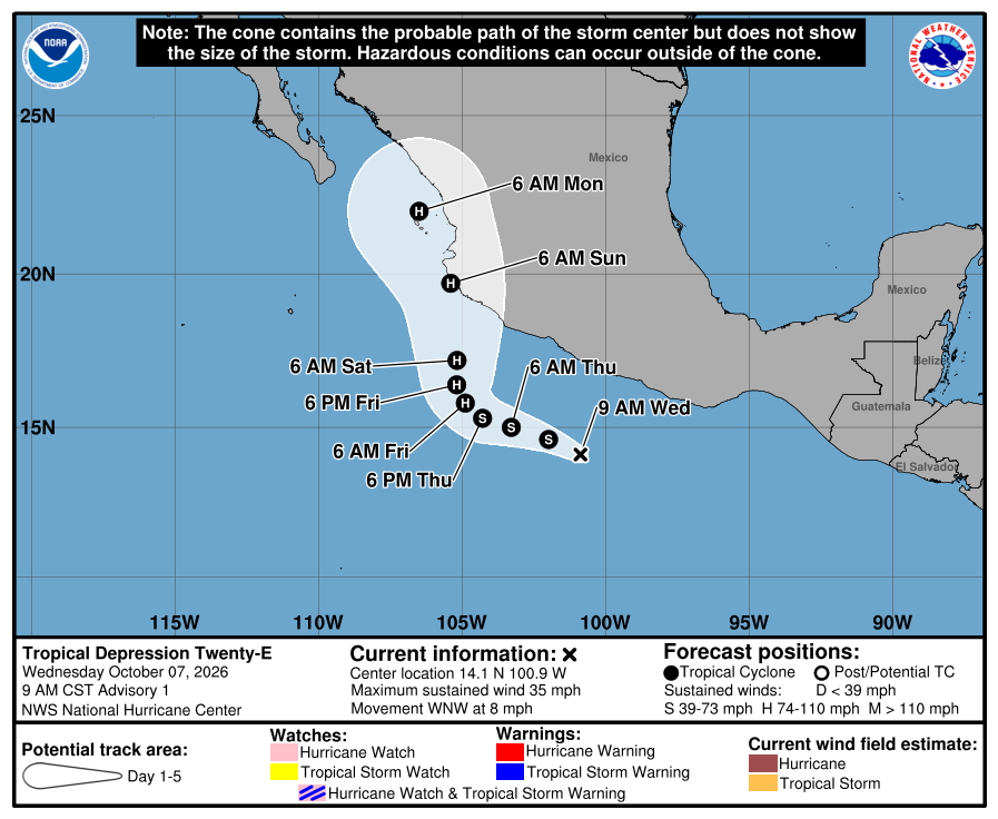
Official NHC cone for Twenty-E, Advisory 1. The path turns north along the mainland coast this weekend, east of the Baja tip. It is five days out and can shift. Check the newest NHC graphic. 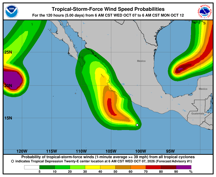
NHC wind-chance chart for Twenty-E, Advisory 1. Cabo San Lucas 7%, San José del Cabo 8%, La Paz 4% by Monday. Small, but new. It is not a landfall forecast for Todos Santos. NHC lists no hazards affecting land for Rachel or Twenty-E. SMN still shows light showers in BCS and seas about 1-2 m on the west coast, so stay careful near arroyos and in the ocean. The next complete advisories are due at 2:00 PM MST Wednesday. The live official-source panel above may update before this written report.
-
Rachel holds at 80 mph, still Category 1, moving farther from Baja; NHC now expects it to fall apart after a weekend turn inland over northern Baja California or southern California, far from our corridor; corridor still outside every watch and warning; lighter SMN showers today
- What changed: Rachel is still Category 1 at about 80 mph. It is farther from Baja — about 740 miles west of the tip — and still moving away. Todos Santos, Pescadero, and Cerritos stay outside every watch and warning. New: NHC now expects it to fall apart after a weekend turn far north of us.
- What this means here: Rachel is still not a storm threat for Todos Santos, Pescadero, or Cerritos. It is far offshore and moving away. Lead local prep with SMN: lighter scattered showers today (about 0.2–1 in / 5-25 mm) and seas about 3–7 ft / 1-2 m. Soft arroyos after Polo and rough surf are the local story — not a hurricane hit in town.
- Stronger or weaker: About the same as Advisory 40 — still 80 mph and 979 mb. NHC expects it to keep weakening, to tropical-storm strength by about tonight, then a weak post-tropical low by Saturday night, then fall apart inland by Sunday night.
- Path and timing: Moving west-northwest at about 7 mph, farther from Baja. Late this week NHC turns it northeast toward northern Baja California and southern California — far northwest of our corridor. That weekend turn is the least certain part.
- Wind chance: Cabo / La Paz stay under 3%. NHC does not list Todos Santos separately.
- Windy + multi-source: NHC, SMN, Proteccion Civil BCS, and Windy agree: no corridor watch or warning. Seas stay elevated near Pescadero — treat the ocean as rough. Proteccion Civil BCS: no new storm notice this check.
- Do now: Expect light showers. Do not drive flooded arroyos. Stay out of rough surf.
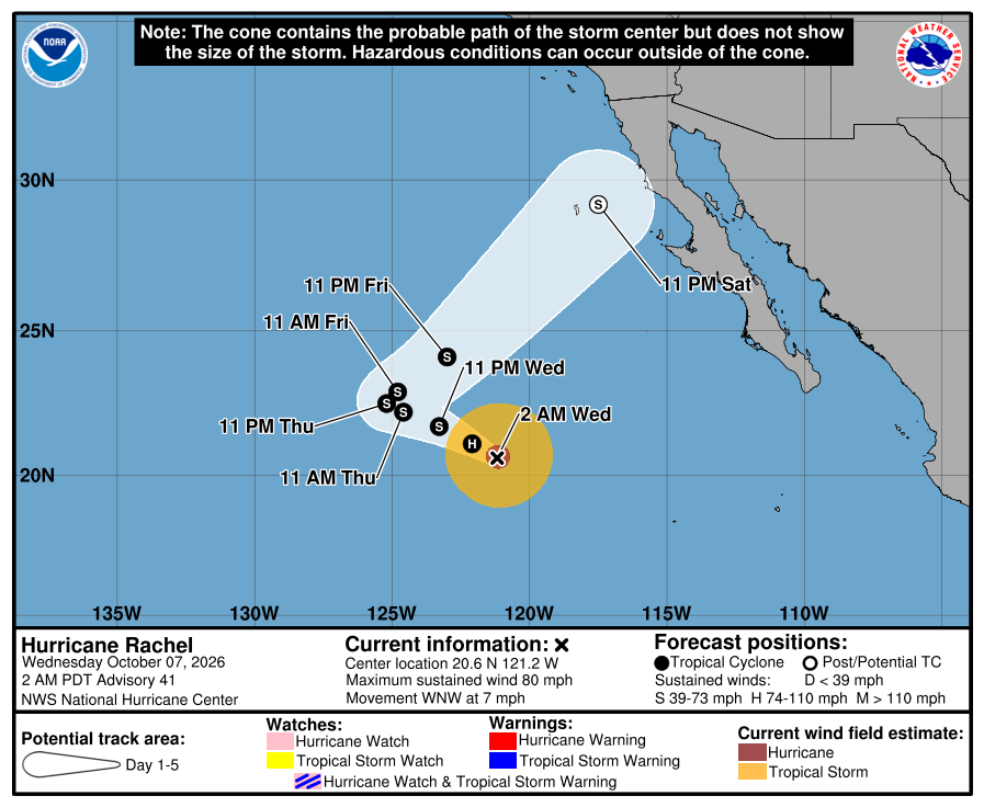
Official NHC cone, 2:00 AM Wednesday. It shows the forecast area for Rachel's center, not all areas at risk of rain, wind, surf, or flooding. The weekend part of the cone bends northeast, and its far end touches the northern Baja Pacific coast, far north of us. Our corridor stays outside the cone and outside all watches and warnings. Check the newest NHC graphic. 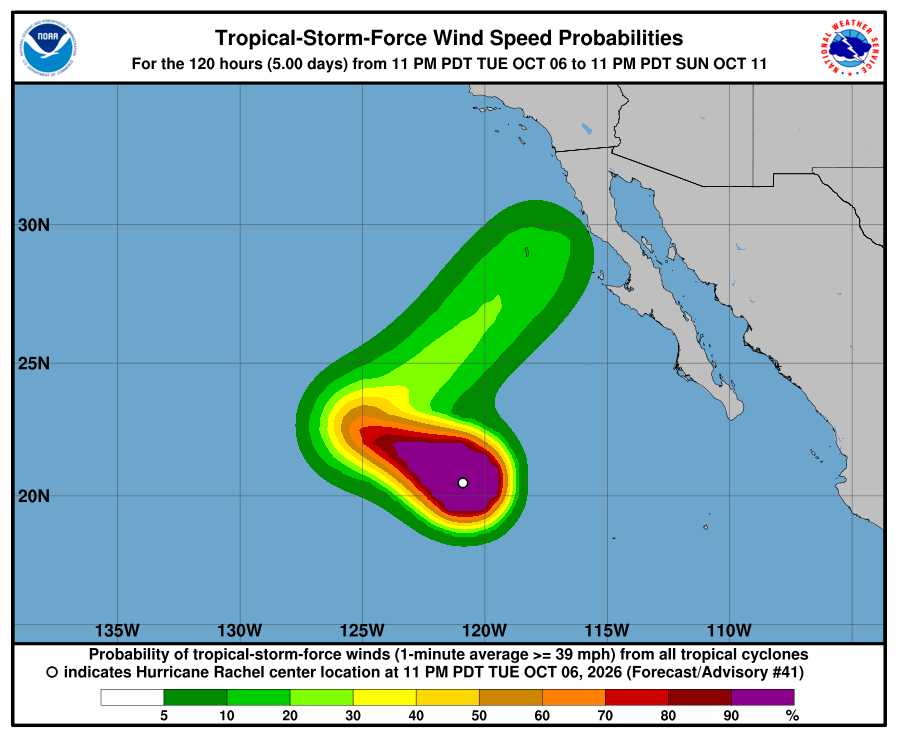
NHC wind-chance chart, Advisory 41. Cabo / La Paz listing stays under 3%. Use this with the cone — it is not a landfall forecast for Todos Santos. NHC's Advisory 41 lists no hazards affecting land. SMN still shows scattered showers today in BCS and seas about 1-2 m on the west coast of BCS, so stay careful near arroyos and in the ocean. The next complete advisory was due at 8:00 AM MST Wednesday (see Advisory 42 above). Advisory 42 above supersedes this earlier Wednesday 2 AM report. The live official-source panel above may update before this written report.
-
Rachel holds at 80 mph, still Category 1, moving west-northwest and farther from Baja; weekend turn still points at the northern Baja peninsula and southern California as a weak post-tropical low, far from our corridor; corridor still outside every watch and warning; SMN rain tonight, lighter Wednesday
- What changed: Little change for our corridor. NHC Advisory 40 shows Hurricane Rachel holding at winds near 80 mph, still Category 1, pressure 979 mb (both unchanged). Rachel is moving west-northwest (285 degrees) at 6 mph (was west at 7). The center is about 695 miles west-southwest of the southern tip of Baja California (was about 675 miles), near 20.4N 120.4W. There are still no coastal watches or warnings, and NHC still lists no hazards affecting land. Hurricane-force winds extend outward up to 35 miles (unchanged); tropical-storm-force winds up to 140 miles (unchanged). Discussion: storms have spread a little over the north side, but the strongest storms stay on the south side because wind shear from the northeast is pulling dry air into the north side. Intensity held at 70 kt. Forecast: INIT 70 kt → 12h 65 → 24h 60 → 36h 55 → 48h 50 → 60h 40 → 72h 40 → 96h 40 (post-tropical) → 120h 35 (post-tropical). NHC made little change to the track and the strength forecast.
- What this means here: Rachel is far out at sea and does not change the risk for our towns. Lead local prep with SMN: tonight and early Wednesday, heavy showers with lightning about 25-50 mm / ~1-2 in are still possible in central and southern BCS (SMN issue 558, 6:00 PM Mexico City time today). Wednesday looks lighter: showers about 5-25 mm / ~0.2-1 in with lightning across BCS, and seas about 1-2 m / ~3-7 ft on the west coast of BCS. Thursday through Saturday stay at about 5-25 mm of showers (SMN four-day outlook issue 279, unchanged). Todos Santos, Pescadero, and Cerritos remain outside any hurricane or tropical-storm watch or warning. Rachel is not heading toward our corridor. The weekend turn points at the northern Baja peninsula and southern California, about 560 miles northwest of Todos Santos at NHC's Sunday 5 PM point, and NHC expects Rachel to be a weak post-tropical low (about 40-45 mph) by then. Local risk is rain tonight, soft arroyos after Polo, and rough seas — not a named-storm landfall in town. The system south of southern Mexico (92E, 90%/48h, 90%/7d) is also not heading toward the corridor.
- Stronger or weaker: About the same as Advisory 39: winds 80 mph and pressure 979 mb, both unchanged. NHC says dry air and cooler water ahead, and stronger wind shear after the turn, should keep Rachel weakening steadily. NHC still expects Rachel to drop below hurricane strength by about Wednesday morning and to become post-tropical by Saturday (both unchanged).
- Path and timing: Near 20.4N 120.4W, moving west-northwest (285 degrees) at 6 mph. High pressure over the western United States keeps steering Rachel west-northwest for the next couple of days, farther from Baja. Late this week a large trough (a dip in the upper-level winds) coming from the northwest should slow Rachel and turn it sharply northeast, then speed it up toward the northern Baja California peninsula and southern California. NHC made little change to the track. NHC still expects Rachel to become a weak post-tropical low by Saturday. NHC's last forecast point, Sunday 5 PM, is near 29.6N 116.1W, about 40 mph. That point is about 40 miles off the northern Baja Pacific coast near El Rosario and about 560 miles northwest of Todos Santos. It is later in time than Advisory 39's last point (Sunday 11 AM, about 545 miles northwest of us), so it sits farther north. The far end of the cone now covers part of the northern Baja peninsula on Sunday. That far-out part of the forecast is the least certain. The cone is not an impact boundary. All of Rachel's strong winds are far southwest of our towns. We will check each new advisory for any change in the weekend turn.
- Wind chance: NHC five-day tropical-storm-force wind odds for Cabo San Lucas, San José del Cabo, and La Paz stay under the 3% listing threshold (none listed). Isla Guadalupe, far to the north off northern Baja, is at 6% by Sunday (was 8%). Punta Eugenia, on the central Baja Pacific coast about 430 miles northwest of us, is at 6% by Sunday (was 5%). NHC does not list Todos Santos separately.
- Windy vs NHC: Agree for our corridor. We checked Windy against NHC. Both keep Rachel offshore, with no corridor watch or warning. Near-Pescadero marine (Open-Meteo / Windy-style proxy) shows waves about 1.6 m now, about 1.6 m overnight and early Wednesday, then about 1.7-1.8 m Wednesday evening through Friday — still elevated. NHC lists no surf hazard for Baja in its advisory. SMN still shows seas about 1-2 m on the west coast of BCS Wednesday, and Windy still shows elevated waves near Pescadero. That is a difference in wording, not a watch conflict. Treat the ocean as rough until local waves come down. SMN's newest forecasts (issues 558 and 279) do not discuss Rachel; NHC's weekend turn is at the edge of SMN's four-day window. Multi-source NHC + SMN + Proteccion Civil BCS + Windy: agree on no corridor watch. Proteccion Civil BCS: no new storm notice found this check. The state government's newest posts are not about weather. The last storm-related notice said Los Cabos schools reopened Monday, Oct 5. NHC remains official for watches. No conflict for our corridor.
- Do now: Plan around SMN rain tonight (~25-50 mm / ~1-2 in); Wednesday looks lighter (~5-25 mm). Do not drive through flooded arroyos; ground is still soft after Polo. Stay out of rough surf. Our corridor is outside all hurricane and tropical-storm watches; Rachel is not heading toward Todos Santos, Pescadero, or Cerritos. If you plan travel to the northern Baja Pacific coast or southern California this weekend, check NHC again later in the week. Follow Proteccion Civil BCS for any local notices. Next complete NHC advisory is due at 2:00 AM MST Wednesday.
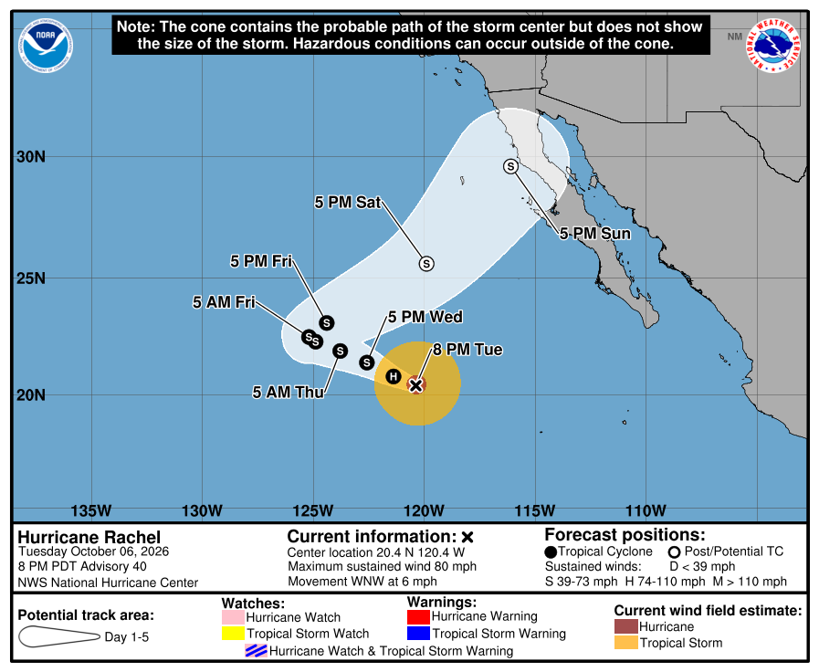
Official NHC cone, 8:00 PM Tuesday. It shows the forecast area for Rachel's center, not all areas at risk of rain, wind, surf, or flooding. The weekend part of the cone bends northeast, and its far end covers part of the northern Baja peninsula on Sunday, far north of us. Our corridor stays outside the cone and outside all watches and warnings. Check the newest NHC graphic. 
NHC wind-chance chart, Advisory 40. Cabo / La Paz listing stays under 3%. Use this with the cone — it is not a landfall forecast for Todos Santos. NHC's Advisory 40 lists no hazards affecting land. SMN still shows heavy showers possible tonight in central and southern BCS and seas about 1-2 m on the west coast of BCS Wednesday, so stay careful near arroyos and in the ocean. The next complete advisory was due at 2:00 AM MST Wednesday (see Advisory 41 above). Advisory 41 above supersedes this earlier Tuesday 8 PM report. The live official-source panel above may update before this written report.
-
Rachel slightly weaker at 80 mph, still Category 1, moving west and farther from Baja; weekend turn nudged slightly right toward the central Baja Pacific waters as a weak post-tropical low, far from our corridor; corridor still outside every watch and warning; SMN rain tonight, lighter Wednesday
- What changed: NHC Advisory 39 shows Hurricane Rachel slightly weaker, with winds near 80 mph (was 85), still Category 1, pressure 979 mb (was 977). Rachel is moving west (275 degrees) at 7 mph (was 8). The center is about 675 miles west-southwest of the southern tip of Baja California (was about 640 miles), near 20.5N 120.1W. There are still no coastal watches or warnings. Hurricane-force winds extend outward up to 35 miles (unchanged); tropical-storm-force winds up to 140 miles (unchanged). Discussion: wind shear from the northeast and dry air are eroding the north side of the storm; the eye is now open on the north side, and the strongest storms are mainly on the south side. Intensity lowered to 70 kt. Forecast: INIT 70 kt → 12h 65 → 24h 60 → 36h 55 → 48h 50 → 60h 40 → 72h 40 → 96h 40 (post-tropical) → 120h 35 (post-tropical). NHC nudged the end of the track slightly right and faster. New in this advisory: NHC no longer lists any hazards affecting land, including the Baja surf statement that Advisory 38 carried.
- What this means here: Rachel is far out at sea and does not change the risk for our towns. Lead local prep with SMN: this afternoon and tonight (through about 7 AM Wednesday), heavy showers with lightning about 25-50 mm / ~1-2 in are still possible in central and southern BCS, with seas about 2-3 m / ~7-10 ft on the west coast of BCS (SMN four-day outlook issue 279, 2:00 PM Mexico City time today; same as the morning forecast, issue 557). New in SMN issue 279: Wednesday rain is now lower, about 5-25 mm / ~0.2-1 in of showers across BCS (was 25-50 mm in southern BCS), with seas about 1-2 m / ~3-7 ft on the west coast of the peninsula. Thursday through Saturday stay at about 5-25 mm of showers. Todos Santos, Pescadero, and Cerritos remain outside any hurricane or tropical-storm watch or warning. Rachel is not heading toward our corridor. The weekend turn points at the waters off the central Baja Pacific coast, about 545 miles northwest of Todos Santos at NHC's Sunday point, and NHC expects Rachel to be a weak post-tropical low (about 40-45 mph) by then. Local risk is rain tonight, soft arroyos after Polo, and rough seas — not a named-storm landfall in town. The system south of southern Mexico (92E, 90%/48h, 90%/7d) is also not heading toward the corridor.
- Stronger or weaker: Weaker than Advisory 37 and 38: winds down from 85 to 80 mph; pressure up from 977 to 979 mb; the storm's cloud tops are warming and its north side is falling apart. NHC says dry, stable air and cooler water ahead should keep Rachel weakening steadily. NHC now expects Rachel to drop below hurricane strength by about Wednesday morning (about half a day sooner) and to become post-tropical by about Saturday morning (unchanged).
- Path and timing: Near 20.5N 120.1W, moving west (275 degrees) at 7 mph. A high-pressure ridge over the western United States keeps steering Rachel west to west-northwest for the next couple of days, farther from Baja. Late this week a trough (a dip in the upper-level winds) near the U.S. west coast should slow Rachel, turn it sharply northeast, and then speed it up. NHC nudged the end of the track slightly to the right and faster. NHC still expects Rachel to become a weak post-tropical low by about Saturday morning. NHC's Sunday 11 AM point is near 28.5N 117.0W, about 40 mph. That point is about 545 miles northwest of Todos Santos and about 125 miles off Punta Eugenia on the central Baja Pacific coast (Advisory 38 had it about 260 miles off). The far end of the cone now reaches the Pacific coast of the northern half of the peninsula on Sunday. That far-out part of the forecast is the least certain. The cone is not an impact boundary. All of Rachel's strong winds are far southwest of our towns. We will check each new advisory for any change in the weekend turn.
- Wind chance: NHC five-day tropical-storm-force wind odds for Cabo San Lucas, San José del Cabo, and La Paz stay under the 3% listing threshold (none listed). Isla Guadalupe, far to the north off northern Baja, stays at 8% by Sunday. Punta Eugenia, on the central Baja Pacific coast about 430 miles northwest of us, is newly listed at 5% by Sunday. NHC does not list Todos Santos separately.
- Windy vs NHC: Agree for our corridor. We checked Windy against NHC. Both keep Rachel offshore, with no corridor watch or warning. Near-Pescadero marine (Open-Meteo / Windy-style proxy) shows waves about 1.7 m this afternoon, about 1.5 m tonight and early Wednesday, then about 1.7 m Wednesday afternoon through Friday — still elevated. NHC no longer lists a surf hazard for Baja in its advisory (Advisory 38 still did). SMN still shows seas about 2-3 m on the west coast of BCS tonight, and Windy still shows elevated waves near Pescadero. That is a difference in wording, not a watch conflict. Treat the ocean as rough until local waves come down. SMN's newest outlook (issue 279) does not discuss Rachel; NHC's weekend turn is at the edge of SMN's four-day window. Multi-source NHC + SMN + Proteccion Civil BCS + Windy: agree on no corridor watch. Proteccion Civil BCS: no new storm notice found this check. The state government's only new safety post today is a general search protocol for natural disasters, not a Rachel alert. The last storm-related notice said Los Cabos schools reopened Monday, Oct 5. NHC remains official for watches. No conflict for our corridor.
- Do now: Plan around SMN rain tonight (~25-50 mm / ~1-2 in); Wednesday looks lighter (~5-25 mm). Do not drive through flooded arroyos; ground is still soft after Polo. Stay out of rough surf. Our corridor is outside all hurricane and tropical-storm watches; Rachel is not heading toward Todos Santos, Pescadero, or Cerritos. If you plan travel to the central or northern Baja Pacific coast this weekend, check NHC again later in the week. Follow Proteccion Civil BCS for any local notices. Next complete NHC advisory is due at 8:00 PM MST.
Official NHC cone, 2:00 PM Tuesday. It shows the forecast area for Rachel's center, not all areas at risk of rain, wind, surf, or flooding. The weekend part of the cone bends northeast, and its far end now reaches the Pacific coast of the central and northern peninsula on Sunday, far north of us. Our corridor stays outside the cone and outside all watches and warnings. Check the newest NHC graphic. 
NHC wind-chance chart, Advisory 39. Cabo / La Paz listing stays under 3%. Use this with the cone — it is not a landfall forecast for Todos Santos. NHC's Advisory 39 lists no hazards affecting land. SMN still shows rough seas (about 2-3 m) on the west coast of BCS tonight, so stay careful in the ocean. The next complete advisory was due at 8:00 PM MST Tuesday (see Advisory 40 above). Advisory 40 above supersedes this earlier Tuesday 2 PM report. The live official-source panel above may update before this written report.
-
Rachel holds at 85 mph, still Category 1, moving west and farther from Baja; NHC now expects a weak post-tropical low by Saturday, with the weekend turn far from our corridor; corridor still outside every watch and warning; SMN rain today; Baja surf for the next several days
- What changed: NHC Advisory 38 shows Hurricane Rachel holding at winds near 85 mph (unchanged), still Category 1, pressure 977 mb (was 976). Rachel is moving west (275 degrees) at 8 mph (unchanged). The center is about 640 miles west-southwest of the southern tip of Baja California (was about 585 miles), near 20.5N 119.5W. There are still no coastal watches or warnings. Hurricane-force winds extend outward up to 35 miles (was 40); tropical-storm-force winds up to 140 miles (was 150). Discussion: the inner core is weaker, with a large, ragged eye, and the strongest storms are mainly on the south side because of wind shear from the northeast and drier air. Intensity held at 75 kt. Forecast: INIT 75 kt → 12h 75 → 24h 70 → 36h 60 → 48h 55 → 60h 50 → 72h 45 → 96h 40 (post-tropical) → 120h 35 (post-tropical). New in this discussion: NHC now expects Rachel to become post-tropical by 96 hours (about Saturday morning), one day sooner than in Advisory 37.
- What this means here: Rachel is far out at sea and does not change the risk for our towns. Lead local prep with SMN: today, Tuesday, heavy showers with lightning about 25-50 mm / ~1-2 in are possible in central and southern BCS, and seas about 2-3 m / ~7-10 ft on the west coast of BCS (SMN issue 557, 6:00 AM Mexico City time today, still the newest; same numbers as Monday night). SMN's four-day outlook (issue 278, unchanged) still shows Wednesday rain about 25-50 mm / ~1-2 in in southern BCS with seas about 1-2 m / ~3-7 ft, then lighter rain about 5-25 mm Thursday and Friday. Todos Santos, Pescadero, and Cerritos remain outside any hurricane or tropical-storm watch or warning. Rachel is not heading toward our corridor. The weekend turn points at the waters off the northern part of the peninsula, about 640 miles west-northwest of Todos Santos at NHC's Sunday-morning point, and NHC expects Rachel to be a weak post-tropical low (about 40-45 mph) by then. Local risk is rain, soft arroyos after Polo, plus life-threatening swell along the Baja California Peninsula for the next several days — not a named-storm landfall in town. The system south of southern Mexico (92E, 90%/48h, 90%/7d) is also not heading toward the corridor.
- Stronger or weaker: About the same as Advisory 37: winds steady at 85 mph; still Category 1; pressure up slightly from 976 to 977 mb; wind field a little smaller. NHC says drier, more stable air, wind shear from the northeast, and water cooling below 26°C in about a day should make Rachel weaken steadily. NHC expects Rachel to drop below hurricane strength by about Wednesday evening and to become post-tropical by about Saturday morning.
- Path and timing: Near 20.5N 119.5W, moving west (275 degrees) at 8 mph. A high-pressure ridge keeps steering Rachel west to west-northwest for the next several days, farther from Baja. Late this week a trough (a dip in the upper-level winds) near the U.S. west coast should slow Rachel and turn it sharply northeast, then speed it up. NHC now expects Rachel to become a weak post-tropical low one day sooner, by about Saturday morning. NHC's Sunday-morning point is near 27.7N 119.3W, about 40 mph — still out at sea, about 640 miles west-northwest of Todos Santos and about 260 miles off the central Baja Pacific coast. That far-out part of the forecast is the least certain. NHC says its track is very similar to the last advisory. The cone is not an impact boundary. Hurricane-force winds extend outward up to 35 miles; tropical-storm-force winds up to 140 miles — all far southwest of our towns. We will check each new advisory for any change in the weekend turn.
- Wind chance: NHC five-day tropical-storm-force wind odds for Cabo San Lucas, San José del Cabo, and La Paz stay under the 3% listing threshold (none listed). Isla Guadalupe, far to the north off northern Baja, is now listed at 8% by Sunday (was 4%). NHC does not list Todos Santos separately.
- Windy vs NHC: Agree for our corridor. We checked Windy against NHC. Both keep Rachel offshore, with no corridor watch or warning. Near-Pescadero marine (Open-Meteo / Windy-style proxy) shows waves about 1.7 m this morning, easing to about 1.5-1.6 m tonight and Wednesday morning, then about 1.7 m Thursday — still elevated, which agrees with the NHC surf hazard. SMN west-coast BCS seas (~2-3 m today; ~1-2 m Wednesday) remain a higher Mexico marine number (swell-size difference, not a watch conflict). SMN's newest forecast (issue 557) does not discuss Rachel; NHC's weekend turn is beyond SMN's four-day window. Multi-source NHC + SMN + Proteccion Civil BCS + Windy: agree on no corridor watch; NHC's land hazard for Baja remains mainly dangerous surf. Proteccion Civil BCS: no new storm notice found this check (the state government's newest posts are not about weather); the last storm-related notice said Los Cabos schools reopened Monday, Oct 5. NHC remains official for watches. No conflict for our corridor.
- Do now: Plan around SMN rain today (~25-50 mm / ~1-2 in) and more rain possible Wednesday. Do not drive through flooded arroyos; ground is still soft after Polo. Stay out of the ocean: dangerous swell for the next several days. Our corridor is outside all hurricane and tropical-storm watches; Rachel is not heading toward Todos Santos, Pescadero, or Cerritos. If you plan travel to the northern Baja Pacific coast this weekend, check NHC again later in the week. Follow Proteccion Civil BCS for any local notices. Next complete NHC advisory is due at 2:00 PM MST.
Official NHC cone, 8:00 AM Tuesday. It shows the forecast area for Rachel's center, not all areas at risk of rain, wind, surf, or flooding. The weekend part of the cone bends northeast toward the waters off northern Baja, far north of us. Our corridor stays outside the cone and outside all watches and warnings. Check the newest NHC graphic. 
NHC wind-chance chart, Advisory 38. Cabo / La Paz listing stays under 3%. Use this with the cone — it is not a landfall forecast for Todos Santos. NHC says swells from Rachel will keep affecting the Baja California Peninsula and parts of southern California for the next several days, with life-threatening surf. The next complete advisory was due at 2:00 PM MST Tuesday (see Advisory 39 above). Advisory 39 above supersedes this earlier Tuesday 8 AM report. The live official-source panel above may update before this written report.
-
Rachel weakens a little to 85 mph, still Category 1, moving west and farther from Baja; weekend turn toward northern Baja as a weak low, far from our corridor; corridor still outside every watch and warning; SMN rain today; Baja surf for the next several days
- What changed: NHC Advisory 37 shows Hurricane Rachel a little weaker — winds near 85 mph (was 90), still Category 1, pressure 976 mb (was 973). Rachel is moving west (270 degrees) at 8 mph (was 9 mph). The center is about 585 miles west-southwest of the southern tip of Baja California (was about 540 miles), near 20.3N 118.6W. There are still no coastal watches or warnings. Hurricane-force winds extend outward up to 40 miles (unchanged); tropical-storm-force winds up to 150 miles (was 140). Discussion: the eye is now hidden by cloud and the storms around it are weaker, mainly on the west side. Intensity lowered to 75 kt. Forecast: INIT 75 kt → 12h 75 → 24h 70 → 36h 65 → 48h 60 → 60h 55 → 72h 50 → 96h 40 → 120h 35 (post-tropical). New in this discussion: NHC says Rachel should turn sharply northeast late in the week and speed up toward the northern Baja California Peninsula over the weekend as a weak post-tropical low.
- What this means here: Rachel is far out at sea and does not change the risk for our towns. Lead local prep with SMN: today, Tuesday, heavy showers with lightning about 25-50 mm / ~1-2 in are possible in central and southern BCS, and seas about 2-3 m / ~7-10 ft on the west coast of BCS (SMN issue 556, 6:00 PM Mexico City time Monday, still the newest; next SMN issue due ~6:00 AM Mexico City time). SMN's four-day outlook (issue 278, unchanged) still shows Wednesday rain about 25-50 mm / ~1-2 in in southern BCS with seas about 1-2 m / ~3-7 ft, then lighter rain about 5-25 mm Thursday and Friday. Todos Santos, Pescadero, and Cerritos remain outside any hurricane or tropical-storm watch or warning. Rachel is not heading toward our corridor. The weekend turn points at the northern part of the peninsula, more than 600 miles northwest of Todos Santos, and NHC expects Rachel to be weak (about 40 mph, post-tropical) by then. Local risk is rain, soft arroyos after Polo, plus life-threatening swell along the Baja California Peninsula for the next several days — not a named-storm landfall in town. The system south of southern Mexico (92E, 80%/48h, 90%/7d) is also not heading toward the corridor.
- Stronger or weaker: Weaker than Advisory 36: winds down from 90 to 85 mph; still Category 1; pressure up from 973 to 976 mb. NHC says drier, more stable air, wind shear from the east, and cooler water should make Rachel weaken steadily. NHC expects Rachel to drop below hurricane strength by about Wednesday night and to become post-tropical by Saturday night.
- Path and timing: Near 20.3N 118.6W, moving west (270 degrees) at 8 mph. A high-pressure ridge keeps steering Rachel west to west-northwest for the next few days, farther from Baja. Late this week a trough (a dip in the upper-level winds) near the U.S. west coast should slow Rachel and turn it sharply northeast. NHC now says it should then speed up toward the northern Baja California Peninsula over the weekend, as a weak post-tropical low near 40 mph. NHC's Saturday-night point is near 26.9N 119.5W — still out at sea, and more than 600 miles northwest of Todos Santos. That far-out part of the forecast is the least certain. NHC says its track is very similar to the last advisory. The cone is not an impact boundary. Hurricane-force winds extend outward up to 40 miles; tropical-storm-force winds up to 150 miles — all far southwest of our towns. We will check each new advisory for any change in the weekend turn.
- Wind chance: NHC five-day tropical-storm-force wind odds for Cabo San Lucas, San José del Cabo, and La Paz stay under the 3% listing threshold (none listed). Isla Guadalupe, far to the north off northern Baja, is now listed at 4% by Sunday. NHC does not list Todos Santos separately.
- Windy vs NHC: Agree for our corridor. We checked Windy against NHC. Both keep Rachel offshore, with no corridor watch or warning. Near-Pescadero marine (Open-Meteo / Windy-style proxy) shows waves about 1.7 m now, about 1.6 m Wednesday, then a small rise to about 1.8 m Thursday — still elevated, which agrees with the NHC surf hazard. SMN west-coast BCS seas (~2-3 m today; ~1-2 m Wednesday) remain a higher Mexico marine number (swell-size difference, not a watch conflict). SMN still says Rachel is moving away from Mexico's coast; SMN's outlooks do not yet address NHC's weekend turn, which is beyond their four-day window. Multi-source NHC + SMN + Proteccion Civil BCS + Windy: agree on no corridor watch; NHC's land hazard for Baja remains mainly dangerous surf. Proteccion Civil BCS: no new storm notice found this check (the state government's newest posts are not about weather); the last storm-related notice said Los Cabos schools reopened Monday, Oct 5. NHC remains official for watches. No conflict for our corridor.
- Do now: Plan around SMN rain today (~25-50 mm / ~1-2 in) and more rain possible Wednesday. Do not drive through flooded arroyos; ground is still soft after Polo. Stay out of the ocean: dangerous swell for the next several days. Our corridor is outside all hurricane and tropical-storm watches; Rachel is not heading toward Todos Santos, Pescadero, or Cerritos. If you plan travel to the northern Baja Pacific coast this weekend, check NHC again later in the week. Follow Proteccion Civil BCS for any local notices. Next complete NHC advisory is due at 8:00 AM MST.
Official NHC cone, 2:00 AM Tuesday. It shows the forecast area for Rachel's center, not all areas at risk of rain, wind, surf, or flooding. The weekend part of the cone bends northeast toward the northern Baja coast, far north of us. Our corridor stays outside the cone and outside all watches and warnings. Check the newest NHC graphic. 
NHC wind-chance chart, Advisory 37. Cabo / La Paz listing stays under 3%. Use this with the cone — it is not a landfall forecast for Todos Santos. NHC says swells from Rachel will keep affecting the Baja California Peninsula and parts of southern California for the next several days, with life-threatening surf. The next complete advisory was due at 8:00 AM MST Tuesday (see Advisory 38 above). Advisory 38 above supersedes this earlier Tuesday 2 AM report. The live official-source panel above may update before this written report.
-
Rachel steady near 90 mph, still Category 1, moving west and farther from Baja; corridor still outside every watch and warning; SMN rain tonight and Tuesday; Baja surf for the next couple of days
- What changed: NHC Advisory 36 shows Hurricane Rachel at the same strength — winds near 90 mph, still Category 1, pressure 973 mb (both unchanged from Advisory 35). Rachel is moving west (270 degrees) at 9 mph (was 8 mph). The center is about 540 miles west-southwest of the southern tip of Baja California (was about 495 miles), near 20.4N 117.9W. There are still no coastal watches or warnings. Hurricane-force winds extend outward up to 40 miles; tropical-storm-force winds up to 140 miles (both unchanged). Discussion: Rachel looks far less impressive on satellite than earlier today — the eye is filling in again and the storms around it are uneven. Intensity held at 80 kt. Forecast: INIT 80 kt → 12h 80 → 24h 75 → 36h 70 → 48h 65 → 60h 60 → 72h 55 → 96h 45 → 120h 35 (post-tropical).
- What this means here: Rachel is far out at sea and does not change the risk for our towns. Lead local prep with SMN: tonight and Tuesday, heavy showers with lightning about 25-50 mm / ~1-2 in are possible in central and southern BCS, and seas about 2-3 m / ~7-10 ft on the west coast of BCS on Tuesday (SMN issue 556, 6:00 PM Mexico City time, still the newest). SMN's four-day outlook (issue 278, unchanged) still shows Wednesday rain about 25-50 mm / ~1-2 in in southern BCS with seas about 1-2 m / ~3-7 ft, then lighter rain about 5-25 mm Thursday and Friday. Todos Santos, Pescadero, and Cerritos remain outside any hurricane or tropical-storm watch or warning. Rachel is not heading toward our corridor — it is moving west, away from Baja, about 540 miles from the Baja tip. Local risk is rain, soft arroyos after Polo, plus life-threatening swell along the Baja California Peninsula for the next couple of days — not a named-storm landfall in town. The system near the Gulf of Tehuantepec (92E, 70%/48h, 90%/7d) is also not heading toward the corridor.
- Stronger or weaker: About the same as Advisory 35: winds stay at 90 mph; still Category 1; pressure stays at 973 mb. NHC says its strength may go up and down a little over the next day or so, then Rachel should weaken slowly as it moves over much cooler water and into drier air. NHC still expects Rachel to lose its tropical structure (post-tropical) by Saturday.
- Path and timing: Near 20.4N 117.9W, moving west (270 degrees) at 9 mph. A high-pressure area to the north-northeast keeps steering Rachel west to west-northwest for the next several days, farther from Baja. Late in the week that high weakens and a trough (a dip in the upper-level winds) near the U.S. west coast should slow Rachel and turn it northeast — but by then it should be far to the west, near 122-126W (more than 750 miles from our coast) and weak. NHC made only small changes to the track. That far-out part is less certain; we will keep checking each advisory. The cone is not an impact boundary. Hurricane-force winds extend outward up to 40 miles; tropical-storm-force winds up to 140 miles — all far southwest of our towns.
- Wind chance: NHC five-day tropical-storm-force wind odds for Cabo San Lucas, San José del Cabo, and La Paz stay under the 3% listing threshold (none listed; only open-ocean points far to the west are listed). NHC does not list Todos Santos separately.
- Windy vs NHC: Agree. We checked Windy against NHC. Both keep Rachel offshore and moving away from Baja, with no corridor watch or warning. Near-Pescadero marine (Open-Meteo / Windy-style proxy) shows waves about 1.8 m tonight, easing to about 1.7 m Tuesday and about 1.6 m Wednesday — slowly easing but still elevated, which agrees with the NHC surf hazard. SMN west-coast BCS seas (~2-3 m Tuesday; ~1-2 m Wednesday) remain a higher Mexico marine number (swell-size difference, not a watch conflict). Multi-source NHC + SMN + Proteccion Civil BCS + Windy: agree on offshore track and no corridor watch; NHC's land hazard for Baja remains mainly dangerous surf. Proteccion Civil BCS: no new storm notice found this check (the state government's newest posts today are not about weather); the last storm-related notice said Los Cabos schools reopen today, Monday Oct 5. NHC remains official for watches. No track conflict.
- Do now: Plan around SMN rain tonight and Tuesday (~25-50 mm / ~1-2 in) and more rain possible Wednesday. Do not drive through flooded arroyos; ground is still soft after Polo. Stay out of the ocean: dangerous swell for the next couple of days. Our corridor is outside all hurricane and tropical-storm watches; Rachel is not heading toward Todos Santos, Pescadero, or Cerritos. Follow Proteccion Civil BCS for any local notices. Next complete NHC advisory is due at 2:00 AM MST Tuesday.
Official NHC cone, 8:00 PM Monday. It shows the forecast area for Rachel's center, not all areas at risk of rain, wind, surf, or flooding. Our corridor stays outside the cone and outside all watches and warnings. Check the newest NHC graphic. 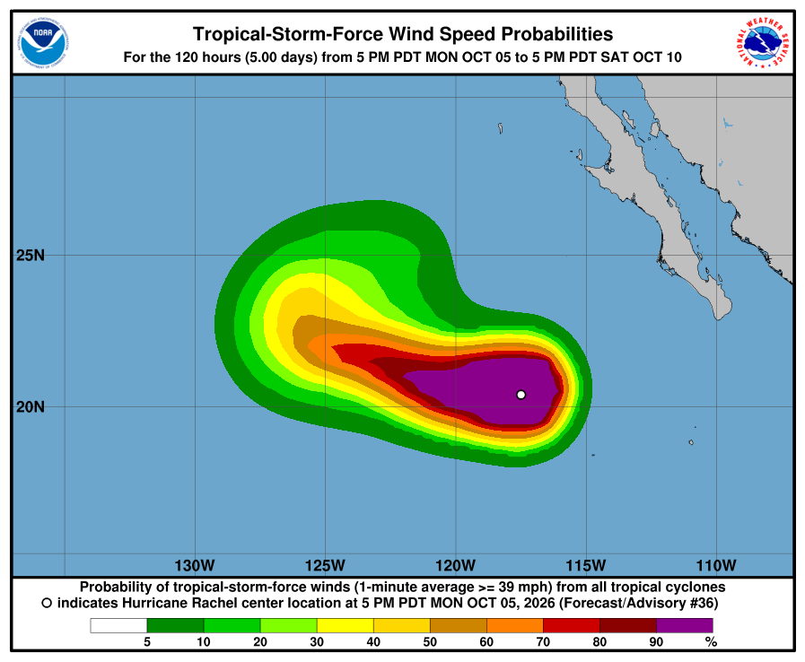
NHC wind-chance chart, Advisory 36. Cabo / La Paz listing stays under 3%. Use this with the cone — it is not a landfall forecast for Todos Santos. NHC says swells from Rachel will keep affecting the Baja California Peninsula for the next couple of days, with life-threatening surf. The next complete advisory was due at 2:00 AM MST Tuesday (see Advisory 37 above). Advisory 37 above supersedes this earlier Monday night report. The live official-source panel above may update before this written report.
-
Rachel a little stronger near 90 mph, still Category 1, moving west and farther from Baja; corridor still outside every watch and warning; Baja surf for the next couple of days
- What changed: NHC Advisory 35 shows Hurricane Rachel a little stronger — winds near 90 mph (was 85 mph), still Category 1, pressure 973 mb (was 976 mb). Rachel is moving west (265 degrees) at 8 mph (was 7 mph). The center is about 495 miles west-southwest of the southern tip of Baja California (was about 440 miles), near 20.3N 117.1W. There are still no coastal watches or warnings. Hurricane-force winds extend outward up to 40 miles; tropical-storm-force winds up to 140 miles (both unchanged). Discussion: the weakening trend has paused for now; Rachel has a large, well-defined eye with storms fairly even around it. Intensity raised to 80 kt (was 75). Forecast: INIT 80 kt → 12h 80 → 24h 75 → 36h 70 → 48h 65 → 60h 60 → 72h 55 → 96h 45 → 120h 35 (post-tropical).
- What this means here: The small strengthening is far out at sea and does not change the risk for our towns. Lead local prep with SMN: today, Monday, showers and locally heavy rain with lightning about 25-50 mm / ~1-2 in in central and southern BCS, gusts near 30-50 km/h, and seas about 2.5-3.5 m / ~8-12 ft on the south coast of BCS (SMN issue 555, still the newest). SMN's new four-day outlook (issue 278, 2:00 PM Mexico City time) shows Wednesday rain about 25-50 mm / ~1-2 in in southern BCS with seas about 1-2 m / ~3-7 ft, then lighter rain about 5-25 mm Thursday and Friday. Todos Santos, Pescadero, and Cerritos remain outside any hurricane or tropical-storm watch or warning. Rachel is not heading toward our corridor — it is moving west, away from Baja, about 495 miles from the Baja tip. Local risk is rain, soft arroyos after Polo, plus life-threatening swell along the Baja California Peninsula for the next couple of days — not a named-storm landfall in town. The system near the Gulf of Tehuantepec (92E, 60%/48h, 90%/7d) is also not heading toward the corridor.
- Stronger or weaker: A little stronger than Advisory 34: winds 85 → 90 mph; still Category 1; pressure 976 → 973 mb. NHC made no notable change to its strength forecast: about the same for the next 12 hours, then gradual weakening as Rachel moves over cooler water and into much drier air. NHC still expects Rachel to lose its tropical structure (post-tropical) by Saturday.
- Path and timing: Near 20.3N 117.1W, moving west (265 degrees) at 8 mph. A high-pressure area to the north-northeast keeps steering Rachel west to west-northwest for the next few days, farther from Baja. By the weekend that high weakens and a trough (a dip in the upper-level winds) near the U.S. west coast should slow Rachel and turn it northeast — but by then it should be far to the west, near 124-126W (more than 850 miles from our coast) and weakening. NHC made no significant change to the track; it sits near the middle of the model guidance. That far-out part is less certain; we will keep checking each advisory. The cone is not an impact boundary. Hurricane-force winds extend outward up to 40 miles; tropical-storm-force winds up to 140 miles — all far southwest of our towns.
- Wind chance: NHC five-day tropical-storm-force wind odds for Cabo San Lucas, San José del Cabo, and La Paz stay under the 3% listing threshold (none listed; only open-ocean points far to the west are listed). NHC does not list Todos Santos separately.
- Windy vs NHC: Agree. We checked Windy against NHC. Both keep Rachel offshore and moving away from Baja, with no corridor watch or warning. Near-Pescadero marine (Open-Meteo / Windy-style proxy) shows waves about 1.8 m now and this evening, and about 1.7 m Tuesday and Wednesday — slowly easing but still elevated, which agrees with the NHC surf hazard. SMN south-coast BCS seas (~2.5-3.5 m today; ~1-2 m Wednesday) remain a higher Mexico marine number (swell-size difference, not a watch conflict). Multi-source NHC + SMN + Proteccion Civil BCS + Windy: agree on offshore track and no corridor watch; NHC's land hazard for Baja remains mainly dangerous surf. Proteccion Civil BCS: no new storm notice found this check (the state government's newest posts today are not about weather); the last storm-related notice said Los Cabos schools reopen today, Monday Oct 5. NHC remains official for watches. No track conflict.
- Do now: Plan around SMN rain today (~25-50 mm / ~1-2 in) and more rain possible Wednesday. Do not drive through flooded arroyos; ground is still soft after Polo. Stay out of the ocean: dangerous swell for the next couple of days. Our corridor is outside all hurricane and tropical-storm watches; Rachel is not heading toward Todos Santos, Pescadero, or Cerritos. Follow Proteccion Civil BCS for any local notices. Next complete NHC advisory is due at 8:00 PM MST.
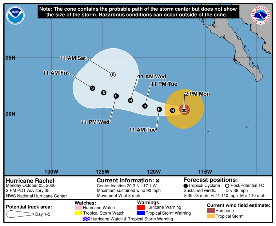
Official NHC cone, 2:00 PM Monday. It shows the forecast area for Rachel's center, not all areas at risk of rain, wind, surf, or flooding. Our corridor stays outside the cone and outside all watches and warnings. Check the newest NHC graphic. 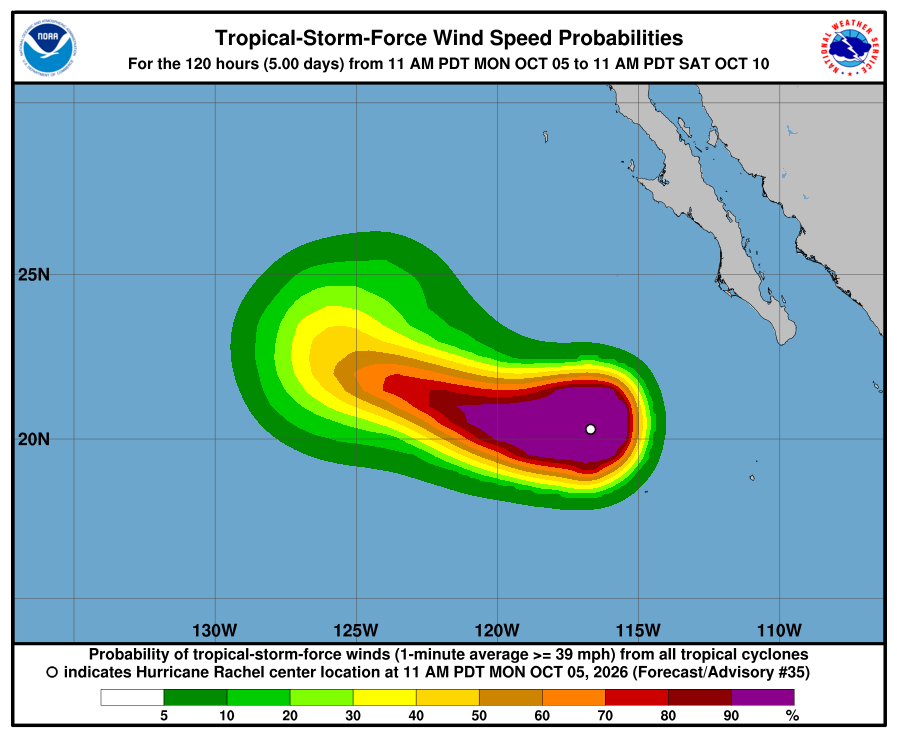
NHC wind-chance chart, Advisory 35. Cabo / La Paz listing stays under 3%. Use this with the cone — it is not a landfall forecast for Todos Santos. NHC says swells from Rachel will keep affecting the Baja California Peninsula for the next couple of days, with life-threatening surf. The next complete advisory was due at 8:00 PM MST (see Advisory 36 above). Advisory 36 above supersedes this earlier Monday afternoon report. The live official-source panel above may update before this written report.
-
Rachel slightly weaker near 85 mph, still Category 1, moving west and farther from Baja; corridor still outside every watch and warning; Baja surf for the next couple of days
- What changed: NHC Advisory 34 shows Hurricane Rachel a little weaker — winds near 85 mph (was 90 mph), still Category 1, pressure 976 mb (was 970 mb). Rachel is moving west (275 degrees) at 7 mph (was 8 mph). The center is about 440 miles west-southwest of the southern tip of Baja California (was about 405 miles), near 20.4N 116.2W. There are still no coastal watches or warnings. Hurricane-force winds extend outward up to 40 miles (was 45); tropical-storm-force winds up to 140 miles (was 150). Discussion: Rachel still has a ring of storms around a large eye, but wind shear from the northeast is pushing dry air into it and wearing away the north and northwest side. Intensity lowered to 75 kt (was 80). Forecast: INIT 75 kt → 12h 75 → 24h 70 → 36h 70 → 48h 65 → 60h 60 → 72h 50 → 96h 45 → 120h 35 (post-tropical).
- What this means here: Lead local prep with SMN rain today, Monday, about 25-50 mm / ~1-2 in in central and southern BCS, with lightning, gusts near 30-50 km/h, and seas about 2.5-3.5 m / ~8-12 ft on the south coast of BCS (new SMN issue 555). SMN's four-day outlook (issue 277) shows Tuesday rain about 25-50 mm with seas about 2-3 m. Todos Santos, Pescadero, and Cerritos remain outside any hurricane or tropical-storm watch or warning. Rachel is not heading toward our corridor — it is moving west, away from Baja, about 440 miles from the Baja tip. SMN also says Rachel will gradually stop affecting Mexico. Local risk is rain, soft arroyos after Polo, plus life-threatening swell along the Baja California Peninsula for the next couple of days — not a named-storm landfall in town. The EPAC system south of the Gulf of Tehuantepec (50%/48h, 90%/7d) is also not heading toward the corridor.
- Stronger or weaker: A little weaker than Advisory 33: winds 90 → 85 mph; still Category 1; pressure 970 → 976 mb. NHC expects strength to go up and down a little for about a day, then steadier weakening from about Wednesday as Rachel reaches cooler water and drier air. NHC now expects Rachel to lose its tropical structure (post-tropical) by Saturday.
- Path and timing: Near 20.4N 116.2W, moving west (275 degrees) at 7 mph. NHC expects this westward motion to continue for the next several days, farther from Baja. Late in the week a trough (a dip in the upper-level winds) should slow Rachel and make it turn sharply northeast — but by then it should be far to the west, near 125-127W (more than 900 miles from our coast) and weakening. That far-out part is less certain; we will keep checking each advisory. NHC's track is very similar to the previous one. The cone is not an impact boundary. Hurricane-force winds extend outward up to 40 miles; tropical-storm-force winds up to 140 miles — all far southwest of our towns.
- Wind chance: NHC five-day tropical-storm-force wind odds for Cabo San Lucas, San José del Cabo, and La Paz stay under the 3% listing threshold (none listed; only open-ocean points far to the west are listed). NHC does not list Todos Santos separately.
- Windy vs NHC: Agree. We checked Windy against NHC. Both keep Rachel offshore and moving away from Baja, with no corridor watch or warning. Near-Pescadero marine (Open-Meteo / Windy-style proxy) shows waves ~1.9 m now, ~1.8 m this evening, and ~1.7 m Tuesday — slowly easing but still elevated, agreeing with the NHC surf hazard. SMN south-coast BCS seas (~2.5-3.5 m) remain a higher Mexico marine number (swell-size difference, not a watch conflict). Multi-source NHC + SMN + Proteccion Civil BCS + Windy: agree on offshore track and no corridor watch; SMN carries rain today ~25-50 mm / seas ~2.5-3.5 m (Tuesday ~25-50 mm / seas ~2-3 m); NHC's land hazard for Baja remains mainly dangerous surf. Proteccion Civil BCS: no newer notice found this check; the last one said Los Cabos schools reopen today, Monday Oct 5. NHC remains official for watches. No track conflict.
- Do now: Plan around SMN rain today (~25-50 mm / ~1-2 in) and rough seas. Do not drive through flooded arroyos; ground is still soft after Polo. Stay out of the ocean: dangerous swell for the next couple of days. Our corridor is outside all hurricane and tropical-storm watches; Rachel is not heading toward Todos Santos, Pescadero, or Cerritos. Follow Proteccion Civil BCS for any local notices. Next complete NHC advisory is due at 2:00 PM MST.
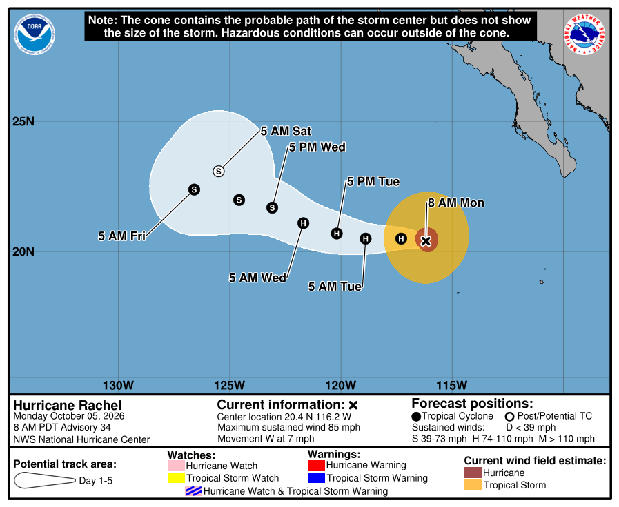
Official NHC cone, 8:00 AM Monday. It shows the forecast area for Rachel's center, not all areas at risk of rain, wind, surf, or flooding. Our corridor stays outside the cone and outside all watches and warnings. Check the newest NHC graphic. 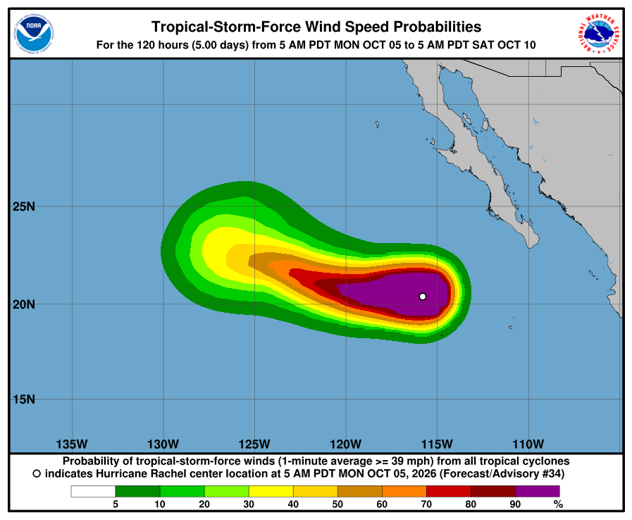
NHC wind-chance chart, Advisory 34. Cabo / La Paz listing stays under 3%. Use this with the cone — it is not a landfall forecast for Todos Santos. NHC says swells from Rachel will keep affecting the Baja California Peninsula for the next couple of days, with life-threatening surf. The next complete advisory was due at 2:00 PM MST (see Advisory 35 above). Advisory 35 above supersedes this earlier Monday morning report. The live official-source panel above may update before this written report.
-
Rachel weakens to Category 1 near 90 mph and keeps moving west, away from Baja; corridor still outside every watch and warning; Baja surf for the next couple of days
- What changed: NHC Advisory 33 shows Hurricane Rachel weaker — winds near 90 mph (was 100 mph), now Category 1 (was Category 2), pressure 970 mb (was 967 mb). Rachel is moving west (280 degrees) at 8 mph (was west-northwest at 7 mph). The center is about 405 miles west-southwest of the southern tip of Baja California (was about 365 miles), near 20.4N 115.6W. There are still no coastal watches or warnings. Hurricane-force winds extend outward up to 45 miles (was 40); tropical-storm-force winds up to 150 miles (was 140) — the wind field spread out a little as the storm weakened. Discussion: Rachel just went through an eyewall replacement (the old small eye broke down and a broader ring formed), and some dry air and wind shear are hitting it. Intensity lowered to 80 kt. Forecast: INIT 80 kt → 12h 75 → 24h 75 → 36h 75 → 48h 75 → 60h 65 → 72h 60 → 96h 50 → 120h 40.
- What this means here: Lead local prep with SMN rain today, Monday, about 25-50 mm / ~1-2 in in central and southern BCS, gusts near 30-50 km/h, and seas about 2.5-3.5 m / ~8-12 ft (SMN issue 554). SMN's four-day outlook (issue 277) shows Tuesday rain about 25-50 mm with seas about 2-3 m. Todos Santos, Pescadero, and Cerritos remain outside any hurricane or tropical-storm watch or warning. Rachel is not heading toward our corridor — it is moving west, away from Baja, about 405 miles from the Baja tip. Local risk is rain, soft arroyos after Polo, plus life-threatening swell along the Baja California Peninsula for the next couple of days — not a named-storm landfall in town. The EPAC system south of southern Mexico (40%/48h, 90%/7d) is also not heading toward the corridor.
- Stronger or weaker: Weaker than Advisory 32: winds 100 → 90 mph; now Category 1 (was Category 2); pressure 967 → 970 mb. NHC expects a little more weakening today, then strength may hold steady for a day or two, then slow weakening from the middle of the week over cooler water.
- Path and timing: Near 20.4N 115.6W, moving west (280 degrees) at 8 mph. NHC expects slow west to west-northwest motion for the next several days, farther from Baja. Late in the week the models spread out more: NHC shows Rachel slowing down far to the west (near 126W by Saturday, more than 1,000 miles from our coast) and possibly starting a turn. That far-out part is less certain; we will keep checking each advisory. NHC's track is just a touch north of the previous one. The cone is not an impact boundary. Hurricane-force winds extend outward up to 45 miles; tropical-storm-force winds up to 150 miles — all far southwest of our towns.
- Wind chance: NHC five-day tropical-storm-force wind odds for Cabo San Lucas, San José del Cabo, and La Paz stay under the 3% listing threshold (none listed). NHC does not list Todos Santos separately.
- Windy vs NHC: Agree. We checked Windy against NHC. Both keep Rachel offshore and moving away from Baja, with no corridor watch or warning. Near-Pescadero marine (Open-Meteo / Windy-style proxy) shows waves ~2.3 m early this morning, easing to ~2.1 m by midday, ~1.9 m this evening, and ~1.8 m Tuesday — still elevated, agreeing with the NHC surf hazard. SMN BCS-coast seas (~2.5-3.5 m) remain a higher Mexico marine number (swell-size difference, not a watch conflict). Multi-source NHC + SMN + Proteccion Civil BCS + Windy: agree on offshore track and no corridor watch; SMN carries rain today ~25-50 mm / seas ~2.5-3.5 m (Tuesday ~25-50 mm / seas ~2-3 m); NHC's land hazard for Baja remains mainly dangerous surf. Proteccion Civil BCS: the State Civil Protection Council says Los Cabos schools reopen today, Monday Oct 5, and asks people to keep following official notices. NHC remains official for watches. No track conflict.
- Do now: Plan around SMN rain today (~25-50 mm / ~1-2 in) and rough seas. Do not drive through flooded arroyos; ground is still soft after Polo. Stay out of the ocean: dangerous swell for the next couple of days. Our corridor is outside all hurricane and tropical-storm watches; Rachel is not heading toward Todos Santos, Pescadero, or Cerritos. Follow Proteccion Civil BCS for any local notices. Next complete NHC advisory is due at 8:00 AM MST.
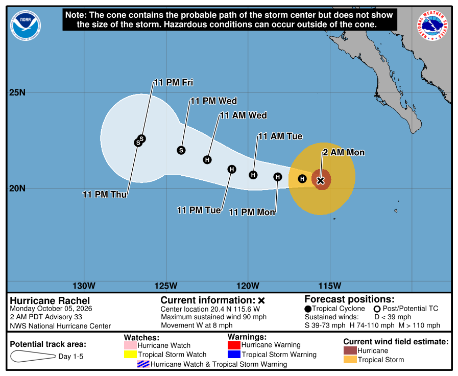
Official NHC cone, 2:00 AM Monday. It shows the forecast area for Rachel's center, not all areas at risk of rain, wind, surf, or flooding. Our corridor stays outside the cone and outside all watches and warnings. Check the newest NHC graphic. 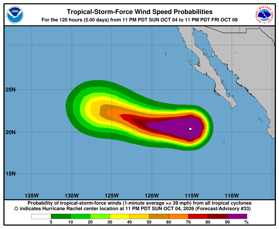
NHC wind-chance chart, Advisory 33. Cabo / La Paz listing stays under 3%. Use this with the cone — it is not a landfall forecast for Todos Santos. NHC says swells from Rachel will keep affecting the Baja California Peninsula for the next couple of days, with life-threatening surf. The next complete advisory was due at 8:00 AM MST (see Advisory 34 above). Advisory 34 above supersedes this earlier Monday early-morning report. The live official-source panel above may update before this written report.
-
Rachel weakens a little to 100 mph, still Category 2, and keeps moving away from Baja; corridor still outside every watch and warning; Baja surf for the next couple of days
- What changed: NHC Advisory 32 shows Hurricane Rachel a little weaker — winds near 100 mph (was 105 mph), still Category 2, pressure 967 mb (was 965 mb). Rachel is moving west-northwest (290 degrees) at 7 mph (was west at 6 mph). The center is about 365 miles west-southwest of the southern tip of Baja California (was about 340 miles), near 20.2N 114.8W. There are still no coastal watches or warnings. Hurricane-force winds extend outward up to 40 miles (same); tropical-storm-force winds up to 140 miles (same). Discussion: the eye has filled in and the inner core has come apart; dry air has reached the core; intensity lowered to 85 kt (NHC says this may be generous). Forecast: INIT 85 kt → 12h 85 → 24h 80 → 36h 80 → 48h 75 → 60h 65 → 72h 60 → 96h 50 → 120h 40.
- What this means here: Lead local prep with SMN rain this afternoon and tonight, about 50-75 mm / ~2-3 in across central and southern BCS, gusts near 30-50 km/h, and seas about 2.5-3.5 m / ~8-12 ft (SMN issue 554). SMN's four-day outlook (issue 277) shows Tuesday rain about 25-50 mm with seas about 2-3 m. Todos Santos, Pescadero, and Cerritos remain outside any hurricane or tropical-storm watch or warning. Rachel is not heading toward our corridor — it is moving away from Baja, about 365 miles from the Baja tip. Local risk is rain, soft arroyos after Polo, plus life-threatening swell along the Baja California Peninsula for the next couple of days — not a named-storm landfall in town. Remnants of Polo, Remnants of Nineteen-E, and the EPAC system south of southern Mexico (30%/48h, 90%/7d) are also not heading toward the corridor.
- Stronger or weaker: A little weaker than Advisory 31: winds 105 → 100 mph; still Category 2; pressure 965 → 967 mb. Wind field the same size (hurricane-force 40 mi, tropical-storm-force 140 mi). NHC says strength may go up and down tonight, then slow weakening should start Monday as Rachel reaches drier air and cooler water.
- Path and timing: Near 20.2N 114.8W, moving west-northwest (290 degrees) at 7 mph. Slow, mostly westward motion through the middle of the week, then a turn back to the west-northwest by the end of the week. NHC's track is very close to the previous one. The cone is not an impact boundary. Hurricane-force winds extend outward up to 40 miles; tropical-storm-force winds up to 140 miles — all far southwest of our towns.
- Wind chance: NHC five-day tropical-storm-force wind odds for Cabo San Lucas, San José del Cabo, and La Paz stay under the 3% listing threshold (none listed). NHC does not list Todos Santos separately.
- Windy vs NHC: Agree. We checked Windy against NHC. Both keep Rachel offshore and moving away from Baja, with no corridor watch or warning. Near-Pescadero marine (Open-Meteo / Windy-style proxy) tonight shows waves ~2.4 m, easing to ~2.1 m Monday morning and ~1.9 m Monday evening — still elevated, agreeing with the NHC surf hazard. SMN BCS-coast seas (~2.5-3.5 m) remain a higher Mexico marine number (swell-size difference, not a watch conflict). Multi-source NHC + SMN + Proteccion Civil BCS + Windy: agree on offshore track and no corridor watch; SMN carries rain tonight ~50-75 mm / seas ~2.5-3.5 m (Tuesday ~25-50 mm / seas ~2-3 m); NHC's land hazard for Baja remains mainly dangerous surf. Proteccion Civil BCS has no new corridor-specific Rachel notice (latest post: Polo recovery, Sep 29). NHC remains official for watches. No track conflict.
- Do now: Plan around SMN rain tonight (~50-75 mm / ~2-3 in) and rough seas. Do not drive through flooded arroyos; ground is still soft after Polo. Stay out of the ocean: dangerous swell for the next couple of days. Our corridor is outside all hurricane and tropical-storm watches; Rachel is not heading toward Todos Santos, Pescadero, or Cerritos. Follow Proteccion Civil BCS for any local notices. Next complete NHC advisory is due at 2:00 AM MST.
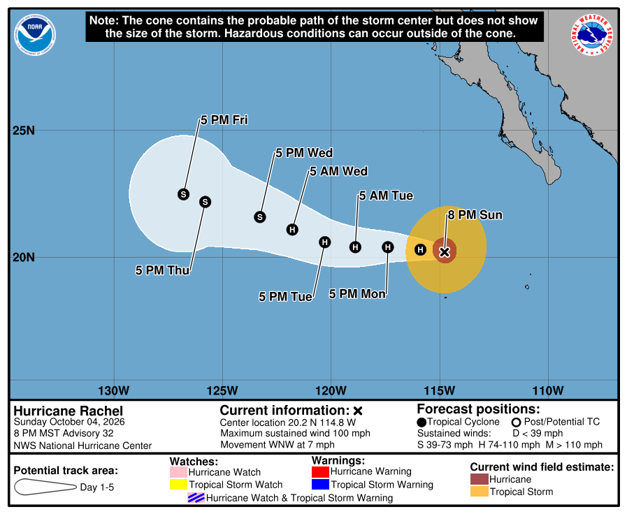
Official NHC cone, 8:00 PM Sunday. It shows the forecast area for Rachel's center, not all areas at risk of rain, wind, surf, or flooding. Our corridor stays outside the cone and outside all watches and warnings. Check the newest NHC graphic. 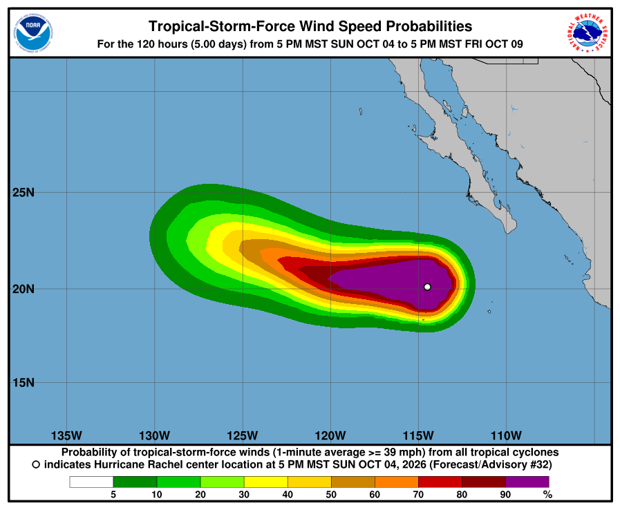
NHC wind-chance chart, Advisory 32. Cabo / La Paz listing stays under 3%. Use this with the cone — it is not a landfall forecast for Todos Santos. NHC says swells from Rachel will keep affecting the Baja California Peninsula for the next couple of days, with life-threatening surf. The next complete advisory was due at 2:00 AM MST (see Advisory 33 above). Advisory 33 above supersedes this earlier Sunday evening report. The live official-source panel above may update before this written report.
-
Rachel holds at Category 2 near 105 mph and turns west, away from Baja; corridor still outside every watch and warning; Baja surf through Monday
- What changed: NHC Advisory 31 shows Hurricane Rachel holding its strength — still Category 2 near 105 mph with pressure 965 mb (same as Advisory 30). Rachel has turned west (270 degrees) at 6 mph (was west-northwest at 6 mph). The center is about 340 miles southwest of the southern tip of Baja California (was about 310 miles SW), near 20.1N 114.3W. There are still no coastal watches or warnings. Hurricane-force winds extend outward up to 40 miles (same); tropical-storm-force winds up to 140 miles (was 125). Discussion: little change in the past several hours; the eye is a little more cloud-filled and ragged than this morning; intensity held at 90 kt. A high pressure system north of Rachel should keep it on a slow westward track through midweek, then a turn back to the west-northwest late in the week. Forecast: INIT 90 kt → 12h 90 → 24h 85 → 36h 80 → 48h 75 → 60h 70 → 72h 65 → 96h 55 → 120h 45.
- What this means here: Lead local prep with SMN this afternoon about 50-75 mm / ~2-3 in across central and southern BCS, gusts near 50-70 km/h, and seas about 3-4 m / ~10-13 ft. SMN's new four-day outlook (issue 277) shows Tuesday rain about 25-50 mm with seas about 2-3 m. Todos Santos, Pescadero, and Cerritos remain outside any hurricane or tropical-storm watch or warning. Rachel is not heading toward our corridor — it is moving west, away from Baja, about 340 miles SW of the Baja tip. Local risk is rain, soft arroyos after Polo, plus life-threatening swell along the Baja California Peninsula through Monday — not a named-storm landfall in town. Remnants of Polo, Remnants of Nineteen-E, Hurricane Nolo (Central Pacific), and the EPAC system south of southern Mexico (20%/48h, 90%/7d) are also not heading toward the corridor.
- Stronger or weaker: About the same as Advisory 30: winds stay at 105 mph; still Category 2; pressure stays at 965 mb. Tropical-storm-force wind field a bit larger (125→140 mi); hurricane-force still 40 mi. NHC expects Rachel to hold through tonight, then weaken steadily from Monday as it reaches drier air and cooler water.
- Path and timing: Near 20.1N 114.3W, moving west (270 degrees) at 6 mph. Slow westward motion through the middle of the week, then a turn back to the west-northwest by the end of the week. NHC made little change to the track. The cone is not an impact boundary. Hurricane-force winds extend outward up to 40 miles; tropical-storm-force winds up to 140 miles — all far southwest of our towns.
- Wind chance: NHC five-day tropical-storm-force wind odds for Cabo San Lucas, San José del Cabo, and La Paz stay under the 3% listing threshold (none listed). NHC does not list Todos Santos separately.
- Windy vs NHC: Agree. We checked Windy against NHC. Both keep Rachel offshore and moving west, away from Baja, with no corridor watch or warning. Near-Pescadero marine (Open-Meteo / Windy-style proxy) this afternoon shows waves ~2.5 m, easing to ~2.2 m tonight and ~1.8 m Monday — still elevated, agreeing with the NHC surf hazard through Monday. SMN BCS-coast seas (~3-4 m) remain a higher Mexico marine number (swell-size difference, not a watch conflict). Multi-source NHC + SMN + Proteccion Civil BCS + Windy: agree on offshore track and no corridor watch; SMN carries this-afternoon rain ~50-75 mm / seas ~3-4 m (Tuesday ~25-50 mm / seas ~2-3 m); NHC's land hazard for Baja remains mainly dangerous surf through Monday. Proteccion Civil BCS has no new corridor-specific Rachel notice (latest post: Polo recovery, Sep 29). NHC remains official for watches. No track conflict.
- Do now: Plan around SMN this-afternoon rain (~50-75 mm / ~2-3 in) and elevated seas. Do not drive through flooded arroyos; ground is still soft after Polo. Stay out of the ocean: dangerous swell through Monday. Our corridor is outside all hurricane and tropical-storm watches; Rachel is not heading toward Todos Santos, Pescadero, or Cerritos. Follow Proteccion Civil BCS for any local notices. Next complete NHC advisory is due at 8:00 PM MST.
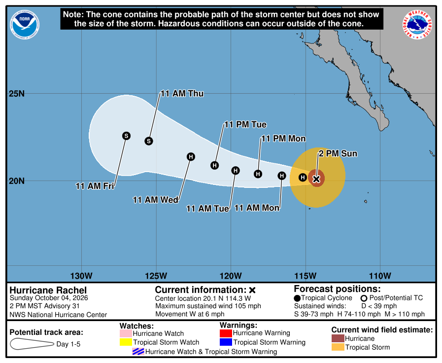
Official NHC cone, 2:00 PM Sunday. It shows the forecast area for Rachel's center, not all areas at risk of rain, wind, surf, or flooding. Our corridor stays outside the cone and outside all watches and warnings. Check the newest NHC graphic. 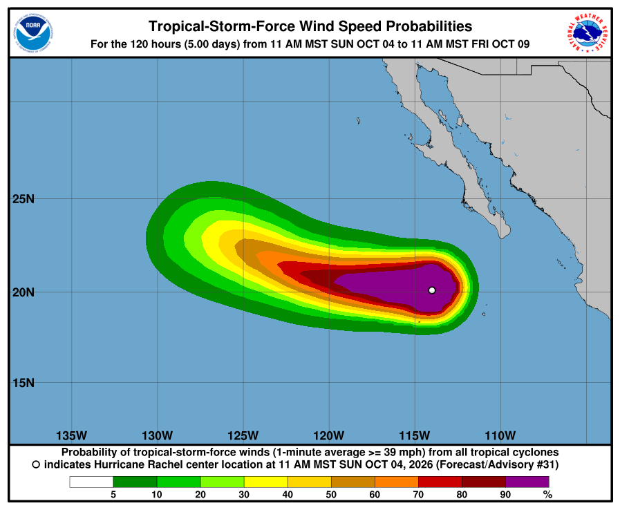
NHC wind-chance chart, Advisory 31. Cabo / La Paz listing stays under 3%. Use this with the cone — it is not a landfall forecast for Todos Santos. NHC says swells from Rachel will affect the Baja California Peninsula through Monday, with life-threatening surf. The next complete advisory was due at 8:00 PM MST (see Advisory 32 above). Advisory 32 above supersedes this earlier Sunday afternoon report. The live official-source panel above may update before this written report.
-
Rachel strengthens a little more to Category 2 near 105 mph, still slow WNW; corridor still outside every watch and warning; Baja surf through Monday
- What changed: NHC Advisory 30 shows Hurricane Rachel strengthening a little more — now Category 2 near 105 mph (from near 100 mph at Advisory 29) with pressure down to 965 mb (from 968). The center is about 310 miles southwest of the southern tip of Baja California (was about 280 miles SW), now near 20.2N 113.8W and moving west-northwest (290 degrees) at 6 mph (was 5). There are still no coastal watches or warnings. Hurricane-force winds extend outward up to 40 miles (was 45); tropical-storm-force winds up to 125 miles (was 140). Discussion notes intensity nudged to 90 kt; eye more distinct; turn west later today through midweek; maintain today then slowly weaken Monday; track nudged slightly north / a little slower vs prior. Forecast: INIT 90 kt → 12h 90 → 24h 85 → 36h 80 → 48h 75 → 60h 70 → 72h 65 → 96h 55 → 120h 45.
- What this means here: Lead local prep with SMN this afternoon about 50-75 mm / ~2-3 in across central and southern BCS, gusts near 50-70 km/h, and seas about 3-4 m / ~10-13 ft. SMN's four-day outlook (issue 276) still carries Monday rain about 25-50 mm with seas about 2-3 m. Todos Santos, Pescadero, and Cerritos remain outside any hurricane or tropical-storm watch or warning. Rachel is not heading toward our corridor — moving west-northwest ~310 miles SW of the Baja tip, turning west later today. Local risk is Sunday rain, soft arroyos after Polo, plus life-threatening swell along the Baja California Peninsula through Monday — not a named-storm landfall in town. Remnants of Polo, Remnants of Nineteen-E, Hurricane Nolo (Central Pacific), and the EPAC invest south of southern Mexico (20%/48h, 90%/7d) are also not heading toward the corridor.
- Stronger or weaker: A little stronger than Advisory 29: winds 100→105 mph; still Category 2; pressure 968→965 mb. Wind field a bit smaller (hurricane-force 45→40 mi; TS-force 140→125 mi). NHC expects maintain today then slowly weaken Monday; Rachel should remain a hurricane for the next few days. Forecast: INIT 90 → 12h 90 → 24h 85 → 36h 80 → 48h 75 → 60h 70 → 72h 65 → 96h 55 → 120h 45.
- Path and timing: Near 20.2N 113.8W, moving west-northwest (290 degrees) at 6 mph. Turn west later today through midweek; track nudged slightly north / a little slower vs prior. The cone is not an impact boundary. Hurricane-force winds extend outward up to 40 miles; tropical-storm-force winds up to 125 miles — all well south of our towns.
- Wind chance: NHC five-day tropical-storm-force wind odds for Cabo San Lucas, San José del Cabo, and La Paz stay under the 3% listing threshold (none listed). NHC does not list Todos Santos separately.
- Windy vs NHC: Agree. We checked Windy against NHC. Both keep Rachel offshore south of Baja with no corridor watch or warning. Near-Pescadero marine (Open-Meteo / Windy-style proxy) around 8–10 AM MST Sunday waves ~2.62–2.68 m — elevated, agreeing with NHC surf hazard. SMN BCS-coast seas (~3-4 m) remain higher-end Mexico marine magnitude (nuance, not a watch conflict). Multi-source NHC + SMN + Proteccion Civil BCS + Windy: agree on offshore track and no corridor watch; SMN carries this-afternoon rain ~50-75 mm / seas ~3-4 m (Monday ~25-50 mm / seas ~2-3 m); NHC's land hazard for Baja remains mainly dangerous surf through Monday. Protección Civil BCS has no new corridor-specific Rachel hurricane/TS watch (its latest posts are about Polo recovery, Sep 29). NHC remains official for watches. No material track conflict.
- Do now: Plan around SMN this-afternoon rain (~50-75 mm / ~2-3 in) and elevated seas (~3-4 m SMN / ~2.6 m near Pescadero) and do not drive flooded arroyo crossings — ground is still soft after Polo. Stay out of the ocean: elevated seas and dangerous swell through Monday. Corridor stays outside hurricane/TS watches; Rachel is not toward Todos Santos–Pescadero–Cerritos. Follow Proteccion Civil BCS for any local notices. Next complete NHC advisory is due at 2:00 PM MST.
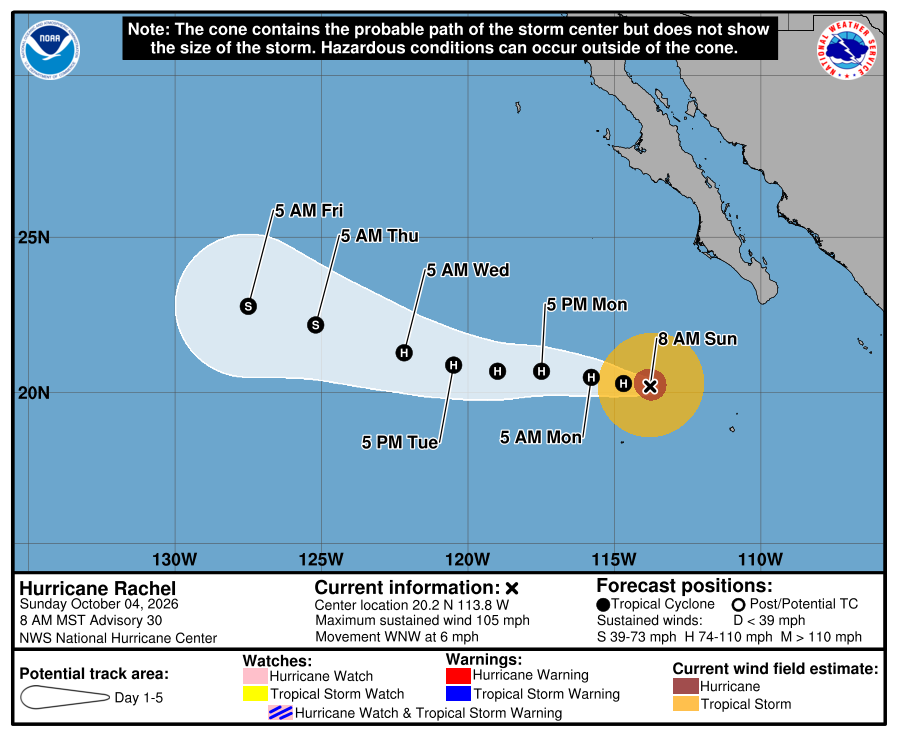
Official NHC cone, 8:00 AM Sunday. It shows the forecast area for Rachel's center, not all areas at risk of rain, wind, surf, or flooding. Our corridor stays outside the cone and outside all watches and warnings. Check the newest NHC graphic. 
NHC wind-chance chart, Advisory 30. Cabo / La Paz listing stays under 3%. Use this with the cone — it is not a landfall forecast for Todos Santos. NHC says swells from Rachel will affect the Baja California Peninsula through Monday, with life-threatening surf. The next complete advisory was due at 2:00 PM MST (see Advisory 31 above). Advisory 31 above supersedes this earlier Sunday morning report. The live official-source panel above may update before this written report.
-
Rachel strengthens to Category 2 near 100 mph, still slow WNW; corridor still outside every watch and warning; Baja surf through Monday
- What changed: NHC Advisory 29 shows Hurricane Rachel strengthening a little more while it moves west-northwestward - now Category 2 near 100 mph (from Category 1 near 90 mph at Advisory 28) with pressure down to 968 mb (from 970). The center is about 280 miles southwest of the southern tip of Baja California (was about 275 miles SW), now near 20.2N 113.2W and moving west-northwest (295 degrees) at 5 mph. There are still no coastal watches or warnings. Hurricane-force winds extend outward up to 45 miles; tropical-storm-force winds up to 140 miles (was 150). Discussion notes intensity raised to 85 kt from satellite estimates trending up, eyewall more symmetric with colder tops, track minor adjustments and well clustered guidance, crossing Polo's cold wake now but development not consistent with that, none of the intensity guidance shows additional strengthen next 24 hours despite slightly warmer water ahead - steady about 12 hours then gradual weaken; annular characteristics may slow later weaken; intensity forecast near the upper edge of guidance.
- What this means here: Lead local prep with SMN Sunday about 50-75 mm / ~2-3 in across central and southern BCS, gusts near 50-70 km/h, and seas about 3-4 m / ~10-13 ft. SMN's four-day outlook still carries Monday rain about 25-50 mm with seas about 2-3 m. Todos Santos, Pescadero, and Cerritos remain outside any hurricane or tropical-storm watch or warning. Rachel is not heading toward our corridor - moving west-northwest and staying ~280 miles SW of the Baja tip. Local risk is Sunday rain, soft arroyos after Polo, plus life-threatening swell along the Baja California Peninsula through Monday - not a named-storm landfall in town. Remnants of Polo, Remnants of Nineteen-E, Hurricane Nolo (Central Pacific), and the EPAC invest south of southern Mexico are also not heading toward the corridor.
- Stronger or weaker: Stronger than Advisory 28: winds 90→100 mph; now Category 2 (was Category 1); pressure 970→968 mb. NHC expects steady intensity about 12 hours then gradual weakening starting Monday; Rachel should remain a hurricane for the next few days. Forecast: INIT 85 kt → 12h 85 → 24h 80 → 36h 80 → 48h 75 → 60h 70 → 72h 65 → 96h 55 → 120h 45.
- Path and timing: Near 20.2N 113.2W, moving west-northwest (295 degrees) at 5 mph. Turn west with a speed-up over the next 72 hours as a mid-level ridge strengthens; after about 72 hours turn west-northwest again toward a ridge break near 130-135W. The cone is not an impact boundary. Hurricane-force winds extend outward up to 45 miles; tropical-storm-force winds up to 140 miles - all well south of our towns.
- Wind chance: NHC five-day tropical-storm-force wind odds for Cabo San Lucas, San Jose del Cabo, and La Paz stay under the 3% listing threshold (none listed). NHC does not list Todos Santos separately.
- Windy vs NHC: Agree. We checked Windy against NHC. Both keep Rachel offshore south of Baja with no corridor watch or warning. Near-Pescadero marine (Open-Meteo / Windy-style proxy) around 2-4 AM MST Sunday waves ~2.36 m - elevated, agreeing with NHC surf hazard. SMN BCS-coast seas (~3-4 m) remain higher-end Mexico marine magnitude (nuance, not a watch conflict). Multi-source NHC + SMN + Proteccion Civil BCS + Windy: agree on offshore track and no corridor watch; SMN carries Sunday rain ~50-75 mm / seas ~3-4 m (Monday ~25-50 mm / seas ~2-3 m); NHC's land hazard for Baja remains mainly dangerous surf through Monday. Protección Civil BCS showed no new corridor-specific Rachel hurricane/TS watch (latest posts still Polo recovery). NHC remains official for watches. No material track conflict.
- Do now: Plan around SMN Sunday rain (~50-75 mm / ~2-3 in) and elevated seas (~3-4 m SMN / ~2.36 m near Pescadero) and do not drive flooded arroyo crossings - ground is still soft after Polo. Stay out of the ocean: elevated seas and dangerous swell through Monday. Corridor stays outside hurricane/TS watches; Rachel is not toward Todos Santos-Pescadero-Cerritos. Follow Proteccion Civil BCS for any local notices. Next complete NHC advisory is due at 8:00 AM MST.
Official NHC cone, 2:00 AM Sunday. It shows the forecast area for Rachel's center, not all areas at risk of rain, wind, surf, or flooding. Our corridor stays outside the cone and outside all watches and warnings. Check the newest NHC graphic. 
NHC wind-chance chart, Advisory 29. Cabo / La Paz listing stays under 3%. Use this with the cone - it is not a landfall forecast for Todos Santos. NHC says swells from Rachel will affect west-central Mexico through the weekend and the Baja California Peninsula through Monday, with life-threatening surf. The next complete advisory was due at 8:00 AM MST (see Advisory 30 above). Advisory 30 above supersedes this earlier Sunday morning report. The live official-source panel above may update before this written report.
-
Rachel strengthens to near 90 mph, still slow WNW; corridor still outside every watch and warning; Baja surf through Monday
- What changed: NHC Advisory 28 shows Hurricane Rachel strengthening slightly as it continues west-northwestward — now Category 1 near 90 mph (from 80 mph at Advisory 27) with pressure down to 970 mb (from 977). The center is about 275 miles southwest of the southern tip of Baja California (was about 270 miles SW), now near 20.0N 112.8W and moving west-northwest (300 degrees) at 5 mph. There are still no coastal watches or warnings. NHC expects some weakening Sunday then possible restrengthening Monday/Tuesday; Rachel should remain a hurricane for the next few days. Discussion notes intensity raised to 80 kt from a consensus of satellite estimates, track largely unchanged, Polo’s cold wake plus shear and dry air favoring weaken Sunday, and possible annular characteristics that may temper the weakening before some re-intensification through about 72 hours.
- What this means here: Lead local prep with SMN tonight and Sunday about 50-75 mm / ~2-3 in across central and southern BCS, gusts near 50-70 km/h, and seas about 3-4 m / ~10-13 ft. SMN’s four-day outlook still carries Monday rain about 25-50 mm with seas about 2-3 m. Todos Santos, Pescadero, and Cerritos remain outside any hurricane or tropical-storm watch or warning. Rachel is not heading toward our corridor — moving west-northwest and staying ~275 miles SW of the Baja tip. Local risk is heavier overnight/Sunday rain, soft arroyos after Polo, plus life-threatening swell along the Baja California Peninsula through Monday — not a named-storm landfall in town. Remnants of Polo, Remnants of Nineteen-E, Hurricane Nolo (Central Pacific), and the EPAC invest south of southern Mexico are also not heading toward the corridor.
- Stronger or weaker: Stronger than Advisory 27: winds 80→90 mph; still Category 1; pressure 977→970 mb. NHC expects some weakening Sunday (tropical storm possible), with possible restrengthening Monday/Tuesday; Rachel should remain a hurricane for the next few days.
- Path and timing: Near 20.0N 112.8W, moving west-northwest (300 degrees) at 5 mph. Slow WNW continues; west to west-northwest through mid-next week with a gradual speed-up. The cone is not an impact boundary. Hurricane-force winds extend outward up to 45 miles; tropical-storm-force winds up to 150 miles — all well south of our towns.
- Wind chance: NHC five-day tropical-storm-force wind odds for Cabo San Lucas, San José del Cabo, and La Paz stay under the 3% listing threshold (none listed). NHC does not list Todos Santos separately.
- Windy vs NHC: Agree. We checked Windy against NHC. Both keep Rachel offshore south of Baja with no corridor watch or warning. Near-Pescadero marine (Open-Meteo / Windy-style proxy) around 8–10 PM MST Saturday waves ~2.4 m — elevated, agreeing with NHC surf hazard. SMN BCS-coast seas (~3-4 m) remain higher-end Mexico marine magnitude (nuance, not a watch conflict). Multi-source NHC + SMN + Protección Civil BCS + Windy: agree on offshore track and no corridor watch; SMN carries tonight–Sunday rain ~50-75 mm / seas ~3-4 m (Monday ~25-50 mm / seas ~2-3 m); NHC’s land hazard for Baja remains mainly dangerous surf through Monday. Protección Civil BCS shows no new corridor-specific Rachel hurricane/TS watch (latest posts still Polo recovery). NHC remains official for watches. No material track conflict.
- Do now: Plan around SMN tonight–Sunday rain (~50-75 mm / ~2-3 in) and elevated seas (~3-4 m SMN / ~2.4 m near Pescadero) and do not drive flooded arroyo crossings — ground is still soft after Polo. Stay out of the ocean: elevated seas and dangerous swell through Monday. Corridor stays outside hurricane/TS watches; Rachel is not toward Todos Santos–Pescadero–Cerritos. Follow Protección Civil BCS for any local notices. Next complete NHC advisory is due at 2:00 AM MST.
Official NHC cone, 8:00 PM Saturday. It shows the forecast area for Rachel’s center, not all areas at risk of rain, wind, surf, or flooding. Our corridor stays outside the cone and outside all watches and warnings. Check the newest NHC graphic. 
NHC wind-chance chart, Advisory 28. Cabo / La Paz listing stays under 3%. Use this with the cone — it is not a landfall forecast for Todos Santos. NHC says swells from Rachel will affect west-central Mexico through the weekend and the Baja California Peninsula through Monday, with life-threatening surf. The next complete advisory was due at 2:00 AM MST (see Advisory 29 above). Advisory 29 above supersedes this earlier Saturday evening report. The live official-source panel above may update before this written report.
-
Rachel near 80 mph, still slow WNW; corridor still outside every watch and warning; Baja surf through Monday
- What changed: NHC Advisory 27 shows Hurricane Rachel continuing slowly west-northwestward — still Category 1 near 80 mph (from 85 mph at Advisory 26) with pressure up to 977 mb (from 973). The center is about 270 miles southwest of the southern tip of Baja California (was about 270 miles SSW), now near 19.8N 112.5W and moving west-northwest (300 degrees) at 5 mph (was 3). There are still no coastal watches or warnings. NHC expects some weakening the next day or so (forecast dips to tropical-storm strength Sunday afternoon before slight restrengthening Monday), and Rachel remaining a hurricane for the next few days. Discussion notes a larger eye with the inner eyewall fading, intensity lowered to 70 kt from a compromise of satellite estimates, track largely unchanged following HCCA, Polo’s cold wake plus northeasterly shear and dry air, then some re-intensification after the weekend before drier air and cooler SSTs weaken Rachel later.
- What this means here: Lead local prep with upgraded SMN evening issue 552 — tonight and Sunday about 50-75 mm / ~2-3 in across central and southern BCS (was ~25-50 mm / ~1-2 in at the afternoon Adv 27 publish), gusts near 50-70 km/h, and seas about 3-4 m / ~10-13 ft. SMN’s four-day outlook still carries Monday rain about 25-50 mm with seas about 2-3 m. Todos Santos, Pescadero, and Cerritos remain outside any hurricane or tropical-storm watch or warning. Rachel is not heading toward our corridor — moving west-northwest and staying ~270 miles SW of the Baja tip. Local risk is heavier overnight/Sunday rain, soft arroyos after Polo, plus life-threatening swell along the Baja California Peninsula through Monday — not a named-storm landfall in town. Remnants of Polo, Remnants of Nineteen-E, Hurricane Nolo (Central Pacific), and the EPAC invest south of southern Mexico are also not heading toward the corridor.
- Stronger or weaker: Weaker than Advisory 26: winds 85→80 mph; still Category 1; pressure 973→977 mb. NHC expects some weakening the next day or so (tropical storm possible Sunday), with slight restrengthening possible Monday; Rachel should remain a hurricane for the next few days.
- Path and timing: Near 19.8N 112.5W, moving west-northwest (300 degrees) at 5 mph. Slow WNW continues through tonight; west to west-northwest Sunday through mid-next week with a gradual speed-up. The cone is not an impact boundary. Hurricane-force winds extend outward up to 45 miles; tropical-storm-force winds up to 150 miles — all well south of our towns.
- Wind chance: NHC five-day tropical-storm-force wind odds for Cabo San Lucas, San José del Cabo, and La Paz stay under the 3% listing threshold (none listed). NHC does not list Todos Santos separately.
- Windy vs NHC: Agree. We checked Windy against NHC. Both keep Rachel offshore south of Baja with no corridor watch or warning. Near-Pescadero marine (Open-Meteo / Windy-style proxy) around 6–8 PM MST Saturday waves ~2.3–2.4 m — elevated, agreeing with NHC surf hazard. SMN BCS-coast seas (~3-4 m) remain higher-end Mexico marine magnitude (nuance, not a watch conflict). Multi-source NHC + SMN + Protección Civil BCS + Windy: agree on offshore track and no corridor watch; SMN evening issue 552 carries tonight–Sunday rain ~50-75 mm / seas ~3-4 m (Monday ~25-50 mm / seas ~2-3 m); NHC’s land hazard for Baja remains mainly dangerous surf through Monday. Protección Civil BCS shows no new corridor-specific Rachel hurricane/TS watch (latest posts still Polo recovery). NHC remains official for watches. No material track conflict.
- Do now: Plan around SMN tonight–Sunday rain (~50-75 mm / ~2-3 in) and elevated seas (~3-4 m SMN / ~2.3–2.4 m near Pescadero) and do not drive flooded arroyo crossings — ground is still soft after Polo. Stay out of the ocean: elevated seas and dangerous swell through Monday. Corridor stays outside hurricane/TS watches; Rachel is not toward Todos Santos–Pescadero–Cerritos. Follow Protección Civil BCS for any local notices. Next complete NHC advisory is due at 8:00 PM MST.
Official NHC cone, 2:00 PM Saturday. It shows the forecast area for Rachel’s center, not all areas at risk of rain, wind, surf, or flooding. Our corridor stays outside the cone and outside all watches and warnings. Check the newest NHC graphic. 
NHC wind-chance chart, Advisory 27. Cabo / La Paz listing stays under 3%. Use this with the cone — it is not a landfall forecast for Todos Santos. NHC says swells from Rachel will affect west-central Mexico through the weekend and the Baja California Peninsula through Monday, with life-threatening surf. The next complete advisory was due at 8:00 PM MST (see Advisory 28 above). Advisory 28 above supersedes this earlier Saturday afternoon report. The live official-source panel above may update before this written report.
-
Rachel near 85 mph, slow WNW; corridor still outside every watch and warning; Baja surf through Monday
- What changed: NHC Advisory 26 shows Hurricane Rachel moving slowly west-northwestward — still Category 1 near 85 mph (from 90 mph at Advisory 25) with pressure up to 973 mb (from 969). The center is about 270 miles south-southwest of the southern tip of Baja California (same distance band), now near 19.6N 112.1W and moving west-northwest (290 degrees) at 3 mph (was west near 5). There are still no coastal watches or warnings. NHC expects some weakening the next day or so, with slight restrengthening possible Monday, and Rachel remaining a hurricane for the next few days. Discussion notes intensity lowered to 75 kt, dry air in the northwest quadrant, a track slightly north of the previous through 60 hours then slightly south at days 4–5, cross-track spread near average confidence, and Polo’s cold wake then slight restrengthening after.
- What this means here: Lead local prep with SMN Saturday rain and seas — Saturday about 25-50 mm / ~1-2 in locally heavy across central and southern BCS, gusts near 40-60 km/h, and seas about 3-4 m / ~10-13 ft (Sunday rain still ~25-50 mm with seas ~2-3 m). Todos Santos, Pescadero, and Cerritos remain outside any hurricane or tropical-storm watch or warning. Rachel is not heading toward our corridor — moving west-northwest and staying ~270 miles SSW of the Baja tip. Local risk is Saturday rain, soft arroyos after Polo, plus life-threatening swell along the Baja California Peninsula through Monday — not a named-storm landfall in town. Remnants of Polo, Remnants of Nineteen-E, Hurricane Nolo (Central Pacific), and the EPAC invest south of southern Mexico are also not heading toward the corridor.
- Stronger or weaker: Weaker than Advisory 25: winds 90→85 mph; still Category 1; pressure 969→973 mb. NHC expects some weakening the next day or so, with slight restrengthening possible Monday; Rachel should remain a hurricane for the next few days.
- Path and timing: Near 19.6N 112.1W, moving west-northwest (290 degrees) at 3 mph. Slow WNW continues through tonight; west to west-northwest Sunday through mid-next week with a gradual speed-up. The cone is not an impact boundary. Hurricane-force winds extend outward up to 45 miles; tropical-storm-force winds up to 150 miles — all well south of our towns.
- Wind chance: NHC five-day tropical-storm-force wind odds for Cabo San Lucas, San José del Cabo, and La Paz stay under the 3% listing threshold (none listed). NHC does not list Todos Santos separately.
- Windy vs NHC: Agree. We checked Windy against NHC. Both keep Rachel offshore south of Baja with no corridor watch or warning. Near-Pescadero marine (Open-Meteo / Windy-style proxy) around 9–10 AM MST Saturday waves ~2.5–2.6 m — elevated, agreeing with NHC surf hazard. SMN BCS-coast seas (~3-4 m Saturday) remain higher-end Mexico marine magnitude (nuance, not a watch conflict). Multi-source NHC + SMN + Protección Civil BCS + Windy: agree on offshore track and no corridor watch; SMN carries Saturday rain ~25-50 mm / seas ~3-4 m (Sunday ~25-50 mm / seas ~2-3 m); NHC’s land hazard for Baja remains mainly dangerous surf through Monday. Protección Civil BCS shows no new corridor-specific Rachel hurricane/TS watch (latest posts still Polo recovery). NHC remains official for watches. No material track conflict.
- Do now: Plan around SMN Saturday rain (~25-50 mm / ~1-2 in locally heavy) and elevated seas (~3-4 m SMN / ~2.5–2.6 m near Pescadero) and do not drive flooded arroyo crossings — ground is still soft after Polo. Stay out of the ocean: elevated seas and dangerous swell through Monday. Corridor stays outside hurricane/TS watches; Rachel is not toward Todos Santos–Pescadero–Cerritos. Follow Protección Civil BCS for any local notices. Next complete NHC advisory is due at 2:00 PM MST.
Official NHC cone, 8:00 AM Saturday. It shows the forecast area for Rachel’s center, not all areas at risk of rain, wind, surf, or flooding. Our corridor stays outside the cone and outside all watches and warnings. Check the newest NHC graphic. 
NHC wind-chance chart, Advisory 26. Cabo / La Paz listing stays under 3%. Use this with the cone — it is not a landfall forecast for Todos Santos. NHC says swells from Rachel will affect west-central Mexico through the weekend and the Baja California Peninsula through Monday, with life-threatening surf. The next complete advisory was due at 2:00 PM MST (see Advisory 27 above). Advisory 27 above supersedes this earlier Saturday morning report. The live official-source panel above may update before this written report.
-
Rachel weakens to Category 1 near 90 mph; continues west; corridor still outside every watch and warning
- What changed: NHC Advisory 25 shows Hurricane Rachel weakening slightly as it continues westward — now Category 1 near 90 mph (from Category 2 / 100 mph at Advisory 24) with pressure up to 969 mb (from 966). The center is about 270 miles south-southwest of the southern tip of Baja California (was about 265 miles SSW), still moving west near 5 mph. There are still no coastal watches or warnings. NHC expects a turn toward the west-northwest today with a gradual increase in forward speed, additional slow weakening over the next day or two, and Rachel remaining a hurricane for several days. Discussion notes less organized convection (southern semicircle only, no eyewall), intensity near 80 kt, crossing Polo’s cold wake plus northeasterly shear, with the track nudged a little south after 48–60 hours.
- What this means here: Lead local prep with SMN Saturday rain and seas — Saturday about 25-50 mm / ~1-2 in locally heavy across central and southern BCS, gusts near 40-60 km/h, and seas about 3-4 m / ~10-13 ft (Sunday rain still ~25-50 mm with seas ~2-3 m). Overnight/current-period SMN product also carried intense southern-BCS rain about 75-150 mm / ~3.0-5.9 in. Todos Santos, Pescadero, and Cerritos remain outside any hurricane or tropical-storm watch or warning. Rachel is not heading toward our corridor — moving west and staying ~270 miles SSW of the Baja tip. Local risk is Saturday rain, soft arroyos after Polo, plus life-threatening swell along the Baja California Peninsula through the weekend — not a named-storm landfall in town. Remnants of Polo, Remnants of Nineteen-E, Hurricane Nolo (Central Pacific), and the EPAC invest south of southern Mexico are also not heading toward the corridor.
- Stronger or weaker: Weaker than Advisory 24: winds 100→90 mph; Category 2→Category 1; pressure 966→969 mb. NHC expects additional slow weakening the next day or two, but Rachel should remain a hurricane for several days.
- Path and timing: Near 19.4N 111.8W, moving west (275 degrees) at 5 mph. Turn toward the west-northwest today with a gradual increase in forward speed. The cone is not an impact boundary. Hurricane-force winds extend outward up to 45 miles; tropical-storm-force winds up to 150 miles — all well south of our towns.
- Wind chance: NHC five-day tropical-storm-force wind odds for Cabo San Lucas, San José del Cabo, and La Paz stay under the 3% listing threshold (none listed). NHC does not list Todos Santos separately.
- Windy vs NHC: Agree. We checked Windy against NHC. Both keep Rachel offshore south of Baja with no corridor watch or warning. Near-Pescadero marine (Open-Meteo / Windy-style proxy) around 3:00 AM MST Saturday waves ~2.6 m — elevated, agreeing with NHC surf hazard. SMN BCS-coast seas (~3-4 m Saturday) remain higher-end Mexico marine magnitude (nuance, not a watch conflict). Multi-source NHC + SMN + Protección Civil BCS + Windy: agree on offshore track and no corridor watch; SMN carries Saturday rain ~25-50 mm / seas ~3-4 m (Sunday ~25-50 mm / seas ~2-3 m); overnight/current-period also ~75-150 mm southern BCS; NHC’s land hazard for Baja remains mainly dangerous surf through the weekend. Protección Civil BCS shows no new corridor-specific Rachel hurricane/TS watch (latest posts still Polo recovery). NHC remains official for watches. No material track conflict.
- Do now: Plan around SMN Saturday rain (~25-50 mm / ~1-2 in locally heavy) and elevated seas (~3-4 m SMN / ~2.6 m near Pescadero) and do not drive flooded arroyo crossings — ground is still soft after Polo. Stay out of the ocean: elevated seas and dangerous swell through the weekend. Corridor stays outside hurricane/TS watches; Rachel is not toward Todos Santos–Pescadero–Cerritos. Follow Protección Civil BCS for any local notices. Next complete NHC advisory is due at 8:00 AM MST.
Official NHC cone, 2:00 AM Saturday. It shows the forecast area for Rachel’s center, not all areas at risk of rain, wind, surf, or flooding. Our corridor stays outside the cone and outside all watches and warnings. Check the newest NHC graphic. 
NHC wind-chance chart, Advisory 25. Cabo / La Paz listing stays under 3%. Use this with the cone — it is not a landfall forecast for Todos Santos. NHC said swells from Rachel would affect west-central Mexico and the Baja California Peninsula through the weekend, with life-threatening surf. The next complete advisory was due at 8:00 AM MST (see Advisory 26 above). Advisory 26 above supersedes this earlier Saturday morning report. The live official-source panel above may update before this written report.
-
Rachel still Category 2 near 100 mph; continues west past Socorro; corridor still outside every watch and warning
- What changed: NHC Advisory 24 shows Hurricane Rachel continuing westward as it passes Socorro Island, still Category 2 near 100 mph (from 105 mph at Advisory 23) with pressure up to 966 mb (from 963). The center is about 265 miles south-southwest of the southern tip of Baja California (was about 260 miles SSW), still moving west near 5 mph. There are still no coastal watches or warnings. NHC expects some weakening over the next day or two; Rachel should remain a hurricane for several days, with a gradual turn west-northwest and a speed-up on Saturday.
- What this means here: Prepare locally for SMN southern-BCS rain — current-period intense rain about 75-150 mm / ~3.0-5.9 in in parts of southern BCS, with tomorrow locally heavy about 25-50 mm / ~1-2 in across central and southern BCS — gusts near 40-60 km/h, and tomorrow seas about 3-4 m / ~10-13 ft (four-day Friday product also carried seas near 5-6 m / ~16-20 ft). Todos Santos, Pescadero, and Cerritos remain outside any hurricane or tropical-storm watch or warning. Rachel is not heading toward our corridor — moving west and staying ~265 miles SSW of the Baja tip. Local risk is rain, soft arroyos after Polo, plus life-threatening swell along the Baja California Peninsula through the weekend — not a named-storm landfall in town. Remnants of Polo, Remnants of Nineteen-E, Hurricane Nolo (Central Pacific), and the EPAC invest south of southern Mexico are also not heading toward the corridor.
- Stronger or weaker: Weaker than Advisory 23: winds 105→100 mph; still Category 2; pressure 963→966 mb. NHC expects some weakening the next day or two, but Rachel should remain a hurricane for several days.
- Path and timing: Near 19.4N 111.5W, moving west (280 degrees) at 5 mph. Gradual turn west-northwest with a speed-up expected on Saturday. The cone is not an impact boundary. Hurricane-force winds extend outward up to 45 miles; tropical-storm-force winds up to 150 miles — all well south of our towns.
- Wind chance: NHC five-day tropical-storm-force wind odds for Cabo San Lucas, San José del Cabo, and La Paz stay under the 3% listing threshold (none listed). NHC does not list Todos Santos separately.
- Windy vs NHC: Agree. We checked Windy against NHC. Both keep Rachel offshore south of Baja with no corridor watch or warning. Near-Pescadero marine (Open-Meteo / Windy-style proxy) Friday evening waves ~2.5–2.6 m — elevated, agreeing with NHC surf hazard. SMN BCS-coast seas remain higher-end Mexico marine magnitude (nuance, not a watch conflict). Multi-source NHC + SMN + Protección Civil BCS + Windy: agree on offshore track and no corridor watch; SMN carries southern-BCS rain ~75-150 mm current period / tomorrow ~25-50 mm and seas ~3-4 m tomorrow (four-day Friday also ~5-6 m); NHC’s land hazard for Baja remains mainly dangerous surf through the weekend. Protección Civil BCS shows no new corridor-specific Rachel hurricane/TS watch (latest posts still Polo recovery). NHC remains official for watches. No material track conflict.
- Do now: Plan around SMN rain (current-period ~75-150 mm / ~3.0-5.9 in; tomorrow ~25-50 mm / ~1-2 in locally heavy) and do not drive flooded arroyo crossings — ground is still soft after Polo. Stay out of the ocean: elevated seas and dangerous swell through the weekend. Corridor stays outside hurricane/TS watches; Rachel is not toward Todos Santos–Pescadero–Cerritos. Follow Protección Civil BCS for any local notices. Next complete NHC advisory is due at 2:00 AM MST.
Official NHC cone, 8:00 PM Friday. It shows the forecast area for Rachel’s center, not all areas at risk of rain, wind, surf, or flooding. Our corridor stays outside the cone and outside all watches and warnings. Check the newest NHC graphic. 
NHC wind-chance chart, Advisory 24. Cabo / La Paz listing stays under 3%. Use this with the cone — it is not a landfall forecast for Todos Santos. NHC says swells from Rachel will affect west-central Mexico and the Baja California Peninsula through the weekend, with life-threatening surf. The next complete advisory was due at 2:00 AM MST (see Advisory 25 above). Advisory 25 above supersedes this earlier Friday evening report. The live official-source panel above may update before this written report.
-
Rachel still Category 2 near 105 mph; continues west past Socorro; corridor still outside every watch and warning
- What changed: NHC Advisory 23 shows Hurricane Rachel continuing to lash Socorro Island as it moves slowly westward, still Category 2 near 105 mph (from 110 mph at Advisory 22) with pressure up to 963 mb (from 959). The center is about 260 miles south-southwest of the southern tip of Baja California (was about 255 miles SSW), now moving west near 5 mph (was west near 6). There are still no coastal watches or warnings. Socorro Island measured about 61 mph sustained with an 85 mph gust as Rachel passed nearby. NHC expects some weakening over the next day or two; Rachel should remain a hurricane for several days, with a gradual turn west-northwest and a speed-up by Monday.
- What this means here: Prepare locally for SMN southern-BCS rain — this-afternoon locally heavy about 25-50 mm / ~1-2 in, with SMN’s four-day Friday day total about 75-150 mm / ~3.0-5.9 in in parts of southern BCS — gusts near 40-60 km/h, and BCS west-coast seas near 5-6 m / ~16-20 ft. Todos Santos, Pescadero, and Cerritos remain outside any hurricane or tropical-storm watch or warning. Rachel is not heading toward our corridor — moving west and staying ~260 miles SSW of the Baja tip. Local risk is rain, soft arroyos after Polo, plus life-threatening swell along the Baja California Peninsula through the weekend — not a named-storm landfall in town. Remnants of Polo, Remnants of Nineteen-E, Tropical Storm Nolo / Hurricane Nolo (Central Pacific), and the EPAC invest south of southern Mexico are also not heading toward the corridor.
- Stronger or weaker: Weaker than Advisory 22: winds 110→105 mph; still Category 2; pressure 959→963 mb. NHC expects some weakening the next day or two, but Rachel should remain a hurricane for several days.
- Path and timing: Near 19.3N 111.1W, moving west (265 degrees) at 5 mph. Gradual turn west-northwest with a speed-up expected by Monday. The cone is not an impact boundary. Hurricane-force winds extend outward up to 45 miles; tropical-storm-force winds up to 150 miles — all well south of our towns.
- Wind chance: NHC five-day tropical-storm-force wind odds for Cabo San Lucas, San José del Cabo, and La Paz stay under the 3% listing threshold (none listed). NHC does not list Todos Santos separately.
- Windy vs NHC: Agree. We checked Windy against NHC. Both keep Rachel offshore south of Baja with no corridor watch or warning. Near-Pescadero marine (Open-Meteo / Windy-style proxy) Friday afternoon waves ~2.3–2.4 m — elevated, agreeing with NHC surf hazard. SMN BCS-coast 5–6 m is higher-end Mexico marine magnitude (nuance, not a watch conflict). Multi-source NHC + SMN + Protección Civil BCS + Windy: agree on offshore track and no corridor watch; SMN carries southern-BCS rain ~25-50 mm this afternoon / Friday day total ~75-150 mm and seas ~5-6 m / ~16-20 ft; NHC’s land hazard for Baja remains mainly dangerous surf through the weekend. Protección Civil BCS shows no new corridor-specific Rachel hurricane/TS watch (latest posts still Polo recovery). NHC remains official for watches. No material track conflict.
- Do now: Plan around SMN rain (~25-50 mm / ~1-2 in this afternoon locally heavy; Friday day total up to ~75-150 mm / ~3.0-5.9 in in parts of southern BCS) and do not drive flooded arroyo crossings — ground is still soft after Polo. Stay out of the ocean: seas near 5-6 m / ~16-20 ft on BCS coasts, with dangerous swell through the weekend. Corridor stays outside hurricane/TS watches; Rachel is not toward Todos Santos–Pescadero–Cerritos. Follow Protección Civil BCS for any local notices. Next complete NHC advisory is due at 8:00 PM MST.
Official NHC cone, 2:00 PM Friday. It shows the forecast area for Rachel’s center, not all areas at risk of rain, wind, surf, or flooding. Our corridor stays outside the cone and outside all watches and warnings. Check the newest NHC graphic. 
NHC wind-chance chart, Advisory 23. Cabo / La Paz listing stays under 3%. Use this with the cone — it is not a landfall forecast for Todos Santos. NHC says swells from Rachel will affect west-central Mexico and the Baja California Peninsula through the weekend, with life-threatening surf. The next complete advisory was due at 8:00 PM MST (see Advisory 24 above). Advisory 24 above supersedes this earlier Friday afternoon report. The live official-source panel above may update before this written report.
-
Rachel weakens to Category 2 near 110 mph; corridor still outside every watch and warning
- What changed: NHC Advisory 22 shows Hurricane Rachel passing just north of Socorro Island and weakening to Category 2 near 110 mph (from Category 3 / 115 mph at Advisory 21) with pressure up to 959 mb (from 955). The center is about 255 miles south-southwest of the southern tip of Baja California (was about 245 miles south), now moving west near 6 mph (was west near 5). There are still no coastal watches or warnings. Socorro Island measured about 57 mph sustained with a 79 mph gust as Rachel passed nearby. NHC expects additional weakening over the next day or two; Rachel should remain a hurricane for several days, with a gradual turn west-northwest and a speed-up by Monday.
- What this means here: Prepare locally for SMN this-afternoon southern-BCS rain about 25-50 mm / ~1-2 in locally heavy (four-day outlook also 25-50 mm), with arroyos that can rise on Polo-soaked ground, and BCS west-coast seas near 5-6 m / ~16-20 ft. Thursday totals had been higher (~75-150 mm) — today’s 25-50 mm is the current afternoon figure. Todos Santos, Pescadero, and Cerritos remain outside any hurricane or tropical-storm watch or warning. Rachel is not heading toward our corridor — moving west and staying ~255 miles SSW of the Baja tip. Local risk is rain, soft arroyos after Polo, plus life-threatening swell along the Baja California Peninsula through the weekend — not a named-storm landfall in town. Remnants of Polo, Remnants of Nineteen-E, Tropical Storm Nolo (Central Pacific), and the EPAC invest south of southern Mexico are also not heading toward the corridor.
- Stronger or weaker: Weaker than Advisory 21: winds 115→110 mph; Category 3→2; pressure 955→959 mb. NHC expects additional weakening the next day or two, but Rachel should remain a hurricane for several days.
- Path and timing: Near 19.3N 110.8W, moving west (265 degrees) at 6 mph. Gradual turn west-northwest with a speed-up expected by Monday. The cone is not an impact boundary. Hurricane-force winds extend outward up to 45 miles; tropical-storm-force winds up to 150 miles — all well south of our towns.
- Wind chance: NHC five-day tropical-storm-force wind odds for Cabo San Lucas, San José del Cabo, and La Paz stay under the 3% listing threshold (none listed). NHC does not list Todos Santos separately.
- Windy vs NHC: Agree. We checked Windy against NHC. Both keep Rachel offshore south of Baja with no corridor watch or warning. Near-Pescadero marine (Open-Meteo / Windy-style proxy) Friday morning waves ~2.4–2.5 m — elevated, agreeing with NHC surf hazard. SMN BCS-coast 5–6 m is higher-end Mexico marine magnitude (nuance, not a watch conflict). Multi-source NHC + SMN + Protección Civil BCS + Windy: agree on offshore track and no corridor watch; SMN carries this-afternoon southern-BCS rain ~25-50 mm / ~1-2 in and seas ~5-6 m / ~16-20 ft; NHC’s land hazard for Baja remains mainly dangerous surf through the weekend. Protección Civil BCS shows no new corridor-specific Rachel hurricane/TS watch (latest posts still Polo recovery). NHC remains official for watches. No material track conflict.
- Do now: Plan around SMN this-afternoon rain (~25-50 mm / ~1-2 in locally heavy) and do not drive flooded arroyo crossings — ground is still soft after Polo. Stay out of the ocean: seas near 5-6 m / ~16-20 ft on BCS coasts, with dangerous swell through the weekend. Corridor stays outside hurricane/TS watches; Rachel is not toward Todos Santos–Pescadero–Cerritos. Follow Protección Civil BCS for any local notices. Next complete NHC advisory is due at 2:00 PM MST.
Official NHC cone, 8:00 AM Friday. It shows the forecast area for Rachel’s center, not all areas at risk of rain, wind, surf, or flooding. Our corridor stays outside the cone and outside all watches and warnings. Check the newest NHC graphic. 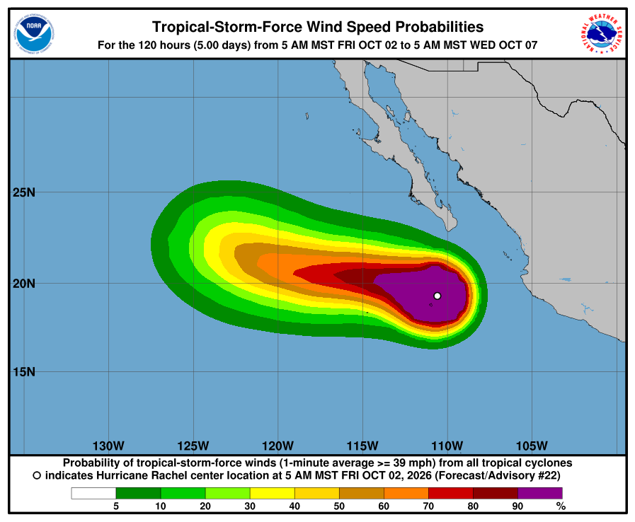
NHC wind-chance chart, Advisory 22. Cabo / La Paz listing stays under 3%. Use this with the cone — it is not a landfall forecast for Todos Santos. NHC says swells from Rachel will affect west-central Mexico and the Baja California Peninsula through the weekend, with life-threatening surf. The next complete advisory was due at 2:00 PM MST (see Advisory 23 above). Advisory 23 above supersedes this earlier Friday morning report. The live official-source panel above may update before this written report.
-
Rachel weakens slightly to 115 mph; corridor still outside every watch and warning
- What changed: NHC Advisory 21 shows Hurricane Rachel weakening slightly to Category 3 near 115 mph (from 120 mph at Advisory 20) with pressure up to 955 mb (from 950). The center is about 245 miles south of the southern tip of Baja California (was about 235), now moving west near 5 mph (was west-northwest near 3). There are still no coastal watches or warnings. NHC expects Rachel to remain near current intensity today, then gradual weakening over the next couple of days.
- What this means here: Prepare locally for SMN rain of about 75-150 mm / ~3.0-5.9 in on southern BCS, with arroyos that can rise on Polo-soaked ground, and BCS west-coast seas near 5-6 m / ~16-20 ft Friday. SMN also has tomorrow rain still locally heavy about 25-50 mm / ~1-2 in. Todos Santos, Pescadero, and Cerritos remain outside any hurricane or tropical-storm watch or warning. Rachel is not heading toward our corridor — moving west and staying ~245 miles south of the Baja tip. Local risk is rain, soft arroyos after Polo, plus life-threatening swell along the Baja California Peninsula through the weekend — not a named-storm landfall in town. Remnants of Polo, Remnants of Nineteen-E, Tropical Storm Nolo (Central Pacific), and the EPAC invest south of southern Mexico are also not heading toward the corridor.
- Stronger or weaker: Slightly weaker than Advisory 20: winds 120→115 mph; pressure 950→955 mb. Still Category 3. NHC expects near-current intensity today, then gradual weakening the next couple of days.
- Path and timing: Near 19.4N 110.4W, moving west at 5 mph. Slow westward motion continues. The cone is not an impact boundary. Hurricane-force winds extend outward up to 40 miles; tropical-storm-force winds up to 150 miles — all well south of our towns.
- Wind chance: NHC five-day tropical-storm-force wind odds for Cabo San Lucas, San José del Cabo, and La Paz stay under the 3% listing threshold (none listed). NHC does not list Todos Santos separately.
- Windy vs NHC: Agree. We checked Windy against NHC. Both keep Rachel offshore south of Baja with no corridor watch or warning. Near-Pescadero marine (Open-Meteo / Windy-style proxy) Friday waves ~2.6–3.0 m — elevated, agreeing with NHC surf hazard. SMN BCS-coast 5–6 m is higher-end Mexico marine magnitude (nuance, not a watch conflict). Multi-source NHC + SMN + Protección Civil BCS + Windy: agree on offshore track and no corridor watch; SMN carries southern-BCS rain ~75-150 mm / ~3.0-5.9 in and Friday seas ~5-6 m / ~16-20 ft; NHC’s land hazard for Baja remains mainly dangerous surf through the weekend. Protección Civil BCS page shows no new corridor-specific Rachel hurricane/TS watch overnight. NHC remains official for watches. No material track conflict.
- Do now: Plan around SMN rain (~75-150 mm / ~3.0-5.9 in; tomorrow still ~25-50 mm / ~1-2 in locally heavy) and do not drive flooded arroyo crossings — ground is still soft after Polo. Stay out of the ocean: seas near 5-6 m / ~16-20 ft on BCS coasts Friday, with dangerous swell through the weekend. Corridor stays outside hurricane/TS watches; Rachel is not toward Todos Santos–Pescadero–Cerritos. Follow Protección Civil BCS for any local notices. Next complete NHC advisory is due at 8:00 AM MST.
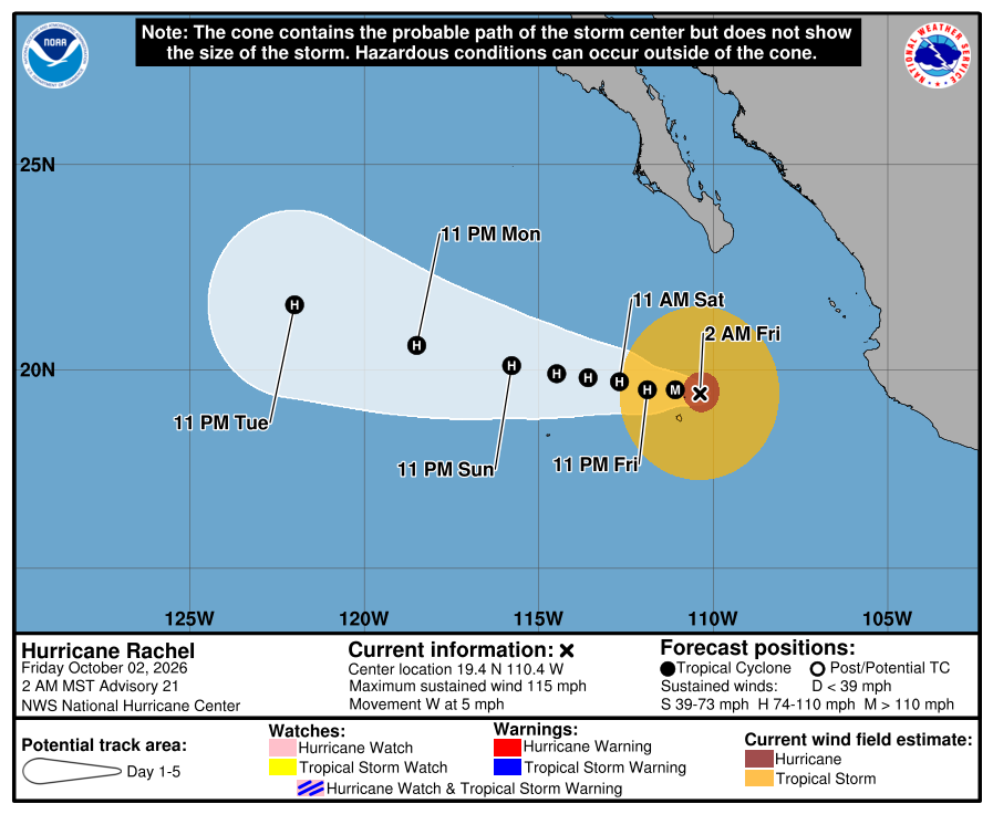
Official NHC cone, 2:00 AM Friday. It shows the forecast area for Rachel’s center, not all areas at risk of rain, wind, surf, or flooding. Our corridor stays outside the cone and outside all watches and warnings. Check the newest NHC graphic. 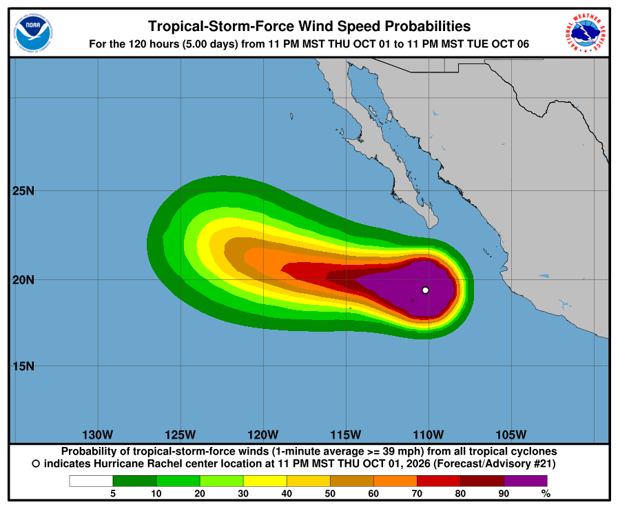
NHC wind-chance chart, Advisory 21. Cabo / La Paz listing stays under 3%. Use this with the cone — it is not a landfall forecast for Todos Santos. NHC says swells from Rachel will affect west-central Mexico and the Baja California Peninsula through the weekend, with life-threatening surf. The next complete advisory was due at 8:00 AM MST (see Advisory 22 above). Advisory 22 above supersedes this earlier Friday morning report. The live official-source panel above may update before this written report.
-
Rachel holding Category 3; corridor still outside every watch and warning
- What changed: NHC Advisory 20 holds Rachel at Category 3 near 120 mph with pressure still 950 mb — “holding steady.” The center is about 235 miles south of the southern tip of Baja California, moving west-northwest near 3 mph. There are still no coastal watches or warnings. NHC expects some additional strengthening overnight (near 130 mph), then gradual weakening this weekend.
- What this means here: Prepare locally for SMN rain of about 75-150 mm / ~3.0-5.9 in through early Friday on southern BCS, with arroyos that can rise on Polo-soaked ground, and BCS west-coast seas near 5-6 m / ~16-20 ft Friday. Todos Santos, Pescadero, and Cerritos remain outside any hurricane or tropical-storm watch or warning. Rachel is not heading toward our corridor. NHC keeps a slow westward to west-northwest track south of Baja. Local risk is rain, soft arroyos after Polo, plus life-threatening swell along the Baja California Peninsula through the weekend - not a named-storm landfall in town. Remnants of Polo, Remnants of Nineteen-E (final advisory earlier today), and Tropical Storm Nolo are also not heading toward the corridor.
- Stronger or weaker: About the same as Advisory 19 at 120 mph and 950 mb. Intensity held. NHC still forecasts a brief peak near 130 mph within about 12 hours, then gradual weakening.
- Path and timing: Near 19.5N 109.9W, moving west-northwest at 3 mph. Slow westward to west-northwest motion continues the next couple of days, with a gradual increase in forward speed later. The cone is not an impact boundary. Hurricane-force winds extend outward up to 40 miles; tropical-storm-force winds up to 150 miles — all well south of our towns.
- Wind chance: NHC five-day tropical-storm-force wind odds for Cabo San Lucas, San José del Cabo, and La Paz stay under the 3% listing threshold (none listed). NHC does not list Todos Santos separately.
- Windy vs NHC: Agree. We checked Windy (ECMWF-style) against NHC. Both keep Rachel offshore south of Baja with no corridor watch or warning. Multi-source NHC + SMN + Protección Civil BCS + Windy: agree on offshore track and no corridor watch; SMN carries southern-BCS rain ~75-150 mm / ~3.0-5.9 in and Friday seas ~5-6 m / ~16-20 ft; NHC's land hazard for Baja remains mainly dangerous surf through the weekend. Protección Civil BCS page shows no new corridor-specific watch for Rachel tonight. NHC remains official for watches. No material track conflict.
- Do now: Plan around SMN rain (~75-150 mm / ~3.0-5.9 in through early Friday) and do not drive flooded arroyo crossings - ground is still soft after Polo. Stay out of the ocean: seas near 5-6 m / ~16-20 ft on BCS coasts Friday, with dangerous swell through the weekend. Corridor stays outside hurricane/TS watches; Rachel is not toward Todos Santos-Pescadero-Cerritos. Follow Protección Civil BCS for any local notices. Next complete NHC advisory is due at 2:00 AM MST.
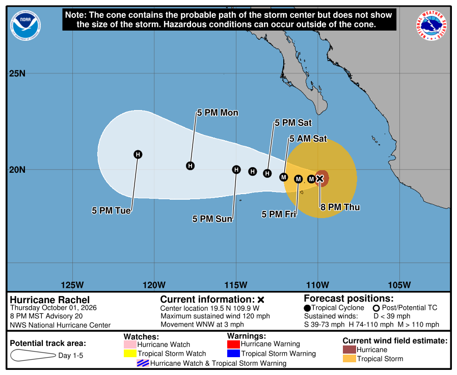
Official NHC cone, 8:00 PM Thursday. It shows the forecast area for Rachel’s center, not all areas at risk of rain, wind, surf, or flooding. Our corridor stays outside the cone and outside all watches and warnings. Check the newest NHC graphic. 
NHC wind-chance chart, Advisory 20. Cabo / La Paz listing stays under 3%. Use this with the cone — it is not a landfall forecast for Todos Santos. NHC says swells from Rachel will affect west-central Mexico and the Baja California Peninsula through the weekend, with life-threatening surf. The next complete advisory was due at 2:00 AM MST (see Advisory 21 above). Advisory 21 above supersedes this earlier Thursday evening report. The live official-source panel above may update before this written report.
-
Rachel reaches Category 3; corridor still outside every watch and warning
- What changed: NHC Advisory 19 raised Rachel to a Category 3 major hurricane near 120 mph (from 105 mph at Advisory 18). Pressure fell to 950 mb. The center is about 245 miles south of the southern tip of Baja California, moving west near 3 mph. There are still no coastal watches or warnings.
- What this means here: Todos Santos, Pescadero, and Cerritos remain outside any hurricane or tropical-storm watch or warning. Rachel is not heading toward our corridor. NHC keeps the center south of Baja on a slow west to west-northwest track. Local risk is soft arroyos after Polo plus life-threatening swell along the Baja California Peninsula through the end of the week — not a named-storm landfall in town. Remnants of Polo, Remnants of Nineteen-E, and Tropical Storm Nolo are also not heading toward the corridor.
- Stronger or weaker: Stronger than Advisory 18. Winds rose from 105 to 120 mph. Pressure fell from 964 to 950 mb. NHC expects some additional strengthening for about a day, then gradual weakening this weekend.
- Path and timing: Near 19.4N 109.5W, moving west at 3 mph. Slow west to west-northwest motion continues the next couple of days. The cone is not an impact boundary. Hurricane-force winds extend outward up to 40 miles; tropical-storm-force winds up to 150 miles — all well south of our towns.
- Wind chance: NHC five-day tropical-storm-force wind odds for Cabo San Lucas, San José del Cabo, and La Paz stay under the 3% listing threshold. NHC does not list Todos Santos separately.
- Windy vs NHC: Agree. We checked Windy (ECMWF-style) against NHC. Both keep Rachel offshore south of Baja with no corridor watch or warning. SMN also flags southern-BCS rain and elevated oleaje; NHC’s land hazard for Baja is mainly dangerous surf. NHC remains official for watches. No material track conflict.
- Do now: Stay out of the ocean when swells are up. Treat arroyos as soft after Polo — do not drive flooded crossings. No corridor hurricane prep from Rachel’s track right now. Follow Protección Civil BCS for any local notices. Next complete NHC advisory is due at 8:00 PM MST.
Historical NHC cone, 2:00 PM Thursday. The newer 8:00 PM Thursday cone is above. It shows the forecast area for Rachel’s center, not all areas at risk of rain, wind, surf, or flooding. 
NHC wind-chance chart, Advisory 19. Cabo / La Paz listing stays under 3%. Use this with the cone — it is not a landfall forecast for Todos Santos. NHC said swells from Rachel would affect west-central Mexico and the Baja California Peninsula through the end of the week, with life-threatening surf. Advisory 20 above supersedes this earlier Thursday afternoon report.
-
Rachel strengthens to Category 2 at 105 mph; corridor still outside every watch and warning
- What changed: NHC Advisory 18 raised Rachel to near 105 mph (from 100 mph at Advisory 17). Pressure fell to 964 mb. The center is about 230 miles south of the southern tip of Baja California, moving west-northwest near 6 mph. There are still no coastal watches or warnings.
- What this means here: Todos Santos, Pescadero, and Cerritos remain outside any hurricane or tropical-storm watch or warning. Rachel is not heading toward our corridor. NHC keeps a west-northwest to west track that stays south of Baja. Local risk is soft arroyos after Polo plus life-threatening swell along the Baja California Peninsula through the end of the week — not a named-storm landfall in town.
- Stronger or weaker: Stronger than Advisory 17. Winds rose from 100 to 105 mph. Pressure fell from 972 to 964 mb. NHC says some additional strengthening is possible during the next couple of days.
- Path and timing: Near 19.6N 109.6W, moving west-northwest at 6 mph. Slow west-northwest to west motion continues the next couple of days. The cone is not an impact boundary. Hurricane-force winds extend outward up to 35 miles; tropical-storm-force winds up to 150 miles — all well south of our towns.
- Wind chance: NHC five-day tropical-storm-force wind odds for Cabo San Lucas, San José del Cabo, and La Paz stay under the 3% listing threshold. NHC does not list Todos Santos separately.
- Windy model check: NHC and Windy/ECMWF-style open checks agreed the center stays offshore south of Baja with no corridor watch or warning. NHC remains official for watches. No material track conflict.
- Do now: Stay out of the ocean when swells are up. Treat arroyos as soft after Polo — do not drive flooded crossings. No corridor hurricane prep from Rachel’s track at this advisory. Follow Protección Civil BCS for any local notices. Next complete NHC advisory was due at 2:00 PM MST (see Advisory 19 above).
Historical NHC cone, 8:00 AM Thursday. The newer 2:00 PM Thursday cone is above. It shows the forecast area for Rachel’s center, not all areas at risk of rain, wind, surf, or flooding. 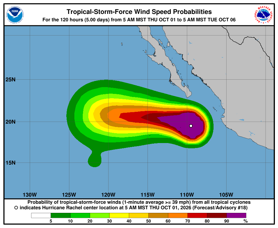
NHC wind-chance chart, Advisory 18. Cabo / La Paz listing stays under 3%. Use this with the cone — it is not a landfall forecast for Todos Santos. NHC said swells from Rachel would affect west-central Mexico and the Baja California Peninsula through the end of the week, with life-threatening surf. Advisory 19 above supersedes this earlier Thursday morning report.
-
Rachel reaches Category 2; still south of Baja with no corridor watch
- What changed: NHC Advisory 17 raised Rachel to a Category 2 hurricane near 100 mph (from 90 mph at Advisory 16). Pressure was 972 mb. The center was about 245 miles south of Cabo San Lucas, moving west-northwest near 6 mph. There were still no coastal watches or warnings. NHC noted interests in southern Baja California Sur should monitor Rachel.
- What this means here: Todos Santos, Pescadero, and Cerritos remained outside any hurricane or tropical-storm watch or warning. Rachel was not heading toward our corridor. On the forecast track, the center continued away from mainland Mexico and passed south of the Baja California Peninsula. Local risk was soft arroyos after Polo plus building dangerous swell — not a named-storm landfall in town. Heavier rain and gust risk in the advisory focused on southwestern mainland Mexico, not our corridor towns.
- Stronger or weaker: Stronger than Advisory 16. Winds rose from 90 to 100 mph. Pressure fell from 975 to 972 mb. NHC expected continued strengthening and a major hurricane within the next couple of days.
- Path and timing: Near 19.4N 109.3W, moving west-northwest at 6 mph. That motion was expected to continue for a couple of days, with a later turn more toward the west. The cone is not an impact boundary. Hurricane-force winds extended outward up to 35 miles; tropical-storm-force winds up to 150 miles — well south of our towns.
- Wind chance: NHC’s five-day chance of tropical-storm-force winds was about 6% for Cabo San Lucas and about 4% for San José del Cabo. La Paz was not listed. NHC does not list Todos Santos separately.
- Windy model check: NHC and Windy/ECMWF-style open checks agreed the center stayed south of Baja with no corridor watch or warning. NHC remains official for watches. No material track conflict.
- Do now: Stay out of the ocean when swells are up. Treat arroyos as soft after Polo — do not drive flooded crossings. No corridor hurricane prep from Rachel’s track at this advisory. Follow Protección Civil BCS for any local notices. Next complete NHC advisory was due at 8:00 AM MST.
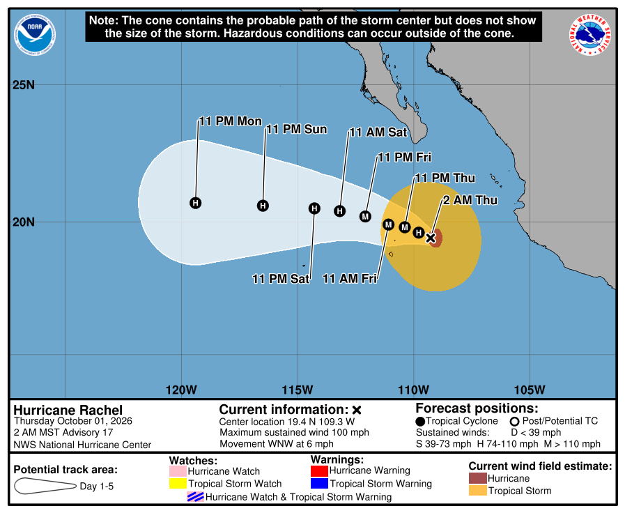
Historical NHC cone, 2:00 AM Thursday. Newer Thursday cones are above. It shows the forecast area for Rachel’s center, not all areas at risk of rain, wind, surf, or flooding. 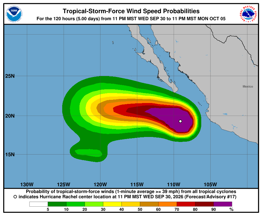
NHC wind-chance chart, Advisory 17. Cabo about 6% and San José del Cabo about 4% for tropical-storm-force winds over five days. Not a landfall forecast for Todos Santos. NHC said swells would affect the southwestern coast of Mexico and spread north along west-central Mexico and the Baja California Peninsula through the end of the week, with life-threatening surf. Later Thursday advisories above supersede this overnight report.
-
Mexico drops all coastal watches and warnings; Rachel still Category 1 offshore
- What changed: NHC Advisory 14 reported that the government of Mexico discontinued all coastal watches and warnings for Rachel. Rachel remained a Category 1 hurricane near 85 mph with pressure near 978 mb. The center was about 220 miles southwest of Cabo Corrientes, moving northwest near 9 mph. NHC said rapid strengthening was expected and Rachel could become a major hurricane within about a day. Interests in southern Baja California Sur should monitor the progress of Rachel.
- What this means here: Todos Santos, Pescadero, and Cerritos were not inside any Rachel hurricane or tropical-storm watch or warning — and the discontinued products were for southwestern mainland Mexico, not our corridor. On the forecast track, Rachel was expected to move away from mainland Mexico and pass south of the Baja California Peninsula through Thursday. Locally, soft arroyos after Polo and building Pacific swell remained the corridor story — not a named-storm landfall in town.
- Stronger or weaker: About the same strength as Advisory 13 at 85 mph. Pressure was near 978 mb. NHC still expected rapid strengthening later Wednesday into Thursday.
- Path and timing: Near 18.1N 108.0W, moving northwest at 9 mph. NHC expected a slower northwest motion for a day or two, then a turn west-northwest and west later in the week, passing south of Baja. The cone is not an impact boundary.
- Wind chance: NHC’s five-day chance of tropical-storm-force winds was about 8% for Cabo San Lucas and about 5% for San José del Cabo. La Paz was not listed. NHC does not list Todos Santos separately.
- Do now: Stay out of flooded arroyos after Polo. Watch for building swell. No corridor hurricane prep from Rachel’s track at this advisory. Follow Protección Civil BCS for any local notices. Next complete NHC advisory was due at 2:00 PM MST.
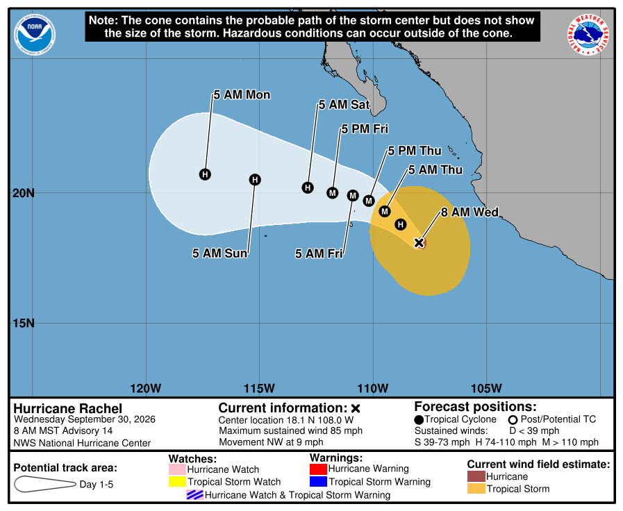
Historical NHC cone, 8:00 AM Wednesday. Newer Rachel cones are above. It shows the forecast area for Rachel’s center, not all areas at risk of rain, wind, surf, or flooding. Our corridor stayed outside all watches and warnings. 
NHC wind-chance chart, Advisory 14. Cabo about 8% and San José del Cabo about 5% for tropical-storm-force winds over five days. Not a landfall forecast for Todos Santos. NHC key messages at this cycle: core forecast to remain offshore; large waves could produce life-threatening surf along southwestern and west-central Mexico and southern Baja. Later Rachel advisories above supersede this Wednesday morning report.
-
Corridor still outside the warning; BCS rain raised to 6–12 inches as landfall nears
- What this means here: Todos Santos, Pescadero, and Cerritos are still not inside a hurricane warning or hurricane watch. The west-coast hurricane warning still ends at Santa Fe, north of our corridor — no west-coast breakpoint change with Advisory 31. For people here, the near-term story sharpened overnight: NHC now forecasts 6 to 12 inches of rain across portions of Baja California Sur (up from 4–8, locally 12), with life-threatening flooding and mudslides possible, plus rough surf and coastal flooding risk. Conditions are expected to begin deteriorating this morning farther north in the warning area; our corridor still faces heavy rain and arroyo flood risk even though it is outside the named warning. Farther from us, Mexico upgraded the east-coast hurricane warning north of Santa Rosalía to Bahía San Juan Bautista and still has mainland warning/watch products — those matter for those communities, not as a hit forecast for Todos Santos.
- Stronger or weaker: A little weaker than Intermediate 30A. Winds are down to 115 mph (from 120) and pressure is up to 958 mb (from 954). Polo is still a Category 3 major hurricane. NHC expects it near major-hurricane strength when it reaches west BCS late today (most likely around 95 kt / 110 mph), then still a hurricane for a mainland Mexico landfall late tonight or early Tuesday.
- Path and timing: Polo is about 125 miles southwest of Cabo San Lázaro (about 270 miles south-southwest of Santa Rosalía), moving north-northeast at 10 mph. NHC expects a turn northeast this afternoon, inland along the west coast of Baja California Sur late this afternoon or early this evening, across the peninsula, then inland in southern Sonora late Monday night or early Tuesday. Hurricane conditions are expected in the west-coast warning area by late this afternoon, with tropical-storm conditions beginning in the southern portion of that warning later this morning. The cone is not an impact boundary.
- Wind chance: NHC no longer lists La Paz, Cabo San Lucas, or San José del Cabo (under the 3% listing threshold). Loreto is about 87% for tropical-storm-force winds, about 39% for 50-kt winds, and about 8% for hurricane-force winds. NHC does not list Todos Santos separately.
- Do now: For the corridor: plan around heavier rain and flooded arroyos today, stay out of the ocean (dangerous surf), and secure outdoor items. Do not drive flooded arroyos. Follow Protección Civil BCS for local instructions. Next intermediate NHC advisory is due at 5:00 AM MST (about 6:00 AM Mexico City); next full advisory at 8:00 AM MST (about 9:00 AM Mexico City).
Official NHC cone, 2:00 AM Monday. It shows the forecast area for Polo's center, not all areas at risk of rain, wind, surf, or flooding. Check the newest NHC graphic. NHC forecasts 6 to 12 inches of rain across portions of Baja California Sur, and 4 to 6 inches (locally 8) across southern and central Sonora, with life-threatening flooding and mudslides possible. The next intermediate advisory is due at 5:00 AM and the next full advisory at 8:00 AM Todos Santos time. The live official-source panel above may update before this written report.
-
Corridor still outside the hurricane warning; Polo a little stronger at 125 mph
- What this means here: Todos Santos, Pescadero, and Cerritos are still not inside a hurricane warning or hurricane watch. The west-coast hurricane warning still ends at Santa Fe, north of our corridor. No watch/warning changes with this advisory. For people here, the near-term story is heavier rain (NHC now 4 to 8 inches across parts of BCS, locally up to 12), rough ocean and flooded arroyos — not a named hurricane landfall in town. Tropical-storm conditions remain possible farther north in the southern west-coast warning as soon as tonight into early Monday. Farther from us, Mexico still has a west-coast hurricane warning (Punta Abreojos to Santa Fe), an east-coast hurricane warning (Loreto to Santa Rosalía), and mainland watches; those products matter for those communities, not as a hit forecast for Todos Santos.
- Stronger or weaker: A little stronger than Advisory 27. Winds are up to 125 mph (from 120) and pressure is down to 949 mb (from 952). Polo is still a Category 3 major hurricane. NHC raised the intensity forecast and now shows Polo reaching the west coast of BCS as about a 95-kt hurricane; some model guidance (HAFS-B) keeps major-hurricane strength at landfall.
- Path and timing: Polo is about 280 miles west-southwest of Cabo San Lucas (260 miles south-southwest of Cabo San Lázaro), moving north-northwest at 12 mph — a slightly faster track than at 2:00 AM. NHC still expects a turn north later today, then northeast Monday, approach to west BCS Monday as a strong hurricane, across the peninsula Monday night, and toward northwestern mainland Mexico by early Tuesday. Hurricane conditions are expected in the west-coast warning area by Monday afternoon. The cone is not an impact boundary.
- Wind chance: NHC's five-day chance of tropical-storm-force winds in La Paz is about 3% (down slightly from 4% at Advisory 27). Loreto is about 80% for tropical-storm-force winds, about 39% for 50-kt winds, and about 18% for hurricane-force winds. Cabo San Lucas and San José del Cabo are still not listed (under the 3% listing threshold). NHC does not list Todos Santos separately.
- Do now: For the corridor: secure outdoor items, plan around heavy rain and rough surf, and do not drive flooded arroyos. Follow Protección Civil BCS for local instructions. Next intermediate NHC advisory is due around 11:00 AM MST (about 12:00 PM Mexico City); next full advisory at 2:00 PM MST (about 3:00 PM Mexico City).
Historical NHC cone, 8:00 AM Sunday. The newer 2:00 AM Monday cone is above. This shows the forecast area for Polo's center, not the full area of possible impacts. NHC forecasts 4 to 8 inches of rain across parts of BCS, locally up to 12 inches, with life-threatening flooding and mudslides possible. Sonora could see 4 to 6 inches, locally 8. The next intermediate advisory is due at 11:00 AM and the next full advisory at 2:00 PM Todos Santos time. The live official-source panel above may update before this written report.
-
Corridor still outside the hurricane warning; rain and surf are the local story
- What this means here: Todos Santos, Pescadero, and Cerritos are still not inside a hurricane warning or hurricane watch. The west-coast hurricane warning still ends at Santa Fe, north of our corridor. For people here, the near-term story is heavy rain, rough ocean, and flooded arroyos — not a named hurricane landfall in town. NHC still forecasts 4 to 8 inches of rain across parts of BCS (locally up to 10) tonight into Tuesday, and dangerous surf continues along the Pacific coast. Tropical-storm conditions remain possible farther north in the southern west-coast warning as soon as tonight into early Monday. Farther from us, Mexico also has a west-coast hurricane warning (Punta Abreojos to Santa Fe), an east-coast hurricane warning (Loreto to Santa Rosalía), and mainland watches; those products matter for those communities, not as a hit forecast for Todos Santos.
- Stronger or weaker: About the same as the previous full NHC advisory at 8:00 PM. Winds remain 120 mph. Pressure is 952 mb (up slightly from 949). Polo is still a Category 3 major hurricane. NHC still expects it to remain a hurricane as it approaches BCS on Monday, with gradual weakening before landfall.
- Path and timing: Polo is about 300 miles southwest of Cabo San Lucas, moving north-northwest at 10 mph. NHC still expects a turn north later today, then northeast toward the west coast of BCS on Monday, across the peninsula Monday night, and toward northwestern mainland Mexico by early Tuesday. Hurricane conditions are expected in the west-coast warning area by Monday afternoon. Model spread on how fast the center moves after landfall remains high. The cone is not an impact boundary.
- Wind chance: NHC's five-day chance of tropical-storm-force winds in La Paz fell to 4% (down from 9% at Advisory 26). Loreto is still 72%. Cabo San Lucas and San José del Cabo are still not listed (under the 3% listing threshold). NHC does not list Todos Santos separately.
- Do now: For the corridor: secure outdoor items, plan around heavy rain and rough surf, and do not drive flooded arroyos. Follow Protección Civil BCS for local instructions. Next full NHC advisory is due around 8:00 AM MST (about 9:00 AM Mexico City).
Historical NHC cone, 2:00 AM Sunday. The newer 8:00 AM Sunday cone is above. This shows the forecast area for Polo's center, not the full area of possible impacts. NHC forecasts 4 to 8 inches of rain across parts of BCS, locally up to 10 inches. The next intermediate advisory is due at 5:00 AM and the next full advisory at 8:00 AM Todos Santos time. The live official-source panel above may update before this written report.
-
Warning still north of the corridor; Polo down to Category 3
- What this means here: Todos Santos, Pescadero, and Cerritos are still not named in the west-coast hurricane warning. That warning runs Punta Abreojos to Santa Fe — Santa Fe stays the southern breakpoint, north of our corridor. Locally, expect dangerous surf and a real rain/flood risk (NHC 4 to 8 inches in parts of BCS, locally up to 10, Sunday night into Tuesday). Tropical-storm conditions are possible farther north in the southern warning area as soon as Sunday night into early Monday. An east-coast hurricane watch (Bahía San Juan Bautista to San Evaristo) is farther from the Pacific corridor and is secondary context only.
- Stronger or weaker: Weaker than the previous full NHC advisory at 2:00 PM. Hurricane-hunter data put winds at 120 mph (down from 145) and pressure at 949 mb (up from 938). Polo is now a Category 3 major hurricane. NHC still expects it to remain a hurricane as it approaches BCS on Monday.
- Path and timing: Polo is about 325 miles southwest of Cabo San Lucas, moving northwest at 10 mph. NHC still expects a northward turn Sunday, then northeast toward the west coast of BCS on Monday, across the peninsula Monday night, and toward northwestern mainland Mexico by early Tuesday. Hurricane conditions are expected in the west-coast warning area by Monday afternoon. Model spread on how fast the center moves Monday remains high; NHC confidence in that part of the track is low. The cone is not an impact boundary.
- Wind chance: NHC's five-day chance of tropical-storm-force winds in La Paz is 9% (up from 7% at Advisory 25). Loreto is now 72%. Cabo San Lucas and San José del Cabo are still not listed (under the 3% listing threshold). NHC does not list Todos Santos separately.
- Do now: Finish preparations while travel is still safe. Follow Protección Civil BCS for local instructions. Never drive through moving water or a flooded arroyo. Next intermediate advisory is due at 11:00 PM MST; next full advisory at 2:00 AM MST.
Historical NHC cone, 8:00 PM Saturday. The newer 2:00 AM Sunday cone is above. This shows the forecast area for Polo's center, not the full area of possible impacts. NHC forecasts 4 to 8 inches of rain across parts of BCS, locally up to 10 inches. The 2:00 AM Sunday full NHC advisory above supersedes this earlier Saturday report.
-
Polo keeps weakening; still Category 4 on a Monday BCS approach
- What this means here: NHC still expects Polo to approach the west coast of Baja California Sur on Monday as a strong hurricane. The hurricane watch remains from Punta Eugenia to Santa Fe. It does not tell us exactly what will happen in Todos Santos. Dangerous surf continues along the peninsula. Heavy rain could begin in BCS late Sunday into Monday; flooding and mudslides are possible. Protección Civil BCS is moving aid brigades toward Los Cabos and Comondú.
- Stronger or weaker: Weaker than the previous full NHC advisory at 8:00 AM. Winds fell from 155 to 145 mph, and pressure rose from 928 to 938 mb. Polo remains a Category 4 hurricane.
- Path and timing: Polo has turned northwest. NHC expects a northward turn Sunday, then northeast toward BCS on Monday, across the peninsula Monday night, and toward northwestern mainland Mexico by early Tuesday. Hurricane conditions are possible in the watch area Monday afternoon. Tropical-storm conditions could begin in its southern part Sunday night or early Monday. Forecast models agree on the turn but differ a lot on how fast the center moves; some runs approach sooner, others stay farther offshore longer. The cone is not an impact boundary.
- Wind chance: NHC's five-day chance of tropical-storm-force winds in La Paz fell from 10% to 7%. Cabo San Lucas and San José del Cabo are not listed on this advisory (under the 3% listing threshold). Strength and local wind chance measure different things. NHC does not list Todos Santos separately.
- Windy model check: NHC and the models you can compare on Windy still show a north, then northeast turn. They disagree on timing. Some runs move Polo toward BCS faster; others are slower or stall farther offshore. Use NHC for the official track, watches, and strength.
- Do now: Finish preparations while travel is safe. Follow Protección Civil BCS for local instructions. Never drive through moving water or a flooded arroyo.
Historical NHC cone, 2:00 PM Saturday. The newer 8:00 PM cone is above. This shows the forecast area for Polo's center, not the full area of possible impacts. NHC forecasts 4 to 8 inches of rain across parts of BCS, locally up to 10 inches. The 8:00 PM full NHC advisory above supersedes this earlier Saturday report.
-
Polo weakens to Category 4; hurricane watch remains for part of BCS
- What this means here: NHC still expects Polo to reach Baja California Sur on Monday as a strong hurricane. The hurricane watch covers the west coast from Punta Eugenia to Santa Fe. It does not tell us exactly what will happen in Todos Santos. Dangerous surf is expected along the peninsula. Heavy rain could begin in BCS late Sunday into Monday; flooding and mudslides are possible.
- Stronger or weaker: Weaker than the previous full NHC advisory at 2:00 AM. Winds fell from 165 to 155 mph, and pressure rose from 917 to 928 mb. Polo is now Category 4, still a powerful hurricane.
- Path and timing: NHC expects Polo to turn north Sunday, then toward BCS Monday. Hurricane conditions are possible in the watch area Monday afternoon. Tropical-storm conditions could begin in its southern part Sunday night or early Monday. Forecast models agree on the turn but differ on when the center reaches the peninsula. The cone is not an impact boundary.
- Wind chance: NHC's five-day chance of tropical-storm-force winds in La Paz rose from 8% to 10%, even as Polo weakened. Strength and local wind chance measure different things. NHC does not list Todos Santos separately.
- Do now: Finish preparations while travel is safe. Follow Protección Civil BCS for local instructions. Never drive through moving water or a flooded arroyo.
Historical NHC cone, 8:00 AM Saturday. The newer 2:00 PM cone is above. This shows the forecast area for Polo's center, not the full area of possible impacts. NHC forecasts 4 to 8 inches of rain across parts of BCS, locally up to 10 inches. The 2:00 PM full NHC advisory above supersedes this earlier Saturday report.
-
Hurricane watch for part of Baja California Sur; Polo still Category 5
- What this means here: The hurricane watch runs along the west coast from Punta Eugenia to Santa Fe. It does not mean Polo will hit Todos Santos, and it is not an all-clear for the southern corridor. Dangerous surf is expected along the peninsula this weekend. Parts of BCS could get 4 to 8 inches of rain, locally 10 inches, with flooding and mudslides possible.
- Stronger or weaker: Weaker than the previous full NHC advisory at 8:00 PM Friday: winds fell from 175 to 165 mph and pressure rose from 911 to 917 mb by the 2:00 AM full advisory. The 5:00 AM intermediate update lowered winds to 160 mph and raised pressure to 922 mb. Polo remains an extremely dangerous Category 5 hurricane.
- Path and timing: NHC forecasts a turn north Sunday, then toward BCS Monday. Hurricane conditions are possible in the watch area by Monday afternoon; tropical-storm conditions could begin in its southern part Sunday night or early Monday. The center line and cone do not mark the edge of wind, rain, or surf.
- Do now: Finish preparations while roads and weather allow. Follow Protección Civil BCS for local instructions, and do not drive through a flooded arroyo.
Historical NHC cone, 5:00 AM Saturday. The newer 8:00 AM cone is above. This shows the forecast area for Polo's center, not the full area of possible impacts. The 8:00 AM full NHC advisory above supersedes this intermediate update.
-
Polo remains Category 5; BCS watches could begin Saturday
- What this means here: Polo is stronger now. NHC still expects it to weaken before reaching Baja California Sur. Keep preparing.
- Stronger or weaker: Stronger than NHC Advisory 19 at 2:00 AM. Winds rose from 160 to 180 mph. Pressure fell from 929 to 900 mb.
- Path and timing: Polo is moving west at 12 mph. NHC expects a turn northwest and north this weekend, then northeast Monday. Heavy rain may begin late Sunday into Monday. Dangerous surf can arrive sooner.
- Local wind chances: Cabo San Lucas 4%, San Jose del Cabo 4%, and La Paz 19% over five days. All three decreased since the previous advisory. These are wind chances, not landfall odds.
- Windy model check: NHC, UKM, and ECMWF all turn Polo north. They disagree on the exact path and how quickly it weakens. UKM weakens it faster. ECMWF keeps it stronger.
How Polo's forecast path changed
This historical comparison ends at NHC Advisory 20 on Friday morning. The black line shows observed centers to that point. The terra-cotta line is that advisory's forecast; gray lines show selected earlier forecasts. See the newer official cone above for the current outlook.
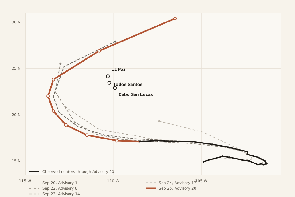
Forecast history through Advisory 20. Each gray line is what NHC forecast at that time. Advisory 20 is emphasized. This is not an impact boundary. 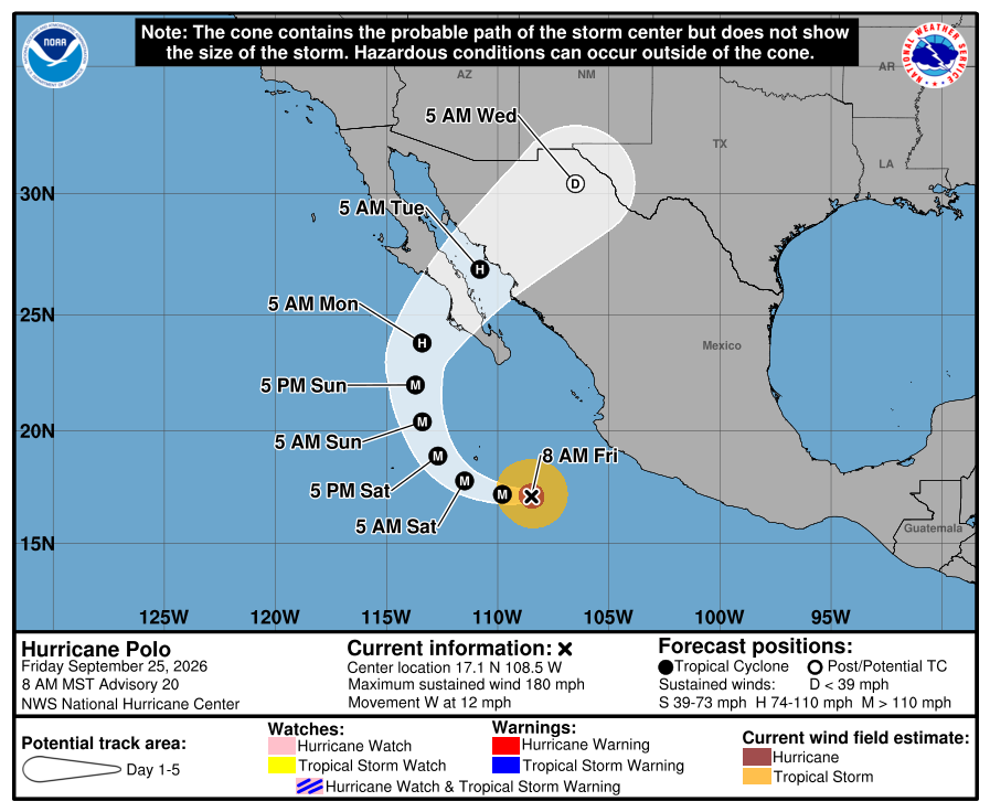
Historical cone. NHC Advisory 20, issued Friday at 8:00 AM Todos Santos time. This graphic is retained to show how the forecast changed; use the newer cone above for the current outlook. At this Friday advisory, NHC forecast 4 to 8 inches of rain across parts of BCS, with isolated totals of 10 inches and possible life-threatening flooding and mudslides. No BCS coastal watch or warning was in effect at that time. A watch has since been issued; see the latest Saturday report above.
Sources: NHC is the official source for Polo's track, strength, watches, warnings, rain, and wind chances. Windy is included only to compare forecast models.
-
NHC raised Polo to 180 mph
At 5:50 AM Todos Santos time, NHC issued a special update saying Polo's winds had reached 180 mph and its pressure had fallen to 908 mb. The center was about 415 miles south-southeast of Cabo San Lucas and moving west at 12 mph.
This special update changed Polo's current strength. It did not include a new track, new wind chances, or a new BCS watch or warning. Advisory 20 followed at 8:00 AM; use the newest entry above for the current full forecast.
-
Polo returned to Category 5; NHC is confident it will cross BCS
At 2:00 AM Todos Santos time, Polo was a Category 5 hurricane with 160 mph winds, moving west at 12 mph. NHC expects it to approach Baja California Sur on Monday. NHC says confidence is high that Polo will make landfall in BCS, cross the Gulf of California, and then make landfall in mainland Mexico. The new forecast moves Polo northeast faster on days four and five than Advisory 18.
There was no BCS tropical-cyclone watch or warning at this advisory time. NHC's five-day chances of tropical-storm-force winds were 7% for Cabo San Lucas, 6% for San Jose del Cabo, and 24% for La Paz. These were wind chances, not landfall odds. Swells were expected to reach BCS today and continue through the weekend, bringing dangerous surf and possible coastal flooding. The forecast center line is not the edge of possible impacts. Advisory 20 followed at 8:00 AM.
-
Polo moved west; the BCS approach remains in the forecast
At 8:00 PM Todos Santos time, Polo was a Category 4 hurricane with 150 mph winds, moving west at 12 mph. NHC says the track forecast changed little. Polo is expected to turn north and northeast after Friday and approach the Baja California Peninsula in about four days. The forecast makes a slightly wider turn than Advisory 17, and NHC still expects Polo to be near major-hurricane strength as it approaches the peninsula.
There is no BCS tropical-cyclone watch or warning at this advisory time. That is not an all-clear. NHC's five-day chances of tropical-storm-force winds are 7% for Cabo San Lucas, 8% for San Jose del Cabo, and 20% for La Paz. These are wind chances, not landfall odds. Swells are expected to reach BCS Friday and continue through the weekend, with dangerous surf and coastal flooding possible. The next full NHC advisory is due at 2:00 AM Todos Santos time on Friday.
-
NHC still forecasts a turn and crossing of BCS
At 2:00 PM Todos Santos time, Polo was a Category 4 hurricane with 150 mph winds, moving west-northwest at 10 mph. NHC says its track reasoning changed little. It still forecasts the center crossing the Baja California Peninsula and entering northwestern mainland Mexico in about four to five days. NHC also says Polo could return to Category 5 tonight or Friday morning.
No coastal watches or warnings are in effect anywhere. That is not an all-clear. BCS should keep monitoring and preparing. NHC's five-day chances of tropical-storm-force winds are 9% for Cabo San Lucas, 8% for San Jose del Cabo, and 22% for La Paz. Swells are expected to reach BCS Friday and continue through the weekend.
Plain timing: ocean effects could begin Friday. Stronger local effects are possible Sunday into Monday. If the track holds, the center would cross the peninsula farther north late Monday into Tuesday. This local timing is an inference from the NHC track, not a forecast that Polo will make landfall in Todos Santos. The forecast center line is not the edge of possible effects.
-
BCS asks residents to stay alert and prepare
Protección Civil BCS says Polo's first regional effects could begin Thursday with showers and gradually higher surf. It expects 25 to 50 mm of rain Friday, 50 to 75 mm Saturday with stronger winds, and more heavy rain in parts of BCS Sunday. Officials are preparing shelters, crews, and equipment.
Airports, ports, and roads across BCS were operating normally when this update was published. This is regional preparation guidance, not a Todos Santos-specific forecast. Use the live official-source panel above and its linked NHC advisory for the current controlling storm forecast.
-
The official forecast now takes Polo across BCS early next week
Polo is a Category 4 hurricane with 155 mph winds. It is moving west-northwest now. NHC says the forecast models agree more closely that it will turn north and northeast, with the forecast center passing over Baja California Sur in about four to five days. The forecast center line is not the edge of possible wind, rain, surf, or flooding. The exact path and timing can still change.
There is no BCS tropical-cyclone watch or warning. That is not an all-clear. NHC's five-day chances of tropical-storm-force winds are 8% for Cabo San Lucas, 8% for San Jose del Cabo, and 20% for La Paz. These are wind chances, not landfall odds.
-
NHC kept the turn toward BCS in the forecast
Polo was a Category 5 hurricane with 160 mph winds. NHC forecast a northward turn toward the Baja California Peninsula late in the weekend and early next week.
-
Polo remained a major hurricane; the late turn was still uncertain
Polo had 160 mph winds. NHC expected the storm to move west first, then turn north toward BCS. Forecast models differed on how quickly that turn would happen.


Prepare without panicking. The hurricane guide has the local checklist.